close
-
Layers w
- Weather Layers
- Pro
- Pro
- Pro
- Pro
- Pro
- Pro
- More Layers
- Pro
- Pro
- Pro
- Pro
-
Upgrade to

3D
Trail Conditions
- Unknown
- Snow Groomed
- Snow Packed
- Snow Covered
- Snow Cover Partial
- Freeze/thaw Cycle
- Icy
- Prevalent Mud
- Wet
- Variable
- Ideal
- Dry
- Very Dry
Trail Flow (Ridden Direction)
Trailforks scans users ridelogs to determine the most popular direction each trail is ridden. A good flowing trail network will have most trails flowing in a single direction according to their intension.
The colour categories are based on what percentage of riders are riding a trail in its intended direction.
The colour categories are based on what percentage of riders are riding a trail in its intended direction.
- > 96%
- > 90%
- > 80%
- > 70%
- > 50%
- < 50%
- bi-directional trail
- no data
Trail Last Ridden
Trailforks scans ridelogs to determine the last time a trail was ridden.
- < 2 days
- < 1 week
- < 2 weeks
- < 1 month
- < 6 months
- > 6 months
Trail Ridden Direction
The intended direction a trail should be ridden.
- Downhill Only
- Downhill Primary
- Both Directions
- Uphill Primary
- Uphill Only
- One Direction
Contribute Details
Colors indicate trail is missing specified detail.
- Description
- Photos
- Description & Photos
- Videos
Trail Popularity ?
Trailforks scans ridelogs to determine which trails are ridden the most in the last 9 months.
Trails are compared with nearby trails in the same city region with a possible 25 colour shades.
Think of this as a heatmap, more rides = more kinetic energy = warmer colors.
- most popular
- popular
- less popular
- not popular
ATV/ORV/OHV Filter
Max Vehicle Width
inches
US Cell Coverage
Legend

Radar Time
Activity Recordings
Trailforks uses anonymized public activity data.
?
Activity Recordings
Trailforks uses anonymized public activity data.
?
Personal Heatmap
▶
Activity Types
all
/
none
▶
Options
2
Date range
month
–
Winter Trails
Warning
A routing network for winter maps does not exist. Selecting trails using the winter trails layer has been disabled.
Missing Trails
Most Popular
Least Popular
Trails are colored based on popularity. The more popular a trail is, the more red. Less popular trails trend towards green.
Jump Magnitude Heatmap
Heatmap of where riders jump on trails. Zoom in to see individual jumps, click circles to view jump details.
BC Backroad Status
![map legend]()
Service Road Atlas is a free to use, community-driven service for viewing and creating reports on the numerous back-country service roads around B.C. and Alberta.

Slope Aspect
Direction the slope faces
Trails Deemphasized
Trails are shown in grey.
Only show trails with no bike usage.
Suggested Layers
Based on selected activity type
Save the current map location and zoom level as your default home location whenever this page is loaded.
Save
No description for Beverly has been added yet!
Login or register to submit one.
Activities Click to view
- Mountain Bike
248 trails
- E-Bike
32 trails
- Horse
14 trails
- Hike
254 trails
- Trail Running
254 trails
- Dirtbike/Moto
1 trails
- ATV/ORV/OHV
1 trails
- Snowshoe
112 trails
- Backcountry Ski
7 trails
- Nordic Ski
73 trails
Region Details
- 33
- 6
- 75
- 92
- 17
- 2
Region Status
Open as of Jun 13, 2026Local Trail Association
Stats
- Avg Trail Rating
- Trails (view details)
- 225
- Trails Mountain Bike
- 250
- Trails E-Bike
- 32
- Trails Horse
- 14
- Trails Hike
- 254
- Trails Trail Running
- 254
- Trails Dirtbike/Moto
- 1
- Trails ATV/ORV/OHV
- 1
- Trails Snowshoe
- 112
- Trails Backcountry Ski
- 7
- Trails Nordic Ski
- 73
- Total Distance
- 45 miles
- Total Descent
- 3,244 ft
- Total Vertical
- 175 ft
- Highest Trailhead
- 181 ft
- Reports
- 941
- Photos
- 293
- Ridden Counter
- 16,623
Sub Regions
-
Alt Reservation
- 4
- 1
-
Bald Hill Trails
- 5
-
Beverly Commons
- 5
- 23
- 8
- 1
-
Beverly Gardens
-
Endicott College
- 5
- 8
- 6
- 1
-
Green's Hill
- 9
-
JC Phillips Nature Preserve
- 1
- 9
- 7
- 1
-
Norwood Pond
- 15
- 4
-
Snake Hill / Sally Milligan Nature Reserve
- 7
- 7
- 1
-
Sterling Woods / Hannah Elementary Trails
- 12
- 7
-
Wenham Lake (Beverly)
- 12
- 5
Popular Beverly Mountain Biking Trails
• 100 ★ 4.6 • 1 mile • 71 ft • 656 •
Popular blue difficulty singletrack. This multi-use trail can be used both directions and has a hard overall physical rating with a 71 ft black diamond climb. On average it takes 23 minutes to complete this trail.
• 100 ★ 5.0 • 5,174 ft • 131 ft • 651 •
Popular blue difficulty singletrack. This multi-use trail can be used both directions. On average it takes 16 minutes to complete this trail.
• 100 ★ 3.0 • 2,323 ft • 70 ft • 549 •
Popular blue difficulty family friendly singletrack. This multi-use trail can be used both directions and has a easy overall physical rating with a 70 ft blue climb. Trail visibility is always easy to follow. On average it takes 4 minutes to complete this trail.
• 100 ★ 3.5 • 2,417 ft • 36 ft • 463 •
Popular blue difficulty singletrack. This multi-use trail can be used both directions. On average it takes 6 minutes to complete this trail.
• 100 ★ 3.5 • 1,995 ft • 92 ft • 417 •
Popular blue difficulty singletrack. This multi-use trail can be used both directions. On average it takes 6 minutes to complete this trail.
• 95 ★ 4.0 • 2,618 ft • 85 ft • 383 •
Popular blue difficulty singletrack. This multi-use trail can be used both directions. On average it takes 9 minutes to complete this trail.
• 90 ★ 0.0 • 1,142 ft • 8 ft • 374 •
Popular green difficulty family friendly singletrack. This multi-use trail can be used both directions and has a moderate overall physical rating with a 8 ft green climb. Trail visibility is always easy to follow. On average it takes 1 minutes to complete this trail.
• 95 ★ 3.5 • 1,704 ft • 37 ft • 354 •
Popular blue difficulty singletrack. This multi-use trail can be used both directions. On average it takes 5 minutes to complete this trail.
Beverly Mountain Bike Routes
★ 4.7 • 5 miles • 369 ft • 4 • Loop •
A relatively easy route, with some tech and some fun jumps. not much climbing, and a few fun decents.
★ 5.0 • 5 miles • 435 ft • 15 •
Post work quick ride arround the perimiter. Black and blues.
11 miles • 1,065 ft • 17 •
So many options this is just a suggestion to get to Pine st
• 5 miles • 544 ft • 7 •
• 5 miles • 483 ft • 6 •
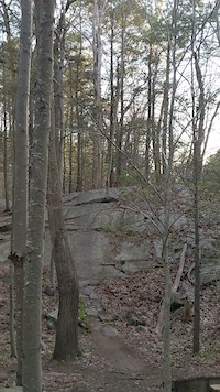
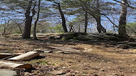
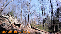
Photos of Beverly Mountain Bike
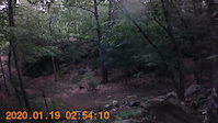
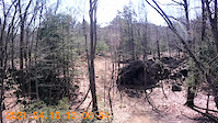
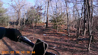
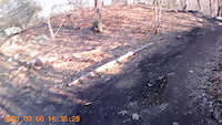
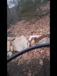
Videos of Beverly Mountain Bike
trail: Red Dot
0:17 |
198 |
Oct 17, 2022
trail: Orange Dot
0:04 |
200 |
Jun 6, 2021
trail: The Pines
0:14 |
|
Apr 26, 2021
trail: Orange Dot
0:12 |
135 |
Apr 11, 2021
trail: Orange Dot
0:10 |
159 |
Apr 11, 2021
trail: Orange Dot
0:17 |
120 |
Mar 10, 2021
trail: Orange Dot
0:30 |
84 |
Mar 10, 2021
trail: Orange Dot
0:14 |
92 |
Jan 22, 2021
Recent Trail Reports
| status | trail | date | condition | info | user |
|---|---|---|---|---|---|
| South Carriage Loop 3 | Jun 13, 2026 @ 10:24am (America/New_York) Jun 13, 2026 | Ideal | bobg13 | ||
| Phillips Loop 3 | Jun 13, 2026 @ 10:24am (America/New_York) Jun 13, 2026 | Ideal | bobg13 | ||
| JC Phillips 4 | Jun 13, 2026 @ 10:24am (America/New_York) Jun 13, 2026 | Variable | bobg13 | ||
| Main House North | Mar 24, 2026 @ 8:37am (America/New_York) Mar 24, 2026 | Variable | bobg13 | ||
| South Carriage Loop 2 | Mar 17, 2026 @ 7:11pm (America/New_York) Mar 17, 2026 | Variable | bobg13 | ||
| Foley Trail | Mar 17, 2026 @ 6:39pm (America/New_York) Mar 17, 2026 | Variable | bobg13 | ||
| Phillips Loop 3 | Feb 28, 2026 @ 10:29am (America/New_York) Feb 28, 2026 | Snow Covered | bobg13 | ||
| Phillips Loop 1 | Feb 24, 2026 @ 6:33pm (America/New_York) Feb 24, 2026 | Snow Covered | bobg13 | ||
| South Carriage Loop 1 | Jan 1, 2026 @ 4:53pm (America/New_York) Jan 1, 2026 | Freeze/thaw Cycle | bobg13 | ||
| Closet Fever | Dec 13, 2025 @ 12:59pm (America/New_York) Dec 13, 2025 | Ideal | AndrewHally MRR |
Activity Feed
| username | action | type | title | date |
|---|---|---|---|---|
| bobg13 | add | report | activity #96874250 | Jun 13, 2026 @ 7:24am Jun 13, 2026 |
| bobg13 | add | report | activity #96874248 and 1 more | Jun 13, 2026 @ 7:24am Jun 13, 2026 |
| bh1026 | ridden | trail | activity #96051408 | Jun 1, 2026 @ 5:20pm Jun 1, 2026 |
| TrevorRobinette | wishlist | trail | activity #95904604 | May 30, 2026 @ 7:00pm May 30, 2026 |
| bh1026 | ridden | route | activity #95368995 | May 23, 2026 @ 5:37pm May 23, 2026 |
Recent Comments
| username | type | title | comment | date |
|---|---|---|---|---|
| trail | Either whoever submitted this trail to TF has... | May 13, 2026 @ 11:32am May 13, 2026 | ||
| trail | Horrible trail. Overgrown and rough. Avoid. | Mar 23, 2025 @ 8:04pm Mar 23, 2025 | ||
| trail | Absolute garbage. Barely a trail. Avoid. | Mar 23, 2025 @ 8:03pm Mar 23, 2025 | ||
| trail | This trail isn't really there anymore. | Jul 26, 2024 @ 6:08pm Jul 26, 2024 | ||
| trail | Its fun but there should be a connector from... | May 20, 2024 @ 1:26pm May 20, 2024 |
Local Badges
-

Completionist0 awarded -

Top 10 Trails0 awarded -
Completionist0 awarded -

10 Green Trails77 awarded -
Completionist0 awarded -

10 Black Trails4 awarded
Activity Type Stats
| activitytype | trails | distance | descent | descent distance | total vertical | rating | global rank | state rank | photos | reports | routes | ridelogs |
|---|---|---|---|---|---|---|---|---|---|---|---|---|
| Mountain Bike | 248 | 45 miles | 3,245 ft | 16 miles | 174 ft | #1,280 | #489 | 219 | 947 | 4 | 16,167 | |
| E-Bike | 32 | 7 miles | 453 ft | 3 miles | 131 ft | 689 | 1 | 112 | ||||
| Horse | 14 | 3 miles | 259 ft | 1 mile | 128 ft | #2,913 | #1,636 | 240 | 3 | |||
| Hike | 254 | 45 miles | 3,245 ft | 16 miles | 174 ft | #1,483 | #672 | 53 | 945 | 1 | 1,320 | |
| Trail Running | 254 | 45 miles | 3,245 ft | 16 miles | 174 ft | #1,175 | #427 | 13 | 945 | 1 | 2,033 | |
| Dirtbike/Moto | 1 | #1,310 | #536 | 227 | 4 | |||||||
| ATV/ORV/OHV | 1 | #1,003 | #468 | 227 | 6 | |||||||
| Snowshoe | 112 | 17 miles | 1,010 ft | 6 miles | 148 ft | #227 | #56 | 12 | 66 | 56 | ||
| Backcountry Ski | 7 | 1 mile | 85 ft | 2,976 ft | 138 ft | #649 | #230 | 4 | 23 | |||
| Nordic Ski | 73 | 10 miles | 617 ft | 4 miles | 148 ft | #880 | #353 | 229 | 48 |
Frequently Asked Questions About Beverly
▼
What are the best places to ride in Beverly?
Beverly has 11 areas to explore for mountain biking. The top rated areas are:
▼
What are the highest rated mountain biking trails in Beverly?
The highest rated mountain biking trails in Beverly are:
- Silver Bullet (4.4/5)
- Red Dot (4.3/5)
- Closet Fever (4.2/5)
- The Pines (4.2/5)
- Ridgeline (4.1/5)
▼
What is the best time of the year to ride in Beverly?
Based on ride log data, the most popular months to ride in Beverly are:
- May (236 activities)
- June (189 activities)
- September (183 activities)
▼
Where can I park to ride in Beverly?
There are 9 parking locations listed in Beverly. The most popular parking spots are: View all parking and trailhead locations on the map to plan your visit.
Activities
- By tbubier
 & contributors
 - Admins: OSRC, NS NEMBA, SiamDelightRules
- #5443 - 7,934 views
- beverly activity log | embed map of Beverly mountain bike trails | beverly mountain biking points of interest
Downloading of trail gps tracks in kml & gpx formats is enabled for Beverly.
You must login to download files.