close
-
Layers w
- Weather Layers
- Pro
- Pro
- Pro
- Pro
- Pro
- Pro
- More Layers
- Pro
- Pro
- Pro
- Pro
-
Upgrade to

3D
Trail Conditions
- Unknown
- Snow Groomed
- Snow Packed
- Snow Covered
- Snow Cover Partial
- Freeze/thaw Cycle
- Icy
- Prevalent Mud
- Wet
- Variable
- Ideal
- Dry
- Very Dry
Trail Flow (Ridden Direction)
Trailforks scans users ridelogs to determine the most popular direction each trail is ridden. A good flowing trail network will have most trails flowing in a single direction according to their intension.
The colour categories are based on what percentage of riders are riding a trail in its intended direction.
The colour categories are based on what percentage of riders are riding a trail in its intended direction.
- > 96%
- > 90%
- > 80%
- > 70%
- > 50%
- < 50%
- bi-directional trail
- no data
Trail Last Ridden
Trailforks scans ridelogs to determine the last time a trail was ridden.
- < 2 days
- < 1 week
- < 2 weeks
- < 1 month
- < 6 months
- > 6 months
Trail Ridden Direction
The intended direction a trail should be ridden.
- Downhill Only
- Downhill Primary
- Both Directions
- Uphill Primary
- Uphill Only
- One Direction
Contribute Details
Colors indicate trail is missing specified detail.
- Description
- Photos
- Description & Photos
- Videos
Trail Popularity ?
Trailforks scans ridelogs to determine which trails are ridden the most in the last 9 months.
Trails are compared with nearby trails in the same city region with a possible 25 colour shades.
Think of this as a heatmap, more rides = more kinetic energy = warmer colors.
- most popular
- popular
- less popular
- not popular
ATV/ORV/OHV Filter
Max Vehicle Width
inches
US Cell Coverage
Legend

Radar Time
Activity Recordings
Trailforks uses anonymized public activity data.
?
Activity Recordings
Trailforks uses anonymized public activity data.
?
Personal Heatmap
▶
Activity Types
all
/
none
▶
Options
2
Date range
month
–
Winter Trails
Warning
A routing network for winter maps does not exist. Selecting trails using the winter trails layer has been disabled.
Missing Trails
Most Popular
Least Popular
Trails are colored based on popularity. The more popular a trail is, the more red. Less popular trails trend towards green.
Jump Magnitude Heatmap
Heatmap of where riders jump on trails. Zoom in to see individual jumps, click circles to view jump details.
BC Backroad Status
![map legend]()
Service Road Atlas is a free to use, community-driven service for viewing and creating reports on the numerous back-country service roads around B.C. and Alberta.

Slope Aspect
Direction the slope faces
Trails Deemphasized
Trails are shown in grey.
Only show trails with no bike usage.
Suggested Layers
Based on selected activity type
Save the current map location and zoom level as your default home location whenever this page is loaded.
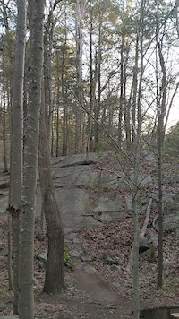
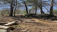
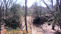
SaveNot a big area but a great network of trails that range from some easy trails to some very technical and rocky sections with punchy climbs. Some rock slabs and difficult to clean rock sections also make this fun for all levels.
Beverly Commons, commonly known as “Greenwood” among area mountain bikers, has great technical riding and a remote felling for a place so surrounded by civilization. At only 126 acres you’d think that there wouldn’t be enough riding here to make it worthwhile. But if you did, you’d be wrong.
Though tightly packed the trails meander through the woods through high ground and low, some difficult and others smooth and flowy. With few exceptions all of the trails are just as much fun in both directions.
About those low areas. North Shore NEMBA has been working hard to avoid boggy areas, building bridges and doing minor trail re-alignments. Beverly Commons has a lot of vernal pools and efforts have been made to steer clear of them.
In 2014 NS NEMBA, working with the town, built a sizable new trail. It consists of a dry loop on the east side of the Commons where an existing trail made an extended tour through a swamp. The new trail was designed to be rocky, wild and challenging. There was a considerable amount of tread work done to insure that the trail wouldn’t degrade over time. It’s a prime example of trail building best practices.
How did Beverly Commons come to exist in this heavily developed area? It appears that the name goes back to colonial times when it was used as a transportation route between north shore communities such as Salem and Gloucester. Like many other “common” lands it was an important source of firewood, lumber, building stones and was used as a common pasture for cows and sheep. Until population pressure and land clearing drove them away it was used by area hunters to stock their larders with deer, moose, cottontail rabbits, turkeys and other edible game.
Much as the early settlers did you’ll enjoy Beverly Commons. Though you’re ‘game’ will be the hunt of trails rather than food for your table.
Primary Trail Type: Cross-Country
AKA: Greenwood Ave
Land Status: City Managed
Land Manager: City of Beverly
 google parking directions
 Access Info:
Greenwood Ave. Beverly
The best place to park is at the end of Greenwood Ave at the trailhead. Parking along Greenwood is also available but please respect the neighbors driveways, mailboxes, etc.
The best place to park is at the end of Greenwood Ave at the trailhead. Parking along Greenwood is also available but please respect the neighbors driveways, mailboxes, etc.
Activities Click to view
- Mountain Bike
40 trails
- Horse
6 trails
- Hike
41 trails
- Trail Running
41 trails
- Snowshoe
11 trails
- Nordic Ski
7 trails
Region Details
- 3
- 5
- 23
- 8
- 1
Region Status
Open as of Jun 3, 2026Local Trail Association
Stats
- Avg Trail Rating
- Trails (view details)
- 40
- Trails Mountain Bike
- 41
- Trails E-Bike
- 1
- Trails Horse
- 6
- Trails Hike
- 41
- Trails Trail Running
- 41
- Trails Snowshoe
- 11
- Trails Nordic Ski
- 7
- Total Distance
- 13 miles
- Total Descent
- 1,597 ft
- Total Vertical
- 140 ft
- Highest Trailhead
- 171 ft
- Reports
- 410
- Photos
- 143
- Ridden Counter
- 10,837
Popular Beverly Commons Mountain Biking Trails
• 100 ★ 4.6 • 1 mile • 71 ft • 656 •
Popular blue difficulty singletrack. This multi-use trail can be used both directions and has a hard overall physical rating with a 71 ft black diamond climb. On average it takes 23 minutes to complete this trail.
• 100 ★ 5.0 • 5,174 ft • 131 ft • 651 •
Popular blue difficulty singletrack. This multi-use trail can be used both directions. On average it takes 16 minutes to complete this trail.
• 100 ★ 3.0 • 2,323 ft • 70 ft • 549 •
Popular blue difficulty family friendly singletrack. This multi-use trail can be used both directions and has a easy overall physical rating with a 70 ft blue climb. Trail visibility is always easy to follow. On average it takes 4 minutes to complete this trail.
• 100 ★ 3.5 • 2,417 ft • 36 ft • 463 •
Popular blue difficulty singletrack. This multi-use trail can be used both directions. On average it takes 6 minutes to complete this trail.
• 100 ★ 3.5 • 1,995 ft • 92 ft • 417 •
Popular blue difficulty singletrack. This multi-use trail can be used both directions. On average it takes 6 minutes to complete this trail.
• 95 ★ 4.0 • 2,618 ft • 85 ft • 383 •
Popular blue difficulty singletrack. This multi-use trail can be used both directions. On average it takes 9 minutes to complete this trail.
• 90 ★ 0.0 • 1,142 ft • 8 ft • 374 •
Popular green difficulty family friendly singletrack. This multi-use trail can be used both directions and has a moderate overall physical rating with a 8 ft green climb. Trail visibility is always easy to follow. On average it takes 1 minutes to complete this trail.
• 95 ★ 3.5 • 1,704 ft • 37 ft • 354 •
Popular blue difficulty singletrack. This multi-use trail can be used both directions. On average it takes 5 minutes to complete this trail.
Beverly Commons Mountain Bike Routes
★ 4.7 • 5 miles • 369 ft • 4 • Loop •
A relatively easy route, with some tech and some fun jumps. not much climbing, and a few fun decents.
★ 5.0 • 5 miles • 435 ft • 15 •
Post work quick ride arround the perimiter. Black and blues.
• 5 miles • 544 ft • 7 •
• 5 miles • 483 ft • 6 •
• 2 miles • 141 ft • 1 •
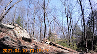
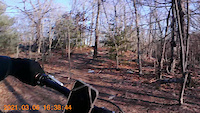
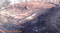
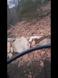
Photos of Beverly Commons Mountain Bike
Videos of Beverly Commons Mountain Bike
trail: Red Dot
0:17 |
198 |
Oct 17, 2022
trail: Orange Dot
0:04 |
200 |
Jun 6, 2021
trail: The Pines
0:14 |
|
Apr 26, 2021
trail: Orange Dot
0:12 |
135 |
Apr 11, 2021
trail: Orange Dot
0:10 |
159 |
Apr 11, 2021
trail: Orange Dot
0:17 |
120 |
Mar 10, 2021
trail: Orange Dot
0:30 |
84 |
Mar 10, 2021
trail: Orange Dot
0:14 |
92 |
Jan 22, 2021
Recent Trail Reports
| status | trail | date | condition | info | user |
|---|---|---|---|---|---|
| The Pines | Dec 13, 2025 @ 12:59pm (America/New_York) Dec 13, 2025 | Ideal | AndrewHally MRR | ||
| Orange Bowl | Dec 13, 2025 @ 12:59pm (America/New_York) Dec 13, 2025 | Ideal | AndrewHally MRR | ||
| Connector | Dec 13, 2025 @ 12:59pm (America/New_York) Dec 13, 2025 | Ideal | AndrewHally MRR | ||
| Chunks | Dec 13, 2025 @ 12:59pm (America/New_York) Dec 13, 2025 | Ideal | AndrewHally MRR | ||
| Red Dot | Dec 13, 2025 @ 12:59pm (America/New_York) Dec 13, 2025 | Ideal | AndrewHally MRR | ||
| Silver Bullet | Dec 13, 2025 @ 12:59pm (America/New_York) Dec 13, 2025 | Ideal | AndrewHally MRR | ||
| Cliff | Sep 20, 2025 @ 11:18am (America/New_York) Sep 20, 2025 | Dry | AndrewHally MRR | ||
| Greenwood 12 | Sep 20, 2025 @ 11:18am (America/New_York) Sep 20, 2025 | Dry | AndrewHally MRR | ||
| Sledgehammer | Sep 20, 2025 @ 11:18am (America/New_York) Sep 20, 2025 | Dry | AndrewHally MRR | ||
| Orange Dot | Sep 20, 2025 @ 11:18am (America/New_York) Sep 20, 2025 | Dry | AndrewHally MRR |
Activity Feed
| username | action | type | title | date |
|---|---|---|---|---|
| livetheride514 | wishlist | region | activity #97335346 | Jun 19, 2026 @ 12:01pm 22 hours |
| TrevorRobinette | wishlist | trail | activity #95904604 | May 30, 2026 @ 7:00pm May 30, 2026 |
| bh1026 | ridden | route | activity #95368995 | May 23, 2026 @ 5:37pm May 23, 2026 |
| mahalo021 | wishlist | route | activity #95172679 | May 21, 2026 @ 7:06am May 21, 2026 |
| colinorm | wishlist | route | activity #95095726 | May 20, 2026 @ 3:03am May 20, 2026 |
Recent Comments
| username | type | title | comment | date |
|---|---|---|---|---|
| trail | Either whoever submitted this trail to TF has... | May 13, 2026 @ 11:32am May 13, 2026 | ||
| trail | Horrible trail. Overgrown and rough. Avoid. | Mar 23, 2025 @ 8:04pm Mar 23, 2025 | ||
| trail | Absolute garbage. Barely a trail. Avoid. | Mar 23, 2025 @ 8:03pm Mar 23, 2025 | ||
| trail | Its fun but there should be a connector from... | May 20, 2024 @ 1:26pm May 20, 2024 | ||
| trail | The neighboring swamp is up on the trail along... | Sep 15, 2023 @ 11:17am Sep 15, 2023 |
Nearby Areas
| name | distance | ||||
|---|---|---|---|---|---|
| Bald Hill Trails | 5 | 0.8 km | |||
| Beverly Gardens | 0.9 km | ||||
| Endicott College | 5 | 8 | 6 | 1 | 0.9 km |
| Piggery/Culvert/Manchester Woods | 1 | 2 | 1 | 1.1 km | |
| Snake Hill / Sally Milligan Nature Reserve | 7 | 7 | 1 | 1.5 km |
Local Badges
-

Completionist0 awarded
Activity Type Stats
| activitytype | trails | distance | descent | descent distance | total vertical | rating | global rank | state rank | photos | reports | routes | ridelogs |
|---|---|---|---|---|---|---|---|---|---|---|---|---|
| Mountain Bike | 40 | 13 miles | 1,598 ft | 5 miles | 141 ft | #2,573 | #898 | 121 | 408 | 4 | 11,003 | |
| E-Bike | 1 | 1,142 ft | 20 ft | 361 ft | 20 ft | #1,656 | 296 | 1 | 72 | |||
| Horse | 6 | 4,511 ft | 118 ft | 1,896 ft | 128 ft | #3,323 | #1,968 | 78 | 2 | |||
| Hike | 41 | 13 miles | 1,598 ft | 5 miles | 141 ft | #3,586 | #1,243 | 19 | 406 | 1 | 381 | |
| Trail Running | 41 | 13 miles | 1,598 ft | 5 miles | 141 ft | #8,163 | #2,828 | 406 | 1 | 154 | ||
| Snowshoe | 11 | 2 miles | 190 ft | 3,123 ft | 128 ft | #1,029 | #511 | 3 | 21 | 17 | ||
| Nordic Ski | 7 | 4,846 ft | 118 ft | 2,014 ft | 128 ft | #1,600 | #786 | 41 | 8 |
Frequently Asked Questions About Beverly Commons
▼
What are the highest rated mountain biking trails in Beverly Commons?
The highest rated mountain biking trails in Beverly Commons are:
- Silver Bullet (4.4/5)
- Red Dot (4.3/5)
- The Pines (4.2/5)
- Ridgeline (4.1/5)
- Ground Swell (4.1/5)
▼
What is the best time of the year to ride in Beverly Commons?
Based on ride log data, the most popular months to ride in Beverly Commons are:
- May (218 activities)
- June (163 activities)
- August (153 activities)
▼
Where can I park to ride in Beverly Commons?
There are 2 parking locations listed in Beverly Commons. The most popular parking spots are:
▼
What is the longest trail in Beverly Commons?
The longest trail in Beverly Commons is Sledgehammer at 1.5 miles. View all trails sorted by distance.
Activities
- By tbubier
 & contributors
 - Admins: OSRC, OSRC, SiamDelightRules
- #5444 - 15,029 views
- beverly commons activity log | embed map of Beverly Commons mountain bike trails | beverly commons mountain biking points of interest
Downloading of trail gps tracks in kml & gpx formats is enabled for Beverly Commons.
You must login to download files.