close
-
Layers w
- Weather Layers
- Pro
- Pro
- Pro
- Pro
- Pro
- Pro
- More Layers
- Pro
- Pro
- Pro
- Pro
-
Upgrade to

3D
Trail Conditions
- Unknown
- Snow Groomed
- Snow Packed
- Snow Covered
- Snow Cover Partial
- Freeze/thaw Cycle
- Icy
- Prevalent Mud
- Wet
- Variable
- Ideal
- Dry
- Very Dry
Trail Flow (Ridden Direction)
Trailforks scans users ridelogs to determine the most popular direction each trail is ridden. A good flowing trail network will have most trails flowing in a single direction according to their intension.
The colour categories are based on what percentage of riders are riding a trail in its intended direction.
The colour categories are based on what percentage of riders are riding a trail in its intended direction.
- > 96%
- > 90%
- > 80%
- > 70%
- > 50%
- < 50%
- bi-directional trail
- no data
Trail Last Ridden
Trailforks scans ridelogs to determine the last time a trail was ridden.
- < 2 days
- < 1 week
- < 2 weeks
- < 1 month
- < 6 months
- > 6 months
Trail Ridden Direction
The intended direction a trail should be ridden.
- Downhill Only
- Downhill Primary
- Both Directions
- Uphill Primary
- Uphill Only
- One Direction
Contribute Details
Colors indicate trail is missing specified detail.
- Description
- Photos
- Description & Photos
- Videos
Trail Popularity ?
Trailforks scans ridelogs to determine which trails are ridden the most in the last 9 months.
Trails are compared with nearby trails in the same city region with a possible 25 colour shades.
Think of this as a heatmap, more rides = more kinetic energy = warmer colors.
- most popular
- popular
- less popular
- not popular
ATV/ORV/OHV Filter
Max Vehicle Width
inches
US Cell Coverage
Legend

Radar Time
Activity Recordings
Trailforks uses anonymized public activity data.
?
Activity Recordings
Trailforks uses anonymized public activity data.
?
Personal Heatmap
▶
Activity Types
all
/
none
▶
Options
2
Date range
month
–
Winter Trails
Warning
A routing network for winter maps does not exist. Selecting trails using the winter trails layer has been disabled.
Missing Trails
Most Popular
Least Popular
Trails are colored based on popularity. The more popular a trail is, the more red. Less popular trails trend towards green.
Jump Magnitude Heatmap
Heatmap of where riders jump on trails. Zoom in to see individual jumps, click circles to view jump details.
BC Backroad Status
![map legend]()
Service Road Atlas is a free to use, community-driven service for viewing and creating reports on the numerous back-country service roads around B.C. and Alberta.

Slope Aspect
Direction the slope faces
Trails Deemphasized
Trails are shown in grey.
Only show trails with no bike usage.
Suggested Layers
Based on selected activity type
Save the current map location and zoom level as your default home location whenever this page is loaded.
Save
No description for Bezirk Thun has been added yet!
Login or register to submit one.
This region uses the Uk/Euro style trail grading system.
Activities Click to view
- Mountain Bike
95 trails
- E-Bike
83 trails
- Hike
78 trails
- Trail Running
78 trails
- Snowshoe
0 trails
- Downhill Ski
0 trails
- Backcountry Ski
0 trails
- Nordic Ski
0 trails
Stats
- Avg Trail Rating
- Trails (view details)
- 100
- Trails Mountain Bike
- 95
- Trails E-Bike
- 83
- Trails Gravel Bike
- 1
- Trails Adaptive Bike
- 1
- Trails Winter Fat Bike
- 1
- Trails Horse
- 1
- Trails Hike
- 78
- Trails Trail Running
- 78
- Total Distance
- 54 miles
- Total Descent Distance
- 38 miles
- Total Descent
- 31,040 ft
- Total Vertical
- 3,818 ft
- Highest Trailhead
- 5,659 ft
- Reports
- 914
- Photos
- 171
- Ridden Counter
- 8,594
Articles
Video: Manuel Scheidegger Claims World's First Wheelied Everest
Jun 22, 2020 from pinkbike.com
The Swiss rider clams to have climbed 9,029 metres on his rear wheel in Steffisburg
Sub Regions
- Blumenstein (4)
- Horrenbach-Buchen (2)
- Pohlern (6)
- Reutigen (5)
- Sigriswil (26)
- Blueme (15)
- Steffisburg (24)
- Thun (16)
- Wattenwil (13)
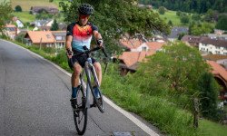
Popular Bezirk Thun Mountain Biking Trails
• 95 ★ 4.8 • 1 mile • 0 ft • 465 •
Verspielter Flowtrail mit hohen Steilwandkurven und vielen Sprüngen.
• 100 ★ 4.9 • 2 miles • 4 ft • 457 •
Highly rated popular blue difficulty family friendly machine groomed. This mountain bike primary trail and has a moderate overall physical rating. It features berm, drop, jump, gap jump and roller coaster. On average it takes 15 minutes to complete this trail.
• 90 ★ 4.0 • 3,261 ft • 7 ft • 191 • • hike
First 100m the Trail is next to a 20m+ Cliff. After crossing the Meadow the Trail get surroundet by big rocky Hudus the " " Attention!!!: At this part of the Trail some Bike hating Person always builds Biketraps with branches.
• 45 ★ 3.7 • 1,946 ft • 10 ft • 183 •
Moderately popular blue difficulty singletrack. This multi-use trail can be used downhill only and has a moderate overall physical rating. On average it takes 3 minutes to complete this trail.
• 85 ★ 4.0 • 1,867 ft • 0 ft • 170 • • hike
Watch out for Hikers!!! Go for a Swim straight down to the Lake of Thun :-)
• 50 ★ 3.0 • 3,491 ft • 34 ft • 126 • • hike
Watch out for Hikers!!! And there is one stair in the middle of the Trail. Just ride next to it.
• 85 ★ 3.4 • 932 ft • 0 ft • 123 •
Upper part of the old school MTB track. Steep and loose. The MTB veterans of Thun call it "Teststrecki" because its a test track for man and machine. Established arround 1990. And yes, it's a black trail!
• 80 ★ 4.5 • 1,476 ft • 0 ft • 115 •
Old school MTB track. Steep and loose. The MTB veterans of Thun call it "Teststrecki" because its a test track for man and machine. Established arround 1990.
Bezirk Thun Mountain Bike Routes
18 miles • 3,928 ft • 5 • Loop •
. Paved: 11km Forest Track: 18km SingleTrail: 1km
6 miles • 1,607 ft • 3 •
Wem zuwenig ist kann Extendet machen. Oberhalb vom Start ein knackiger Anstieg hoch bis zum Offcamber...
★ 5.0 • 17 miles • 4,374 ft • 0 • Loop •
From Thun Trainstation to Reutigen by Bike in 20min. Alternative take Veloland Route 8 Aare - it's...
4 miles • 1,141 ft • 3 •
Der einfachste Aufstieg durch den Wald an den Start des Trails.
6 miles • 1,316 ft • 2 •
Aufstieg auf einer mehrheitlich ruhigen Strasse zum Start des Trails.
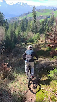
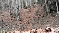
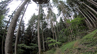
Photos of Bezirk Thun Mountain Bike
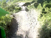
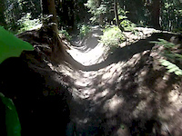
Videos of Bezirk Thun Mountain Bike
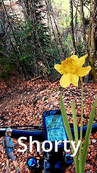
trail: Shorty
0:17 |
3 |
Mar 2, 2026
trail: Abstecher Trail
0:23 |
31 |
Aug 30, 2025
trail: Goldiwheel Trail
5:18 |
287 |
Jan 22, 2021
trail: Heimbergflueh
0:09 |
709 |
Jan 17, 2020
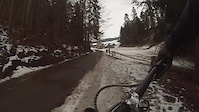
trail: Canyon
0:22 |
124 |
Oct 9, 2019
trail: Canyon
0:18 |
141 |
Jul 21, 2015
trail: Canyon
0:52 |
125 |
Jul 21, 2015
Current Trail Warnings
| status | trail | date | condition | user | info |
|---|---|---|---|---|---|
| 2 Brothers Reutigen | Jun 16, 2026 @ 9:54pm (Europe/Zurich) Jun 16, 2026 | Unknown | Jeremi7Tu80g | Weg ist nicht mehr sichtbar |
Recent Trail Reports
| status | trail | date | condition | info | user |
|---|---|---|---|---|---|
| Manitou Felsen Trail Blueme | Jun 19, 2026 @ 8:55am (Europe/Zurich) 19 hours | Dry | romulXs | ||
| Goldbach Connect Blueme | Jun 19, 2026 @ 8:55am (Europe/Zurich) 19 hours | Ideal | romulXs | ||
| Teststrecki lower Blueme | Jun 19, 2026 @ 8:55am (Europe/Zurich) 19 hours | Dry | romulXs | ||
| Teststrecki upper Blueme | Jun 19, 2026 @ 8:55am (Europe/Zurich) 19 hours | Dry | romulXs | ||
| Abstecher Trail Blueme | Jun 19, 2026 @ 8:55am (Europe/Zurich) 19 hours | Dry | romulXs | ||
| Blueme Blueme | Jun 19, 2026 @ 8:55am (Europe/Zurich) 19 hours | Dry | romulXs | ||
| Schmuggler 2 Reutigen | Jun 14, 2026 @ 8:23pm (Europe/Zurich) Jun 14, 2026 | Ideal | Jeremi7Tu80g | ||
| Schattig Trail Reutigen | Jun 14, 2026 @ 8:23pm (Europe/Zurich) Jun 14, 2026 | Ideal | Jeremi7Tu80g | ||
| Tigerfalle Reutigen | Jun 14, 2026 @ 8:23pm (Europe/Zurich) Jun 14, 2026 | Ideal | Jeremi7Tu80g | ||
| Brotway Reutigen | Jun 14, 2026 @ 8:22pm (Europe/Zurich) Jun 14, 2026 | Unknown | Jeremi7Tu80g |
Activity Feed
| username | action | type | title | date |
|---|---|---|---|---|
| Yuriy0ogDiY | wishlist | trail | activity #97324217 | Jun 19, 2026 @ 9:31am 9 hours |
| romulXs | add | report | activity #97306180 and 5 more | Jun 19, 2026 @ 3:46am 15 hours |
| XTAdventures | ridden | trail | activity #97160518 | Jun 16, 2026 @ 8:47pm 3 days |
| Jeremi7Tu80g | add | report | activity #97132840 | Jun 16, 2026 @ 12:54pm Jun 16, 2026 |
| Jeremi7Tu80g | add | report | activity #96989395 and 3 more | Jun 14, 2026 @ 11:22am Jun 14, 2026 |
Recent Comments
| username | type | title | comment | date |
|---|---|---|---|---|
| trail | cleaned - awesome steep trail 👌💯 technical | Jun 1, 2026 @ 11:23pm Jun 1, 2026 | ||
| report | Herrliche Bedingungen am ersten Märztag | Mar 2, 2026 @ 12:44am Mar 2, 2026 | ||
| trail | Geil, so steil | Nov 10, 2024 @ 11:16pm Nov 10, 2024 | ||
| trail | Avoid if it’s been raining, it doesn’t dry... | May 19, 2024 @ 11:10am May 19, 2024 | ||
| trail | In einem Jahr nützt es niemandem mehr, ob es... | Feb 21, 2024 @ 3:33pm Feb 21, 2024 |
Local Badges
-

Mountain Biking 100k Badge0 awarded -

Descent 10k Badge1 awarded -

Epic Ride Descent 2k0 awarded -
Epic Ride Descent 2k0 awarded -
Mountain Biking 100k Badge0 awarded -

Climbing 10k Badge1 awarded
Bike & Skill Parks
| name | type | city | rating |
|---|---|---|---|
| Pumptrack Lerchenfeld | skill park | Thun | |
| Pumptrack Thierachern | skill park | Thun | |
| Dirt Jump Park Steffisburg | skill park | Thun |
Local Trail Association
Activity Type Stats
| activitytype | trails | distance | descent | descent distance | total vertical | rating | global rank | state rank | photos | reports | routes | ridelogs |
|---|---|---|---|---|---|---|---|---|---|---|---|---|
| Mountain Bike | 95 | 51 miles | 30,374 ft | 36 miles | 3,819 ft | 163 | 914 | 8 | 11,908 | |||
| E-Bike | 83 | 47 miles | 26,772 ft | 33 miles | 3,753 ft | 6 | 871 | 4 | 2,269 | |||
| Gravel Bike | 1 | 4 | 77 | |||||||||
| Winter Fat Bike | 1 | 2 | 3 | |||||||||
| Horse | 1 | 96 | ||||||||||
| Hike | 78 | 45 miles | 23,228 ft | 29 miles | 3,753 ft | 2 | 867 | 707 | ||||
| Trail Running | 78 | 45 miles | 23,228 ft | 29 miles | 3,753 ft | 863 | 176 |
Frequently Asked Questions About Bezirk Thun
▼
What are the best places to ride in Bezirk Thun?
Bezirk Thun has 2 areas to explore for mountain biking.
▼
What are the highest rated mountain biking trails in Bezirk Thun?
The highest rated mountain biking trails in Bezirk Thun are:
- Goldiwheel Trail (4.6/5)
- Rabenfluh Trail (4.6/5)
- Tigerfalle (4.4/5)
- Bluemewald Trail (4.4/5)
- Heimbergflueh (4.3/5)
▼
What is the best time of the year to ride in Bezirk Thun?
Based on ride log data, the most popular months to ride in Bezirk Thun are:
- May (124 activities)
- April (107 activities)
- June (96 activities)
▼
What is the longest trail in Bezirk Thun?
The longest trail in Bezirk Thun is Goldiwheel Trail at 1.5 miles. View all trails sorted by distance.
Activities
Trails
Points of Interest
- By inversedotch
 & contributors
 - Admins: swiss, trailpapst, Thun Kandertal
- #34581 - 4,552 views
- bezirk thun activity log | embed map of Bezirk Thun mountain bike trails | bezirk thun mountain biking points of interest
Downloading of trail gps tracks in kml & gpx formats is enabled for Bezirk Thun.
You must login to download files.