close
-
Layers w
- Weather Layers
- Pro
- Pro
- Pro
- Pro
- Pro
- Pro
- More Layers
- Pro
- Pro
- Pro
- Pro
-
Upgrade to

3D
Trail Conditions
- Unknown
- Snow Groomed
- Snow Packed
- Snow Covered
- Snow Cover Partial
- Freeze/thaw Cycle
- Icy
- Prevalent Mud
- Wet
- Variable
- Ideal
- Dry
- Very Dry
Trail Flow (Ridden Direction)
Trailforks scans users ridelogs to determine the most popular direction each trail is ridden. A good flowing trail network will have most trails flowing in a single direction according to their intension.
The colour categories are based on what percentage of riders are riding a trail in its intended direction.
The colour categories are based on what percentage of riders are riding a trail in its intended direction.
- > 96%
- > 90%
- > 80%
- > 70%
- > 50%
- < 50%
- bi-directional trail
- no data
Trail Last Ridden
Trailforks scans ridelogs to determine the last time a trail was ridden.
- < 2 days
- < 1 week
- < 2 weeks
- < 1 month
- < 6 months
- > 6 months
Trail Ridden Direction
The intended direction a trail should be ridden.
- Downhill Only
- Downhill Primary
- Both Directions
- Uphill Primary
- Uphill Only
- One Direction
Contribute Details
Colors indicate trail is missing specified detail.
- Description
- Photos
- Description & Photos
- Videos
Trail Popularity ?
Trailforks scans ridelogs to determine which trails are ridden the most in the last 9 months.
Trails are compared with nearby trails in the same city region with a possible 25 colour shades.
Think of this as a heatmap, more rides = more kinetic energy = warmer colors.
- most popular
- popular
- less popular
- not popular
ATV/ORV/OHV Filter
Max Vehicle Width
inches
US Cell Coverage
Legend

Radar Time
Activity Recordings
Trailforks uses anonymized public activity data.
?
Activity Recordings
Trailforks uses anonymized public activity data.
?
Personal Heatmap
▶
Activity Types
all
/
none
▶
Options
2
Date range
month
–
Winter Trails
Warning
A routing network for winter maps does not exist. Selecting trails using the winter trails layer has been disabled.
Missing Trails
Most Popular
Least Popular
Trails are colored based on popularity. The more popular a trail is, the more red. Less popular trails trend towards green.
Jump Magnitude Heatmap
Heatmap of where riders jump on trails. Zoom in to see individual jumps, click circles to view jump details.
BC Backroad Status
![map legend]()
Service Road Atlas is a free to use, community-driven service for viewing and creating reports on the numerous back-country service roads around B.C. and Alberta.

Slope Aspect
Direction the slope faces
Trails Deemphasized
Trails are shown in grey.
Only show trails with no bike usage.
Suggested Layers
Based on selected activity type
Save the current map location and zoom level as your default home location whenever this page is loaded.
Save
No description for Bezirk Winterthur has been added yet!
Login or register to submit one.
This region uses the Uk/Euro style trail grading system.
Activities Click to view
- Mountain Bike
88 trails
- E-Bike
71 trails
- Hike
61 trails
- Trail Running
60 trails
- Snowshoe
0 trails
- Downhill Ski
0 trails
- Backcountry Ski
0 trails
- Nordic Ski
0 trails
Stats
- Avg Trail Rating
- Trails (view details)
- 76
- Trails Mountain Bike
- 88
- Trails E-Bike
- 71
- Trails Horse
- 3
- Trails Hike
- 61
- Trails Trail Running
- 60
- Total Distance
- 24 miles
- Total Descent
- 12,207 ft
- Total Vertical
- 1,430 ft
- Highest Trailhead
- 2,870 ft
- Reports
- 910
- Photos
- 67
- Ridden Counter
- 3,018
Sub Regions
- Dättlikon (3)
- Elgg (9)
- Pfungen (3)
- Schlatt ZH (15)
- Turbenthal (10)
- Winterthur (37)
Popular Bezirk Winterthur Mountain Biking Trails
• 100 ★ 4.6 • 2,106 ft • 0 ft • 98 •
is a 600 m very popular blue singletrack trail located in Winterthur. This mountain bike primary trail can be used downhill only.
• 95 ★ 3.9 • 2,103 ft • 0 ft • 91 •
Popular red difficulty machine groomed. This mountain bike primary trail can be used downhill only and has a easy overall physical rating. It features berm and jump. Trail visibility is always easy to follow.
• 85 ★ 3.7 • 1,194 ft • 0 ft • 88 •
Popular green difficulty singletrack. This multi-use trail can be used downhill primary. It features jump and gap jump. On average it takes 1 minutes to complete this trail.
• 75 ★ 3.8 • 1,916 ft • 0 ft • 79 •
Grundsätzlich einfacher Trail von der Ruine Schauenberg Richtung Girenbad mit einigen wenigen S2 Stellen
• 25 ★ 2.4 • 2 miles • 4 ft • 68 •
Schöner Trail mit viel Flow welcher sehr einfach zu Fahren ist. Gegen Ende des Trail ist eine sehr steile Metalltreppe mit zwei engen Richtungswechsel. Diese ist wenn überhaupt nur für sehr geübte Biker fahrbar.
• 90 ★ 3.7 • 2,431 ft • 90 ft • 66 •
Einfacher Trail mit wenigen S2 Abschnitten. Kleiner Stufen an gewissen Stellen
Bezirk Winterthur Mountain Bike Routes
8 miles • 1,630 ft • 4 •
Der Biketrail Elgg ist aus einer gemeinsamen Initiative der Gemeinde Elgg, des Forstamts Elgg sowie...
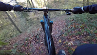
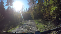
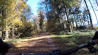
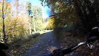
Photos of Bezirk Winterthur Mountain Bike
Videos of Bezirk Winterthur Mountain Bike
trail: Tüebberg II
0:30 |
37 |
Nov 20, 2023
trail: Oberschlatter
0:24 |
39 |
Nov 20, 2023
trail: Schauenberg uphill
2:42 |
9 |
Nov 20, 2023
trail: Schauenberg uphill
0:21 |
5 |
Nov 20, 2023
trail: Tüebberg I
3:52 |
76 |
Nov 20, 2023

trail: THE BAD
12:58 |
44 |
Dec 8, 2025 , Winterthur

trail: THE UGLY
12:58 |
24 |
Dec 8, 2025 , Winterthur

trail: THE GOOD
12:58 |
33 |
Dec 8, 2025 , Winterthur
Current Trail Warnings
| status | trail | date | condition | user | info |
|---|---|---|---|---|---|
| Munitionstrail Winterthur | Jun 14, 2026 @ 6:44pm (Europe/Zurich) Jun 14, 2026 | Ideal | AWESOM-O |
Recent Trail Reports
| status | trail | date | condition | info | user |
|---|---|---|---|---|---|
| THE BAD Winterthur | Jun 21, 2026 @ 3:53pm (Europe/Zurich) 5 hours | Ideal | maccagnodenis | ||
| Brüttener Winterthur | Jun 21, 2026 @ 3:53pm (Europe/Zurich) 5 hours | Ideal | maccagnodenis | ||
| Whimsy Waves Winterthur | Jun 14, 2026 @ 6:44pm (Europe/Zurich) Jun 14, 2026 | Ideal | AWESOM-O | ||
| Loamy Drop Winterthur | Jun 14, 2026 @ 6:44pm (Europe/Zurich) Jun 14, 2026 | Ideal | AWESOM-O | ||
| THE GOOD Winterthur | Jun 14, 2026 @ 6:44pm (Europe/Zurich) Jun 14, 2026 | Ideal | AWESOM-O | ||
| Mattenbach Straight-Line Winterthur | Jun 7, 2026 @ 5:12pm (Europe/Zurich) Jun 7, 2026 | Ideal | AWESOM-O | ||
| BikeTrailElgg - Guegenhard Elgg | Jun 6, 2026 @ 2:23pm (Europe/Zurich) Jun 6, 2026 | Variable | Kartonschachtel | ||
| Biketrail Elgg - Abschnitt Schauenberg Elgg | Jun 6, 2026 @ 2:23pm (Europe/Zurich) Jun 6, 2026 | Prevalent Mud | Kartonschachtel | ||
| Biketrail Elgg - Abschnitt Scheunberg Elgg | May 9, 2026 @ 10:49am (Europe/Busingen) May 9, 2026 | Prevalent Mud | gossi | ||
| Scheunberg Connector Elgg | May 9, 2026 @ 10:49am (Europe/Busingen) May 9, 2026 | Ideal | gossi |
Activity Feed
| username | action | type | title | date |
|---|---|---|---|---|
| maccagnodenis | add | report | activity #97480056 and 1 more | Jun 21, 2026 @ 6:53am 5 hours |
| Toad-Nugget | wishlist | trail | activity #97434730 and 2 more | Jun 20, 2026 @ 2:44pm 21 hours |
| simonNEyyzY | ridden | trail | activity #97374005 | Jun 20, 2026 @ 2:09am 1 day |
| AWESOM-O | add | report | activity #97061103 and 3 more | Jun 15, 2026 @ 1:00pm Jun 15, 2026 |
| DapHE3ec | wishlist | trail | activity #96879311 | Jun 13, 2026 @ 8:16am Jun 13, 2026 |
Recent Comments
| username | type | title | comment | date |
|---|---|---|---|---|
| trail | extremly dry. the top is fun.some berms have... | Jun 30, 2025 @ 7:09am Jun 30, 2025 | ||
| trail | its very dry and fun. better the second time... | Jun 30, 2025 @ 7:07am Jun 30, 2025 | ||
| trail | was on the trail this friday, its dry. lots of... | May 17, 2025 @ 9:23am May 17, 2025 | ||
| trail | Great trail for an XC ride between sections or... | May 4, 2025 @ 1:07am May 4, 2025 | ||
| trail | Schild ist "verschwunden". Trail immer noch... | Mar 1, 2025 @ 9:29am Mar 1, 2025 |
Local Badges
-

Descent 100k Badge0 awarded -

Mountain Biking 100k Badge0 awarded -

Epic Ride Descent 2k1 awarded -

Descent 10k Badge1 awarded -

Climbing 10k Badge0 awarded -

Big Ride 30k3 awarded
Bike & Skill Parks
| name | type | city | rating |
|---|---|---|---|
| Skills Park Winterthur | skill park | Winterthur | |
| Pumptrack Reitplatz Winterthur | skill park | Winterthur | |
| Powerbike Winterthur BMX Track | skill park | Winterthur |
Local Mountain Biking Directory
-
IG Biketrails Winterthur
![IG Biketrails Winterthur]()
-
Porco di Mare Syndicate
![Porco di Mare Syndicate]()
-
Bikestop.chBike Shop
-
Total SportBike Shop
Activity Type Stats
| activitytype | trails | distance | descent | descent distance | total vertical | rating | global rank | state rank | photos | reports | routes | ridelogs |
|---|---|---|---|---|---|---|---|---|---|---|---|---|
| Mountain Bike | 88 | 24 miles | 12,208 ft | 19 miles | 1,430 ft | 66 | 909 | 1 | 10,804 | |||
| E-Bike | 71 | 22 miles | 10,125 ft | 16 miles | 1,430 ft | 1 | 847 | 1 | 783 | |||
| Horse | 3 | 1 mile | 138 ft | 3,294 ft | 823 ft | 21 | ||||||
| Hike | 61 | 19 miles | 8,271 ft | 14 miles | 1,430 ft | 874 | 152 | |||||
| Trail Running | 60 | 18 miles | 8,081 ft | 13 miles | 1,430 ft | 874 | 539 |
Frequently Asked Questions About Bezirk Winterthur
▼
What are the highest rated mountain biking trails in Bezirk Winterthur?
The highest rated mountain biking trails in Bezirk Winterthur are:
- Buechenegg (4.6/5)
- THE GOOD (4.5/5)
- Bodacious Berms (4.2/5)
- Rideplatz Uphill (4.2/5)
- Biketrail Elgg - Abschnitt Schauenberg (4.2/5)
▼
What is the best time of the year to ride in Bezirk Winterthur?
Based on ride log data, the most popular months to ride in Bezirk Winterthur are:
- May (44 activities)
- April (34 activities)
- June (33 activities)
▼
What is the longest trail in Bezirk Winterthur?
The longest trail in Bezirk Winterthur is Töss XC at 3.2 km. View all trails sorted by distance.
▼
What are the best & highest rated hiking trails in Bezirk Winterthur?
The best hiking trails in Bezirk Winterthur are: View all hiking trails sorted by popularity score.
Activities
Trails
Points of Interest
- By inversedotch
 & contributors
 - Admins: swiss, trailpapst, Zürich
- #36385 - 3,318 views
- bezirk winterthur activity log | embed map of Bezirk Winterthur mountain bike trails | bezirk winterthur mountain biking points of interest
Downloading of trail gps tracks in kml & gpx formats is enabled for Bezirk Winterthur.
You must login to download files.