close
-
Layers w
- Weather Layers
- Pro
- Pro
- Pro
- Pro
- Pro
- Pro
- More Layers
- Pro
- Pro
- Pro
- Pro
-
Upgrade to

3D
Trail Conditions
- Unknown
- Snow Groomed
- Snow Packed
- Snow Covered
- Snow Cover Partial
- Freeze/thaw Cycle
- Icy
- Prevalent Mud
- Wet
- Variable
- Ideal
- Dry
- Very Dry
Trail Flow (Ridden Direction)
Trailforks scans users ridelogs to determine the most popular direction each trail is ridden. A good flowing trail network will have most trails flowing in a single direction according to their intension.
The colour categories are based on what percentage of riders are riding a trail in its intended direction.
The colour categories are based on what percentage of riders are riding a trail in its intended direction.
- > 96%
- > 90%
- > 80%
- > 70%
- > 50%
- < 50%
- bi-directional trail
- no data
Trail Last Ridden
Trailforks scans ridelogs to determine the last time a trail was ridden.
- < 2 days
- < 1 week
- < 2 weeks
- < 1 month
- < 6 months
- > 6 months
Trail Ridden Direction
The intended direction a trail should be ridden.
- Downhill Only
- Downhill Primary
- Both Directions
- Uphill Primary
- Uphill Only
- One Direction
Contribute Details
Colors indicate trail is missing specified detail.
- Description
- Photos
- Description & Photos
- Videos
Trail Popularity ?
Trailforks scans ridelogs to determine which trails are ridden the most in the last 9 months.
Trails are compared with nearby trails in the same city region with a possible 25 colour shades.
Think of this as a heatmap, more rides = more kinetic energy = warmer colors.
- most popular
- popular
- less popular
- not popular
ATV/ORV/OHV Filter
Max Vehicle Width
inches
US Cell Coverage
Legend

Radar Time
Activity Recordings
Trailforks uses anonymized public activity data.
?
Activity Recordings
Trailforks uses anonymized public activity data.
?
Personal Heatmap
▶
Activity Types
all
/
none
▶
Options
2
Date range
month
–
Winter Trails
Warning
A routing network for winter maps does not exist. Selecting trails using the winter trails layer has been disabled.
Missing Trails
Most Popular
Least Popular
Trails are colored based on popularity. The more popular a trail is, the more red. Less popular trails trend towards green.
Jump Magnitude Heatmap
Heatmap of where riders jump on trails. Zoom in to see individual jumps, click circles to view jump details.
BC Backroad Status
![map legend]()
Service Road Atlas is a free to use, community-driven service for viewing and creating reports on the numerous back-country service roads around B.C. and Alberta.

Slope Aspect
Direction the slope faces
Trails Deemphasized
Trails are shown in grey.
Only show trails with no bike usage.
Suggested Layers
Based on selected activity type
Save the current map location and zoom level as your default home location whenever this page is loaded.
Save
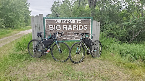
No description for Big Rapids has been added yet!
Login or register to submit one.
Activities Click to view
- Mountain Bike
1 trails
- Horse
1 trails
- Hike
3 trails
- Trail Running
2 trails
Region Details
- 1
Region Status
Caution as of Dec 21, 2021Stats
- Avg Trail Rating
- Trails (view details)
- 1
- Trails Mountain Bike
- 2
- Trails E-Bike
- 2
- Trails Horse
- 1
- Trails Hike
- 3
- Trails Trail Running
- 2
- Trails Snowshoe
- 2
- Trails Nordic Ski
- 2
- Total Distance
- 48 miles
- Total Descent Distance
- 14 miles
- Total Descent
- 284 ft
- Total Vertical
- 357 ft
- Highest Trailhead
- 1,208 ft
- Reports
- -1
- Photos
- 2
- Ridden Counter
- 425
Popular Big Rapids Mountain Biking Trails
• 100 ★ 0.0 • 48 miles • 466 ft • 79 •
Popular green difficulty paved path. This multi-use trail can be used both directions. On average it takes 2 hours28 minutes to complete this trail.
Videos of Big Rapids Mountain Bike

trail: 10
0:34 |
54 |
Feb 4, 2017
trail: Trail 4
12:26 |
13 |
Sep 15, 2016
trail: Trail 3
4:56 |
9 |
Sep 15, 2016
trail: Trail 2
7:51 |
11 |
Sep 15, 2016
trail: Trail 1
22:52 |
12 |
Sep 15, 2016
trail: Trail 2
0:00 |
171 |
Jun 19, 2014

trail: 16
5:14 |
226 |
Oct 16, 2010

trail: 15
0:20 |
143 |
Oct 15, 2010
National Scenic Trails & Official Routes
-
Fred Meijer White Pine Trail
- Mountain Bike
- E-Bike
- Hike
- Trail Running
- Snowmobile
- Nordic Ski
Activity Feed
| username | action | type | title | date |
|---|---|---|---|---|
| jfrano | wishlist | trail | activity #40951226 | Jun 15, 2023 @ 8:18am Jun 15, 2023 |
| rickplite | add | trail | activity #24849954 | Nov 14, 2021 @ 1:37pm Nov 14, 2021 |
| rickplite | add | photo | activity #24814173 and 2 more | Nov 13, 2021 @ 11:35am Nov 13, 2021 |
| rickplite | add | report | activity #24813949 | Nov 13, 2021 @ 11:29am Nov 13, 2021 |
| rickplite | add | photo | activity #23989902 | Oct 11, 2021 @ 8:11pm Oct 11, 2021 |
Local Badges
-

Epic Ride Descent 2k0 awarded -

Descent 10k Badge1 awarded -

Descent 100k Badge0 awarded
Activity Type Stats
| activitytype | trails | distance | descent | descent distance | total vertical | rating | global rank | state rank | photos | reports | routes | ridelogs |
|---|---|---|---|---|---|---|---|---|---|---|---|---|
| Mountain Bike | 1 | 48 miles | 285 ft | 14 miles | 249 ft | #8,479 | #2,723 | 2 | 1 | 1,080 | ||
| E-Bike | 2 | 48 miles | 285 ft | 14 miles | 249 ft | 5 | ||||||
| Horse | 1 | 495 ft | #3,497 | #2,034 | 17 | |||||||
| Hike | 3 | 48 miles | 285 ft | 14 miles | 358 ft | #6,296 | #2,205 | 1 | 20 | |||
| Trail Running | 2 | 48 miles | 285 ft | 14 miles | 249 ft | #5,797 | #1,846 | 1 | 2 | |||
| Snowshoe | 2 | 48 miles | 285 ft | 14 miles | 249 ft | |||||||
| Nordic Ski | 2 | 48 miles | 285 ft | 14 miles | 249 ft | 1 |
- By markholloway
 Trailforks Map Team & contributors
 - Admins: CMMBA
- #11518 - 3,356 views
- big rapids activity log | embed map of Big Rapids mountain bike trails | big rapids mountain biking points of interest
Downloading of trail gps tracks in kml & gpx formats is enabled for Big Rapids.
You must login to download files.