close
-
Layers w
- Weather Layers
- Pro
- Pro
- Pro
- Pro
- Pro
- Pro
- More Layers
- Pro
- Pro
- Pro
- Pro
-
Upgrade to

3D
Trail Conditions
- Unknown
- Snow Groomed
- Snow Packed
- Snow Covered
- Snow Cover Partial
- Freeze/thaw Cycle
- Icy
- Prevalent Mud
- Wet
- Variable
- Ideal
- Dry
- Very Dry
Trail Flow (Ridden Direction)
Trailforks scans users ridelogs to determine the most popular direction each trail is ridden. A good flowing trail network will have most trails flowing in a single direction according to their intension.
The colour categories are based on what percentage of riders are riding a trail in its intended direction.
The colour categories are based on what percentage of riders are riding a trail in its intended direction.
- > 96%
- > 90%
- > 80%
- > 70%
- > 50%
- < 50%
- bi-directional trail
- no data
Trail Last Ridden
Trailforks scans ridelogs to determine the last time a trail was ridden.
- < 2 days
- < 1 week
- < 2 weeks
- < 1 month
- < 6 months
- > 6 months
Trail Ridden Direction
The intended direction a trail should be ridden.
- Downhill Only
- Downhill Primary
- Both Directions
- Uphill Primary
- Uphill Only
- One Direction
Contribute Details
Colors indicate trail is missing specified detail.
- Description
- Photos
- Description & Photos
- Videos
Trail Popularity ?
Trailforks scans ridelogs to determine which trails are ridden the most in the last 9 months.
Trails are compared with nearby trails in the same city region with a possible 25 colour shades.
Think of this as a heatmap, more rides = more kinetic energy = warmer colors.
- most popular
- popular
- less popular
- not popular
ATV/ORV/OHV Filter
Max Vehicle Width
inches
US Cell Coverage
Legend

Radar Time
Activity Recordings
Trailforks uses anonymized public activity data.
?
Activity Recordings
Trailforks uses anonymized public activity data.
?
Personal Heatmap
▶
Activity Types
all
/
none
▶
Options
2
Date range
month
–
Winter Trails
Warning
A routing network for winter maps does not exist. Selecting trails using the winter trails layer has been disabled.
Missing Trails
Most Popular
Least Popular
Trails are colored based on popularity. The more popular a trail is, the more red. Less popular trails trend towards green.
Jump Magnitude Heatmap
Heatmap of where riders jump on trails. Zoom in to see individual jumps, click circles to view jump details.
BC Backroad Status
![map legend]()
Service Road Atlas is a free to use, community-driven service for viewing and creating reports on the numerous back-country service roads around B.C. and Alberta.

Slope Aspect
Direction the slope faces
Trails Deemphasized
Trails are shown in grey.
Only show trails with no bike usage.
Suggested Layers
Based on selected activity type
Save the current map location and zoom level as your default home location whenever this page is loaded.
Save
No description for Big Sur has been added yet!
Login or register to submit one.
Activities Click to view
- Mountain Bike
10 trails
- Adaptive Bike
0 trails
- Horse
14 trails
- Hike
69 trails
- Trail Running
69 trails
Region Details
- 1
- 4
- 1
- 3
Region Status
Open as of May 14, 2026Stats
- Avg Trail Rating
- Trails (view details)
- 63
- Trails Mountain Bike
- 10
- Trails E-Bike
- 1
- Trails Horse
- 14
- Trails Hike
- 69
- Trails Trail Running
- 69
- Trails ATV/ORV/OHV
- 1
- Total Distance
- 154 miles
- Total Descent
- 38,686 ft
- Total Vertical
- 4,816 ft
- Highest Trailhead
- 4,823 ft
- Reports
- 31
- Photos
- 32
- Ridden Counter
- 3,456
Articles
Wanna Hike in California? These Are the 13 Most Stunning Trails.
Jul 18, 2024 from outsideonline.com
A longtime Golden State hiker reveals her dream list of the most beautiful, must-see routes in California
Sub Regions
-
Andrew Molera State Park
- 1
- 2
-
Bottchers Recreation Site
-
Plaskett Ridge
Popular Big Sur Mountain Biking Trails
• 100 ★ 3.9 • 10 miles • 2,773 ft • 109 • • atv
This is a popular trail for offroad vehicle travel with expansive views of the Big Sur coastline and surrounding mountains. Gravel grinders will find this as a welcome break from being buzzed by cars along hwy 1.
• 90 ★ 4.4 • 15 miles • 2,122 ft • 40 •
Seldom Travelled, abandoned road between Arroyo-Seco and the Indians. This takes you deep into the Ventana Wilderness (the road/trail is a ribbon of non-wilderness).
• 60 ★ 3.5 • 1 mile • 50 ft • 37 • • hike
This easy trail leads to the ocean beach. To get to the trail, you must cross the Big Sur River. A seasonal footbridge is put in place around June 15 and removed around October 31. Use extreme caution when wading across the river....
• 50 ★ 3.4 • 3 miles • 1,242 ft • 29 • • hike
Moderately popular black diamond difficulty singletrack. This hike primary trail can be used both directions. On average it takes 38 minutes to complete this trail.
• 80 ★ 2.7 • 3 miles • 2,528 ft • 10 •
The Timber Top trail is steep, averaging 16%. 99.9% of bicyclists will need to push the bicycle to the top. The ride down is gnarly. The hiking trail is known as Forest Service trail named the "Boronda Trail", this is not wilderness. Enjoy.
• 5 ★ 5.0 • 2 miles • 116 ft • 3 • • hike
Posted signs say the trail is closed.
• 5 ★ 0.0 • 5 miles • 1,894 ft • 3 •
The north end of the route is at the Monterey/SLO county line. The south end is a few 100ft south of Ragged pt. The southern end is the "Baldwin Ranch Rd", this road is entirely on Forest Service land and is used weekly (or more by the...
• 5 ★ 0.0 • 3 miles • 862 ft • 1 • • hike
Less popular green difficulty singletrack. This hike primary trail can be used both directions.
Big Sur Mountain Bike Routes
★ 4.0 • 17 miles • 2,659 ft • 0 • Loop •
Bixby Bridge through Old Coast, exit at Molera State Park, ride back to Bixby via HWY 1
11 miles • 1,615 ft • 1 • Loop •
Big Sur to Andrew Molera Ridge trail with epic downhill.
Photos of Big Sur Mountain Bike
Videos of Big Sur Mountain Bike
youtuber
![BOMB VOYAGE in Big Sur | Mountain Biking...]()
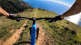
trail: Timber Top/ Boronda trail
15:13 |
812 |
Jan 26, 2022 , Big Sur
Recent Trail Reports
| status | trail | date | condition | info | user |
|---|---|---|---|---|---|
| Old Coast Road | Oct 7, 2025 @ 12:46pm (America/Los_Angeles) Oct 7, 2025 | Very Dry | Nevrfolow | ||
| Creamery Meadows Trail | May 10, 2025 @ 2:54pm May 10, 2025 | Dry | teosoft | ||
| Timber Top/ Boronda trail | Jan 13, 2024 @ 9:12am Jan 13, 2024 | Dry | mikejanyk | ||
| Arroyo Seco - Indians Road | Jan 17, 2022 @ 7:05pm Jan 17, 2022 | Dry | renjim | ||
| Ridge Trail | Jun 17, 2019 @ 1:43pm Jun 17, 2019 | Variable | ruanded |
Activity Feed
| username | action | type | title | date |
|---|---|---|---|---|
| krpayne99 | wishlist | trail | activity #94937453 | May 17, 2026 @ 1:49pm May 17, 2026 |
| Nataliea6R5uX | wishlist | trail | activity #94250787 | May 7, 2026 @ 4:53pm May 7, 2026 |
| knobbysonly | difficultyvote | trail | activity #94188103 | May 6, 2026 @ 5:39pm May 6, 2026 |
| ESP-OFF | wishlist | trail | activity #93280423 | Apr 24, 2026 @ 7:46am Apr 24, 2026 |
| DrDrea | vote | route | activity #92236001 | Apr 8, 2026 @ 11:02pm Apr 8, 2026 |
Recent Comments
| username | type | title | comment | date |
|---|---|---|---|---|
| trail | this is an accurate report. I rode Indians in... | Feb 18, 2026 @ 11:51pm Feb 18, 2026 | ||
| trail | For outsiders visiting, ticks have been... | Mar 23, 2025 @ 9:28am Mar 23, 2025 | ||
| trail | Sounds like a decent ebike ride! Thanks for... | Sep 6, 2023 @ 10:56am Sep 6, 2023 | ||
| trail | This trail is essentially closed. Someone... | Sep 5, 2023 @ 8:53pm Sep 5, 2023 | ||
| trail | Posted sign says trail is closed. | Sep 5, 2023 @ 9:12am Sep 5, 2023 |
Local Badges
-

Epic Ride Climb 2k187 awarded -

Climbing 10k Badge13 awarded -

Climbing 100k Badge0 awarded -

Epic Ride Descent 2k187 awarded -

Descent 10k Badge14 awarded -

Descent 100k Badge0 awarded
Activity Type Stats
| activitytype | trails | distance | descent | descent distance | total vertical | rating | global rank | state rank | photos | reports | routes | ridelogs |
|---|---|---|---|---|---|---|---|---|---|---|---|---|
| Mountain Bike | 10 | 43 miles | 6,867 ft | 17 miles | 3,061 ft | #4,837 | #1,626 | 34 | 27 | 2 | 1,170 | |
| E-Bike | 1 | 5 miles | 1,952 ft | 3 miles | 1,919 ft | 14 | 1 | 326 | ||||
| Horse | 14 | 29 miles | 6,663 ft | 12 miles | 3,422 ft | #1,506 | #887 | 8 | ||||
| Hike | 69 | 149 miles | 36,736 ft | 58 miles | 4,816 ft | #553 | #253 | 9 | 30 | 1,860 | ||
| Trail Running | 69 | 149 miles | 36,736 ft | 58 miles | 4,816 ft | #1,242 | #450 | 30 | 209 | |||
| ATV/ORV/OHV | 1 | 10 miles | 2,585 ft | 5 miles | 1,073 ft | 11 | 2 | 5 |
Frequently Asked Questions About Big Sur
▼
What are the best places to ride in Big Sur?
Big Sur has 6 areas to explore for mountain biking. The top rated areas are:
▼
What are the highest rated mountain biking trails in Big Sur?
The highest rated mountain biking trails in Big Sur are:
- South Boundary Trail (4.1/5)
- Arroyo Seco - Indians Road (4.1/5)
- Old Coast Road (3.9/5)
- Creamery Meadows Trail (3.9/5)
- Ridge Trail (3.9/5)
▼
What is the best time of the year to ride in Big Sur?
Based on ride log data, the most popular months to ride in Big Sur are:
- June (6 activities)
- October (6 activities)
- November (6 activities)
▼
Where can I park to ride in Big Sur?
Activities
Trails
Points of Interest
- Lottie Potrero Camping
- How Far Can You Go? Other
- Pat Springs Campsite Camping
- The Indians Historic Ranch Site Viewpoint
- Old Wagon Caves Sight
- Memorial Park Campground Camping
- Alder Creek Camp Camping
- San Martin Top Viewpoint
- Campsite Camping
- Campsite Camping
- Junipero Serra Peak (5,873 ft)
- Pinyon Peak (5,256 ft)
- Chews Ridge (5,049 ft)
- By ericfoltz
 TRAILFORKS & contributors
 - Admins: MORCA, SOC
- #12431 - 14,583 views
- big sur activity log | embed map of Big Sur mountain bike trails | big sur mountain biking points of interest
Downloading of trail gps tracks in kml & gpx formats is enabled for Big Sur.
You must login to download files.