close
-
Layers w
- Weather Layers
- Pro
- Pro
- Pro
- Pro
- Pro
- Pro
- More Layers
- Pro
- Pro
- Pro
- Pro
-
Upgrade to

3D
Trail Conditions
- Unknown
- Snow Groomed
- Snow Packed
- Snow Covered
- Snow Cover Partial
- Freeze/thaw Cycle
- Icy
- Prevalent Mud
- Wet
- Variable
- Ideal
- Dry
- Very Dry
Trail Flow (Ridden Direction)
Trailforks scans users ridelogs to determine the most popular direction each trail is ridden. A good flowing trail network will have most trails flowing in a single direction according to their intension.
The colour categories are based on what percentage of riders are riding a trail in its intended direction.
The colour categories are based on what percentage of riders are riding a trail in its intended direction.
- > 96%
- > 90%
- > 80%
- > 70%
- > 50%
- < 50%
- bi-directional trail
- no data
Trail Last Ridden
Trailforks scans ridelogs to determine the last time a trail was ridden.
- < 2 days
- < 1 week
- < 2 weeks
- < 1 month
- < 6 months
- > 6 months
Trail Ridden Direction
The intended direction a trail should be ridden.
- Downhill Only
- Downhill Primary
- Both Directions
- Uphill Primary
- Uphill Only
- One Direction
Contribute Details
Colors indicate trail is missing specified detail.
- Description
- Photos
- Description & Photos
- Videos
Trail Popularity ?
Trailforks scans ridelogs to determine which trails are ridden the most in the last 9 months.
Trails are compared with nearby trails in the same city region with a possible 25 colour shades.
Think of this as a heatmap, more rides = more kinetic energy = warmer colors.
- most popular
- popular
- less popular
- not popular
ATV/ORV/OHV Filter
Max Vehicle Width
inches
US Cell Coverage
Legend

Radar Time
Activity Recordings
Trailforks uses anonymized public activity data.
?
Activity Recordings
Trailforks uses anonymized public activity data.
?
Personal Heatmap
▶
Activity Types
all
/
none
▶
Options
2
Date range
month
–
Winter Trails
Warning
A routing network for winter maps does not exist. Selecting trails using the winter trails layer has been disabled.
Missing Trails
Most Popular
Least Popular
Trails are colored based on popularity. The more popular a trail is, the more red. Less popular trails trend towards green.
Jump Magnitude Heatmap
Heatmap of where riders jump on trails. Zoom in to see individual jumps, click circles to view jump details.
BC Backroad Status
![map legend]()
Service Road Atlas is a free to use, community-driven service for viewing and creating reports on the numerous back-country service roads around B.C. and Alberta.

Slope Aspect
Direction the slope faces
Trails Deemphasized
Trails are shown in grey.
Only show trails with no bike usage.
Suggested Layers
Based on selected activity type
Save the current map location and zoom level as your default home location whenever this page is loaded.
SaveBileća (Serbian Cyrillic: Билећа) is a town and municipality located in Republika Srpska, an entity of Bosnia and Herzegovina. As of 2013, the town has a population of 7,476 inhabitants, while the municipality has 10,807 inhabitants.
The first traces of civilization in Bileća date from the Neolithic period, although archaeological sites are insufficiently explored. The first written documentation of Bileća as an inhabited place can be found in Ragusan documents dating from 1286, when it is mentioned under the name Bilechia. Bileća is mentioned in the 14th and 15th century as an important cross road town in caravan routes. It became a part of the Bosnian state for the first time in 1373, after the defeat of Nikola Altomanović.[1] A document dated 8 September 1388, mentions that the army of duke Vlatko Vuković defeated the Turkish army at the Battle of Bileća. In the period from 13th to 16th century in the history of this area is a large number of the "stećci" monolith markers which weigh up to 5 tons. Bileća was held by the Turks from 1466, although this was a rebellious area difficult to control. Nearby lies the town of Vučji Do, in which the Battle of Vučji Do took place in 1876. The Berlin's Congress included Bileća in the Austro-Hungarian Empire, which brought economic development to the region. The first primary school in Bileća was opened in 1880.
The first traces of civilization in Bileća date from the Neolithic period, although archaeological sites are insufficiently explored. The first written documentation of Bileća as an inhabited place can be found in Ragusan documents dating from 1286, when it is mentioned under the name Bilechia. Bileća is mentioned in the 14th and 15th century as an important cross road town in caravan routes. It became a part of the Bosnian state for the first time in 1373, after the defeat of Nikola Altomanović.[1] A document dated 8 September 1388, mentions that the army of duke Vlatko Vuković defeated the Turkish army at the Battle of Bileća. In the period from 13th to 16th century in the history of this area is a large number of the "stećci" monolith markers which weigh up to 5 tons. Bileća was held by the Turks from 1466, although this was a rebellious area difficult to control. Nearby lies the town of Vučji Do, in which the Battle of Vučji Do took place in 1876. The Berlin's Congress included Bileća in the Austro-Hungarian Empire, which brought economic development to the region. The first primary school in Bileća was opened in 1880.
Activities Click to view
- Mountain Bike
5 trails
- E-Bike
0 trails
- Horse
0 trails
- Hike
1 trails
- Trail Running
1 trails
- Dirtbike/Moto
0 trails
- Observed Trials
0 trails
- ATV/ORV/OHV
0 trails
Region Details
- 3
- 2
Region Status
Open as of Mar 14, 2023Stats
- Trails (view details)
- 5
- Trails Mountain Bike
- 5
- Trails Hike
- 1
- Trails Trail Running
- 1
- Total Distance
- 32 miles
- Total Descent Distance
- 18 miles
- Total Descent
- 3,434 ft
- Total Vertical
- 1,910 ft
- Highest Trailhead
- 2,824 ft
- Reports
- 1
- Photos
- 11
Popular Bileca Mountain Biking Trails
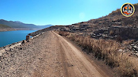
• 5 ★ 0.0 • 25 miles • 1,152 ft • 1 •
Predivna priroda,cijeli dio puta se vozi sa pogledom na Bilećko jezero.Na ruti ima 6-7 tunela pa je potrebno obavezno ponijeti lampu.
• 5 ★ 0.0 • 2,628 ft • 0 ft •
Less popular green difficulty doubletrack. This mountain bike primary trail can be used both directions.
Photos of Bileca Mountain Bike
Videos of Bileca Mountain Bike
trail: Pored jezera 01
4:17 |
3 |
Mar 14, 2023
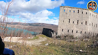
trail: Dvorac Drakuljica
2:05 |
22 |
Mar 14, 2023
Recent Trail Reports
| status | trail | date | condition | info | user |
|---|---|---|---|---|---|
| Pored jezera 01 | Mar 14, 2023 @ 1:02pm Mar 14, 2023 | Unknown | mtbcoin MTB Evolution |
Activity Feed
| username | action | type | title | date |
|---|---|---|---|---|
| CvDSwede | wishlist | trail | activity #58863417 | Sep 14, 2024 @ 4:25pm Sep 14, 2024 |
| mtbcoin | add | photo | activity #49151838 and 1 more | Feb 14, 2024 @ 1:56am Feb 14, 2024 |
| marko-ristivojevic-evolution | update | trail | activity #45779081 | Oct 30, 2023 @ 11:50pm Oct 30, 2023 |
| mtbcoin | add | report | activity #38122279 | Mar 14, 2023 @ 1:03pm Mar 14, 2023 |
| mtbcoin | add | photo | activity #38122024 and 1 more | Mar 14, 2023 @ 12:49pm Mar 14, 2023 |
Activity Type Stats
| activitytype | trails | distance | descent | descent distance | total vertical | rating | global rank | state rank | photos | reports | routes | ridelogs |
|---|---|---|---|---|---|---|---|---|---|---|---|---|
| Mountain Bike | 5 | 32 miles | 3,435 ft | 18 miles | 1,909 ft | #7,908 | #9 | 11 | 1 | 30 | ||
| Hike | 1 | 25 miles | 1,857 ft | 13 miles | 709 ft | #2,359 | #7 | |||||
| Trail Running | 1 | 25 miles | 1,857 ft | 13 miles | 709 ft | #1,869 | #5 |
- By marko-ristivojevic-evolution
 MTB Evolution PD Trebevic & contributors
 - Admins: MTB Evolution, marko-ristivojevic-evolution
- #53514 - 1,063 views
- bileca activity log | embed map of Bileca mountain bike trails |
Downloading of trail gps tracks in kml & gpx formats is enabled for Bileca.
You must login to download files.