close
-
Layers w
- Weather Layers
- Pro
- Pro
- Pro
- Pro
- Pro
- Pro
- More Layers
- Pro
- Pro
- Pro
- Pro
-
Upgrade to

3D
Trail Conditions
- Unknown
- Snow Groomed
- Snow Packed
- Snow Covered
- Snow Cover Partial
- Freeze/thaw Cycle
- Icy
- Prevalent Mud
- Wet
- Variable
- Ideal
- Dry
- Very Dry
Trail Flow (Ridden Direction)
Trailforks scans users ridelogs to determine the most popular direction each trail is ridden. A good flowing trail network will have most trails flowing in a single direction according to their intension.
The colour categories are based on what percentage of riders are riding a trail in its intended direction.
The colour categories are based on what percentage of riders are riding a trail in its intended direction.
- > 96%
- > 90%
- > 80%
- > 70%
- > 50%
- < 50%
- bi-directional trail
- no data
Trail Last Ridden
Trailforks scans ridelogs to determine the last time a trail was ridden.
- < 2 days
- < 1 week
- < 2 weeks
- < 1 month
- < 6 months
- > 6 months
Trail Ridden Direction
The intended direction a trail should be ridden.
- Downhill Only
- Downhill Primary
- Both Directions
- Uphill Primary
- Uphill Only
- One Direction
Contribute Details
Colors indicate trail is missing specified detail.
- Description
- Photos
- Description & Photos
- Videos
Trail Popularity ?
Trailforks scans ridelogs to determine which trails are ridden the most in the last 9 months.
Trails are compared with nearby trails in the same city region with a possible 25 colour shades.
Think of this as a heatmap, more rides = more kinetic energy = warmer colors.
- most popular
- popular
- less popular
- not popular
ATV/ORV/OHV Filter
Max Vehicle Width
inches
US Cell Coverage
Legend

Radar Time
Activity Recordings
Trailforks uses anonymized public activity data.
?
Activity Recordings
Trailforks uses anonymized public activity data.
?
Personal Heatmap
▶
Activity Types
all
/
none
▶
Options
2
Date range
month
–
Winter Trails
Warning
A routing network for winter maps does not exist. Selecting trails using the winter trails layer has been disabled.
Missing Trails
Most Popular
Least Popular
Trails are colored based on popularity. The more popular a trail is, the more red. Less popular trails trend towards green.
Jump Magnitude Heatmap
Heatmap of where riders jump on trails. Zoom in to see individual jumps, click circles to view jump details.
BC Backroad Status
![map legend]()
Service Road Atlas is a free to use, community-driven service for viewing and creating reports on the numerous back-country service roads around B.C. and Alberta.

Slope Aspect
Direction the slope faces
Trails Deemphasized
Trails are shown in grey.
Only show trails with no bike usage.
Suggested Layers
Based on selected activity type
Save the current map location and zoom level as your default home location whenever this page is loaded.
Save
No description for Birmingham has been added yet!
Login or register to submit one.
Activities Click to view
- Mountain Bike
108 trails
- E-Bike
83 trails
- Gravel Bike
14 trails
- Adaptive Bike
10 trails
- Winter Fat Bike
11 trails
- Hike
69 trails
- Trail Running
68 trails
Region Details
- 10
- 1
- 34
- 24
- 14
- 20
- 4
Region Status
Open as of Jun 14, 2026Stats
- Avg Trail Rating
- Trails (view details)
- 126
- Trails Mountain Bike
- 108
- Trails E-Bike
- 83
- Trails Gravel Bike
- 14
- Trails Adaptive Bike
- 10
- Trails Winter Fat Bike
- 11
- Trails Hike
- 69
- Trails Trail Running
- 68
- Total Distance
- 60 miles
- Total Descent Distance
- 24 miles
- Total Descent
- 8,973 ft
- Total Vertical
- 694 ft
- Highest Trailhead
- 1,127 ft
- Reports
- 334
- Photos
- 44
- Ridden Counter
- 29,375
Sub Regions
-
Flora Johnston Nature Park
- 2
-
JCC
- 3
- 4
-
Red Mountain Park
- 13
- 11
- 1
-
Ride BHM Bike Park
- 5
- 9
- 10
- 20
- 4
Popular Birmingham Mountain Biking Trails
• 80 ★ 5.0 • 2,313 ft • 3 ft • 287 •
The easiest full trail from the top at RideBHM. Nice and flowy with some optional jumps and decent-sized berms.
• 100 ★ 4.7 • 1 mile • 146 ft • 278 •
The 73-acre park in the Trace Crossings community has about 5 miles of mountain bike trails.
• 100 ★ 5.0 • 1,798 ft • 206 ft • 266 •
Mucadine Climb is RideBHM's trail climb to peak 2. It is steeper and punchier than but easier than either service road. Walking will be neccesary for many riders but the climb is short enough to walk and offers great views of and on the...
• 85 ★ 5.0 • 1,345 ft • 143 ft • 266 •
Easiest climb at RideBHM that will get you to peak 1.
• 90 ★ 5.0 • 902 ft • 0 ft • 262 •
Natural trail with several small berms, jumps, and drops along with several small rock gardens. Every feature is optional but rolling around them will disrupt the flow of the trail.
• 90 ★ 5.0 • 1,033 ft • 0 ft • 239 •
Double blue jump trail at the end of the first jump line on . Contains medium-sized tabletops and berms and ends halfway down the mountain where you can access and Lower Eureka. There is a cutoff to Valley View after the first few jumps...
• 100 ★ 5.0 • 1,516 ft • 121 ft • 234 •
This trail should be ridden by connecting #3 Trail on the West end of the park. It's a fast fun downhill with a few opportunities for jumps on the way down. You'll know you are at the top when you hear gunshots from the Police practice...
Birmingham Mountain Bike Routes
11 miles • 1,005 ft • 8 •
Just a short loop to stay on the West side of the park while keeping the technical difficulty down....
★ 2.0 • 13 miles • 1,140 ft • 8 •
An inner and outer loop at Red Mountain. Outer loop to start, easier mostly fire road to get the legs...
★ 2.0 • 6 miles • 447 ft • 3 • Loop •
JCC Full Loop Relatively easy course at JCC. Small climbs and fun downhills with a small section of...
6 miles • 501 ft • 6 • Loop •
This loop gets you to the top of Jekyll quickly via Terrace Drive, Peavine Falls Road, and a portion of...
17 miles • 1,229 ft • 7 •
17 mile loop with good sampling of Oak Mountain mtb trails. Includes climb up the Red Road, and ride down...
★ 2.0 • 14 miles • 990 ft • 1 • Loop •
Just a wet ride loop at Oak Mtn State Park so the trails don't get ripped after rain.
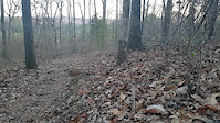
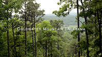
Photos of Birmingham Mountain Bike
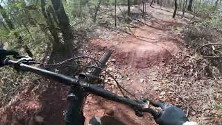
Videos of Birmingham Mountain Bike
trail: McDuffie Fitness Trail
0:50 |
227 |
Feb 4, 2017
trail: IMBA Trail
2:17 |
10242 |
Jun 7, 2013
trail: Temerity
0:34 |
152 |
Nov 18, 2024 , Birmingham

trail: McDuffie Fitness Trail
41:18 |
781 |
Feb 11, 2019 , Birmingham
Current Trail Warnings
| status | trail | date | condition | user | info |
|---|---|---|---|---|---|
| Vulcan Trail | May 29, 2026 @ 12:08pm (America/Chicago) May 29, 2026 | Unknown | OakChuckMtnTrails | Hike |
Recent Trail Reports
| status | trail | date | condition | info | user |
|---|---|---|---|---|---|
| Eureka Mines Trail | Apr 11, 2026 @ 9:38am (America/Kentucky/Monticello) Apr 11, 2026 | Ideal | KudzooRider | ||
| Wenonah Connector | Apr 11, 2026 @ 9:38am (America/Kentucky/Monticello) Apr 11, 2026 | Ideal | KudzooRider | ||
| #10 Mine Trail | Apr 11, 2026 @ 9:38am (America/Kentucky/Monticello) Apr 11, 2026 | Ideal | KudzooRider | ||
| BMRS-Redding Connector | Apr 11, 2026 @ 9:38am (America/Kentucky/Monticello) Apr 11, 2026 | Ideal | KudzooRider | ||
| BMRR North Trail | Apr 11, 2026 @ 9:59am (America/Kentucky/Monticello) Apr 11, 2026 | Ideal | maxxxchap | ||
| Black Creek Loop | Mar 14, 2026 @ 3:13pm (America/Chicago) Mar 14, 2026 | Variable | kk17 | ||
| Kanuga | Dec 22, 2025 @ 1:34pm (America/Chicago) Dec 22, 2025 | Unknown | GrampaGeezy | ||
| Illegal Side Loop | Jun 29, 2025 @ 11:38am Jun 29, 2025 | Unknown | Schew | ||
| JCC Jumpline | Nov 5, 2024 @ 4:54pm Nov 5, 2024 | Wet | Schew | ||
| Historic Birmingham Mineral Railroad: Red Gap Branch | Nov 5, 2024 @ 4:54pm Nov 5, 2024 | Unknown | Schew |
Activity Feed
| username | action | type | title | date |
|---|---|---|---|---|
| DavidLb9kmC | ridden | trail | activity #96868390 | Jun 13, 2026 @ 6:10am Jun 13, 2026 |
| nateolmsted | vote | trail | activity #96417601 and 5 more | Jun 6, 2026 @ 5:13pm Jun 6, 2026 |
| Rsilva123 | add | karma | activity #96339096 | Jun 5, 2026 @ 7:52pm Jun 5, 2026 |
| msmcfate | update | trail | activity #96217138 | Jun 4, 2026 @ 4:36am Jun 4, 2026 |
| kpwithrow | add | trail | activity #96213278 | Jun 4, 2026 @ 3:00am Jun 4, 2026 |
Recent Comments
| username | type | title | comment | date |
|---|---|---|---|---|
| trail | The trail arrows in trail fork show the... | Jul 23, 2025 @ 11:14am Jul 23, 2025 | ||
| trail | Not a blue, I would say single black. Very... | Feb 23, 2025 @ 10:51pm Feb 23, 2025 | ||
| trail | super tough trail coming down from the redding... | Feb 1, 2025 @ 3:18pm Feb 1, 2025 | ||
| report | I b I m o n I Ok on I m oo no b n o no n n h... | Nov 24, 2024 @ 1:27pm Nov 24, 2024 | ||
| report | I M8’qj C Mc O mom mom o | Nov 24, 2024 @ 1:25pm Nov 24, 2024 |
Local Badges
-

Completionist59 awarded -

Big Ride 30k6,396 awarded -

Epic Ride 50k2,059 awarded -

Top 10 Trails105 awarded -

Descent 100k Badge24 awarded -
Completionist9 awarded
Activity Type Stats
| activitytype | trails | distance | descent | descent distance | total vertical | rating | global rank | state rank | photos | reports | routes | ridelogs |
|---|---|---|---|---|---|---|---|---|---|---|---|---|
| Mountain Bike | 108 | 50 miles | 6,975 ft | 19 miles | 636 ft | #1,480 | #560 | 42 | 332 | 11 | 20,753 | |
| E-Bike | 83 | 34 miles | 5,925 ft | 14 miles | 554 ft | #2,693 | #1,053 | 252 | 1 | 734 | ||
| Gravel Bike | 14 | 8 miles | 597 ft | 3 miles | 328 ft | #485 | #1,054 | 50 | 1 | 84 | ||
| Adaptive Bike | 10 | 5 miles | 295 ft | 1 mile | 328 ft | #489 | #1,821 | 28 | ||||
| Winter Fat Bike | 11 | 9 miles | 1,191 ft | 3 miles | 607 ft | #297 | #1,084 | 24 | ||||
| Hike | 69 | 48 miles | 5,387 ft | 17 miles | 696 ft | #1,060 | #484 | 2 | 157 | 859 | ||
| Trail Running | 68 | 48 miles | 5,259 ft | 17 miles | 696 ft | #724 | #270 | 157 | 1,751 |
Frequently Asked Questions About Birmingham
▼
What are the best places to ride in Birmingham?
Birmingham has 6 areas to explore for mountain biking. The top rated areas are:
▼
What are the highest rated mountain biking trails in Birmingham?
The highest rated mountain biking trails in Birmingham are:
- Kanuga (4.5/5)
- Local Flow (4.4/5)
- Upper Eureka (4.3/5)
- Smythe Trail (4.3/5)
- Punch and Drift (4.3/5)
▼
What is the best time of the year to ride in Birmingham?
Based on ride log data, the most popular months to ride in Birmingham are:
- September (93 activities)
- May (86 activities)
- August (84 activities)
▼
Where can I park to ride in Birmingham?
There are 8 parking locations listed in Birmingham. The most popular parking spots are: View all parking and trailhead locations on the map to plan your visit.
Activities
Trails
Points of Interest
- Riley's Roost Treehouse Viewpoint
- Kaul Adventure Tower Sight
- Remy's Dog Park (Large Dogs) Other
- Remy's Dog Park (Small Dogs) Other
- Remy's Dog Park (Special Needs section) Other
- Rushing Rendezvous Treehouse Viewpoint
- Haskell Hideaway Viewpoint
- Ebsco Overlook (West) Viewpoint
- Ebsco Overlook (East) Viewpoint
- RideBHM Summit 1 - (275m / 904ft)
- By brenthillier
 NSMBA TRAILFORKS & contributors
 - Admins: JCGC, JCGC
- #9039 - 14,497 views
- birmingham activity log | embed map of Birmingham mountain bike trails | birmingham mountain biking points of interest
Downloading of trail gps tracks in kml & gpx formats is enabled for Birmingham.
You must login to download files.