close
-
Layers w
- Weather Layers
- Pro
- Pro
- Pro
- Pro
- Pro
- Pro
- More Layers
- Pro
- Pro
- Pro
- Pro
-
Upgrade to

3D
Trail Conditions
- Unknown
- Snow Groomed
- Snow Packed
- Snow Covered
- Snow Cover Partial
- Freeze/thaw Cycle
- Icy
- Prevalent Mud
- Wet
- Variable
- Ideal
- Dry
- Very Dry
Trail Flow (Ridden Direction)
Trailforks scans users ridelogs to determine the most popular direction each trail is ridden. A good flowing trail network will have most trails flowing in a single direction according to their intension.
The colour categories are based on what percentage of riders are riding a trail in its intended direction.
The colour categories are based on what percentage of riders are riding a trail in its intended direction.
- > 96%
- > 90%
- > 80%
- > 70%
- > 50%
- < 50%
- bi-directional trail
- no data
Trail Last Ridden
Trailforks scans ridelogs to determine the last time a trail was ridden.
- < 2 days
- < 1 week
- < 2 weeks
- < 1 month
- < 6 months
- > 6 months
Trail Ridden Direction
The intended direction a trail should be ridden.
- Downhill Only
- Downhill Primary
- Both Directions
- Uphill Primary
- Uphill Only
- One Direction
Contribute Details
Colors indicate trail is missing specified detail.
- Description
- Photos
- Description & Photos
- Videos
Trail Popularity ?
Trailforks scans ridelogs to determine which trails are ridden the most in the last 9 months.
Trails are compared with nearby trails in the same city region with a possible 25 colour shades.
Think of this as a heatmap, more rides = more kinetic energy = warmer colors.
- most popular
- popular
- less popular
- not popular
ATV/ORV/OHV Filter
Max Vehicle Width
inches
US Cell Coverage
Legend

Radar Time
Activity Recordings
Trailforks uses anonymized public activity data.
?
Activity Recordings
Trailforks uses anonymized public activity data.
?
Personal Heatmap
▶
Activity Types
all
/
none
▶
Options
2
Date range
month
–
Winter Trails
Warning
A routing network for winter maps does not exist. Selecting trails using the winter trails layer has been disabled.
Missing Trails
Most Popular
Least Popular
Trails are colored based on popularity. The more popular a trail is, the more red. Less popular trails trend towards green.
Jump Magnitude Heatmap
Heatmap of where riders jump on trails. Zoom in to see individual jumps, click circles to view jump details.
BC Backroad Status
![map legend]()
Service Road Atlas is a free to use, community-driven service for viewing and creating reports on the numerous back-country service roads around B.C. and Alberta.

Slope Aspect
Direction the slope faces
Trails Deemphasized
Trails are shown in grey.
Only show trails with no bike usage.
Suggested Layers
Based on selected activity type
Save the current map location and zoom level as your default home location whenever this page is loaded.
Save
No description for Black Rock has been added yet!
Login or register to submit one.
Primary Trail Type: All-Mountain & Downhill
This region uses the Uk/Euro style trail grading system.
Activities Click to view
- Hike
31 trails
- Mountain Bike
31 trails
- E-Bike
1 trails
- Trail Running
31 trails
Region Details
- 1
- 7
- 6
- 8
- 9
Region Status
Open as of Dec 11, 2025Stats
- Avg Trail Rating
- Trails (view details)
- 31
- Trails Mountain Bike
- 31
- Trails E-Bike
- 1
- Trails Horse
- 3
- Trails Hike
- 31
- Trails Trail Running
- 31
- Total Distance
- 12 miles
- Total Descent
- 3,224 ft
- Total Vertical
- 752 ft
- Highest Trailhead
- 1,046 ft
- Reports
- 116
- Photos
- 11
- Ridden Counter
- 4,523
Popular Black Rock Mountain Biking Trails
• 90 ★ 0.0 • 4,423 ft • 189 ft • 318 •
Long 1:8 climb on a wide traffic free gravel road. Links Cromford Canal with Black Rocks. Useable in both directions just be careful of walkers.
• 100 ★ 4.0 • 1,430 ft • 0 ft • 218 •
The most used line from the small stile down to the Birch Wood Traverse. An option is to do just the first half and cut right back to the trail before it heads downhill. This half is probably Blue.
• 90 ★ 4.0 • 3,304 ft • 0 ft • 190 •
Fun singletrack trail in its own right. Used to access various lines down the hill.
• 80 ★ 5.0 • 1,483 ft • 0 ft • 181 •
Popular red difficulty singletrack. This mountain bike primary trail can be used both directions. On average it takes 2 minutes to complete this trail.
• 85 ★ 4.0 • 1,565 ft • 0 ft • 173 •
Popular black difficulty singletrack. This mountain bike primary trail can be used both directions. On average it takes 2 minutes to complete this trail.
• 50 ★ 5.0 • 2 miles • 302 ft • 164 •
Part of the High Peak Trail including Middleton incline 1:8.
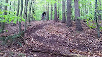
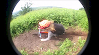
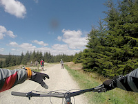
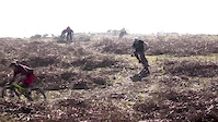
Videos of Black Rock Mountain Bike
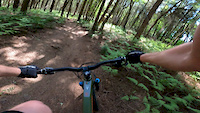
trail: From loamy to the bottom
0:23 |
615 |
Jun 1, 2020
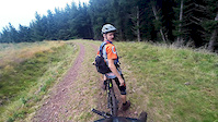
trail: Loamy
3:16 |
134 |
Oct 21, 2018
trail: Loamy
0:58 |
135 |
May 1, 2017
trail: Loamy
0:18 |
66 |
Dec 31, 2016
trail: Loamy
0:08 |
533 |
Jun 27, 2016
trail: Gully
2:02 |
123 |
May 14, 2016
trail: Gully
3:44 |
11115 |
Mar 30, 2016
trail: Loamy
0:36 |
218 |
Mar 18, 2016
Recent Trail Reports
| status | trail | date | condition | info | user |
|---|---|---|---|---|---|
| Loamy | Aug 31, 2025 @ 11:21am Aug 31, 2025 | Ideal | Stolmie9444 | ||
| High Peak Trail to Middleton Top | Aug 31, 2025 @ 11:21am Aug 31, 2025 | Ideal | Stolmie9444 | ||
| Jungle Left | Aug 31, 2025 @ 11:21am Aug 31, 2025 | Ideal | Stolmie9444 | ||
| Black Rocks connector | Aug 31, 2025 @ 11:21am Aug 31, 2025 | Ideal | Stolmie9444 | ||
| alternative | Aug 31, 2025 @ 11:21am Aug 31, 2025 | Ideal | Stolmie9444 | ||
| Trig Point middle | Aug 31, 2025 @ 11:21am Aug 31, 2025 | Ideal | Stolmie9444 | ||
| Sunnybank | Aug 18, 2025 @ 1:46pm Aug 18, 2025 | Ideal | Andymiff | ||
| Hearthstone Lane | Aug 18, 2025 @ 1:46pm Aug 18, 2025 | Ideal | Andymiff | ||
| Last Run/Terry's Turnpike | Mar 20, 2025 @ 9:37am Mar 20, 2025 | Ideal | Andymiff | ||
| Trig Point South | Mar 6, 2025 @ 2:36pm Mar 6, 2025 | Unknown | samanthabeans |
Activity Feed
| username | action | type | title | date |
|---|---|---|---|---|
| scabbyknees | ridden | trail | activity #95965190 | May 31, 2026 @ 11:59am May 31, 2026 |
| steezetoastie | ridden | trail | activity #94162411 and 11 more | May 6, 2026 @ 9:57am May 6, 2026 |
| trailforks | add | video | activity #93603796 and 3 more | Apr 28, 2026 @ 2:00pm Apr 28, 2026 |
| Sethsbikehacks | add | video | activity #93603789 | Apr 28, 2026 @ 2:00pm Apr 28, 2026 |
| jessop1202 | wishlist | region | activity #89065937 | Feb 17, 2026 @ 4:28am Feb 17, 2026 |
Recent Comments
| username | type | title | comment | date |
|---|---|---|---|---|
| trail | Currently rideable. | Dec 31, 2024 @ 6:58am Dec 31, 2024 | ||
| trail | This seems to be a footpath ? | Aug 13, 2020 @ 3:16am Aug 13, 2020 |
Nearby Areas
| name | distance | ||||
|---|---|---|---|---|---|
| Shining Cliff Woods | 1 | 2.8 km | |||
| Annesley Forest | 12.2 km | ||||
| Felley | 1 | 1 | 12.7 km | ||
| Hemlock Stone Open Space | 1 | 16.1 km | |||
| Oakamoor | 16.8 km |
Local Badges
-

Completionist0 awarded
Activity Type Stats
| activitytype | trails | distance | descent | descent distance | total vertical | rating | global rank | state rank | photos | reports | routes | ridelogs |
|---|---|---|---|---|---|---|---|---|---|---|---|---|
| Mountain Bike | 31 | 12 miles | 3,225 ft | 7 miles | 751 ft | #3,121 | #98 | 11 | 116 | 1 | 3,221 | |
| E-Bike | 1 | 2 miles | 62 ft | 2,867 ft | 279 ft | #6,079 | #288 | 110 | 793 | |||
| Horse | 3 | 3 miles | 66 ft | 2,959 ft | 705 ft | 1 | ||||||
| Hike | 31 | 12 miles | 3,225 ft | 7 miles | 751 ft | #7,270 | #178 | 116 | 161 | |||
| Trail Running | 31 | 12 miles | 3,225 ft | 7 miles | 751 ft | #6,468 | #155 | 116 | 69 |
Frequently Asked Questions About Black Rock
▼
What are the highest rated mountain biking trails in Black Rock?
The highest rated mountain biking trails in Black Rock are:
- Alongside the incline (4.1/5)
- Intake Drop (4.1/5)
- Hearthstone Lane (4.1/5)
- High Peak Trail to Middleton Top (4.1/5)
- Coumbs Wood Traverse (4.1/5)
▼
What is the best time of the year to ride in Black Rock?
Based on ride log data, the most popular months to ride in Black Rock are:
- June (10 activities)
- July (6 activities)
- September (4 activities)
▼
Where can I park to ride in Black Rock?
Check the Black Rock trail map for trailhead and parking information. Community members regularly update access and parking details for trails in the area.
▼
What is the longest trail in Black Rock?
The longest trail in Black Rock is High Peak Trail to Middleton Top at 2.9 km. View all trails sorted by distance.
- By phorsey
 Kenya & contributors
 - Admins: wisey, MathieuC, cemoorelife
- #38583 - 15,844 views
- black rock activity log | embed map of Black Rock mountain bike trails |
Downloading of trail gps tracks in kml & gpx formats is enabled for Black Rock.
You must login to download files.