close
-
Layers w
- Weather Layers
- Pro
- Pro
- Pro
- Pro
- Pro
- Pro
- More Layers
- Pro
- Pro
- Pro
- Pro
-
Upgrade to

3D
Trail Conditions
- Unknown
- Snow Groomed
- Snow Packed
- Snow Covered
- Snow Cover Partial
- Freeze/thaw Cycle
- Icy
- Prevalent Mud
- Wet
- Variable
- Ideal
- Dry
- Very Dry
Trail Flow (Ridden Direction)
Trailforks scans users ridelogs to determine the most popular direction each trail is ridden. A good flowing trail network will have most trails flowing in a single direction according to their intension.
The colour categories are based on what percentage of riders are riding a trail in its intended direction.
The colour categories are based on what percentage of riders are riding a trail in its intended direction.
- > 96%
- > 90%
- > 80%
- > 70%
- > 50%
- < 50%
- bi-directional trail
- no data
Trail Last Ridden
Trailforks scans ridelogs to determine the last time a trail was ridden.
- < 2 days
- < 1 week
- < 2 weeks
- < 1 month
- < 6 months
- > 6 months
Trail Ridden Direction
The intended direction a trail should be ridden.
- Downhill Only
- Downhill Primary
- Both Directions
- Uphill Primary
- Uphill Only
- One Direction
Contribute Details
Colors indicate trail is missing specified detail.
- Description
- Photos
- Description & Photos
- Videos
Trail Popularity ?
Trailforks scans ridelogs to determine which trails are ridden the most in the last 9 months.
Trails are compared with nearby trails in the same city region with a possible 25 colour shades.
Think of this as a heatmap, more rides = more kinetic energy = warmer colors.
- most popular
- popular
- less popular
- not popular
ATV/ORV/OHV Filter
Max Vehicle Width
inches
US Cell Coverage
Legend

Radar Time
Activity Recordings
Trailforks uses anonymized public activity data.
?
Activity Recordings
Trailforks uses anonymized public activity data.
?
Personal Heatmap
▶
Activity Types
all
/
none
▶
Options
2
Date range
month
–
Winter Trails
Warning
A routing network for winter maps does not exist. Selecting trails using the winter trails layer has been disabled.
Missing Trails
Most Popular
Least Popular
Trails are colored based on popularity. The more popular a trail is, the more red. Less popular trails trend towards green.
Jump Magnitude Heatmap
Heatmap of where riders jump on trails. Zoom in to see individual jumps, click circles to view jump details.
BC Backroad Status
![map legend]()
Service Road Atlas is a free to use, community-driven service for viewing and creating reports on the numerous back-country service roads around B.C. and Alberta.

Slope Aspect
Direction the slope faces
Trails Deemphasized
Trails are shown in grey.
Only show trails with no bike usage.
Suggested Layers
Based on selected activity type
Save the current map location and zoom level as your default home location whenever this page is loaded.
SaveBlackcomb CRA contains historic public trails that fall with the Blackcomb Mountain Controlled Recreation Area. Extensive maintenance and upgrades have taken place on these trails over the past years, funded in part by Whistler Blackcomb.
Please respect this area and the work done by WB by not participating in any unauthorized trail construction within the CRA.
Please respect this area and the work done by WB by not participating in any unauthorized trail construction within the CRA.
Primary Trail Type: All-Mountain & Downhill
Land Status: Ski Resort
 google parking directions
 Activities Click to view
- Mountain Bike
48 trails
- E-Bike
46 trails
- Hike
41 trails
- Trail Running
44 trails
- Downhill Ski
4 trails
- Backcountry Ski
15 trails
Region Details
- 11
- 1
- 7
- 15
- 7
Region Status
Open as of Jun 20, 2026Stats
- Avg Trail Rating
- Trails (view details)
- 48
- Trails Mountain Bike
- 48
- Trails E-Bike
- 46
- Trails Hike
- 41
- Trails Trail Running
- 44
- Trails Snowshoe
- 2
- Trails Downhill Ski
- 4
- Trails Backcountry Ski
- 15
- Total Distance
- 22 miles
- Total Descent Distance
- 11 miles
- Total Descent
- 8,753 ft
- Total Vertical
- 3,891 ft
- Highest Trailhead
- 6,143 ft
- Reports
- 2,064
- Photos
- 715
- Ridden Counter
- 79,025
Articles
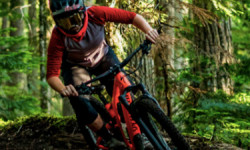
Video: A Rip Down Blackcomb's Dark Crystal in 'Crystallize'
Jan 1, 2020 from pinkbike.com
Lucy Mackie takes a ride down Dark Crystal.
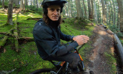
Video: Advice From Chris Kovarik on Riding in the Mud
Oct 29, 2019 from pinkbike.com
You don't win a World Cup by 14 seconds without being an incredible rider.
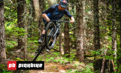
Video: Riding Some Of Whistler's Finest Singletrack
Jun 24, 2019 from pinkbike.com
Jason Lucas and Pete Matthews spent a day exploring three different networks around Whistler and share their first impressions.
Popular Blackcomb CRA Mountain Biking Trails
• 100 ★ 3.2 • 2,290 ft • 163 ft • 5,063 •
To avoid Blackcomb main access mountain road while climbing to / Crazy Trail / .
• 95 ★ 2.5 • 1,145 ft • 105 ft • 4,828 •
To avoid Blackcomb main access mountain road while climbing to .
• 85 ★ 3.4 • 495 ft • 55 ft • 2,736 •
Popular black diamond difficulty singletrack. This mountain bike primary trail can be used both directions and has a hard overall physical rating with a 55 ft black diamond climb. On average it takes minutes to complete this trail.
• 85 ★ 3.0 • 1,266 ft • 54 ft • 2,703 •
Popular green difficulty gravel path. This mountain bike primary trail can be used both directions and has a easy overall physical rating with a 54 ft green climb. On average it takes 2 minutes to complete this trail.
• 90 ★ 4.0 • 1,706 ft • 10 ft • 2,216 •
is a rooty and steep trail that was probably loamy about twenty years ago. It descends through the forest over large root drops and difficult pitches. Other lines join the trail but the original line down stays left. The crux of the...
• 85 ★ 4.0 • 574 ft • 42 ft • 2,165 •
Recently re-opened old hiking trail that follows the river providing a more pleasant climbing line to access yummy from lost lake.
• 100 ★ 4.5 • 2,523 ft • 278 ft • 1,973 •
The first phase of the built for uphill mountain biking in summer and wide of enough to fetch snow in winter season for uphill ski touring. The BBC climbs through the forest providing shade in summer and a nice scenic climb in winter.
• 85 ★ 3.6 • 548 ft • 39 ft • 1,970 •
Popular black diamond difficulty singletrack. This mountain bike primary trail can be used both directions. On average it takes 1 minutes to complete this trail.
Blackcomb CRA Mountain Bike Routes
★ 4.7 • 5 miles • 1,473 ft • 9 • Loop •
Microclimate achieved notoriety when it was featured in the World Enduro Series event in Whistler back in...
10 miles • 3,164 ft • 10 •
Whistler Relive Your Rides Blackcomb Classic Dark Crystal and Hey Bud For other ride suggestions for this...
3 miles • 1,172 ft • 3 •
2021 Worca Virtual Toonie #10 by Arbutus Routes and RMU Time to head up Blackcomb! Climb up the to and...
★ 2.8 • 10 miles • 2,717 ft • 22 • Loop •
Up to with a couple of little detours, down, climb up to Comfortably Numb and descend the Foreplay Descent...
3 miles • 926 ft • 5 • Point to Point •
WORCA TOONIE Virtual Thriller May 27- June 1, 2024 CRA
5 miles • 1,445 ft • 7 •
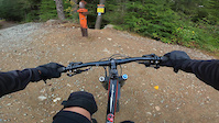
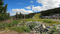
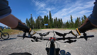
Photos of Blackcomb CRA Mountain Bike
Videos of Blackcomb CRA Mountain Bike
trail: Roam in the Loam
2:50 |
29 |
Aug 10, 2025
trail: Rabbit Tracks
0:46 |
42 |
Jul 30, 2025
trail: Golden Boner
5:30 |
66 |
Jul 27, 2025
trail: Micro Climate
11:12 |
112 |
Aug 1, 2024
trail: Rabbit Tracks
0:53 |
80 |
Jul 16, 2024
trail: Instant Gratification
0:24 |
94 |
Sep 24, 2023
trail: Dark Crystal
17:28 |
47 |
Aug 7, 2023
trail: Dark Crystal
11:59 |
147 |
Sep 8, 2021
Current Trail Warnings
| status | trail | date | condition | user | info |
|---|---|---|---|---|---|
| Dark Crystal | Jun 7, 2026 @ 8:23pm (America/Vancouver) Jun 7, 2026 | Unknown | ben-hryciw WORCA | Please respect the seasonal spring bear... |
Recent Trail Reports
| status | trail | date | condition | info | user |
|---|---|---|---|---|---|
| Horstman Creek | Jun 20, 2026 @ 12:53pm (America/Vancouver) Jun 20, 2026 | Dry | wadeinbc | ||
| Three Balls | Jun 20, 2026 @ 12:53pm (America/Vancouver) Jun 20, 2026 | Ideal | wadeinbc | ||
| Roam in the Loam | Jun 10, 2026 @ 10:46am (America/Vancouver) Jun 10, 2026 | Ideal | willymordant | ||
| Golden Boner | Jun 10, 2026 @ 10:45am (America/Vancouver) Jun 10, 2026 | Ideal | willymordant | ||
| Rabbit Tracks | May 28, 2026 @ 4:50pm (America/Vancouver) May 28, 2026 | Dry | XyukonR | ||
| Blackcomb Bench Climb - Lower | May 26, 2026 @ 3:00pm (America/Vancouver) May 26, 2026 | Ideal | WavisOShea | ||
| Access Road | May 26, 2026 @ 3:00pm (America/Vancouver) May 26, 2026 | Ideal | WavisOShea | ||
| Blackcomb Access Road | May 22, 2026 @ 6:56am (America/Vancouver) May 22, 2026 | Ideal | flipfantasia WORCA | ||
| Instant Gratification XCO Entry | May 21, 2026 @ 11:32am (America/Vancouver) May 21, 2026 | Ideal | WavisOShea | ||
| Hey Bud (Upper) | May 17, 2026 @ 9:50am (America/Vancouver) May 17, 2026 | Variable | ADAMKLGhCl |
Activity Feed
| username | action | type | title | date |
|---|---|---|---|---|
| skibum05 | vote | trail | activity #97578296 and 2 more | Jun 22, 2026 @ 12:20pm 1 day |
| scrosoff | wishlist | trail | activity #97569204 | Jun 22, 2026 @ 10:01am 1 day |
| caspiankai | wishlist | trail | activity #97449207 | Jun 20, 2026 @ 6:50pm 3 days |
| wadeinbc | add | report | activity #97445252 and 1 more | Jun 20, 2026 @ 5:31pm 3 days |
| duyle | wishlist | trail | activity #97360515 | Jun 19, 2026 @ 6:59pm Jun 19, 2026 |
Recent Comments
| username | type | title | comment | date |
|---|---|---|---|---|
| report | Please respect the seasonal spring bear... | Jun 7, 2026 @ 8:23pm Jun 7, 2026 | ||
| report | Dark Crystal and Micro Climate and related... | May 22, 2026 @ 7:01am May 22, 2026 | ||
| report | Nice!! Thanks | Apr 13, 2026 @ 7:10pm Apr 13, 2026 | ||
| report | Not ready yet to climb up. There is snow | Apr 10, 2026 @ 1:01pm Apr 10, 2026 | ||
| report | I wouldn't worry about it, this trail stands... | Oct 12, 2025 @ 9:55am Oct 12, 2025 |
Nearby Areas
| name | distance | ||||
|---|---|---|---|---|---|
| Lost Lake | 11 | 30 | 2 | 1.1 km | |
| Whistler Mountain Bike Park | 10 | 55 | 45 | 26 | 1.5 km |
| Whistler Village | 1 | 13 | 8 | 3 | 1.6 km |
| No Flow Zone | 6 | 20 | 5 | 3.3 km | |
| Whistler North | 7 | 9 | 35 | 6 | 3.4 km |
Local Badges
-

Completionist23 awarded
Bike & Skill Parks
| name | type | city | rating |
|---|---|---|---|
| Whistler Pump Track | skill park | Whistler |
Upcoming Local Events
-
-
-
-
Local Products
Local Trail Supporters
- Dave Anderson
- Paul Stevens
Local Products
Local Trail Supporters
- Dave Anderson
- Paul Stevens
Activity Type Stats
| activitytype | trails | distance | descent | descent distance | total vertical | rating | global rank | state rank | photos | reports | routes | ridelogs |
|---|---|---|---|---|---|---|---|---|---|---|---|---|
| Mountain Bike | 48 | 16 miles | 7,408 ft | 9 miles | 1,946 ft | #299 | #40 | 685 | 2,066 | 36 | 19,006 | |
| E-Bike | 46 | 14 miles | 6,578 ft | 8 miles | 1,942 ft | #1,019 | #47 | 17 | 1,770 | 1 | 1,076 | |
| Hike | 41 | 13 miles | 6,781 ft | 9 miles | 3,891 ft | #886 | #54 | 1 | 1,895 | 1,251 | ||
| Trail Running | 44 | 14 miles | 5,495 ft | 7 miles | 3,891 ft | #3,595 | #115 | 1,933 | 527 | |||
| Snowshoe | 2 | 32 | 12 | |||||||||
| Downhill Ski | 4 | 3 miles | 1,286 ft | 2 miles | 2,077 ft | #313 | #20 | 20 | 312 | |||
| Backcountry Ski | 15 | 9 miles | 1,355 ft | 2 miles | 3,665 ft | #12 | #4 | 4 | 74 | 729 |
Frequently Asked Questions About Blackcomb CRA
▼
What are the highest rated mountain biking trails in Blackcomb CRA?
The highest rated mountain biking trails in Blackcomb CRA are:
- Dark Crystal (4.8/5)
- Hey Bud (Upper) (4.6/5)
- Micro Climate (4.6/5)
- Crazy Train (4.5/5)
- Rabbit Tracks (4.3/5)
▼
What is the best time of the year to ride in Blackcomb CRA?
Based on ride log data, the most popular months to ride in Blackcomb CRA are:
- July (618 activities)
- August (474 activities)
- September (209 activities)
▼
Where can I park to ride in Blackcomb CRA?
There are 1 parking locations listed in Blackcomb CRA. The most popular parking spots are:
▼
What is the longest trail in Blackcomb CRA?
The longest trail in Blackcomb CRA is Dark Crystal at 1.7 miles. View all trails sorted by distance.
Activities
Trails
Points of Interest
- By brenthillier
 NSMBA TRAILFORKS & contributors
 - Admins: WORCA, RMOW, WNSC, ridingloam, snowdan, nkoshure, WORCA, TFerrao, dirtshifter, seb-kemp
- #4310 - 31,916 views
- blackcomb cra activity log | embed map of Blackcomb CRA mountain bike trails | blackcomb cra mountain biking points of interest polygons
Downloading of trail gps tracks in kml & gpx formats is enabled for Blackcomb CRA.
You must login to download files.