close
-
Layers w
- Weather Layers
- Pro
- Pro
- Pro
- Pro
- Pro
- Pro
- More Layers
- Pro
- Pro
- Pro
- Pro
-
Upgrade to

3D
Trail Conditions
- Unknown
- Snow Groomed
- Snow Packed
- Snow Covered
- Snow Cover Partial
- Freeze/thaw Cycle
- Icy
- Prevalent Mud
- Wet
- Variable
- Ideal
- Dry
- Very Dry
Trail Flow (Ridden Direction)
Trailforks scans users ridelogs to determine the most popular direction each trail is ridden. A good flowing trail network will have most trails flowing in a single direction according to their intension.
The colour categories are based on what percentage of riders are riding a trail in its intended direction.
The colour categories are based on what percentage of riders are riding a trail in its intended direction.
- > 96%
- > 90%
- > 80%
- > 70%
- > 50%
- < 50%
- bi-directional trail
- no data
Trail Last Ridden
Trailforks scans ridelogs to determine the last time a trail was ridden.
- < 2 days
- < 1 week
- < 2 weeks
- < 1 month
- < 6 months
- > 6 months
Trail Ridden Direction
The intended direction a trail should be ridden.
- Downhill Only
- Downhill Primary
- Both Directions
- Uphill Primary
- Uphill Only
- One Direction
Contribute Details
Colors indicate trail is missing specified detail.
- Description
- Photos
- Description & Photos
- Videos
Trail Popularity ?
Trailforks scans ridelogs to determine which trails are ridden the most in the last 9 months.
Trails are compared with nearby trails in the same city region with a possible 25 colour shades.
Think of this as a heatmap, more rides = more kinetic energy = warmer colors.
- most popular
- popular
- less popular
- not popular
ATV/ORV/OHV Filter
Max Vehicle Width
inches
US Cell Coverage
Legend

Radar Time
Activity Recordings
Trailforks uses anonymized public activity data.
?
Activity Recordings
Trailforks uses anonymized public activity data.
?
Personal Heatmap
▶
Activity Types
all
/
none
▶
Options
2
Date range
month
–
Winter Trails
Warning
A routing network for winter maps does not exist. Selecting trails using the winter trails layer has been disabled.
Missing Trails
Most Popular
Least Popular
Trails are colored based on popularity. The more popular a trail is, the more red. Less popular trails trend towards green.
Jump Magnitude Heatmap
Heatmap of where riders jump on trails. Zoom in to see individual jumps, click circles to view jump details.
BC Backroad Status
![map legend]()
Service Road Atlas is a free to use, community-driven service for viewing and creating reports on the numerous back-country service roads around B.C. and Alberta.

Slope Aspect
Direction the slope faces
Trails Deemphasized
Trails are shown in grey.
Only show trails with no bike usage.
Suggested Layers
Based on selected activity type
Save the current map location and zoom level as your default home location whenever this page is loaded.
SaveHome to many thousands of residents including Virginia Tech students, Blacksburg is nestled at the base of the southern Appalachian Mountains in the region known as the New River Valley. In the mid 2010s the Poverty Creek Trails Coalition (PCTC) adopted stewardship of this region's trails, and actively maintains over 50 miles of trail. Blacksburg features rocky hand-cut singletrack, steep forested terrain, professionally built jump lines, and much more, utilizing the 800+ ft. of vertical available in the mountain ridges just a 10 minute drive from town.
Activities Click to view
- Mountain Bike
73 trails
- E-Bike
4 trails
- Gravel Bike
0 trails
- Adaptive Bike
0 trails
- Horse
15 trails
- Hike
95 trails
- Trail Running
95 trails
Region Details
- 13
- 26
- 15
- 10
Region Status
Open as of May 23, 2026Stats
- Avg Trail Rating
- Trails (view details)
- 89
- Trails Mountain Bike
- 75
- Trails E-Bike
- 4
- Trails Horse
- 15
- Trails Hike
- 95
- Trails Trail Running
- 95
- Total Distance
- 98 miles
- Total Descent
- 18,440 ft
- Total Vertical
- 2,262 ft
- Highest Trailhead
- 4,118 ft
- Reports
- 499
- Photos
- 297
- Ridden Counter
- 8,583
Sub Regions
-
McDonald Hollow
- 3
- 1
- 1
-
Millstone Ridge
- 1
- 1
-
Poverty Creek
- 20
- 12
- 5
-
Stone-cutters Hollow
- 1
- 1
- 2
Popular Blacksburg Mountain Biking Trails
• 80 ★ 4.7 • 1 mile • 0 ft • 288 •
A classic, when descending starts with a few switchbacks before turning towards the fall line. The trail levels out with a few flat senders before becoming a steep chute with countless drops, finally ending at a creek crossing over ....
• 70 ★ 4.5 • 3,625 ft • 0 ft • 270 •
When descending, doubletrack with gradual turns and a sandy/rocky surface that progressively gets narrower and rockier as you near the .
• 85 ★ 4.8 • 2 miles • 7 ft • 258 •
is one option for accessing the Pandapas trail system from the Blacksburg side of Brush Mountain. As a climb, the trail is fairly steep and technical, with numerous rocky and root-filled sections. When descending, this trail is...
• 95 ★ 4.4 • 3,448 ft • 6 ft • 233 •
is a step up in difficulty from with its optional rock garden and jumps. Predominantly a flow trail, users can carry moderate to high speeds around the berms and .
• 65 ★ 4.2 • 2 miles • 127 ft • 231 •
A two flavors trail, when descending it starts chunky and steep with tight switchbacks. It then climbs for a bit and turns into doubletrack with numerous "alt-lines" at most of the corners, and ends at a shallow crossing across .
• 75 ★ 3.5 • 3 miles • 699 ft • 222 •
climbs to the Brush Mountain ridge from the gravel upper lot at Pandapas, it is probably the easiest route to the ridge. . The trail merges with the fire road at the ridge, undulating four times before arriving at the peak, where it...
• 55 ★ 4.0 • 4,295 ft • 115 ft • 222 •
A technical trail with numerous rock gardens, punchy climbs, and even a boulder! Link together with and for the classic Gap-side traverse!
Blacksburg Mountain Bike Routes
★ 5.0 • 13 miles • 2,164 ft • 9 • Loop •
From Parking to Stone Cutters Access, up, connects to Getaway hard climb, Down fast fun Jacobs Ladder,...
★ 5.0 • 14 miles • 2,726 ft • 8 • Loop •
Edited the VT Enduro race to be ridden as a loop.
13 miles • 2,507 ft • 6 • Loop •
Virginia Tech's enduro is back for the ACCC mountain bike season. We 4 have exciting stages lined up for...
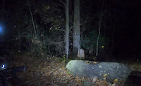
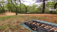
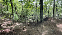
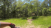
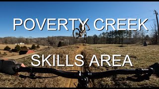
Photos of Blacksburg Mountain Bike
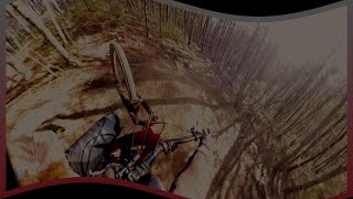
Videos of Blacksburg Mountain Bike

trail: Yard Sale
4:14 |
14 |
May 4, 2026
trail: Poverty Creek
0:08 |
|
May 1, 2024
trail: Wavelength
0:02 |
|
May 25, 2023
trail: Blunderbuss
0:16 |
196 |
Oct 18, 2021
trail: Gateway Trail
8:15 |
603 |
Oct 3, 2013
trail: Wavelength
3:13 |
72 |
Mar 23, 2025 , Blacksburg
trail: BRMBSP Green Line
0:45 |
182 |
Feb 7, 2024 , Blacksburg

trail: Wavelength
3:32 |
313 |
Sep 11, 2023 , Blacksburg
Recent Trail Reports
| status | trail | date | condition | info | user |
|---|---|---|---|---|---|
| Mineral Way | May 23, 2026 @ 8:02pm (America/New_York) May 23, 2026 | Unknown | Connorfowlkes MHS | ||
| Gateway Trail | May 6, 2026 @ 12:27pm (America/Kentucky/Monticello) May 6, 2026 | Ideal | Trailscott RVMBA | ||
| Trillium | May 6, 2026 @ 12:27pm (America/Kentucky/Monticello) May 6, 2026 | Ideal | Trailscott RVMBA | ||
| Prickly Pear | May 6, 2026 @ 12:27pm (America/Kentucky/Monticello) May 6, 2026 | Ideal | Trailscott RVMBA | ||
| Royale | May 6, 2026 @ 12:27pm (America/Kentucky/Monticello) May 6, 2026 | Ideal | Trailscott RVMBA | ||
| May Apple | May 6, 2026 @ 12:27pm (America/Kentucky/Monticello) May 6, 2026 | Ideal | Trailscott RVMBA | ||
| Jacob's Ladder | May 6, 2026 @ 12:27pm (America/Kentucky/Monticello) May 6, 2026 | Ideal | Trailscott RVMBA | ||
| Chimney | Apr 4, 2026 @ 9:21am (America/New_York) Apr 4, 2026 | Variable | wcyoung | ||
| Forest Service Road | Apr 4, 2026 @ 9:21am (America/New_York) Apr 4, 2026 | Snow Packed | wcyoung | ||
| Ida May | Apr 4, 2026 @ 9:21am (America/New_York) Apr 4, 2026 | Dry | wcyoung |
Activity Feed
| username | action | type | title | date |
|---|---|---|---|---|
| Nelsonlm | wishlist | route | activity #97258000 | Jun 18, 2026 @ 9:34am 1 day |
| DCoith | wishlist | trail | activity #97175069 | Jun 17, 2026 @ 5:05am 2 days |
| willhf1011 | wishlist | region | activity #97162840 | Jun 16, 2026 @ 10:09pm 3 days |
| a-berm-loving-fern | wishlist | region | activity #97069146 | Jun 15, 2026 @ 3:29pm Jun 15, 2026 |
| williamnTIpA0 | wishlist | trail | activity #97014396 | Jun 14, 2026 @ 5:10pm Jun 14, 2026 |
Recent Comments
| username | type | title | comment | date |
|---|---|---|---|---|
| trail | Was it pulled from and old map? the first ~430... | May 5, 2026 @ 9:03am May 5, 2026 | ||
| trail | Best public Mtb trail in the southeast | Dec 24, 2025 @ 1:37pm Dec 24, 2025 | ||
| trail | This trail shreds, absolutely great | Oct 6, 2025 @ 5:34pm Oct 6, 2025 | ||
| trail | Blue rating is definitely sandbagged.... | Sep 30, 2023 @ 9:16pm Sep 30, 2023 | ||
| trail | Like what was mentioned. Techy SWVA black into... | Aug 19, 2023 @ 8:24am Aug 19, 2023 |
Local Badges
-

10 Green Trails75 awarded -

10 Blue Trails77 awarded -

10 Black Trails63 awarded -

Epic Ride Climb 2k131 awarded -

Climbing 10k Badge58 awarded -

Climbing 100k Badge13 awarded
Bike & Skill Parks
| name | type | city | rating |
|---|---|---|---|
| Blacksburg Rotary Mountain Biking Skills Park | skill park | Blacksburg |
Activity Type Stats
| activitytype | trails | distance | descent | descent distance | total vertical | rating | global rank | state rank | photos | reports | routes | ridelogs |
|---|---|---|---|---|---|---|---|---|---|---|---|---|
| Mountain Bike | 73 | 67 miles | 12,920 ft | 36 miles | 1,053 ft | #1,531 | #571 | 280 | 500 | 19 | 17,201 | |
| E-Bike | 4 | 6 miles | 604 ft | 4 miles | 535 ft | #7,512 | #2,265 | 394 | 4 | 486 | ||
| Horse | 15 | 10 miles | 2,425 ft | 6 miles | 886 ft | #2,174 | #1,210 | 85 | ||||
| Hike | 95 | 97 miles | 17,946 ft | 47 miles | 2,260 ft | #1,371 | #630 | 18 | 497 | 1 | 534 | |
| Trail Running | 95 | 97 miles | 17,946 ft | 47 miles | 2,260 ft | #1,950 | #633 | 497 | 2 | 513 |
Frequently Asked Questions About Blacksburg
▼
What are the best places to ride in Blacksburg?
Blacksburg has 4 areas to explore for mountain biking. The top rated areas are:
▼
What are the highest rated mountain biking trails in Blacksburg?
The highest rated mountain biking trails in Blacksburg are:
- Gateway Trail (4.5/5)
- Wavelength (4.4/5)
- Jacob's Ladder (4.3/5)
- Yard Sale (4.3/5)
- Poverty Creek (4.3/5)
▼
What is the best time of the year to ride in Blacksburg?
Based on ride log data, the most popular months to ride in Blacksburg are:
- July (78 activities)
- October (55 activities)
- August (51 activities)
▼
Where can I park to ride in Blacksburg?
There are 9 parking locations listed in Blacksburg. The most popular parking spots are:
- Parking
- Parking
- Parking
- A.T. Parking: Rocky Gap (VA 601) Parking Area
- A.T. Parking: Wind Rock (VA Rte 613) Parking Area
Activities
Trails
Points of Interest
- A.T. Shelters: Pine Swamp Branch Shelter Cabin
- A.T. Shelters: Bailey Gap Shelter Cabin
- Wind Rock Vista Viewpoint
- A.T. Shelters: War Spur Shelter Cabin
- Kelly Knob Vista (VA) Viewpoint
- A.T. Shelters: Laurel Creek Shelter Cabin
- Sinking Creek Valley Open Area Vista 4 Viewpoint
- Sinking Creek Valley Open Area Vista 3 Viewpoint
- Sinking Creek Valley Open Area Vista 2 Viewpoint
- A.T. Shelters: Sarver Hollow Shelter Cabin
- Bald Knob (4,354 ft)
- Wrights Peak (4,062 ft)
- Doe Mountain (3,973 ft)
- By Ru-tang & contributors
- Admins: PCTC, RMBA
- #9189 - 17,437 views
- blacksburg activity log | embed map of Blacksburg mountain bike trails | blacksburg mountain biking points of interest polygons
Downloading of trail gps tracks in kml & gpx formats is enabled for Blacksburg.
You must login to download files.