close
-
Layers w
- Weather Layers
- Pro
- Pro
- Pro
- Pro
- Pro
- Pro
- More Layers
- Pro
- Pro
- Pro
- Pro
-
Upgrade to

3D
Trail Conditions
- Unknown
- Snow Groomed
- Snow Packed
- Snow Covered
- Snow Cover Partial
- Freeze/thaw Cycle
- Icy
- Prevalent Mud
- Wet
- Variable
- Ideal
- Dry
- Very Dry
Trail Flow (Ridden Direction)
Trailforks scans users ridelogs to determine the most popular direction each trail is ridden. A good flowing trail network will have most trails flowing in a single direction according to their intension.
The colour categories are based on what percentage of riders are riding a trail in its intended direction.
The colour categories are based on what percentage of riders are riding a trail in its intended direction.
- > 96%
- > 90%
- > 80%
- > 70%
- > 50%
- < 50%
- bi-directional trail
- no data
Trail Last Ridden
Trailforks scans ridelogs to determine the last time a trail was ridden.
- < 2 days
- < 1 week
- < 2 weeks
- < 1 month
- < 6 months
- > 6 months
Trail Ridden Direction
The intended direction a trail should be ridden.
- Downhill Only
- Downhill Primary
- Both Directions
- Uphill Primary
- Uphill Only
- One Direction
Contribute Details
Colors indicate trail is missing specified detail.
- Description
- Photos
- Description & Photos
- Videos
Trail Popularity ?
Trailforks scans ridelogs to determine which trails are ridden the most in the last 9 months.
Trails are compared with nearby trails in the same city region with a possible 25 colour shades.
Think of this as a heatmap, more rides = more kinetic energy = warmer colors.
- most popular
- popular
- less popular
- not popular
ATV/ORV/OHV Filter
Max Vehicle Width
inches
US Cell Coverage
Legend

Radar Time
Activity Recordings
Trailforks uses anonymized public activity data.
?
Activity Recordings
Trailforks uses anonymized public activity data.
?
Personal Heatmap
▶
Activity Types
all
/
none
▶
Options
2
Date range
month
–
Winter Trails
Warning
A routing network for winter maps does not exist. Selecting trails using the winter trails layer has been disabled.
Missing Trails
Most Popular
Least Popular
Trails are colored based on popularity. The more popular a trail is, the more red. Less popular trails trend towards green.
Jump Magnitude Heatmap
Heatmap of where riders jump on trails. Zoom in to see individual jumps, click circles to view jump details.
BC Backroad Status
![map legend]()
Service Road Atlas is a free to use, community-driven service for viewing and creating reports on the numerous back-country service roads around B.C. and Alberta.

Slope Aspect
Direction the slope faces
Trails Deemphasized
Trails are shown in grey.
Only show trails with no bike usage.
Suggested Layers
Based on selected activity type
Save the current map location and zoom level as your default home location whenever this page is loaded.
Save
No description for Blagoevgrad has been added yet!
Login or register to submit one.
Activities Click to view
- Mountain Bike
21 trails
- E-Bike
15 trails
- Adaptive Bike
0 trails
- Winter Fat Bike
0 trails
- Horse
2 trails
- Hike
17 trails
- Trail Running
17 trails
- Dirtbike/Moto
0 trails
- Observed Trials
0 trails
- ATV/ORV/OHV
0 trails
- Snowmobile
0 trails
- Snowshoe
2 trails
- Downhill Ski
1 trails
- Backcountry Ski
2 trails
- Nordic Ski
1 trails
Region Details
- 11
- 1
- 6
- 2
Region Status
Caution as of Jun 7, 2026Stats
- Avg Trail Rating
- Trails (view details)
- 21
- Trails Mountain Bike
- 21
- Trails E-Bike
- 15
- Trails Horse
- 2
- Trails Hike
- 17
- Trails Trail Running
- 17
- Trails Snowshoe
- 2
- Trails Downhill Ski
- 1
- Trails Backcountry Ski
- 2
- Trails Nordic Ski
- 1
- Total Distance
- 36 miles
- Total Descent Distance
- 13 miles
- Total Descent
- 6,686 ft
- Total Vertical
- 5,809 ft
- Highest Trailhead
- 7,077 ft
- Reports
- 199
- Photos
- 135
- Ridden Counter
- 813
Popular Blagoevgrad Mountain Biking Trails
• 75 ★ 4.0 • 4,190 ft • 15 ft • 92 •
Starts as a regular rural road that leads you to the nearest gully from there you have a solid climb but as soon as you make it the trail turns in to single track quite skinny at some points. The last part is a roller coaster with...
• 45 ★ 5.0 • 2 miles • 91 ft • 20 •
Perfect beginners trail with a bit of climbing and nice flowy descend. The trail is often used by mtbs and e-mtbs for alternate climb to . In the past it was used for a transfer between stages of the enduro races. The trail starts from...
• 5 ★ 5.0 • 5,171 ft • 5 ft • 2 •
The trail is a shortcut of the dirt road going to the Makedonia hut. It is used by hikers and mountain bikers, so be careful and respect each other. It crosses the dirt road twice. This is a national park area, so the access of...
• 40 ★ 0.0 • 1 mile • 839 ft • 2 •
CLIMB TRAIL! Only uphill !Few sections of the trail are quite steep but not that technical. Used primarily by e-bikes.To get to the start of the trail , go uphill O.Che.Ze and after 4 berms you will see a small path in the bushes that...
Blagoevgrad Mountain Bike Routes
★ 5.0 • 21 miles • 3,465 ft • 2 • Out & Back •
A cross-country route going trough the village of Harsovo , climbing up in the mountain where you have...
★ 5.0 • 17 miles • 2,724 ft • 2 • Out & Back •
A route that goes trough the villa areas of Bistritsa and . The route starts with few km of asphalt road...
★ 5.0 • 16 miles • 2,609 ft • 0 • Out & Back •
A nice route that climbs on gravel and fire roads near the village of Gorno harsovo and descends on the...
13 miles • 2,985 ft • 0 • Loop •
A bike specific route that starts from the parking of Rila National Park, climbs on a gravel road up to...
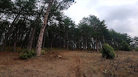
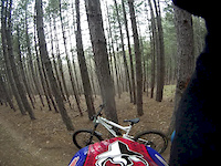
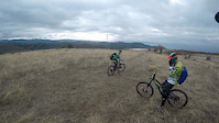
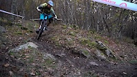
Photos of Blagoevgrad Mountain Bike
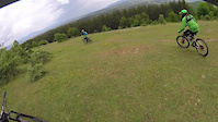
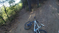
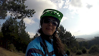
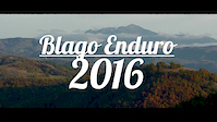
Videos of Blagoevgrad Mountain Bike
trail: Zaeva
0:10 |
106 |
Oct 18, 2021
trail: O.Che.Ze
4:29 |
72 |
Jun 1, 2021
trail: Dabrava
2:26 |
80 |
Nov 8, 2017
trail: Zaeva
3:26 |
178 |
Nov 7, 2017
trail: Dabrava
3:33 |
46 |
Feb 16, 2017
trail: Zaeva
4:32 |
2236 |
Nov 15, 2016
trail: Dabrava
0:00 |
49 |
Oct 31, 2016
trail: Dabrava
0:02 |
751 |
Oct 30, 2016
Current Trail Warnings
| status | trail | date | condition | user | info |
|---|---|---|---|---|---|
| Zaeva | Jun 7, 2026 @ 8:08pm (Europe/Sofia) Jun 7, 2026 | Very Dry | HighCycleBG LFF Enduro | Major erosion (major ruts or slumping,... | |
| Dabrava | Jun 7, 2026 @ 8:10pm (Europe/Sofia) Jun 7, 2026 | Very Dry | HighCycleBG LFF Enduro | Major erosion (major ruts or slumping,... | |
| O.Che.Ze | Jun 7, 2026 @ 8:04pm (Europe/Sofia) Jun 7, 2026 | Very Dry | HighCycleBG LFF Enduro | Several sections are heavily eroded by... |
Recent Trail Reports
| status | trail | date | condition | info | user |
|---|---|---|---|---|---|
| Nailonka | Apr 11, 2026 @ 11:20am (Europe/Sofia) Apr 11, 2026 | Ideal | aplced | ||
| Access Road to Dabrava , Mosta, Nailonka | Apr 11, 2026 @ 11:20am (Europe/Sofia) Apr 11, 2026 | Ideal | aplced | ||
| O.Che.Ze to Shuttle pick up connector | Apr 11, 2026 @ 11:20am (Europe/Sofia) Apr 11, 2026 | Ideal | aplced | ||
| Access Road to Zaeva and O.Che.Ze | Apr 11, 2026 @ 11:20am (Europe/Sofia) Apr 11, 2026 | Ideal | aplced | ||
| Mosta | May 30, 2025 @ 12:58pm May 30, 2025 | Ideal | HighCycleBG LFF Enduro | ||
| Connector: Trail Ends - Access roads | Sep 10, 2021 @ 5:27am Sep 10, 2021 | Ideal | grishata1 | ||
| Bistritsa to Dabrava Transfer | Aug 22, 2021 @ 12:26am Aug 22, 2021 | Ideal | grishata1 | ||
| Delvino XC Loop | Aug 2, 2021 @ 5:21am Aug 2, 2021 | Dry | HighCycleBG LFF Enduro | ||
| Dabrava XC Loop | Aug 2, 2021 @ 5:21am Aug 2, 2021 | Dry | HighCycleBG LFF Enduro | ||
| Makedonia Hut Shortcuts | Jul 31, 2021 @ 4:39am Jul 31, 2021 | Ideal | grishata1 |
Activity Feed
| username | action | type | title | date |
|---|---|---|---|---|
| HighCycleBG | add | report | activity #96473945 and 2 more | Jun 7, 2026 @ 10:06am Jun 7, 2026 |
| sh0g0 | vote | trail | activity #96086267 and 1 more | Jun 2, 2026 @ 8:30am Jun 2, 2026 |
| sh0g0 | ridden | trail | activity #96077685 and 1 more | Jun 2, 2026 @ 5:50am Jun 2, 2026 |
| UKuojT | ridden | trail | activity #92617333 | Apr 14, 2026 @ 1:26pm Apr 14, 2026 |
| aplced | add | report | activity #92390635 and 6 more | Apr 11, 2026 @ 7:41am Apr 11, 2026 |
Recent Comments
| username | type | title | comment | date |
|---|---|---|---|---|
| report | Walat hamad | Sep 17, 2022 @ 7:14pm Sep 17, 2022 | ||
| report | Walat hamad | Sep 17, 2022 @ 7:12pm Sep 17, 2022 |
Local Badges
-

Epic Mountain Bike Climb 2k12 awarded -

Climbing 10k Badge8 awarded -

Mountain Biking 100k Badge0 awarded -

Epic Ride Descent 2k12 awarded -

Descent 10k Badge10 awarded -

Descent 100k Badge0 awarded
Activity Type Stats
| activitytype | trails | distance | descent | descent distance | total vertical | rating | global rank | state rank | photos | reports | routes | ridelogs |
|---|---|---|---|---|---|---|---|---|---|---|---|---|
| Mountain Bike | 21 | 36 miles | 6,686 ft | 13 miles | 5,810 ft | #1,456 | #3 | 135 | 199 | 4 | 1,410 | |
| E-Bike | 15 | 27 miles | 3,537 ft | 9 miles | 5,810 ft | #1,227 | #11 | 167 | 4 | 131 | ||
| Horse | 2 | 1 mile | 1,109 ft | 1 mile | 4,954 ft | #543 | #1 | 26 | ||||
| Hike | 17 | 26 miles | 6,594 ft | 12 miles | 5,774 ft | #2,009 | #8 | 198 | 2 | 47 | ||
| Trail Running | 17 | 26 miles | 6,594 ft | 12 miles | 5,774 ft | #1,516 | #6 | 198 | 2 | 3 | ||
| Snowshoe | 2 | 1 mile | 948 ft | 1 mile | 1,768 ft | #252 | #1 | 7 | 7 | |||
| Downhill Ski | 1 | 5,171 ft | 604 ft | 4,879 ft | 597 ft | #386 | #1 | 7 | 480 | |||
| Backcountry Ski | 2 | 1 mile | 948 ft | 1 mile | 1,768 ft | #263 | #1 | 7 | 139 | |||
| Nordic Ski | 1 | 2,493 ft | 348 ft | 2,369 ft | 348 ft | #322 | #1 | 5 | 17 |
Frequently Asked Questions About Blagoevgrad
▼
What are the highest rated mountain biking trails in Blagoevgrad?
The highest rated mountain biking trails in Blagoevgrad are:
- Dabrava (4.3/5)
- Mosta (4.3/5)
- Zaeva (4.2/5)
- Kalaukci (4.2/5)
- Makedonia Hut Shortcuts (4.2/5)
▼
What is the best time of the year to ride in Blagoevgrad?
Based on ride log data, the most popular months to ride in Blagoevgrad are:
- April (4 activities)
- October (4 activities)
- June (4 activities)
▼
Where can I park to ride in Blagoevgrad?
There are 3 parking locations listed in Blagoevgrad. The most popular parking spots are: View all parking and trailhead locations on the map to plan your visit.
▼
What is the longest trail in Blagoevgrad?
The longest trail in Blagoevgrad is Dabrava at 3.2 km. View all trails sorted by distance.
Activities
Trails
- By Banditdos & contributors
- Admins: pufalot, LFF Enduro, grishata1, HighCycleBG
- #11153 - 7,632 views
- blagoevgrad activity log | embed map of Blagoevgrad mountain bike trails | blagoevgrad mountain biking points of interest
Downloading of trail gps tracks in kml & gpx formats is enabled for Blagoevgrad.
You must login to download files.