close
-
Layers w
- Weather Layers
- Pro
- Pro
- Pro
- Pro
- Pro
- Pro
- More Layers
- Pro
- Pro
- Pro
- Pro
-
Upgrade to

3D
Trail Conditions
- Unknown
- Snow Groomed
- Snow Packed
- Snow Covered
- Snow Cover Partial
- Freeze/thaw Cycle
- Icy
- Prevalent Mud
- Wet
- Variable
- Ideal
- Dry
- Very Dry
Trail Flow (Ridden Direction)
Trailforks scans users ridelogs to determine the most popular direction each trail is ridden. A good flowing trail network will have most trails flowing in a single direction according to their intension.
The colour categories are based on what percentage of riders are riding a trail in its intended direction.
The colour categories are based on what percentage of riders are riding a trail in its intended direction.
- > 96%
- > 90%
- > 80%
- > 70%
- > 50%
- < 50%
- bi-directional trail
- no data
Trail Last Ridden
Trailforks scans ridelogs to determine the last time a trail was ridden.
- < 2 days
- < 1 week
- < 2 weeks
- < 1 month
- < 6 months
- > 6 months
Trail Ridden Direction
The intended direction a trail should be ridden.
- Downhill Only
- Downhill Primary
- Both Directions
- Uphill Primary
- Uphill Only
- One Direction
Contribute Details
Colors indicate trail is missing specified detail.
- Description
- Photos
- Description & Photos
- Videos
Trail Popularity ?
Trailforks scans ridelogs to determine which trails are ridden the most in the last 9 months.
Trails are compared with nearby trails in the same city region with a possible 25 colour shades.
Think of this as a heatmap, more rides = more kinetic energy = warmer colors.
- most popular
- popular
- less popular
- not popular
ATV/ORV/OHV Filter
Max Vehicle Width
inches
US Cell Coverage
Legend

Radar Time
Activity Recordings
Trailforks uses anonymized public activity data.
?
Activity Recordings
Trailforks uses anonymized public activity data.
?
Personal Heatmap
▶
Activity Types
all
/
none
▶
Options
2
Date range
month
–
Winter Trails
Warning
A routing network for winter maps does not exist. Selecting trails using the winter trails layer has been disabled.
Missing Trails
Most Popular
Least Popular
Trails are colored based on popularity. The more popular a trail is, the more red. Less popular trails trend towards green.
Jump Magnitude Heatmap
Heatmap of where riders jump on trails. Zoom in to see individual jumps, click circles to view jump details.
BC Backroad Status
![map legend]()
Service Road Atlas is a free to use, community-driven service for viewing and creating reports on the numerous back-country service roads around B.C. and Alberta.

Slope Aspect
Direction the slope faces
Trails Deemphasized
Trails are shown in grey.
Only show trails with no bike usage.
Suggested Layers
Based on selected activity type
Save the current map location and zoom level as your default home location whenever this page is loaded.
Save
No description for Blansko has been added yet!
Login or register to submit one.
This region uses the Uk/Euro style trail grading system.
Activities Click to view
- Mountain Bike
21 trails
- E-Bike
9 trails
- Gravel Bike
0 trails
- Adaptive Bike
0 trails
- Winter Fat Bike
1 trails
- Hike
11 trails
- Trail Running
11 trails
Region Details
- 3
- 8
- 6
- 4
Region Status
Open as of Apr 6, 2026Stats
- Avg Trail Rating
- Trails (view details)
- 21
- Trails Mountain Bike
- 21
- Trails E-Bike
- 9
- Trails Winter Fat Bike
- 1
- Trails Hike
- 11
- Trails Trail Running
- 11
- Total Distance
- 20 miles
- Total Descent
- 4,066 ft
- Total Vertical
- 1,037 ft
- Highest Trailhead
- 1,915 ft
- Reports
- 343
- Photos
- 62
- Ridden Counter
- 3,214
Sub Regions
-
Boskovice
- 1
- 1
-
Singletrail Moravský kras | Jedovnické stezky
- 4
- 3
Popular Blansko Mountain Biking Trails
• 90 ★ 4.4 • 1 mile • 150 ft • 439 •
Highly rated popular green difficulty singletrack. This mountain bike primary trail can be used downhill only. On average it takes 7 minutes to complete this trail.
• 85 ★ 4.2 • 3 miles • 341 ft • 435 •
Highly rated popular green difficulty singletrack. This mountain bike primary trail can be used downhill only. On average it takes 23 minutes to complete this trail.
• 85 ★ 4.4 • 1 mile • 224 ft • 412 •
Highly rated popular blue difficulty singletrack. This mountain bike primary trail can be used downhill only and has a easy overall physical rating. On average it takes 9 minutes to complete this trail.
• 100 ★ 4.8 • 1 mile • 96 ft • 402 •
Highly rated popular blue difficulty singletrack. This mountain bike primary trail can be used downhill only. It features berm and jump. On average it takes 8 minutes to complete this trail.
• 95 ★ 4.2 • 4,196 ft • 97 ft • 386 •
Popular green difficulty family friendly singletrack. This mountain bike primary trail can be used downhill only. On average it takes 3 minutes to complete this trail.
• 60 ★ 2.9 • 1 mile • 303 ft • 312 •
Moderately popular green difficulty family friendly singletrack. This mountain bike primary trail can be used one direction. On average it takes 9 minutes to complete this trail.
• 5 ★ 0.0 • 1,663 ft • 0 ft • 19 •
Less popular blue difficulty singletrack. This mountain bike primary trail can be used downhill only. On average it takes 6 minutes to complete this trail.
• 70 ★ 4.0 • 3,757 ft • 24 ft • 13 •
Enduro trail s mnoha bočními variantami (jedna z nich je oblíbený trail Santa Cruz), místy dosti strmý se spoustou kořenů, hrabankou, odkloněnými místy. Náročný na brzdy.
Photos of Blansko Mountain Bike
Videos of Blansko Mountain Bike

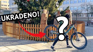
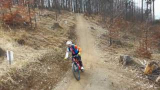
trail: Vánoční
2:07 |
1084 |
Dec 23, 2015
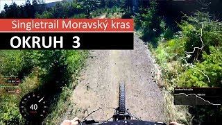
trail: Seč
8:01 |
18 |
Mar 22, 2026 , Blansko
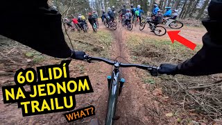
trail: Vashe Koryto
15:46 |
37 |
Jan 1, 2026 , Blansko
trail: Vashe Koryto
2:54 |
34 |
Jan 1, 2026 , Blansko
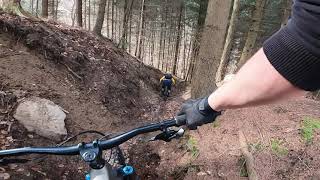
trail: Pod cestou
7:17 |
470 |
Apr 13, 2018 , Blansko

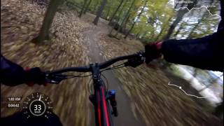
trail: U konvičky
506 |
Nov 9, 2017 , Blansko
trail: Paseky
549 |
Nov 9, 2017 , Blansko
Recent Trail Reports
| status | trail | date | condition | info | user |
|---|---|---|---|---|---|
| Seč | Apr 6, 2026 @ 12:42pm (Europe/Vienna) Apr 6, 2026 | Ideal | Denny21 | ||
| Vashe Koryto | Apr 6, 2026 @ 12:42pm (Europe/Vienna) Apr 6, 2026 | Ideal | Denny21 | ||
| Hořec | Apr 6, 2026 @ 12:42pm (Europe/Vienna) Apr 6, 2026 | Ideal | Denny21 | ||
| Vranov-Šebrov-Kořenov | Apr 6, 2026 @ 12:42pm (Europe/Vienna) Apr 6, 2026 | Ideal | Denny21 | ||
| Paseky | Apr 5, 2026 @ 12:31pm (Europe/Vienna) Apr 5, 2026 | Very Dry | Denny21 | ||
| Tipeček | Apr 5, 2026 @ 12:31pm (Europe/Vienna) Apr 5, 2026 | Dry | Denny21 | ||
| Duchoslav | Apr 5, 2026 @ 12:31pm (Europe/Vienna) Apr 5, 2026 | Dry | Denny21 | ||
| Rakovecký | Apr 5, 2026 @ 12:31pm (Europe/Vienna) Apr 5, 2026 | Dry | Denny21 | ||
| U konvičky | Apr 5, 2026 @ 12:31pm (Europe/Vienna) Apr 5, 2026 | Dry | Denny21 | ||
| Stoupací | Apr 5, 2026 @ 12:31pm (Europe/Vienna) Apr 5, 2026 | Ideal | Denny21 |
Activity Feed
| username | action | type | title | date |
|---|---|---|---|---|
| PavelN2ikLu | ridden | trail | activity #95862071 | May 30, 2026 @ 9:39am May 30, 2026 |
| Denny21 | comment | trail | activity #92072870 | Apr 6, 2026 @ 1:04pm Apr 6, 2026 |
| Denny21 | vote | trail | activity #92072244 and 2 more | Apr 6, 2026 @ 12:53pm Apr 6, 2026 |
| Denny21 | add | report | activity #92072116 and 4 more | Apr 6, 2026 @ 12:51pm Apr 6, 2026 |
| Denny21 | add | report | activity #91983232 and 5 more | Apr 5, 2026 @ 8:56am Apr 5, 2026 |
Recent Comments
| username | type | title | comment | date |
|---|---|---|---|---|
| trail | S přibývajícím sklonem lepší a lepší.... | Apr 6, 2026 @ 1:04pm Apr 6, 2026 | ||
| report | Uzavřeno | Aug 11, 2024 @ 3:14am Aug 11, 2024 | ||
| skillpark | graveled Pumptrack with a few small... | May 5, 2024 @ 10:42pm May 5, 2024 | ||
| trail | flowy one. single-track works good with... | May 5, 2024 @ 10:31pm May 5, 2024 | ||
| trail | it seams there is a new surface – there is... | May 5, 2024 @ 10:30pm May 5, 2024 |
Local Badges
-

Epic Ride Climb 2k42 awarded -

Climbing 10k Badge29 awarded -

Climbing 100k Badge1 awarded -

Epic Ride Descent 2k42 awarded -

Descent 10k Badge29 awarded -

Descent 100k Badge1 awarded
Bike & Skill Parks
| name | type | city | rating |
|---|---|---|---|
| Pumptrack Jedovnice | skill park | Blansko |
Activity Type Stats
| activitytype | trails | distance | descent | descent distance | total vertical | rating | global rank | state rank | photos | reports | routes | ridelogs |
|---|---|---|---|---|---|---|---|---|---|---|---|---|
| Mountain Bike | 21 | 20 miles | 4,065 ft | 11 miles | 1,037 ft | #1,954 | #14 | 60 | 342 | 5,765 | ||
| E-Bike | 9 | 5 miles | 361 ft | 2 miles | 915 ft | #1,603 | #11 | 317 | 248 | |||
| Winter Fat Bike | 1 | #126 | #25 | |||||||||
| Hike | 11 | 11 miles | 1,847 ft | 6 miles | 1,037 ft | #3,258 | #22 | 321 | 402 | |||
| Trail Running | 11 | 11 miles | 1,847 ft | 6 miles | 1,037 ft | #2,767 | #22 | 321 | 13 |
Frequently Asked Questions About Blansko
▼
What are the best places to ride in Blansko?
Blansko has 2 areas to explore for mountain biking. The top rated areas are:
▼
What are the highest rated mountain biking trails in Blansko?
The highest rated mountain biking trails in Blansko are:
- Paseky (4.5/5)
- Rakovecký (4.2/5)
- Tipeček (4.2/5)
- Duchoslav (4.1/5)
- U konvičky (4.1/5)
▼
What is the best time of the year to ride in Blansko?
Based on ride log data, the most popular months to ride in Blansko are:
- August (41 activities)
- June (38 activities)
- July (38 activities)
▼
Where can I park to ride in Blansko?
There are 1 parking locations listed in Blansko. The most popular parking spots are:
Activities
Trails
Points of Interest
- By roflkoptr & contributors
- Admins: ČeMBA, ČeMBA, ČeMBA, ČeMBA, ČeMBA, ČeMBA, ČeMBA, ČeMBA, ČeMBA, ČeMBA
- #15487 - 4,884 views
- blansko activity log | embed map of Blansko mountain bike trails | blansko mountain biking points of interest
Downloading of trail gps tracks in kml & gpx formats is enabled for Blansko.
You must login to download files.