close
-
Layers w
- Weather Layers
- Pro
- Pro
- Pro
- Pro
- Pro
- Pro
- More Layers
- Pro
- Pro
- Pro
- Pro
-
Upgrade to

3D
Trail Conditions
- Unknown
- Snow Groomed
- Snow Packed
- Snow Covered
- Snow Cover Partial
- Freeze/thaw Cycle
- Icy
- Prevalent Mud
- Wet
- Variable
- Ideal
- Dry
- Very Dry
Trail Flow (Ridden Direction)
Trailforks scans users ridelogs to determine the most popular direction each trail is ridden. A good flowing trail network will have most trails flowing in a single direction according to their intension.
The colour categories are based on what percentage of riders are riding a trail in its intended direction.
The colour categories are based on what percentage of riders are riding a trail in its intended direction.
- > 96%
- > 90%
- > 80%
- > 70%
- > 50%
- < 50%
- bi-directional trail
- no data
Trail Last Ridden
Trailforks scans ridelogs to determine the last time a trail was ridden.
- < 2 days
- < 1 week
- < 2 weeks
- < 1 month
- < 6 months
- > 6 months
Trail Ridden Direction
The intended direction a trail should be ridden.
- Downhill Only
- Downhill Primary
- Both Directions
- Uphill Primary
- Uphill Only
- One Direction
Contribute Details
Colors indicate trail is missing specified detail.
- Description
- Photos
- Description & Photos
- Videos
Trail Popularity ?
Trailforks scans ridelogs to determine which trails are ridden the most in the last 9 months.
Trails are compared with nearby trails in the same city region with a possible 25 colour shades.
Think of this as a heatmap, more rides = more kinetic energy = warmer colors.
- most popular
- popular
- less popular
- not popular
ATV/ORV/OHV Filter
Max Vehicle Width
inches
US Cell Coverage
Legend

Radar Time
Activity Recordings
Trailforks uses anonymized public activity data.
?
Activity Recordings
Trailforks uses anonymized public activity data.
?
Personal Heatmap
▶
Activity Types
all
/
none
▶
Options
2
Date range
month
–
Winter Trails
Warning
A routing network for winter maps does not exist. Selecting trails using the winter trails layer has been disabled.
Missing Trails
Most Popular
Least Popular
Trails are colored based on popularity. The more popular a trail is, the more red. Less popular trails trend towards green.
Jump Magnitude Heatmap
Heatmap of where riders jump on trails. Zoom in to see individual jumps, click circles to view jump details.
BC Backroad Status
![map legend]()
Service Road Atlas is a free to use, community-driven service for viewing and creating reports on the numerous back-country service roads around B.C. and Alberta.

Slope Aspect
Direction the slope faces
Trails Deemphasized
Trails are shown in grey.
Only show trails with no bike usage.
Suggested Layers
Based on selected activity type
Save the current map location and zoom level as your default home location whenever this page is loaded.
SaveThis picturesque rural area west of Nelson only has a couple trails. The trails are well built, with a wide variety of unique features and advanced terrain.
 google parking directions
 Activities Click to view
- Mountain Bike
24 trails
- E-Bike
19 trails
- Hike
12 trails
- Trail Running
12 trails
- Dirtbike/Moto
7 trails
- ATV/ORV/OHV
5 trails
Region Details
- 11
- 1
- 11
- 1
Region Status
Caution as of Jun 7, 2026Local Trail Association
Stats
- Avg Trail Rating
- Trails (view details)
- 24
- Trails Mountain Bike
- 24
- Trails E-Bike
- 19
- Trails Hike
- 12
- Trails Trail Running
- 12
- Trails Dirtbike/Moto
- 7
- Trails ATV/ORV/OHV
- 5
- Trails Snowshoe
- 1
- Total Distance
- 46 miles
- Total Descent
- 10,866 ft
- Total Vertical
- 3,312 ft
- Highest Trailhead
- 5,107 ft
- Reports
- 293
- Photos
- 72
- Ridden Counter
- 1,159
Popular Blewett Mountain Biking Trails
• 85 ★ 4.0 • 4,603 ft • 81 ft • 280 •
This is good times for all experienced riders with descent flow mixed amongst some surfy steeps and fast traverses. After second road crossing, the trail cruises parallel and directly beneath the Copper Mountain FSR and will naturally...
• 45 ★ 3.9 • 1 mile • 133 ft • 187 •
This is good times for all experienced riders with descent flow mixed amongst some surfy steeps and fast traverses. After second road crossing, the trail cruises parallel and directly beneath the Copper Mountain FSR and will naturally...
• 65 ★ 4.2 • 1 mile • 16 ft • 138 •
Here's another great trail in the '49er group, with similar flavour. The trail begins next to the '49er/Choker entrance, on the right hand side. The first section is a mix of easy descent and a little short climb though the older forest...
• 60 ★ 4.0 • 449 ft • 49 ft • 97 •
This is a short connector, linking Choker to Bottom Feeder, allowing for a nice variation for your descent.
• 45 ★ 5.0 • 2,057 ft • 0 ft • 96 •
Drops in off the start of and is a worthy first choice if you are here to ride more than one trail. Rolls through older, regenerated logging blocks, and hits the road climb twice for a couple different options to make small or big loops...
• 40 ★ 4.5 • 1,243 ft • 20 ft • 92 •
Drops in off the start of and is a worthy first choice if you are here to ride more than one trail. Rolls through older, regenerated logging blocks, and hits the road climb twice for a couple different options to make small or big loops...
• 60 ★ 4.0 • 850 ft • 11 ft • 90 •
Here's a , across from Hotwheels and entrances. This will allow riders to avoid the muddy section of the previous access during the Spring melt. Cross the bridge at the entrance, then a short climb. The trail begins a gentle descent...
• 50 ★ 4.4 • 4,774 ft • 40 ft • 71 •
Starting just a little further up the road from the & Choker entrance. The first section descends through a beautiful forest, with a nice steep section before crossing the road. The middle bit is short and features a nice bridge over a...
Blewett Mountain Bike Routes
★ 3.5 • 4 miles • 495 ft • 0 •
Smooth singletrack with rocky, rooty, twisty sections which get your attention. Intermediate due to a...
• 10 miles • 2,671 ft • 4 •
• 15 miles • 1,860 ft • 1 •
• 6 miles • 1,139 ft • 4 •
• 4 miles • 1,099 ft • 3 •
Photos of Blewett Mountain Bike
Videos of Blewett Mountain Bike
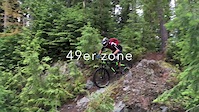
trail: Jackleg
2:16 |
394 |
Jun 24, 2018

trail: Bottom Feeder
4:33 |
641 |
Jul 9, 2018 , Nelson
Recent Trail Reports
| status | trail | date | condition | info | user |
|---|---|---|---|---|---|
| Buck Knuckle | Jun 7, 2026 @ 8:34am (America/Vancouver) Jun 7, 2026 | Variable | Rahmg | ||
| 49er - Blindside | Jun 5, 2026 @ 12:37pm (America/Vancouver) Jun 5, 2026 | Ideal | Atli13 NCC | ||
| 49er | Jun 5, 2026 @ 12:36pm (America/Vancouver) Jun 5, 2026 | Ideal | Atli13 NCC | ||
| Moosehead | Jun 3, 2026 @ 4:23pm (America/Vancouver) Jun 3, 2026 | Ideal | Atli13 NCC | ||
| Hotwheels | May 17, 2026 @ 10:35am (America/Creston) May 17, 2026 | Ideal | tmowat | ||
| Access | May 17, 2026 @ 10:35am (America/Creston) May 17, 2026 | Ideal | tmowat | ||
| Stubby | May 17, 2026 @ 10:35am (America/Creston) May 17, 2026 | Ideal | tmowat | ||
| Bottom Feeder | May 7, 2026 @ 2:30pm (America/Vancouver) May 7, 2026 | Ideal | Atli13 NCC | ||
| Jackleg | May 7, 2026 @ 2:24pm (America/Vancouver) May 7, 2026 | Dry | Atli13 NCC | ||
| Upper Choker | Apr 23, 2026 @ 8:35am (America/Vancouver) Apr 23, 2026 | Variable | conradallgaier |
Activity Feed
| username | action | type | title | date |
|---|---|---|---|---|
| Atli13 | update | trail | activity #96807894 | Jun 12, 2026 @ 8:54am Jun 12, 2026 |
| XhHzGQ3 | ridden | trail | activity #96703226 | Jun 10, 2026 @ 4:39pm Jun 10, 2026 |
| Patdob | wishlist | trail | activity #96538115 | Jun 8, 2026 @ 7:26am Jun 8, 2026 |
| Rahmg | add | report | activity #96464889 | Jun 7, 2026 @ 8:34am Jun 7, 2026 |
| Rahmg | ridden | trail | activity #96464154 | Jun 7, 2026 @ 8:27am Jun 7, 2026 |
Recent Comments
| username | type | title | comment | date |
|---|---|---|---|---|
| trail | Great addition to the 49er network. Definitely... | Sep 14, 2025 @ 4:35pm Sep 14, 2025 | ||
| report | Not the responsibility of the NCC. whoever... | Jul 25, 2025 @ 11:18am Jul 25, 2025 | ||
| report | Top climb section still not clear. | May 25, 2025 @ 11:03am May 25, 2025 | ||
| trail | The portion below the lower road is in great... | Apr 18, 2025 @ 3:47pm Apr 18, 2025 | ||
| trail | Good below the access road but some trees and... | Apr 18, 2025 @ 3:47pm Apr 18, 2025 |
Nearby Areas
| name | distance | ||||
|---|---|---|---|---|---|
| Rover Creek | 4 | 2 | 2.5 km | ||
| Morning Mountain | 3 | 11 | 4 | 1 | 4.6 km |
| Smallwood Creek | 2 | 10 | 2 | 4.9 km | |
| Giveout and Gold Creek | 8 | 5 | 10 | 3 | 5.6 km |
| Mountain Station | 1 | 7 | 22 | 3 | 8.7 km |
Local Badges
-

Completionist0 awarded
Local Products
Activity Type Stats
| activitytype | trails | distance | descent | descent distance | total vertical | rating | global rank | state rank | photos | reports | routes | ridelogs |
|---|---|---|---|---|---|---|---|---|---|---|---|---|
| Mountain Bike | 24 | 46 miles | 10,866 ft | 18 miles | 3,314 ft | #3,728 | #165 | 71 | 293 | 1 | 691 | |
| E-Bike | 19 | 20 miles | 5,997 ft | 11 miles | 2,792 ft | #4,671 | #183 | 209 | 47 | |||
| Hike | 12 | 35 miles | 2,329 ft | 9 miles | 3,314 ft | #6,312 | #256 | 148 | 1 | 110 | ||
| Trail Running | 12 | 35 miles | 2,329 ft | 9 miles | 3,314 ft | #5,505 | #196 | 148 | 1 | 38 | ||
| Dirtbike/Moto | 7 | 17 miles | 561 ft | 3 miles | 3,173 ft | #717 | #66 | 1 | 58 | 10 | ||
| ATV/ORV/OHV | 5 | 6 miles | 509 ft | 3 miles | 1,240 ft | #555 | #49 | 26 | 2 | |||
| Snowshoe | 1 | 449 ft | 33 ft | 197 ft | 43 ft | 1 | 1 |
Frequently Asked Questions About Blewett
▼
What are the highest rated mountain biking trails in Blewett?
The highest rated mountain biking trails in Blewett are:
- Bottom Feeder (4.2/5)
- Upper Choker (4.2/5)
- Lower Choker (4.1/5)
- Jackleg (4.1/5)
- 49er - Blindside (4.1/5)
▼
What is the best time of the year to ride in Blewett?
Based on ride log data, the most popular months to ride in Blewett are:
- August (16 activities)
- June (13 activities)
- July (10 activities)
▼
Where can I park to ride in Blewett?
There are 3 parking locations listed in Blewett. The most popular parking spots are: View all parking and trailhead locations on the map to plan your visit.
▼
What is the longest trail in Blewett?
The longest trail in Blewett is Taster's Choice at 7.5 km. View all trails sorted by distance.
Activities
- By canadaka
 Trailforks & contributors
 - Admins: KCTS, NCC, FOPRTS, eastonwest
- #1990 - 8,542 views
- blewett activity log | embed map of Blewett mountain bike trails | blewett mountain biking points of interest
Downloading of trail gps tracks in kml & gpx formats is disabled for Blewett.