close
-
Layers w
- Weather Layers
- Pro
- Pro
- Pro
- Pro
- Pro
- Pro
- More Layers
- Pro
- Pro
- Pro
- Pro
-
Upgrade to

3D
Trail Conditions
- Unknown
- Snow Groomed
- Snow Packed
- Snow Covered
- Snow Cover Partial
- Freeze/thaw Cycle
- Icy
- Prevalent Mud
- Wet
- Variable
- Ideal
- Dry
- Very Dry
Trail Flow (Ridden Direction)
Trailforks scans users ridelogs to determine the most popular direction each trail is ridden. A good flowing trail network will have most trails flowing in a single direction according to their intension.
The colour categories are based on what percentage of riders are riding a trail in its intended direction.
The colour categories are based on what percentage of riders are riding a trail in its intended direction.
- > 96%
- > 90%
- > 80%
- > 70%
- > 50%
- < 50%
- bi-directional trail
- no data
Trail Last Ridden
Trailforks scans ridelogs to determine the last time a trail was ridden.
- < 2 days
- < 1 week
- < 2 weeks
- < 1 month
- < 6 months
- > 6 months
Trail Ridden Direction
The intended direction a trail should be ridden.
- Downhill Only
- Downhill Primary
- Both Directions
- Uphill Primary
- Uphill Only
- One Direction
Contribute Details
Colors indicate trail is missing specified detail.
- Description
- Photos
- Description & Photos
- Videos
Trail Popularity ?
Trailforks scans ridelogs to determine which trails are ridden the most in the last 9 months.
Trails are compared with nearby trails in the same city region with a possible 25 colour shades.
Think of this as a heatmap, more rides = more kinetic energy = warmer colors.
- most popular
- popular
- less popular
- not popular
ATV/ORV/OHV Filter
Max Vehicle Width
inches
US Cell Coverage
Legend

Radar Time
Activity Recordings
Trailforks uses anonymized public activity data.
?
Activity Recordings
Trailforks uses anonymized public activity data.
?
Personal Heatmap
▶
Activity Types
all
/
none
▶
Options
2
Date range
month
–
Winter Trails
Warning
A routing network for winter maps does not exist. Selecting trails using the winter trails layer has been disabled.
Missing Trails
Most Popular
Least Popular
Trails are colored based on popularity. The more popular a trail is, the more red. Less popular trails trend towards green.
Jump Magnitude Heatmap
Heatmap of where riders jump on trails. Zoom in to see individual jumps, click circles to view jump details.
BC Backroad Status
![map legend]()
Service Road Atlas is a free to use, community-driven service for viewing and creating reports on the numerous back-country service roads around B.C. and Alberta.

Slope Aspect
Direction the slope faces
Trails Deemphasized
Trails are shown in grey.
Only show trails with no bike usage.
Suggested Layers
Based on selected activity type
Save the current map location and zoom level as your default home location whenever this page is loaded.
Save
No description for Bloomington has been added yet!
Login or register to submit one.
Activities Click to view
- Mountain Bike
25 trails
- Adaptive Bike
0 trails
- Hike
53 trails
- Trail Running
53 trails
Region Details
- 2
- 2
- 4
- 16
- 1
Region Status
Open as of Jun 18, 2026Stats
- Avg Trail Rating
- Trails (view details)
- 35
- Trails Mountain Bike
- 26
- Trails Hike
- 53
- Trails Trail Running
- 53
- Total Distance
- 43 miles
- Total Descent
- 4,817 ft
- Total Vertical
- 420 ft
- Highest Trailhead
- 961 ft
- Reports
- 147
- Photos
- 4
- Ridden Counter
- 1,184
Sub Regions
-
Allens Creek State Recreation Area
-
Amy Weingartner Branigin Peninsula Preserve
-
Morgan-Monroe State Forest
- 1
-
Owen-Putnam State Forest
- 2
- 1
-
Paynetown State Recreation Area
- 2
- 1
-
Wapehani Bike Park
- 14
- 1
Popular Bloomington Mountain Biking Trails
• 90 ★ 0.0 • 1,201 ft • 10 ft • 58 •
Quick loop if you don't feel like heading across the creek bridge.
• 75 ★ 1.0 • 1,483 ft • 61 ft • 48 •
Popular blue difficulty singletrack. This mountain bike primary trail can be used both directions and has a moderate overall physical rating with a 61 ft blue climb. On average it takes 4 minutes to complete this trail.
• 80 ★ 2.0 • 1 mile • 112 ft • 47 •
Popular blue difficulty singletrack. This mountain bike primary trail can be used both directions. On average it takes 9 minutes to complete this trail.
• 75 ★ 1.0 • 2,671 ft • 0 ft • 45 •
Popular blue difficulty singletrack. This mountain bike primary trail can be used both directions and has a moderate overall physical rating with a 0 ft green climb. Trail visibility is always easy to follow. On average it takes 3 minutes to complete this trail.
• 50 ★ 2.5 • 1 mile • 58 ft • 42 •
Updated easy trail after trail closures in 2019.
• 100 ★ 0.0 • 1,076 ft • 10 ft • 39 •
Popular blue difficulty singletrack. This mountain bike primary trail can be used both directions. It features bridge. On average it takes 1 minutes to complete this trail.
• 70 ★ 0.0 • 3,650 ft • 6 ft • 37 •
Popular white difficulty paved path. This multi-use trail can be used both directions. On average it takes 2 minutes to complete this trail.
• 100 ★ 0.0 • 640 ft • 10 ft • 37 •
Popular blue difficulty singletrack. This mountain bike primary trail can be used both directions. On average it takes 1 minutes to complete this trail.
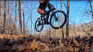
Bloomington Mountain Bike Routes
Videos of Bloomington Mountain Bike
trail: Main Blue
7:20 |
264 |
Apr 19, 2024 , Bloomington
Recent Trail Reports
| status | trail | date | condition | info | user |
|---|---|---|---|---|---|
| Fruit Loopty Loop | Jun 6, 2026 @ 10:24am (America/Indiana/Indianapolis) Jun 6, 2026 | Ideal | Ewoods161 | ||
| Main Blue | Jun 6, 2026 @ 10:24am (America/Indiana/Indianapolis) Jun 6, 2026 | Ideal | Ewoods161 | ||
| Malcolm in the Middle | Jun 6, 2026 @ 10:24am (America/Indiana/Indianapolis) Jun 6, 2026 | Ideal | Ewoods161 | ||
| Gravel Access Road | Jun 3, 2026 @ 6:08pm (America/Indiana/Indianapolis) Jun 3, 2026 | Ideal | thedogsweed | ||
| Energy Expert | Jun 3, 2026 @ 6:08pm (America/Indiana/Indianapolis) Jun 3, 2026 | Ideal | thedogsweed | ||
| Submarine Shortcut | Jun 3, 2026 @ 6:08pm (America/Indiana/Indianapolis) Jun 3, 2026 | Ideal | thedogsweed | ||
| Baby Skunk | Jun 3, 2026 @ 6:08pm (America/Indiana/Indianapolis) Jun 3, 2026 | Ideal | thedogsweed | ||
| Easy Peasy Lemon Squeezy | Jun 3, 2026 @ 6:08pm (America/Indiana/Indianapolis) Jun 3, 2026 | Ideal | thedogsweed | ||
| Rooty Lake Front | Jun 3, 2026 @ 9:23am (America/Indiana/Indianapolis) Jun 3, 2026 | Ideal | Ewoods161 | ||
| Log A-Frame | Sep 3, 2023 @ 2:04pm Sep 3, 2023 | Dry | McBooty |
Activity Feed
| username | action | type | title | date |
|---|---|---|---|---|
| Ewoods161 | add | report | activity #96372055 and 2 more | Jun 6, 2026 @ 8:09am Jun 6, 2026 |
| thedogsweed | add | report | activity #96198342 and 5 more | Jun 3, 2026 @ 6:39pm Jun 3, 2026 |
| Ewoods161 | add | report | activity #96183007 and 6 more | Jun 3, 2026 @ 3:05pm Jun 3, 2026 |
| Ewoods161 | wishlist | region | activity #96177331 | Jun 3, 2026 @ 1:25pm Jun 3, 2026 |
| thedogsweed | add | report | activity #93496496 | Apr 26, 2026 @ 8:05pm Apr 26, 2026 |
Local Badges
-

Epic Mountain Bike Climb 2k4 awarded -

Climbing 10k Badge10 awarded -

Mountain Biking 100k Badge0 awarded -

Epic Ride Descent 2k4 awarded -

Descent 10k Badge10 awarded -

Descent 100k Badge0 awarded
Local Mountain Biking Directory
-
Bloomington Bicycles
![Bloomington Bicycles]()
-
Revolution Bike & BeanBike Shop
-
BikesmithBike Shop
-
Best Bicycle Inc. DbaBike Shop
-
Bicycledoctorusa.comBike Shop
Activity Type Stats
| activitytype | trails | distance | descent | descent distance | total vertical | rating | global rank | state rank | photos | reports | routes | ridelogs |
|---|---|---|---|---|---|---|---|---|---|---|---|---|
| Mountain Bike | 25 | 12 miles | 853 ft | 5 miles | 404 ft | #11,352 | #3,463 | 4 | 147 | 1 | 3,397 | |
| Hike | 53 | 43 miles | 4,816 ft | 19 miles | 420 ft | #4,426 | #1,558 | 147 | 733 | |||
| Trail Running | 53 | 43 miles | 4,816 ft | 19 miles | 420 ft | #4,668 | #1,440 | 147 | 337 |
Frequently Asked Questions About Bloomington
▼
What are the best places to ride in Bloomington?
Bloomington has 7 areas to explore for mountain biking. The top rated areas are:
▼
What are the highest rated mountain biking trails in Bloomington?
The highest rated mountain biking trails in Bloomington are:
- Easy Peasy Lemon Squeezy (3.6/5)
- Terrain Park (3.6/5)
- Baby Skunk (3.6/5)
- Malcolm in the Middle (3.6/5)
- Energy Expert (3.5/5)
▼
What is the best time of the year to ride in Bloomington?
Based on ride log data, the most popular months to ride in Bloomington are:
- July (15 activities)
- October (7 activities)
- June (6 activities)
▼
Where can I park to ride in Bloomington?
There are 14 parking locations listed in Bloomington. The most popular parking spots are: View all parking and trailhead locations on the map to plan your visit.
Activities
Trails
Points of Interest
- By daylenrides & contributors
- Admins: apply
- #5291 - 7,135 views
- bloomington activity log | embed map of Bloomington mountain bike trails | bloomington mountain biking points of interest
Downloading of trail gps tracks in kml & gpx formats is enabled for Bloomington.
You must login to download files.