close
-
Layers w
- Weather Layers
- Pro
- Pro
- Pro
- Pro
- Pro
- Pro
- More Layers
- Pro
- Pro
- Pro
- Pro
-
Upgrade to

3D
Trail Conditions
- Unknown
- Snow Groomed
- Snow Packed
- Snow Covered
- Snow Cover Partial
- Freeze/thaw Cycle
- Icy
- Prevalent Mud
- Wet
- Variable
- Ideal
- Dry
- Very Dry
Trail Flow (Ridden Direction)
Trailforks scans users ridelogs to determine the most popular direction each trail is ridden. A good flowing trail network will have most trails flowing in a single direction according to their intension.
The colour categories are based on what percentage of riders are riding a trail in its intended direction.
The colour categories are based on what percentage of riders are riding a trail in its intended direction.
- > 96%
- > 90%
- > 80%
- > 70%
- > 50%
- < 50%
- bi-directional trail
- no data
Trail Last Ridden
Trailforks scans ridelogs to determine the last time a trail was ridden.
- < 2 days
- < 1 week
- < 2 weeks
- < 1 month
- < 6 months
- > 6 months
Trail Ridden Direction
The intended direction a trail should be ridden.
- Downhill Only
- Downhill Primary
- Both Directions
- Uphill Primary
- Uphill Only
- One Direction
Contribute Details
Colors indicate trail is missing specified detail.
- Description
- Photos
- Description & Photos
- Videos
Trail Popularity ?
Trailforks scans ridelogs to determine which trails are ridden the most in the last 9 months.
Trails are compared with nearby trails in the same city region with a possible 25 colour shades.
Think of this as a heatmap, more rides = more kinetic energy = warmer colors.
- most popular
- popular
- less popular
- not popular
ATV/ORV/OHV Filter
Max Vehicle Width
inches
US Cell Coverage
Legend

Radar Time
Activity Recordings
Trailforks uses anonymized public activity data.
?
Activity Recordings
Trailforks uses anonymized public activity data.
?
Personal Heatmap
▶
Activity Types
all
/
none
▶
Options
2
Date range
month
–
Winter Trails
Warning
A routing network for winter maps does not exist. Selecting trails using the winter trails layer has been disabled.
Missing Trails
Most Popular
Least Popular
Trails are colored based on popularity. The more popular a trail is, the more red. Less popular trails trend towards green.
Jump Magnitude Heatmap
Heatmap of where riders jump on trails. Zoom in to see individual jumps, click circles to view jump details.
BC Backroad Status
![map legend]()
Service Road Atlas is a free to use, community-driven service for viewing and creating reports on the numerous back-country service roads around B.C. and Alberta.

Slope Aspect
Direction the slope faces
Trails Deemphasized
Trails are shown in grey.
Only show trails with no bike usage.
Suggested Layers
Based on selected activity type
Save the current map location and zoom level as your default home location whenever this page is loaded.
Save
No description for Bludenz has been added yet!
Login or register to submit one.
This region uses the Uk/Euro style trail grading system.
Activities Click to view
- Mountain Bike
17 trails
- E-Bike
6 trails
- Hike
24 trails
- Trail Running
24 trails
Region Details
- 1
- 3
- 11
- 1
Region Status
Open as of Apr 25, 2026Stats
- Avg Trail Rating
- Trails (view details)
- 19
- Trails Mountain Bike
- 17
- Trails E-Bike
- 6
- Trails Hike
- 24
- Trails Trail Running
- 24
- Total Distance
- 29 miles
- Total Descent
- 16,398 ft
- Total Vertical
- 5,745 ft
- Highest Trailhead
- 7,582 ft
- Reports
- 41
- Photos
- 35
- Ridden Counter
- 395
Popular Bludenz Mountain Biking Trails
• 5 ★ 3.4 • 2 miles • 6 ft • 52 •
Der Muttersberg Trail bietet in der überregionalen Bikelandschaft ein einzigartiges Angebot. Deutlich über 700 Höhenmeter sorgen, auf dem fast 5 Kilometer langen Trail, für ein beinahe endloses Gravity-Erlebnis der ganz besonderen...
• 85 ★ 4.5 • 2 miles • 269 ft • 38 •
Popular blue difficulty singletrack. This mountain bike primary trail can be used downhill primary. On average it takes 1 hour52 minutes to complete this trail.
• 95 ★ 0.0 • 2 miles • 184 ft • 37 •
Popular green difficulty singletrack. This multi-use trail can be used downhill primary. On average it takes 17 minutes to complete this trail.
• 65 ★ 4.7 • 4,058 ft • 6 ft • 22 •
Highly rated moderately popular blue difficulty singletrack. This mountain bike primary trail can be used downhill only. On average it takes 4 minutes to complete this trail.
• 100 ★ 3.0 • 1 mile • 0 ft • 20 •
Popular blue difficulty singletrack. This mountain bike primary trail can be used downhill primary. On average it takes 7 minutes to complete this trail.
• 70 ★ 4.0 • 1 mile • 12 ft • 16 •
Popular blue difficulty singletrack. This mountain bike primary trail can be used downhill only. On average it takes 7 minutes to complete this trail.
• 60 ★ 4.5 • 3,099 ft • 15 ft • 12 •
Need a shuttle up to Laz, or you combine the upper half of Muttersberg Downhill with a short road connection to the Messweg Trail.
• 75 ★ 4.0 • 2,349 ft • 0 ft • 12 •
Popular green difficulty singletrack. This mountain bike primary trail can be used both directions. On average it takes 3 minutes to complete this trail.
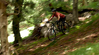
Photos of Bludenz Mountain Bike
Videos of Bludenz Mountain Bike
trail: Singletrail Muttersberg
2:12 |
317 |
Nov 2, 2019

trail: Singletrail Muttersberg
4:06 |
601 |
Apr 20, 2019 , Bludenz
Recent Trail Reports
| status | trail | date | condition | info | user |
|---|---|---|---|---|---|
| Singletrail Muttersberg | Apr 25, 2026 @ 9:40pm (Europe/Vienna) Apr 25, 2026 | Dry | Freeze225 | ||
| Uphill Rellstal - Schweizer Tor | Aug 4, 2024 @ 12:08am Aug 4, 2024 | Unknown | giovanni-fk | ||
| Muttersbergbahn | May 27, 2024 @ 7:34am May 27, 2024 | Variable | YkKbyh | ||
| Tobelbach Trail | Sep 23, 2022 @ 5:38am Sep 23, 2022 | Ideal | MeinerEiner | ||
| Gondola Trail | Aug 6, 2022 @ 2:30am Aug 6, 2022 | Ideal | giovanni-fk | ||
| Sender Trail | Aug 6, 2022 @ 2:30am Aug 6, 2022 | Ideal | giovanni-fk | ||
| Kristakopf | Jul 8, 2022 @ 8:58am Jul 8, 2022 | Dry | Raphael6ya4fI | ||
| Forest Lump | Mar 6, 2022 @ 6:43am Mar 6, 2022 | Ideal | MeinerEiner | ||
| Messweg First Line | Mar 1, 2021 @ 12:34am Mar 1, 2021 | Ideal | cattledogcrew | ||
| Riederhof | May 29, 2020 @ 10:52pm May 29, 2020 | Ideal | phirue |
Activity Feed
| username | action | type | title | date |
|---|---|---|---|---|
| ArvisgLV | ridden | trail | activity #97310377 | Jun 19, 2026 @ 5:43am 2 days |
| HerbertUgeBI0 | ridden | trail | activity #97267435 | Jun 18, 2026 @ 11:55am 2 days |
| Tinoid | vote | trail | activity #94739157 | May 15, 2026 @ 3:08am May 15, 2026 |
| arno420 | comment | report | activity #94406227 | May 10, 2026 @ 2:14am May 10, 2026 |
| digestive | ridden | trail | activity #93926837 | May 3, 2026 @ 2:40am May 3, 2026 |
Recent Comments
| username | type | title | comment | date |
|---|---|---|---|---|
| report | How are there trails , 99% of trails here in... | May 10, 2026 @ 2:14am May 10, 2026 | ||
| trail | Oberster Teil eher blau und als Uphill nicht... | Oct 15, 2025 @ 1:43pm Oct 15, 2025 | ||
| trail | Einfacher ist der Trail hinten am See beim... | Oct 15, 2025 @ 1:38pm Oct 15, 2025 | ||
| trail | Zwei drei rote Stellen und sicherlich ein... | Oct 15, 2025 @ 1:35pm Oct 15, 2025 | ||
| trail | Flowy trifft's meines Erachtens nicht.... | May 31, 2025 @ 9:04am May 31, 2025 |
Local Badges
-

Epic Ride Descent 2k33 awarded -

Descent 10k Badge4 awarded -

Descent 100k Badge0 awarded -

Epic Mountain Bike Climb 2k2 awarded -

Climbing 10k Badge0 awarded -

Mountain Biking 100k Badge0 awarded
Activity Type Stats
| activitytype | trails | distance | descent | descent distance | total vertical | rating | global rank | state rank | photos | reports | routes | ridelogs |
|---|---|---|---|---|---|---|---|---|---|---|---|---|
| Mountain Bike | 17 | 25 miles | 12,667 ft | 15 miles | 5,000 ft | #3,817 | #39 | 35 | 41 | 848 | ||
| E-Bike | 6 | 14 miles | 4,580 ft | 6 miles | 4,915 ft | #3,038 | #39 | 37 | 179 | |||
| Hike | 24 | 27 miles | 13,809 ft | 16 miles | 5,745 ft | #1,147 | #12 | 27 | 303 | |||
| Trail Running | 24 | 27 miles | 13,809 ft | 16 miles | 5,745 ft | #3,618 | #46 | 27 | 24 |
Frequently Asked Questions About Bludenz
▼
What are the highest rated mountain biking trails in Bludenz?
The highest rated mountain biking trails in Bludenz are:
- Sender Trail (4.3/5)
- Messweg First Line (4.2/5)
- Kristakopf (4.1/5)
- Itonskopf Trail (4.1/5)
- Tobelbach Trail (4/5)
▼
What is the best time of the year to ride in Bludenz?
Based on ride log data, the most popular months to ride in Bludenz are:
- August (12 activities)
- September (10 activities)
- July (10 activities)
▼
Where can I park to ride in Bludenz?
▼
What is the longest trail in Bludenz?
The longest trail in Bludenz is Itonskopf Trail at 2.2 miles. View all trails sorted by distance.
Activities
Trails
- By phirue & contributors
- Admins: troubletoni
- #28252 - 2,992 views
- bludenz activity log | embed map of Bludenz mountain bike trails | bludenz mountain biking points of interest
Downloading of trail gps tracks in kml & gpx formats is enabled for Bludenz.
You must login to download files.