close
-
Layers w
- Weather Layers
- Pro
- Pro
- Pro
- Pro
- Pro
- Pro
- More Layers
- Pro
- Pro
- Pro
- Pro
-
Upgrade to

3D
Trail Conditions
- Unknown
- Snow Groomed
- Snow Packed
- Snow Covered
- Snow Cover Partial
- Freeze/thaw Cycle
- Icy
- Prevalent Mud
- Wet
- Variable
- Ideal
- Dry
- Very Dry
Trail Flow (Ridden Direction)
Trailforks scans users ridelogs to determine the most popular direction each trail is ridden. A good flowing trail network will have most trails flowing in a single direction according to their intension.
The colour categories are based on what percentage of riders are riding a trail in its intended direction.
The colour categories are based on what percentage of riders are riding a trail in its intended direction.
- > 96%
- > 90%
- > 80%
- > 70%
- > 50%
- < 50%
- bi-directional trail
- no data
Trail Last Ridden
Trailforks scans ridelogs to determine the last time a trail was ridden.
- < 2 days
- < 1 week
- < 2 weeks
- < 1 month
- < 6 months
- > 6 months
Trail Ridden Direction
The intended direction a trail should be ridden.
- Downhill Only
- Downhill Primary
- Both Directions
- Uphill Primary
- Uphill Only
- One Direction
Contribute Details
Colors indicate trail is missing specified detail.
- Description
- Photos
- Description & Photos
- Videos
Trail Popularity ?
Trailforks scans ridelogs to determine which trails are ridden the most in the last 9 months.
Trails are compared with nearby trails in the same city region with a possible 25 colour shades.
Think of this as a heatmap, more rides = more kinetic energy = warmer colors.
- most popular
- popular
- less popular
- not popular
ATV/ORV/OHV Filter
Max Vehicle Width
inches
US Cell Coverage
Legend

Radar Time
Activity Recordings
Trailforks uses anonymized public activity data.
?
Activity Recordings
Trailforks uses anonymized public activity data.
?
Personal Heatmap
▶
Activity Types
all
/
none
▶
Options
2
Date range
month
–
Winter Trails
Warning
A routing network for winter maps does not exist. Selecting trails using the winter trails layer has been disabled.
Missing Trails
Most Popular
Least Popular
Trails are colored based on popularity. The more popular a trail is, the more red. Less popular trails trend towards green.
Jump Magnitude Heatmap
Heatmap of where riders jump on trails. Zoom in to see individual jumps, click circles to view jump details.
BC Backroad Status
![map legend]()
Service Road Atlas is a free to use, community-driven service for viewing and creating reports on the numerous back-country service roads around B.C. and Alberta.

Slope Aspect
Direction the slope faces
Trails Deemphasized
Trails are shown in grey.
Only show trails with no bike usage.
Suggested Layers
Based on selected activity type
Save the current map location and zoom level as your default home location whenever this page is loaded.
Save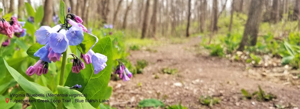
While the main purpose of Blue Marsh was to provide flood control to part of the Schuylkill River Valley, over the years the lake has become a recreational hotspot. With over 36 miles of trails, 6200 acres of land, 1148 acres of water, picnic areas, a small beach and boat launches the lake can accommodate all kinds of outdoor enthusiasts. The dam is an earthfill dam that that is 1,775 feet long, 98 feet high and can hold upwards of 16.28 billion gallons of water. During the summer months, the water level is maintained at 290 feet above sea level. In the winter the lake is drawn down five feet to provide for additional flood water storage.
The grasp of Blue Marsh does not stop there. Over the years, the park staff has increased outreach efforts and organizes volunteers for events that happen all year round. Three of the larger programs include Take Pride in Blue Marsh (April), Get Outdoors Day (June), and National Public Lands Day (September). Tours and programs for school and civic groups emphasize the Corps missions, water safety and outdoor recreation. Contact Blue Marsh Lake to find out more about these and other programs we offer.
Hours
The developed recreation areas are open at 8:00 AM every day and close at dusk.
source: website
Primary Trail Type: Cross-Country
Land Status: Military Managed
Land Manager: US Army Corps of Engineers
 google parking directions
Links
IMBA Ride Center

Reading
Activities Click to view
- Mountain Bike
44 trails
- Horse
34 trails
- Hike
49 trails
- Trail Running
49 trails
- Snowshoe
42 trails
- Nordic Ski
42 trails
Region Details
- 5
- 8
- 15
- 1
Region Status
Caution as of 3 daysStats
- Avg Trail Rating
- Trails (view details)
- 29
- Trails Mountain Bike
- 44
- Trails Horse
- 34
- Trails Hike
- 49
- Trails Trail Running
- 49
- Trails Snowshoe
- 42
- Trails Nordic Ski
- 42
- Total Distance
- 38 miles
- Total Descent Distance
- 15 miles
- Total Descent
- 3,438 ft
- Total Vertical
- 308 ft
- Highest Trailhead
- 556 ft
- Reports
- 683
- Photos
- 508
- Ridden Counter
- 9,849
Popular Blue Marsh Lake Mountain Biking Trails
• 100 ★ 4.0 • 2 miles • 187 ft • 761 •
Two miles of fun, machine-built flow trail between the Lower Stilling Basin Parking Lot and the Water Road Parking Lot. Built by DirtSculpt as part of BAMBA's Blue Marsh Trail Restoration Project-Phase 2, in partnership with USACE.
• 100 ★ 4.6 • 4 miles • 330 ft • 613 •
This trail is dedicated in memory to cyclist, Loren Holl. Machine-built flowy trail providing more fun options by the State Hill Boat Launch area. This trail was built by as part of 's Blue Marsh Trail Restoration Project-Phase 3, in...
• 100 ★ 3.5 • 2,575 ft • 38 ft • 597 •
New singletrack machine built flow trail that runs parallel to the old . Runs from Old State Hill Road to near Dike C
• 100 ★ 4.0 • 1,407 ft • 0 ft • 553 •
New singletrack machine-built flow trail that connects to from the old / Old State Hill Road.
• 100 ★ 3.7 • 741 ft • 0 ft • 541 •
Connector from parking lot to new lower Stilling Basin Trail.
• 100 ★ 3.8 • 2,336 ft • 94 ft • 515 •
This bi-directional trail is a fun way to go from the Visitor's Center to the Lower Stilling Basin Parking Lot. It was built by DirtSculpt LLC as part of BAMBA's Blue Marsh Trail Restoration Project, Phase 1-A, in partnership with USACE.
• 100 ★ 0.0 • 456 ft • 0 ft • 310 •
Alternate straight climb up over four water bar rock steps. Bypasses the steep switchbacks of the Basin Climb Trail.
• 80 ★ 3.0 • 3 miles • 161 ft • 310 •
Standard Blue Marsh Trail...mix of packed dirt, sand, and shale singletrack. Lots of ups and downs, both heavy forest and open fields.
Blue Marsh Lake Mountain Bike Routes
9 miles • 608 ft • 4 • Out & Back •
This route starts at the State Hill Boat Launch parking area and hits all of the new mountain bike trails...
★ 4.0 • 5 miles • 596 ft • 0 • Loop •
Fun after work special. A bunch of great downhills, but you pay for it with just as bad of a climb. Both...
10 miles • 740 ft • 0 •
Loop around the northwest end of Blue Marsh Lake, starts and ends at old church road parking lot by bridge
Photos of Blue Marsh Lake Mountain Bike
Videos of Blue Marsh Lake Mountain Bike

trail: Tulpy Flow Trail
12:47 |
1295 |
Jul 18, 2021 , Reading
youtuber
![Blue Marsh Epic]()

9:59 |
959 |
Aug 18, 2017 , Reading
Current Trail Warnings
| status | trail | date | condition | user | info |
|---|---|---|---|---|---|
| Tulpy Flow Trail | Jun 16, 2026 @ 8:56pm (America/New_York) 3 days | Unknown | Mitchrider | Large tree down across trail, blocking trail | |
| State Hill Loop | May 28, 2026 @ 5:12pm (America/New_York) May 28, 2026 | Unknown | CoalIronScrap | tree down blocking trail |
Recent Trail Reports
| status | trail | date | condition | info | user |
|---|---|---|---|---|---|
| Lake Border Trail (Bernville Road Overpass to Rec Area) | Mar 28, 2026 @ 2:55pm (America/New_York) Mar 28, 2026 | Dry | NESnowman | ||
| Visitor's Center to Stilling Basin | Oct 18, 2025 @ 8:34am (America/New_York) Oct 18, 2025 | Ideal | CycleTopher | ||
| Connector to Stilling Basin | Oct 18, 2025 @ 8:34am (America/New_York) Oct 18, 2025 | Ideal | CycleTopher | ||
| Basin Parking Lot Connector | Oct 18, 2025 @ 8:34am (America/New_York) Oct 18, 2025 | Ideal | CycleTopher | ||
| State Hill Loop Spur | Sep 11, 2025 @ 8:13am Sep 11, 2025 | Unknown | bankofdad | ||
| Loren Holl Memorial Loop | Sep 7, 2025 @ 10:48am Sep 7, 2025 | Unknown | tjpapich BAMBA | ||
| Highland Hill Trail | Aug 27, 2025 @ 7:15am Aug 27, 2025 | Variable | Mitchrider | ||
| State Hill Dike C Connector - East | Aug 23, 2025 @ 11:42am Aug 23, 2025 | Ideal | chrisrebman | ||
| State Hill Dike C Connector Trail - West | Aug 23, 2025 @ 11:42am Aug 23, 2025 | Dry | chrisrebman | ||
| Alternate Basin Climb (horses) | Apr 20, 2025 @ 3:25pm Apr 20, 2025 | Variable | zeddicus41 |
Activity Feed
| username | action | type | title | date |
|---|---|---|---|---|
| Mitchrider | add | report | activity #97151771 | Jun 16, 2026 @ 5:56pm 3 days |
| JillAGamber | add | report | activity #97134808 and 1 more | Jun 16, 2026 @ 1:28pm Jun 16, 2026 |
| rondixon | add | karma | activity #96530468 | Jun 8, 2026 @ 4:29am Jun 8, 2026 |
| dmotel | wishlist | route | activity #96024716 | Jun 1, 2026 @ 9:55am Jun 1, 2026 |
| dmotel | wishlist | route | activity #95991821 | May 31, 2026 @ 6:07pm May 31, 2026 |
Recent Comments
| username | type | title | comment | date |
|---|---|---|---|---|
| report | This was already cleared when I rode tonight. | Oct 3, 2025 @ 6:26pm Oct 3, 2025 | ||
| report | Tree is at the last switch back heading toward... | Sep 30, 2025 @ 5:01pm Sep 30, 2025 | ||
| report | Cleared. | Sep 14, 2025 @ 6:47pm Sep 14, 2025 | ||
| report | Cleared. | Sep 13, 2025 @ 11:57am Sep 13, 2025 | ||
| report | Cleared. | Sep 13, 2025 @ 11:56am Sep 13, 2025 |
Nearby Areas
| name | distance | ||||
|---|---|---|---|---|---|
| Reading Urban Trails | 4 | 7.5 km | |||
| Mount Penn Preserve | 24 | 33 | 56 | 9 | 8.4 km |
| Antietam Lake Park | 15 | 15 | 8 | 9.3 km | |
| Neversink Mountain Preserve | 11 | 10 | 3 | 1 | 9.6 km |
| Green Hills Preserve | 8 | 1 | 11.7 km |
Local Badges
-

Completionist0 awarded
Bike & Skill Parks
| name | type | city | rating |
|---|---|---|---|
| Blue Marsh Bike Skills Area | skill park | Reading |
Activity Type Stats
| activitytype | trails | distance | descent | descent distance | total vertical | rating | global rank | state rank | photos | reports | routes | ridelogs |
|---|---|---|---|---|---|---|---|---|---|---|---|---|
| Mountain Bike | 44 | 38 miles | 3,438 ft | 15 miles | 308 ft | #3,484 | #1,214 | 520 | 683 | 6 | 9,312 | |
| Horse | 34 | 31 miles | 2,949 ft | 13 miles | 308 ft | #1,031 | #533 | 198 | 2 | |||
| Hike | 49 | 38 miles | 3,438 ft | 15 miles | 308 ft | #4,659 | #1,669 | 1 | 682 | 248 | ||
| Trail Running | 49 | 38 miles | 3,438 ft | 15 miles | 308 ft | #3,913 | #1,094 | 682 | 169 | |||
| Snowshoe | 42 | 37 miles | 3,317 ft | 15 miles | 308 ft | #284 | #74 | 287 | 3 | |||
| Nordic Ski | 42 | 37 miles | 3,317 ft | 15 miles | 308 ft | #356 | #92 | 253 | 6 |
Frequently Asked Questions About Blue Marsh Lake
▼
What are the highest rated mountain biking trails in Blue Marsh Lake?
The highest rated mountain biking trails in Blue Marsh Lake are:
- Loren Holl Memorial Loop (4.3/5)
- Tulpy Flow Trail (4/5)
- State Hill Dike C Connector Trail - West (4/5)
- Visitor's Center to Stilling Basin (3.9/5)
- Connector to Stilling Basin (3.9/5)
▼
What is the best time of the year to ride in Blue Marsh Lake?
Based on ride log data, the most popular months to ride in Blue Marsh Lake are:
- July (188 activities)
- August (130 activities)
- September (121 activities)
▼
Where can I park to ride in Blue Marsh Lake?
There are 10 parking locations listed in Blue Marsh Lake. The most popular parking spots are: View all parking and trailhead locations on the map to plan your visit.
▼
What is the longest trail in Blue Marsh Lake?
The longest trail in Blue Marsh Lake is Loren Holl Memorial Loop at 3.8 miles. View all trails sorted by distance.
Activities
Trails
Points of Interest
- By brenthillier
 NSMBA TRAILFORKS & contributors
 - Admins: BAMBA, USACE, BTW, BAMBA
- #5661 - 34,975 views
- blue marsh lake activity log | embed map of Blue Marsh Lake mountain bike trails | blue marsh lake mountain biking points of interest
Downloading of trail gps tracks in kml & gpx formats is enabled for Blue Marsh Lake.
You must login to download files.