close
-
Layers w
- Weather Layers
- Pro
- Pro
- Pro
- Pro
- Pro
- Pro
- More Layers
- Pro
- Pro
- Pro
- Pro
-
Upgrade to

3D
Trail Conditions
- Unknown
- Snow Groomed
- Snow Packed
- Snow Covered
- Snow Cover Partial
- Freeze/thaw Cycle
- Icy
- Prevalent Mud
- Wet
- Variable
- Ideal
- Dry
- Very Dry
Trail Flow (Ridden Direction)
Trailforks scans users ridelogs to determine the most popular direction each trail is ridden. A good flowing trail network will have most trails flowing in a single direction according to their intension.
The colour categories are based on what percentage of riders are riding a trail in its intended direction.
The colour categories are based on what percentage of riders are riding a trail in its intended direction.
- > 96%
- > 90%
- > 80%
- > 70%
- > 50%
- < 50%
- bi-directional trail
- no data
Trail Last Ridden
Trailforks scans ridelogs to determine the last time a trail was ridden.
- < 2 days
- < 1 week
- < 2 weeks
- < 1 month
- < 6 months
- > 6 months
Trail Ridden Direction
The intended direction a trail should be ridden.
- Downhill Only
- Downhill Primary
- Both Directions
- Uphill Primary
- Uphill Only
- One Direction
Contribute Details
Colors indicate trail is missing specified detail.
- Description
- Photos
- Description & Photos
- Videos
Trail Popularity ?
Trailforks scans ridelogs to determine which trails are ridden the most in the last 9 months.
Trails are compared with nearby trails in the same city region with a possible 25 colour shades.
Think of this as a heatmap, more rides = more kinetic energy = warmer colors.
- most popular
- popular
- less popular
- not popular
ATV/ORV/OHV Filter
Max Vehicle Width
inches
US Cell Coverage
Legend

Radar Time
Activity Recordings
Trailforks uses anonymized public activity data.
?
Activity Recordings
Trailforks uses anonymized public activity data.
?
Personal Heatmap
▶
Activity Types
all
/
none
▶
Options
2
Date range
month
–
Winter Trails
Warning
A routing network for winter maps does not exist. Selecting trails using the winter trails layer has been disabled.
Missing Trails
Most Popular
Least Popular
Trails are colored based on popularity. The more popular a trail is, the more red. Less popular trails trend towards green.
Jump Magnitude Heatmap
Heatmap of where riders jump on trails. Zoom in to see individual jumps, click circles to view jump details.
BC Backroad Status
![map legend]()
Service Road Atlas is a free to use, community-driven service for viewing and creating reports on the numerous back-country service roads around B.C. and Alberta.

Slope Aspect
Direction the slope faces
Trails Deemphasized
Trails are shown in grey.
Only show trails with no bike usage.
Suggested Layers
Based on selected activity type
Save the current map location and zoom level as your default home location whenever this page is loaded.
Save
No description for Bogota has been added yet!
Login or register to submit one.
Activities Click to view
- Mountain Bike
21 trails
- E-Bike
18 trails
- Gravel Bike
0 trails
- Adaptive Bike
0 trails
- Winter Fat Bike
0 trails
- Hike
16 trails
- Trail Running
16 trails
Region Details
- 3
- 1
- 11
- 5
Region Status
Open as of Apr 26, 2026Stats
- Trails (view details)
- 20
- Trails Mountain Bike
- 21
- Trails E-Bike
- 18
- Trails Horse
- 1
- Trails Hike
- 16
- Trails Trail Running
- 16
- Trails Dirtbike/Moto
- 2
- Trails ATV/ORV/OHV
- 1
- Total Distance
- 16 miles
- Total Descent
- 3,963 ft
- Total Vertical
- 9,893 ft
- Highest Trailhead
- 11,034 ft
- Reports
- 36
- Photos
- 16
- Ridden Counter
- 320
Articles
Video: Remy Metailler and Matt Walker Ride an Urban Downhill Race Course in Bogota
Oct 12, 2019 from pinkbike.com
Railing through the streets of the Colombian capital.
Sub Regions
-
Faca, Bojacá & Zipacón
-
La Ceja
-
Llanogrande
-
Mesa de Yeguas
- 1
-
Mesa De Yeguas Country Club
- 1
- 1
Popular Bogota Mountain Biking Trails
• 90 ★ 0.0 • 2,166 ft • 0 ft • 30 •
Popular blue difficulty singletrack. This mountain bike primary trail can be used downhill primary and has a moderate overall physical rating with a 0 ft blue climb. It features drop, jump, rock garden and roller coaster. On average it takes 2 minutes to complete this trail.
• 75 ★ 0.0 • 2 miles • 60 ft • 28 •
Popular green difficulty gravel path. This mountain bike primary trail can be used both directions. On average it takes 25 minutes to complete this trail.
• 65 ★ 0.0 • 835 ft • 0 ft • 20 •
Moderately popular blue difficulty singletrack. This mountain bike primary trail can be used downhill primary and has a moderate overall physical rating with a 0 ft blue climb. It features jump and rock garden. On average it takes 1 minutes to complete this trail.
• 55 ★ 0.0 • 3,750 ft • 0 ft • 14 •
A small section of a primitive trail to the Monserrate summit. A few technical features and loose rocks.
• 60 ★ 0.0 • 2,187 ft • 0 ft • 14 •
Moderately popular blue difficulty singletrack. This mountain bike primary trail can be used both directions and has a hard overall physical rating with a 0 ft black diamond climb. Trail visibility is always easy to follow. On average it takes 2 minutes to complete this trail.
• 85 ★ 0.0 • 1,991 ft • 24 ft • 11 •
Popular blue difficulty singletrack. This multi-use trail can be used downhill primary and has a moderate overall physical rating with a 24 ft blue climb. Trail visibility is always easy to follow.
• 95 ★ 0.0 • 3,973 ft • 282 ft • 10 •
Popular blue difficulty singletrack. This mountain bike primary trail can be used both directions and has a moderate overall physical rating with a 282 ft blue climb. Trail visibility is always easy to follow.
• 80 ★ 0.0 • 1,168 ft • 26 ft • 8 •
Popular blue difficulty singletrack. This mountain bike primary trail can be used downhill primary and has a moderate overall physical rating with a 26 ft blue climb. Trail visibility is always easy to follow.
Bogota Mountain Bike Routes
32 miles • 5,126 ft • 0 • Loop •
Ruta pistera, con caminos y una de las sendas mas famosas del lugar.
27 miles • 2,177 ft • 0 •
inicia en madrid pasa por bojaca alto de la mona para salir a zipacon regresando a madrid por carretera...
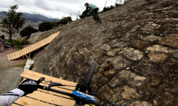
Photos of Bogota Mountain Bike
Recent Trail Reports
| status | trail | date | condition | info | user |
|---|---|---|---|---|---|
| La Biometropolis | Jul 8, 2024 @ 8:29am Jul 8, 2024 | Prevalent Mud | JuanRocha52F | ||
| DH La Clasica | Mar 31, 2023 @ 4:41pm Mar 31, 2023 | Dry | ALFREDOxVARON | ||
| DH La Cortica | Jan 19, 2023 @ 10:11pm Jan 19, 2023 | Wet | DanielWeinstein | ||
| DH Hollywood | Oct 18, 2022 @ 5:46pm Oct 18, 2022 | Dry | victorlem | ||
| Simon Bolivar XC | Feb 24, 2021 @ 5:33am Feb 24, 2021 | Ideal | domglid | ||
| DH Valina | May 28, 2020 @ 4:03am May 28, 2020 | Variable | Kanguro67 |
Activity Feed
| username | action | type | title | date |
|---|---|---|---|---|
| AMG | add | route | activity #83156860 | Oct 28, 2025 @ 5:36am Oct 28, 2025 |
| ikendothis | add | poi | activity #77977702 | Aug 12, 2025 @ 9:37am Aug 12, 2025 |
| AMG | add | trail | activity #68332716 and 4 more | Mar 24, 2025 @ 8:22am Mar 24, 2025 |
| AMG | add | trail | activity #68033574 and 4 more | Mar 19, 2025 @ 10:18am Mar 19, 2025 |
| JuanRocha52F | add | report | activity #55336705 | Jul 8, 2024 @ 8:29am Jul 8, 2024 |
Recent Comments
| username | type | title | comment | date |
|---|---|---|---|---|
| trail | This is not a black diamond trail. It is not a... | Oct 30, 2020 @ 4:43pm Oct 30, 2020 |
Local Badges
-

10 Blue Trails1 awarded -

Epic Mountain Bike Climb 2k7 awarded -

Climbing 10k Badge1 awarded -

Mountain Biking 100k Badge0 awarded -

Epic Ride Descent 2k7 awarded -

Descent 10k Badge1 awarded
Activity Type Stats
| activitytype | trails | distance | descent | descent distance | total vertical | rating | global rank | state rank | photos | reports | routes | ridelogs |
|---|---|---|---|---|---|---|---|---|---|---|---|---|
| Mountain Bike | 21 | 16 miles | 3,963 ft | 10 miles | 9,892 ft | #7,351 | #17 | 16 | 36 | 5 | 20,801 | |
| E-Bike | 18 | 8 miles | 2,379 ft | 6 miles | 8,888 ft | #1,377 | #5 | 19 | 3 | 293 | ||
| Horse | 1 | 3,750 ft | 161 ft | 3,415 ft | 161 ft | 2 | 2 | |||||
| Hike | 16 | 7 miles | 1,089 ft | 4 miles | 9,367 ft | #2,207 | #5 | 34 | 259 | |||
| Trail Running | 16 | 7 miles | 1,089 ft | 4 miles | 9,367 ft | #1,769 | #5 | 34 | 1 | 105 | ||
| Dirtbike/Moto | 2 | 7 miles | 1,608 ft | 5 miles | 1,155 ft | 2 | ||||||
| ATV/ORV/OHV | 1 | 6 miles | 1,447 ft | 4 miles | 1,155 ft | 2 | 2 |
Frequently Asked Questions About Bogota
▼
What are the best places to ride in Bogota?
Bogota has 5 areas to explore for mountain biking. The top rated areas are:
▼
What are the highest rated mountain biking trails in Bogota?
The highest rated mountain biking trails in Bogota are:
- DH La Clasica (0/5)
- PN Enrique Olaya Herrera (0/5)
- Simon Bolivar XC (0/5)
- DH La Cortica (0/5)
- Alternativa La Clasica (0/5)
▼
What is the best time of the year to ride in Bogota?
Based on ride log data, the most popular months to ride in Bogota are:
- February (51 activities)
- July (45 activities)
- November (43 activities)
▼
Where can I park to ride in Bogota?
There are 1 parking locations listed in Bogota. The most popular parking spots are:
Activities
Trails
- By brenthillier
 NSMBA TRAILFORKS & contributors
 - Admins: apply
- #7501 - 9,147 views
- bogota activity log | embed map of Bogota mountain bike trails | bogota mountain biking points of interest
Downloading of trail gps tracks in kml & gpx formats is enabled for Bogota.
You must login to download files.