close
-
Layers w
- Weather Layers
- Pro
- Pro
- Pro
- Pro
- Pro
- Pro
- More Layers
- Pro
- Pro
- Pro
- Pro
-
Upgrade to

3D
Trail Conditions
- Unknown
- Snow Groomed
- Snow Packed
- Snow Covered
- Snow Cover Partial
- Freeze/thaw Cycle
- Icy
- Prevalent Mud
- Wet
- Variable
- Ideal
- Dry
- Very Dry
Trail Flow (Ridden Direction)
Trailforks scans users ridelogs to determine the most popular direction each trail is ridden. A good flowing trail network will have most trails flowing in a single direction according to their intension.
The colour categories are based on what percentage of riders are riding a trail in its intended direction.
The colour categories are based on what percentage of riders are riding a trail in its intended direction.
- > 96%
- > 90%
- > 80%
- > 70%
- > 50%
- < 50%
- bi-directional trail
- no data
Trail Last Ridden
Trailforks scans ridelogs to determine the last time a trail was ridden.
- < 2 days
- < 1 week
- < 2 weeks
- < 1 month
- < 6 months
- > 6 months
Trail Ridden Direction
The intended direction a trail should be ridden.
- Downhill Only
- Downhill Primary
- Both Directions
- Uphill Primary
- Uphill Only
- One Direction
Contribute Details
Colors indicate trail is missing specified detail.
- Description
- Photos
- Description & Photos
- Videos
Trail Popularity ?
Trailforks scans ridelogs to determine which trails are ridden the most in the last 9 months.
Trails are compared with nearby trails in the same city region with a possible 25 colour shades.
Think of this as a heatmap, more rides = more kinetic energy = warmer colors.
- most popular
- popular
- less popular
- not popular
ATV/ORV/OHV Filter
Max Vehicle Width
inches
US Cell Coverage
Legend

Radar Time
Activity Recordings
Trailforks uses anonymized public activity data.
?
Activity Recordings
Trailforks uses anonymized public activity data.
?
Personal Heatmap
▶
Activity Types
all
/
none
▶
Options
2
Date range
month
–
Winter Trails
Warning
A routing network for winter maps does not exist. Selecting trails using the winter trails layer has been disabled.
Missing Trails
Most Popular
Least Popular
Trails are colored based on popularity. The more popular a trail is, the more red. Less popular trails trend towards green.
Jump Magnitude Heatmap
Heatmap of where riders jump on trails. Zoom in to see individual jumps, click circles to view jump details.
BC Backroad Status
![map legend]()
Service Road Atlas is a free to use, community-driven service for viewing and creating reports on the numerous back-country service roads around B.C. and Alberta.

Slope Aspect
Direction the slope faces
Trails Deemphasized
Trails are shown in grey.
Only show trails with no bike usage.
Suggested Layers
Based on selected activity type
Save the current map location and zoom level as your default home location whenever this page is loaded.
SavePopular Trail Networks
view all areas »
No description for Boise has been added yet!
Login or register to submit one.
Activities Click to view
- Mountain Bike
407 trails
- E-Bike
122 trails
- Gravel Bike
69 trails
- Adaptive Bike
75 trails
- Winter Fat Bike
40 trails
- Horse
100 trails
- Hike
423 trails
- Trail Running
419 trails
- Dirtbike/Moto
73 trails
- ATV/ORV/OHV
30 trails
- Snowshoe
1 trails
- Downhill Ski
136 trails
- Nordic Ski
17 trails
Region Details
- 41
- 55
- 125
- 148
- 34
- 2
Region Status
Open as of 2 daysLocal Trail Association
Stats
- Avg Trail Rating
- Trails (view details)
- 612
- Trails Mountain Bike
- 407
- Trails E-Bike
- 122
- Trails Gravel Bike
- 69
- Trails Adaptive Bike
- 75
- Trails Winter Fat Bike
- 40
- Trails Horse
- 100
- Trails Hike
- 423
- Trails Trail Running
- 419
- Trails Dirtbike/Moto
- 73
- Trails Observed Trials
- 1
- Trails ATV/ORV/OHV
- 30
- Trails Snowmobile
- 1
- Trails Snowshoe
- 1
- Trails Downhill Ski
- 136
- Trails Backcountry Ski
- 4
- Trails Nordic Ski
- 17
- Total Distance
- 782 miles
- Total Descent
- 152,063 ft
- Total Vertical
- 5,129 ft
- Highest Trailhead
- 7,552 ft
- Reports
- 6,681
- Photos
- 926
- Ridden Counter
- 127,446
Articles
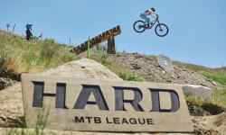
Video & Results: The 2026 Hard MTB League Qualifier Full Race Replay
May 27, 2026 from pinkbike.com
Kailey Skelton and Nik Nestoroff top the charts in the Boise foothills, conquering Braydon Bringhurst's updated, tech-heavy "up-and-down"...
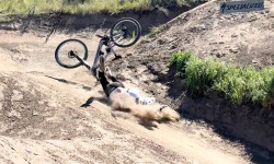
Video: Phil Atwill Breaks Down His Heavy Hard MTB League Wipeout
May 26, 2026 from pinkbike.com
"I got humbled hard." The World Cup downhill specialist shares the practice crash details that cut his Boise campaign short.
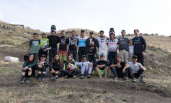
Strait, Atwill, & Ropelato: Hard MTB League Unveils Stacked 2026 Roster
Apr 6, 2026 from pinkbike.com
From freeride legends to World Cup veterans, 38 athletes are headed to Boise this May to prove who is the most versatile rider in the world.
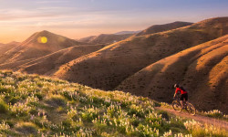
The Best Summer Weekend Trips of 2025
Jun 3, 2025 from outsideonline.com
There are only 14 weekends between Memorial Day and Labor Day this year. So you better make them count.
Sub Regions
-
Bishop Kelly
- 3
- 1
-
Bogus Basin
- 12
- 27
- 5
-
Boise Bike Park
- 3
- 3
- 1
- 1
-
Boise Foothills
- 4
- 7
- 4
-
Boise Greenbelt Dirt Jumps
- 1
- 1
- 1
- 1
-
Camelsback / Hulls Gulch
- 4
- 5
- 3
-
Corrals
- 5
- 7
-
Dry Creek
- 9
- 8
- 1
-
Foothills East Reserve
- 5
- 1
-
Frontier Point Nordic Center
-
Hillside to Harrison Hollow
- 5
- 10
- 1
-
Lucky Peak
- 4
- 6
-
Mahalo
- 1
-
Military Reserve Park
- 3
- 12
- 10
-
Oregon Trail Network
- 1
- 17
- 7
-
Polecat
- 1
- 20
- 14
-
Seaman's Gulch
- 2
- 3
-
Table Rock
- 6
- 9
- 17
- 2
Popular Boise Mountain Biking Trails
• 85 ★ 3.9 • 2 miles • 126 ft • 1,692 •
Trail provides link between the Military Reserve Trails and trails in the upper Foothills. Combine with #26 Three Bears Trail for a great mid-elevation loop. Region: Rocky Canyon: #26A
• 100 ★ 3.7 • 1 mile • 26 ft • 1,617 •
Downhill Only smooth single track with multi-use travel that gets a lot of users. This trail is popular as it connects up to / 3 Bears / Trail. Thus allowing users to loop in lower/shorter foothill rides or connect up for longer rides...
• 100 ★ 4.0 • 1 mile • 482 ft • 1,610 •
A very popular trail used typically for climbing, very busy with uphill traffic. Often called "slide-winder" or "sand-winder" due to the loose sandy surface in the summer, in the fall and spring this trail is excellent.
• 100 ★ 4.3 • 2 miles • 0 ft • 1,463 •
One of the most heavily used trails on the Ridge to Rivers system. Following Hulls Creek, this trail provides moderate technical riding opportunities. Connects to #28 Crestline (via #4 8th Street Motorcycle Trail), #0 Hulls Gulch...
• 100 ★ 2.4 • 1,831 ft • 42 ft • 1,407 •
Northern segment of #22A Central Ridge Spur.
• 100 ★ 3.0 • 3,399 ft • 123 ft • 1,350 •
heavy used double wide track that starts from the 8th street extension parking lot
• 100 ★ 4.3 • 1 mile • 154 ft • 1,255 •
Highly rated popular blue difficulty singletrack. This mountain bike primary trail. On average it takes 8 minutes to complete this trail.
• 100 ★ 3.0 • 1,798 ft • 0 ft • 1,174 •
Trail provides a multi-use non-motorized route from #36 to and connects to #37 .
Boise Mountain Bike Routes
★ 4.5 • 8 miles • 1,324 ft • 6 • Loop •
Easy climb up Corral Creek gets you to a fun descent down Bobs trail.
★ 5.0 • 18 miles • 2,865 ft • 5 • Loop •
For those who are looking for a fun, but challenging loop that's great for groups or solo, this is one of...
★ 5.0 • 21 miles • 3,141 ft • 3 • Loop •
Park at Freddy's Stack Rock trail head on Bogus Basin rd, ride 3 miles up Bogus Basin rd, Around the...
★ 5.0 • 16 miles • 1,809 ft • 4 • Loop •
to Chukar and Cartwright ridge
★ 5.0 • 7 miles • 859 ft • 4 •
A short fun loop, with a fun technical downhill.
7 miles • 871 ft • 3 • Loop •
Ride from Military Reserve trailhead up CCW and down back to trailhead.
Photos of Boise Mountain Bike
Videos of Boise Mountain Bike
trail: Freddys Stack Rock (Lower)
0:00 |
25 |
Feb 17, 2025
trail: Air Traffic Control
0:14 |
144 |
Aug 4, 2024
trail: Hobo Juice
2:47 |
232 |
Aug 9, 2023
trail: Eastside
12:04 |
86 |
May 29, 2023
trail: Blue Line
0:06 |
46 |
Apr 22, 2023
trail: Green Line
0:03 |
20 |
Apr 22, 2023
trail: Green Line
0:14 |
22 |
Apr 22, 2023
trail: Lower Hulls Gulch
0:06 |
|
May 15, 2022
Recent Trail Reports
| status | trail | date | condition | info | user |
|---|---|---|---|---|---|
| Bogus Creek | Jun 23, 2026 @ 5:27pm (America/Boise) 2 days | Dry | crbondurant | ||
| Shindig | Jun 23, 2026 @ 5:27pm (America/Boise) 2 days | Very Dry | crbondurant | ||
| The Face | Jun 23, 2026 @ 5:27pm (America/Boise) 2 days | Dry | crbondurant | ||
| Packing Connect | Jun 23, 2026 @ 5:27pm (America/Boise) 2 days | Dry | crbondurant | ||
| Around the Mountain | Jun 23, 2026 @ 5:27pm (America/Boise) 2 days | Dry | crbondurant | ||
| Hawkins Reserve Loop | Jun 22, 2026 @ 2:26pm (America/Boise) Jun 22, 2026 | Dry | Soapdude89 | ||
| Hawkins Connect | Jun 22, 2026 @ 2:26pm (America/Boise) Jun 22, 2026 | Dry | Soapdude89 | ||
| Sinker Creek Trail | Jun 22, 2026 @ 8:08am (America/Boise) Jun 22, 2026 | Ideal | argent200 | ||
| Mahalo | Jun 21, 2026 @ 8:59am (America/Boise) Jun 21, 2026 | Ideal | jeffnelson19784 | ||
| Freddys Stack Rock (Lower) | Jun 21, 2026 @ 8:59am (America/Boise) Jun 21, 2026 | Dry | jeffnelson19784 |
Activity Feed
| username | action | type | title | date |
|---|---|---|---|---|
| Et233003 | ridden | trail | activity #97805308 and 1 more | Jun 25, 2026 @ 5:45pm 4 hours |
| steph-fuller | comment | trail | activity #97792887 | Jun 25, 2026 @ 2:17pm 8 hours |
| crbondurant | add | report | activity #97785001 and 4 more | Jun 25, 2026 @ 12:12pm 10 hours |
| Et233003 | ridden | trail | activity #97779787 and 1 more | Jun 25, 2026 @ 10:55am 11 hours |
| matux | wishlist | trail | activity #97700164 | Jun 24, 2026 @ 8:36am 2 days |
Recent Comments
| username | type | title | comment | date |
|---|---|---|---|---|
| trail | I think it’s more than 100 yards. And... | Jun 25, 2026 @ 2:17pm 8 hours | ||
| trail | The first 100 yards from the start of the... | May 23, 2026 @ 3:15pm May 23, 2026 | ||
| trail | Bowhead reach goes. Green | May 18, 2026 @ 6:47am May 18, 2026 | ||
| trail | Bowhead reach goes. Green | May 18, 2026 @ 6:47am May 18, 2026 | ||
| trail | Bowhead reach goes. Green | May 18, 2026 @ 6:40am May 18, 2026 |
Local Badges
-

10 Black Trails61 awarded -

Top 10 Trails17 awarded -

Completionist1 awarded -
Completionist0 awarded -
Completionist0 awarded -
Completionist0 awarded
Bike & Skill Parks
| name | type | city | rating |
|---|---|---|---|
| Bogus Basin | bike park | Boise | |
| Bogus Basin Mountain Recreation Area | bike park | Boise | |
| Boise Greenbelt Dirt Jumps | skill park | Boise | |
| J.A. & Kathryn Albertson Family Foundation Bike Park | skill park | Boise | |
| Owyhee Motorcycle Club | skill park | Boise |
Local Trail Supporters
![Oregon Trail NHT]()
![Hidden Springs Town Association]()
- Ridge to Rivers
Activity Type Stats
| activitytype | trails | distance | descent | descent distance | total vertical | rating | global rank | state rank | photos | reports | routes | ridelogs |
|---|---|---|---|---|---|---|---|---|---|---|---|---|
| Mountain Bike | 407 | 591 miles | 95,991 ft | 244 miles | 4,928 ft | #53 | #19 | 775 | 6,674 | 60 | 164,659 | |
| E-Bike | 122 | 258 miles | 45,568 ft | 105 miles | 4,449 ft | #233 | #672 | 93 | 5,196 | 4 | 4,825 | |
| Gravel Bike | 69 | 123 miles | 8,235 ft | 39 miles | 5,052 ft | #28 | #674 | 636 | 2 | 575 | ||
| Adaptive Bike | 75 | 116 miles | 9,360 ft | 42 miles | 4,928 ft | #12 | #1,145 | 2 | 732 | 1 | 6 | |
| Winter Fat Bike | 40 | 63 miles | 3,645 ft | 28 miles | 4,478 ft | #16 | #783 | 168 | 3 | |||
| Horse | 100 | 279 miles | 46,201 ft | 114 miles | 4,183 ft | #37 | #328 | 1,829 | 38 | |||
| Hike | 423 | 687 miles | 101,913 ft | 283 miles | 4,928 ft | #49 | #39 | 43 | 6,651 | 3 | 12,870 | |
| Trail Running | 419 | 665 miles | 94,688 ft | 271 miles | 4,928 ft | #57 | #34 | 6 | 6,651 | 5 | 18,589 | |
| Dirtbike/Moto | 73 | 236 miles | 40,781 ft | 91 miles | 4,669 ft | #57 | #34 | 1 | 1,078 | 1 | 71 | |
| Observed Trials | 1 | 17 miles | 325 ft | 4 miles | 1,175 ft | 6 | 33 | |||||
| ATV/ORV/OHV | 30 | 128 miles | 19,557 ft | 47 miles | 4,183 ft | #50 | #31 | 1,064 | 20 | |||
| Snowmobile | 1 | 11 miles | 404 ft | 2 miles | 2,536 ft | 3 | 4 | |||||
| Snowshoe | 1 | 2,129 ft | 177 ft | 1,381 ft | 115 ft | #334 | #91 | 3 | 115 | |||
| Downhill Ski | 136 | 47 miles | 42,838 ft | 43 miles | 1,778 ft | #95 | #42 | 2 | 6,150 | |||
| Backcountry Ski | 4 | 1 mile | 374 ft | 2,421 ft | 276 ft | 1 | 487 | |||||
| Nordic Ski | 17 | 13 miles | 1,736 ft | 6 miles | 866 ft | #256 | #71 | 3 | 1,309 |
Frequently Asked Questions About Boise
▼
What are the best places to ride in Boise?
Boise has 21 areas to explore for mountain biking. The top rated areas are:
▼
What are the highest rated mountain biking trails in Boise?
The highest rated mountain biking trails in Boise are:
- Around the Mountain (4.6/5)
- Dry Creek (4.6/5)
- Landslide Loop (4.4/5)
- Bob's Trail (4.4/5)
- Rock Island (West) (4.4/5)
▼
What is the best time of the year to ride in Boise?
Based on ride log data, the most popular months to ride in Boise are:
- July (1,433 activities)
- June (993 activities)
- August (935 activities)
▼
Where can I park to ride in Boise?
There are 63 parking locations listed in Boise. The most popular parking spots are: View all parking and trailhead locations on the map to plan your visit.
Activities
- Boise Mountain Biking Trails
- Boise E-Biking Trails
- Boise Gravel Biking Trails
- Boise Adaptive Biking Trails
- Boise Winter Fat Biking Trails
- Boise Horseback Trails
- Boise Hiking Trails
- Boise Trail Running Trails
- Boise Dirtbiking Trails
- Boise ATVing/Offroading Trails
- Boise Skiing Trails
- Boise Nordic Skiing Trails
Trails
Points of Interest
- Information Map Kiosk
- Shafer Butte Campground Camping
- Mount Heinen Peak (1927m - 6322ft) Summit
- large rock obstacle TTF
- Table Rock Viewpoint
- Dagger Falls Sight
- Boundary Creek Campground Camping
- Jim Hall Foothills Learning Center Other
- Pioneer Lodge
- Frontier Point Nordic Lodge
- Shafer Butte (7,572 ft)
- Bald Mountain (7,477 ft)
- Mores Mountain (7,221 ft)
- By brenthillier
 NSMBA TRAILFORKS & contributors
 - Admins: SWIMBA
- #3536 - 81,079 views
- boise activity log | embed map of Boise mountain bike trails | boise mountain biking points of interest
Downloading of trail gps tracks in kml & gpx formats is enabled for Boise.
You must login to download files.