close
-
Layers w
- Weather Layers
- Pro
- Pro
- Pro
- Pro
- Pro
- Pro
- More Layers
- Pro
- Pro
- Pro
- Pro
-
Upgrade to

3D
Trail Conditions
- Unknown
- Snow Groomed
- Snow Packed
- Snow Covered
- Snow Cover Partial
- Freeze/thaw Cycle
- Icy
- Prevalent Mud
- Wet
- Variable
- Ideal
- Dry
- Very Dry
Trail Flow (Ridden Direction)
Trailforks scans users ridelogs to determine the most popular direction each trail is ridden. A good flowing trail network will have most trails flowing in a single direction according to their intension.
The colour categories are based on what percentage of riders are riding a trail in its intended direction.
The colour categories are based on what percentage of riders are riding a trail in its intended direction.
- > 96%
- > 90%
- > 80%
- > 70%
- > 50%
- < 50%
- bi-directional trail
- no data
Trail Last Ridden
Trailforks scans ridelogs to determine the last time a trail was ridden.
- < 2 days
- < 1 week
- < 2 weeks
- < 1 month
- < 6 months
- > 6 months
Trail Ridden Direction
The intended direction a trail should be ridden.
- Downhill Only
- Downhill Primary
- Both Directions
- Uphill Primary
- Uphill Only
- One Direction
Contribute Details
Colors indicate trail is missing specified detail.
- Description
- Photos
- Description & Photos
- Videos
Trail Popularity ?
Trailforks scans ridelogs to determine which trails are ridden the most in the last 9 months.
Trails are compared with nearby trails in the same city region with a possible 25 colour shades.
Think of this as a heatmap, more rides = more kinetic energy = warmer colors.
- most popular
- popular
- less popular
- not popular
ATV/ORV/OHV Filter
Max Vehicle Width
inches
US Cell Coverage
Legend

Radar Time
Activity Recordings
Trailforks uses anonymized public activity data.
?
Activity Recordings
Trailforks uses anonymized public activity data.
?
Personal Heatmap
▶
Activity Types
all
/
none
▶
Options
2
Date range
month
–
Winter Trails
Warning
A routing network for winter maps does not exist. Selecting trails using the winter trails layer has been disabled.
Missing Trails
Most Popular
Least Popular
Trails are colored based on popularity. The more popular a trail is, the more red. Less popular trails trend towards green.
Jump Magnitude Heatmap
Heatmap of where riders jump on trails. Zoom in to see individual jumps, click circles to view jump details.
BC Backroad Status
![map legend]()
Service Road Atlas is a free to use, community-driven service for viewing and creating reports on the numerous back-country service roads around B.C. and Alberta.

Slope Aspect
Direction the slope faces
Trails Deemphasized
Trails are shown in grey.
Only show trails with no bike usage.
Suggested Layers
Based on selected activity type
Save the current map location and zoom level as your default home location whenever this page is loaded.
SaveBoler Mountain has 120 acres of property, which offers some of the best cross country terrain in Ontario.
We offer a Beginner loop and an advanced loop. We have been host to many local, provincial and national events including Canada Cups, Canada Summer Games, Ontario Cups, Points races and Citizens races.
We offer a Beginner loop and an advanced loop. We have been host to many local, provincial and national events including Canada Cups, Canada Summer Games, Ontario Cups, Points races and Citizens races.
source: Boler Mountain Page
Primary Trail Type: Cross-Country
Shuttleable: YES
Land Status: Ski Resort
Land Manager: Boler Mountain
Activities Click to view
- Mountain Bike
35 trails
- Hike
4 trails
- Trail Running
4 trails
- Downhill Ski
15 trails
Region Details
- 9
- 19
- 7
Region Status
Open as of Jun 9, 2026- Day Ticket
- $12 CAD
Stats
- Avg Trail Rating
- Trails (view details)
- 50
- Trails Mountain Bike
- 35
- Trails Hike
- 4
- Trails Trail Running
- 4
- Trails Downhill Ski
- 15
- Total Distance
- 7 miles
- Total Descent
- 1,946 ft
- Total Vertical
- 194 ft
- Highest Trailhead
- 1,054 ft
- Reports
- 1,178
- Photos
- 61
- Ridden Counter
- 8,276
Popular Boler Mountain Mountain Biking Trails
• 100 ★ 4.7 • 727 ft • 6 ft • 273 •
Popular blue difficulty family friendly singletrack. This mountain bike primary trail can be used one direction and has a moderate overall physical rating with a 6 ft green climb. Trail visibility is always easy to follow. On average it takes minutes to complete this trail.
• 90 ★ 4.5 • 578 ft • 7 ft • 270 •
Popular green difficulty family friendly singletrack. This mountain bike primary trail can be used one direction and has a easy overall physical rating with a 7 ft green climb. Trail visibility is always easy to follow. On average it takes minutes to complete this trail.
• 80 ★ 5.0 • 640 ft • 5 ft • 270 •
A nice curvy trail nestled in a grove of pine trees featuring banked turned and rollers much like a pump track.
• 95 ★ 5.0 • 790 ft • 11 ft • 263 •
Popular blue difficulty family friendly singletrack. This mountain bike primary trail can be used one direction and has a easy overall physical rating with a 11 ft green climb. It features berm. Trail visibility is always easy to follow. On average it takes 1 minutes to complete this trail.
• 70 ★ 5.0 • 688 ft • 29 ft • 262 •
Popular green difficulty family friendly singletrack. This mountain bike primary trail can be used one direction and has a moderate overall physical rating with a 29 ft green climb. Trail visibility is always easy to follow. On average it takes 1 minutes to complete this trail.
• 95 ★ 5.0 • 925 ft • 36 ft • 258 •
Popular blue difficulty family friendly singletrack. This mountain bike primary trail can be used one direction and has a moderate overall physical rating with a 36 ft green climb. It features berm and roller coaster. Trail visibility is always easy to follow. On average it takes 1 minutes to complete this trail.
• 90 ★ 5.0 • 1,035 ft • 7 ft • 251 •
Popular green difficulty family friendly singletrack. This mountain bike primary trail can be used one direction with a 7 ft green climb. Trail visibility is always easy to follow. On average it takes minutes to complete this trail.
• 85 ★ 5.0 • 1,049 ft • 33 ft • 249 •
Popular blue difficulty family friendly singletrack. This mountain bike primary trail can be used one direction and has a hard overall physical rating with a 33 ft blue climb. It features drop and roller coaster. Trail visibility is always easy to follow. On average it takes 2 minutes to complete this trail.
Boler Mountain Mountain Bike Routes
★ 5.0 • 3 miles • 253 ft • 0 • Loop •
The Red Trail is new this year and is 4.5 km in length and runs along the west side of the new hill and...
★ 5.0 • 3 miles • 298 ft • 0 •
Hard first climb to get into the forest behind the ski hill but well worth it. Fun banks and rollers...
★ 5.0 • 2 miles • 147 ft • 0 • Loop •
The 2.5 km Yellow Trail still has some moderate climbs and a few berms
• 20 miles • 1,559 ft • 141 •
• 16 miles • 1,350 ft • 96 •
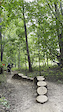
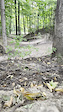
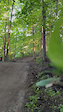
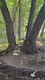
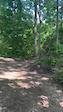
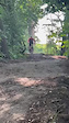
Photos of Boler Mountain Mountain Bike
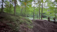
Videos of Boler Mountain Mountain Bike
0:06 |
18 |
Oct 2, 2025
0:14 |
4 |
Oct 2, 2025
0:14 |
13 |
Oct 2, 2025
0:26 |
11 |
Oct 2, 2025
0:05 |
16 |
Jul 17, 2025
0:07 |
15 |
Jul 17, 2025

0:07 |
13 |
Jul 17, 2025
0:07 |
13 |
Jul 17, 2025
Recent Trail Reports
| status | trail | date | condition | info | user |
|---|---|---|---|---|---|
| Unnamed | Jun 9, 2026 @ 5:39pm (America/Toronto) Jun 9, 2026 | Ideal | Aescalpius | ||
| Rooted Wall By-Pass | May 26, 2026 @ 5:52pm (America/Toronto) May 26, 2026 | Ideal | Juanflight | ||
| Backyard Creeper | May 26, 2026 @ 5:52pm (America/Toronto) May 26, 2026 | Ideal | Juanflight | ||
| Fire Road | May 26, 2026 @ 5:52pm (America/Toronto) May 26, 2026 | Ideal | Juanflight | ||
| Race to Finish Line | May 26, 2026 @ 5:52pm (America/Toronto) May 26, 2026 | Ideal | Juanflight | ||
| Pull the Chute | May 26, 2026 @ 5:52pm (America/Toronto) May 26, 2026 | Ideal | Juanflight | ||
| Almost There | May 26, 2026 @ 5:52pm (America/Toronto) May 26, 2026 | Ideal | Juanflight | ||
| Rooted Wall | May 26, 2026 @ 5:52pm (America/Toronto) May 26, 2026 | Ideal | Juanflight | ||
| Twist'N Shout | May 26, 2026 @ 5:52pm (America/Toronto) May 26, 2026 | Ideal | Juanflight | ||
| The Turns | May 26, 2026 @ 5:52pm (America/Toronto) May 26, 2026 | Ideal | Juanflight |
Activity Feed
| username | action | type | title | date |
|---|---|---|---|---|
| jazthedj | vote | trail | activity #98397337 | Jul 4, 2026 @ 3:07am 10 hours |
| Aescalpius | add | report | activity #96667944 | Jun 10, 2026 @ 6:14am Jun 10, 2026 |
| AtomicGary | update | trail | activity #96554307 | Jun 8, 2026 @ 11:42am Jun 8, 2026 |
| AtomicGary | ridden | trail | activity #96554147 and 1 more | Jun 8, 2026 @ 11:39am Jun 8, 2026 |
| natedagreat | add | trail | activity #96546180 and 1 more | Jun 8, 2026 @ 9:45am Jun 8, 2026 |
Recent Comments
| username | type | title | comment | date |
|---|---|---|---|---|
| trail | Blue connector | Jun 8, 2026 @ 11:41am Jun 8, 2026 | ||
| report | Trails in Great shape | Oct 2, 2025 @ 9:38am Oct 2, 2025 | ||
| report | All good | May 23, 2024 @ 4:06pm May 23, 2024 |
Nearby Areas
| name | distance | ||||
|---|---|---|---|---|---|
| Warbler Woods | 11 | 1.2 km | |||
| Springbank Park | 2.5 km | ||||
| Komoka Provincial Park | 23 | 2.7 km | |||
| Medway Creek | 2 | 5 km | |||
| Stoney Creek Meadows | 7.1 km |
Local Badges
-

Completionist32 awarded
Activity Type Stats
| activitytype | trails | distance | descent | descent distance | total vertical | rating | global rank | state rank | photos | reports | routes | ridelogs |
|---|---|---|---|---|---|---|---|---|---|---|---|---|
| Mountain Bike | 35 | 5 miles | 597 ft | 2 miles | 131 ft | #811 | #27 | 60 | 1,118 | 4 | 4,421 | |
| Hike | 4 | #13,367 | #334 | 898 | 159 | |||||||
| Trail Running | 4 | #12,646 | 898 | 19 | ||||||||
| Downhill Ski | 15 | 3 miles | 1,348 ft | 2 miles | 190 ft | #265 | #9 | 1 | 131 | 218 |
Frequently Asked Questions About Boler Mountain
▼
What are the highest rated mountain biking trails in Boler Mountain?
The highest rated mountain biking trails in Boler Mountain are:
- The Lookout (4.2/5)
- The Turns (4.2/5)
- Berm Alley (4.2/5)
- Rolling Pines (4.2/5)
- Race to Finish Line (4.2/5)
▼
What is the best time of the year to ride in Boler Mountain?
Based on ride log data, the most popular months to ride in Boler Mountain are:
- August (19 activities)
- July (17 activities)
- June (16 activities)
▼
Where can I park to ride in Boler Mountain?
Check the Boler Mountain trail map for trailhead and parking information. Community members regularly update access and parking details for trails in the area.
▼
What is the longest trail in Boler Mountain?
The longest trail in Boler Mountain is Unnamed at 1.0 mile. View all trails sorted by distance.
- By AtomicGary BOLER & contributors
- Admins: BOLER, steveleo
- #9612 - 21,184 views
- boler mountain activity log | embed map of Boler Mountain mountain bike trails | boler mountain mountain biking points of interest
Downloading of trail gps tracks in kml & gpx formats is enabled for Boler Mountain.
You must login to download files.