close
-
Layers w
- Weather Layers
- Pro
- Pro
- Pro
- Pro
- Pro
- Pro
- More Layers
- Pro
- Pro
- Pro
- Pro
-
Upgrade to

3D
Trail Conditions
- Unknown
- Snow Groomed
- Snow Packed
- Snow Covered
- Snow Cover Partial
- Freeze/thaw Cycle
- Icy
- Prevalent Mud
- Wet
- Variable
- Ideal
- Dry
- Very Dry
Trail Flow (Ridden Direction)
Trailforks scans users ridelogs to determine the most popular direction each trail is ridden. A good flowing trail network will have most trails flowing in a single direction according to their intension.
The colour categories are based on what percentage of riders are riding a trail in its intended direction.
The colour categories are based on what percentage of riders are riding a trail in its intended direction.
- > 96%
- > 90%
- > 80%
- > 70%
- > 50%
- < 50%
- bi-directional trail
- no data
Trail Last Ridden
Trailforks scans ridelogs to determine the last time a trail was ridden.
- < 2 days
- < 1 week
- < 2 weeks
- < 1 month
- < 6 months
- > 6 months
Trail Ridden Direction
The intended direction a trail should be ridden.
- Downhill Only
- Downhill Primary
- Both Directions
- Uphill Primary
- Uphill Only
- One Direction
Contribute Details
Colors indicate trail is missing specified detail.
- Description
- Photos
- Description & Photos
- Videos
Trail Popularity ?
Trailforks scans ridelogs to determine which trails are ridden the most in the last 9 months.
Trails are compared with nearby trails in the same city region with a possible 25 colour shades.
Think of this as a heatmap, more rides = more kinetic energy = warmer colors.
- most popular
- popular
- less popular
- not popular
ATV/ORV/OHV Filter
Max Vehicle Width
inches
US Cell Coverage
Legend

Radar Time
Activity Recordings
Trailforks uses anonymized public activity data.
?
Activity Recordings
Trailforks uses anonymized public activity data.
?
Personal Heatmap
▶
Activity Types
all
/
none
▶
Options
2
Date range
month
–
Winter Trails
Warning
A routing network for winter maps does not exist. Selecting trails using the winter trails layer has been disabled.
Missing Trails
Most Popular
Least Popular
Trails are colored based on popularity. The more popular a trail is, the more red. Less popular trails trend towards green.
Jump Magnitude Heatmap
Heatmap of where riders jump on trails. Zoom in to see individual jumps, click circles to view jump details.
BC Backroad Status
![map legend]()
Service Road Atlas is a free to use, community-driven service for viewing and creating reports on the numerous back-country service roads around B.C. and Alberta.

Slope Aspect
Direction the slope faces
Trails Deemphasized
Trails are shown in grey.
Only show trails with no bike usage.
Suggested Layers
Based on selected activity type
Save the current map location and zoom level as your default home location whenever this page is loaded.
Save
No description for Bollebygd has been added yet!
Login or register to submit one.
This region uses the Uk/Euro style trail grading system.
Activities Click to view
- Mountain Bike
346 trails
- Adaptive Bike
0 trails
- Winter Fat Bike
0 trails
- Horse
6 trails
- Hike
330 trails
- Trail Running
330 trails
Region Details
- 86
- 94
- 140
- 23
- 3
Region Status
Caution as of Jun 17, 2026Stats
- Avg Trail Rating
- Trails (view details)
- 346
- Trails Mountain Bike
- 346
- Trails E-Bike
- 2
- Trails Horse
- 6
- Trails Hike
- 330
- Trails Trail Running
- 330
- Total Distance
- 142 miles
- Total Descent Distance
- 66 miles
- Total Descent
- 17,393 ft
- Total Vertical
- 700 ft
- Highest Trailhead
- 889 ft
- Reports
- 178
- Photos
- 31
- Ridden Counter
- 2,988
Sub Regions
-
Bollebygd
- 77
- 118
- 15
- 2
-
Bollekollen
- 2
- 2
- 2
- 1
-
Gesebol/Olsfors/Hultafors
- 14
- 15
- 6
Popular Bollebygd Mountain Biking Trails
• 100 ★ 4.0 • 3,094 ft • 0 ft • 110 •
Bollekollens DH-line. Stora berms, höga farter och stora hopp. Men byggd så att det går att åka som nybörjare också.
• 5 ★ 4.0 • 1,470 ft • 0 ft • 104 •
Less popular green difficulty singletrack. This mountain bike primary trail can be used downhill only. It features a-frame, berm, bridge, drop, jump, gap jump, ladder bridge, log ride, pump track, rock face, rock garden, roller coaster, skinny, teeter totter, wallride and other. On average it takes 2 minutes to complete this trail.
• 5 ★ 4.0 • 965 ft • 0 ft • 100 •
Less popular blue difficulty singletrack. This mountain bike primary trail can be used downhill only. It features berm and drop. On average it takes minutes to complete this trail.
• 5 ★ 4.0 • 1,886 ft • 0 ft • 81 •
Less popular blue difficulty singletrack. This mountain bike primary trail can be used downhill only. It features jump. On average it takes 4 minutes to complete this trail.
• 5 ★ 4.0 • 1,017 ft • 0 ft • 63 •
Less popular red difficulty singletrack. This mountain bike primary trail can be used downhill only. It features berm, bridge, drop, jump and wallride. On average it takes 2 minutes to complete this trail.
• 75 ★ 4.0 • 3,307 ft • 48 ft • 34 •
Popular green difficulty singletrack. This multi-use trail can be used both directions and has a easy overall physical rating with a 48 ft green climb. On average it takes 6 minutes to complete this trail.
Bollebygd Mountain Bike Routes
3 miles • 302 ft • 2 • Loop •
Blå markering följs för att ta sig runt denna 5km långa runda. Mestadels stig men vissa sträckor går...
2 miles • 252 ft • 4 • Loop •
Följ gul markering runt. Går att köra åt båda hållen. Ca hälften går på grus/asfaltsväg, resten...
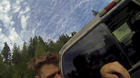
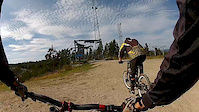
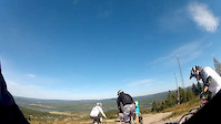
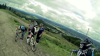
Photos of Bollebygd Mountain Bike

Recent Trail Reports
| status | trail | date | condition | info | user |
|---|---|---|---|---|---|
| Röda Hund | Jun 17, 2026 @ 5:26pm (Europe/Copenhagen) Jun 17, 2026 | Ideal | maythefourthbewithu | ||
| Sikaberget | Jun 17, 2026 @ 5:26pm (Europe/Copenhagen) Jun 17, 2026 | Variable | maythefourthbewithu | ||
| Pomperi | Jun 17, 2026 @ 5:26pm (Europe/Copenhagen) Jun 17, 2026 | Variable | maythefourthbewithu | ||
| Kjell I Högåsen | Jun 17, 2026 @ 5:26pm (Europe/Copenhagen) Jun 17, 2026 | Variable | maythefourthbewithu | ||
| Orren | Jun 17, 2026 @ 5:26pm (Europe/Copenhagen) Jun 17, 2026 | Ideal | maythefourthbewithu | ||
| Grusiga Stigen | Jun 17, 2026 @ 5:26pm (Europe/Copenhagen) Jun 17, 2026 | Ideal | maythefourthbewithu | ||
| Ronjaberget | May 26, 2026 @ 11:23am (Europe/Copenhagen) May 26, 2026 | Ideal | maythefourthbewithu | ||
| Häståsvägen | Jul 22, 2025 @ 1:18pm Jul 22, 2025 | Dry | turbotobbe | ||
| Björkäng | Jul 22, 2025 @ 1:18pm Jul 22, 2025 | Dry | turbotobbe | ||
| Hästskon | Jul 22, 2025 @ 1:18pm Jul 22, 2025 | Dry | turbotobbe |
Activity Feed
| username | action | type | title | date |
|---|---|---|---|---|
| maythefourthbewithu | add | trail | activity #97373238 | Jun 20, 2026 @ 1:51am Jun 20, 2026 |
| maythefourthbewithu | add | report | activity #97208197 and 5 more | Jun 17, 2026 @ 1:59pm Jun 17, 2026 |
| maythefourthbewithu | add | report | activity #95562662 | May 26, 2026 @ 7:16am May 26, 2026 |
| Jumpbox | add | trail | activity #82812841 | Oct 22, 2025 @ 5:41am Oct 22, 2025 |
| Jumpbox | add | trail | activity #82444894 and 2 more | Oct 16, 2025 @ 7:18am Oct 16, 2025 |
Recent Comments
| username | type | title | comment | date |
|---|---|---|---|---|
| trail | 3 broar, tekniskt men skoj! | Oct 1, 2025 @ 1:52am Oct 1, 2025 | ||
| report | Varför orange varning? | May 28, 2025 @ 7:33am May 28, 2025 | ||
| trail | Gör en stigrapport (Trail Report) istället. | May 18, 2024 @ 4:01am May 18, 2024 | ||
| trail | Gör gärna en stigrapport (Trail Report) också. | May 18, 2024 @ 4:00am May 18, 2024 | ||
| trail | Bra Stig | May 18, 2024 @ 3:33am May 18, 2024 |
Local Badges
-

Epic Ride Climb 2k16 awarded -

Climbing 10k Badge11 awarded -

Climbing 100k Badge0 awarded -

Epic Ride Descent 2k16 awarded -

Descent 10k Badge11 awarded -

Descent 100k Badge0 awarded
Bike & Skill Parks
| name | type | city | rating |
|---|---|---|---|
| Bollekollen | bike park | Bollebygd |
Activity Type Stats
| activitytype | trails | distance | descent | descent distance | total vertical | rating | global rank | state rank | photos | reports | routes | ridelogs |
|---|---|---|---|---|---|---|---|---|---|---|---|---|
| Mountain Bike | 346 | 142 miles | 17,392 ft | 66 miles | 699 ft | #1,184 | #66 | 31 | 178 | 2 | 2,137 | |
| E-Bike | 2 | 147 | 22 | |||||||||
| Horse | 6 | 3 miles | 249 ft | 1 mile | 299 ft | #1,613 | #74 | 5 | ||||
| Hike | 330 | 136 miles | 15,663 ft | 62 miles | 699 ft | #1,039 | #59 | 172 | 2 | 68 | ||
| Trail Running | 330 | 136 miles | 15,663 ft | 62 miles | 699 ft | #746 | #61 | 172 | 2 | 997 |
Frequently Asked Questions About Bollebygd
▼
What are the best places to ride in Bollebygd?
Bollebygd has 3 areas to explore for mountain biking. The top rated areas are:
▼
What are the highest rated mountain biking trails in Bollebygd?
The highest rated mountain biking trails in Bollebygd are:
- Röda Hund (4.1/5)
- Skyline-Pölen (4.1/5)
- Stickan (4.1/5)
- Dolda Trollet (4.1/5)
- Down To Lavik (4.1/5)
▼
What is the best time of the year to ride in Bollebygd?
Based on ride log data, the most popular months to ride in Bollebygd are:
- May (33 activities)
- June (33 activities)
- August (32 activities)
▼
Where can I park to ride in Bollebygd?
There are 4 parking locations listed in Bollebygd. The most popular parking spots are: View all parking and trailhead locations on the map to plan your visit.
Activities
Trails
Points of Interest
- By Thorin92 & contributors
- Admins: ollesvenskonthetrail, JALLE, OrjanX, martinlindstr, nivis, Marleey, wikisara, JBohden, maythefourthbewithu
- #14419 - 3,554 views
- bollebygd activity log | embed map of Bollebygd mountain bike trails | bollebygd mountain biking points of interest
Downloading of trail gps tracks in kml & gpx formats is enabled for Bollebygd.
You must login to download files.