close
-
Layers w
- Weather Layers
- Pro
- Pro
- Pro
- Pro
- Pro
- Pro
- More Layers
- Pro
- Pro
- Pro
- Pro
-
Upgrade to

3D
Trail Conditions
- Unknown
- Snow Groomed
- Snow Packed
- Snow Covered
- Snow Cover Partial
- Freeze/thaw Cycle
- Icy
- Prevalent Mud
- Wet
- Variable
- Ideal
- Dry
- Very Dry
Trail Flow (Ridden Direction)
Trailforks scans users ridelogs to determine the most popular direction each trail is ridden. A good flowing trail network will have most trails flowing in a single direction according to their intension.
The colour categories are based on what percentage of riders are riding a trail in its intended direction.
The colour categories are based on what percentage of riders are riding a trail in its intended direction.
- > 96%
- > 90%
- > 80%
- > 70%
- > 50%
- < 50%
- bi-directional trail
- no data
Trail Last Ridden
Trailforks scans ridelogs to determine the last time a trail was ridden.
- < 2 days
- < 1 week
- < 2 weeks
- < 1 month
- < 6 months
- > 6 months
Trail Ridden Direction
The intended direction a trail should be ridden.
- Downhill Only
- Downhill Primary
- Both Directions
- Uphill Primary
- Uphill Only
- One Direction
Contribute Details
Colors indicate trail is missing specified detail.
- Description
- Photos
- Description & Photos
- Videos
Trail Popularity ?
Trailforks scans ridelogs to determine which trails are ridden the most in the last 9 months.
Trails are compared with nearby trails in the same city region with a possible 25 colour shades.
Think of this as a heatmap, more rides = more kinetic energy = warmer colors.
- most popular
- popular
- less popular
- not popular
ATV/ORV/OHV Filter
Max Vehicle Width
inches
US Cell Coverage
Legend

Radar Time
Activity Recordings
Trailforks uses anonymized public activity data.
?
Activity Recordings
Trailforks uses anonymized public activity data.
?
Personal Heatmap
▶
Activity Types
all
/
none
▶
Options
2
Date range
month
–
Winter Trails
Warning
A routing network for winter maps does not exist. Selecting trails using the winter trails layer has been disabled.
Missing Trails
Most Popular
Least Popular
Trails are colored based on popularity. The more popular a trail is, the more red. Less popular trails trend towards green.
Jump Magnitude Heatmap
Heatmap of where riders jump on trails. Zoom in to see individual jumps, click circles to view jump details.
BC Backroad Status
![map legend]()
Service Road Atlas is a free to use, community-driven service for viewing and creating reports on the numerous back-country service roads around B.C. and Alberta.

Slope Aspect
Direction the slope faces
Trails Deemphasized
Trails are shown in grey.
Only show trails with no bike usage.
Suggested Layers
Based on selected activity type
Save the current map location and zoom level as your default home location whenever this page is loaded.
Save
No description for Bolzano has been added yet!
Login or register to submit one.
This region uses the Uk/Euro style trail grading system.
Activities Click to view
- Mountain Bike
52 trails
- E-Bike
52 trails
- Gravel Bike
0 trails
- Adaptive Bike
0 trails
- Winter Fat Bike
0 trails
- Hike
51 trails
- Trail Running
52 trails
- Downhill Ski
22 trails
Region Details
- 10
- 1
- 10
- 9
- 15
- 5
Region Status
Caution as of May 25, 2026Stats
- Avg Trail Rating
- Trails (view details)
- 74
- Trails Mountain Bike
- 52
- Trails E-Bike
- 52
- Trails Horse
- 1
- Trails Hike
- 51
- Trails Trail Running
- 52
- Trails Downhill Ski
- 22
- Total Distance
- 153 miles
- Total Descent
- 75,135 ft
- Total Vertical
- 7,344 ft
- Highest Trailhead
- 7,963 ft
- Reports
- 413
- Photos
- 80
- Ridden Counter
- 2,392
Popular Bolzano Mountain Biking Trails
• 85 ★ 4.3 • 5 miles • 77 ft • 118 •
Long natural trail that descents from top of to Tramin, with a good mix of flow and rocky sections. mostly single track (pretty narrow in some sections) with a short section of double track. some technical passages in it, but overall...
• 100 ★ 2.7 • 1 mile • 132 ft • 96 •
Multitude of different lines. Is also used as a climb and by runners Caution, the small man build features aren't in good shape and the landings can be to short or to far away.
• 60 ★ 3.6 • 4,903 ft • 97 ft • 79 •
Comfortable uplift by the Kohlern Cablecar. Caution, there can be hikers or trail runners on the trail. Slippery when wet.
• 75 ★ 3.3 • 1 mile • 133 ft • 73 •
Comfortable uplift by the Kohlern Cablecar. Caution, there can be hikers or trail runners on the trail. Slippery when wet. Please pass the farm/restaurant at walking speed!
• 100 ★ 4.0 • 2,175 ft • 0 ft • 67 •
Short flow trail with a sequence of small drops/jumps and a couple of gap jumps.
• 85 ★ 3.0 • 3 miles • 1,059 ft • 63 •
Can be used as the uphill to Pemmern for the trail Nr. 9. Be careful at the street crossing. Drawn in Garmin Base Camp using the Open MTB Map. A recorded GPX Track would be preferable.
• 75 ★ 3.5 • 3,788 ft • 155 ft • 62 •
Comfortable uplift by the Kohlern Cablecar. Caution, there can be hikers or trail runners on the trail. Slippery when wet.
• 60 ★ 3.8 • 2 miles • 141 ft • 62 •
Drawn in Garmin Base Camp using the Open MTB Map. A recorded GPX Track would be preferable.
Bolzano Mountain Bike Routes
★ 5.0 • 13 miles • 3,546 ft • 2 • Loop •
Loop from Bozen to Jenesien. The descent goes along the "freeride" trails n6 and n9. The loop can be...
28 miles • 7,084 ft • 1 • Loop •
From Bolzano city take the gondola to Ritten\Renon and then follow the trails to the top of the...
• 3 miles • 85 ft • 1 •
• 19 miles • 9,065 ft • 7 •
Photos of Bolzano Mountain Bike
Videos of Bolzano Mountain Bike
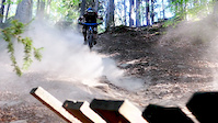
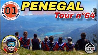
trail: Kohlern upper Nr. 4
2:32 |
419 |
Jan 22, 2018
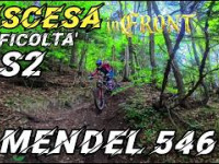
trail: Mendel Nr. 546
7:53 |
97 |
May 24, 2026 , Bolzano
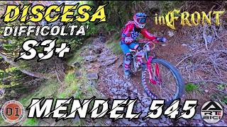
trail: Mendel 'Neuer Weg' Nr. 545
15:09 |
111 |
May 16, 2026 , Bolzano
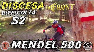
trail: Mendel Nr. 500
11:20 |
78 |
May 16, 2026 , Bolzano
trail: Mendel 'Neuer Weg' Nr. 545
14:37 |
97 |
May 6, 2026 , Bolzano
youtuber
![Bozen | Kohlern Nr. 3 Traildoku | Erste Runde...]()
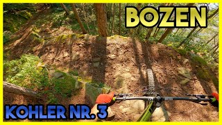
trail: Kohlern Nr. 3
6:08 |
169 |
Jun 2, 2025 , Bolzano
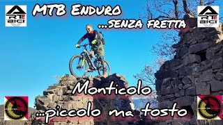
trail: Monte di Mezzo 2
5:25 |
199 |
Dec 18, 2023 , Bolzano
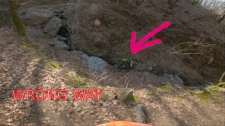
trail: Pineta Trail
7:13 |
209 |
Mar 4, 2022 , Bolzano
Recent Trail Reports
| status | trail | date | condition | info | user |
|---|---|---|---|---|---|
| Sigmundskron | May 25, 2026 @ 1:55pm (Europe/Vaduz) May 25, 2026 | Ideal | succhiafort3 | ||
| Mendel Nr. 546 | May 11, 2026 @ 10:25am (Europe/Rome) May 11, 2026 | Ideal | ArteBici | ||
| Mendel 'Neuer Weg' Nr. 545 | May 11, 2026 @ 10:21am (Europe/Rome) May 11, 2026 | Dry | ArteBici | ||
| Mendel Nr. 500 | May 11, 2026 @ 10:19am (Europe/Rome) May 11, 2026 | Ideal | ArteBici | ||
| F-Low roots | May 8, 2026 @ 4:24pm (Europe/Rome) May 8, 2026 | Dry | succhiafort3 | ||
| Kohlern Schulsteig | Apr 28, 2026 @ 9:48am (Europe/Rome) Apr 28, 2026 | Very Dry | Dadabike1 | ||
| Kohlern Nr. 9 | Apr 28, 2026 @ 9:48am (Europe/Rome) Apr 28, 2026 | Very Dry | Dadabike1 | ||
| Kohlern Nr. 4a/10 | Apr 28, 2026 @ 9:48am (Europe/Rome) Apr 28, 2026 | Very Dry | Dadabike1 | ||
| Kohlern lower Nr. 4 | Apr 28, 2026 @ 9:48am (Europe/Rome) Apr 28, 2026 | Very Dry | Dadabike1 | ||
| Kohlern Nr. 1 | Apr 28, 2026 @ 9:48am (Europe/Rome) Apr 28, 2026 | Very Dry | Dadabike1 |
Activity Feed
| username | action | type | title | date |
|---|---|---|---|---|
| baccanazzo | ridden | trail | activity #97414240 and 3 more | Jun 20, 2026 @ 11:01am 1 hours |
| hubertmi | ridden | trail | activity #97126932 | Jun 16, 2026 @ 11:35am Jun 16, 2026 |
| lines | ridden | trail | activity #97099041 | Jun 16, 2026 @ 4:18am Jun 16, 2026 |
| rafox84 | ridden | trail | activity #96998427 | Jun 14, 2026 @ 1:01pm Jun 14, 2026 |
| TorbenwowuLO | vote | trail | activity #96245541 | Jun 4, 2026 @ 12:26pm Jun 4, 2026 |
Recent Comments
| username | type | title | comment | date |
|---|---|---|---|---|
| trail | Livello tecnico generale S2 con alcuni... | May 11, 2026 @ 1:27am May 11, 2026 | ||
| trail | Livello tecnico generale S3 con qualche... | May 11, 2026 @ 1:24am May 11, 2026 | ||
| trail | Trail di livello S2 tutto naturale, nessun... | May 11, 2026 @ 1:20am May 11, 2026 | ||
| trail | Cobblestones muletrack from top to bottom.... | Mar 29, 2026 @ 10:16am Mar 29, 2026 | ||
| trail | Flowy, fast, sometimes a bit rough... | Mar 29, 2026 @ 10:12am Mar 29, 2026 |
Local Badges
-

10 Black Trails4 awarded -

Epic Ride Climb 2k582 awarded -

Climbing 10k Badge58 awarded -

Climbing 100k Badge8 awarded -

Epic Ride Descent 2k687 awarded -

Descent 10k Badge66 awarded
Bike & Skill Parks
| name | type | city | rating |
|---|---|---|---|
| Skillpark Carezza | skill park | Bolzano |
Activity Type Stats
| activitytype | trails | distance | descent | descent distance | total vertical | rating | global rank | state rank | photos | reports | routes | ridelogs |
|---|---|---|---|---|---|---|---|---|---|---|---|---|
| Mountain Bike | 52 | 121 miles | 49,360 ft | 72 miles | 6,270 ft | #1,496 | #44 | 80 | 412 | 2 | 10,177 | |
| E-Bike | 52 | 66 miles | 12,943 ft | 36 miles | 6,099 ft | #589 | #66 | 353 | 1,138 | |||
| Horse | 1 | 44 | ||||||||||
| Hike | 51 | 97 miles | 60,272 ft | 65 miles | 6,650 ft | #763 | #18 | 408 | 634 | |||
| Trail Running | 52 | 137 miles | 60,738 ft | 86 miles | 6,768 ft | #986 | #31 | 409 | 311 | |||
| Downhill Ski | 22 | 15 miles | 13,793 ft | 14 miles | 2,933 ft | #200 | #19 | 23 |
Frequently Asked Questions About Bolzano
▼
What are the best places to ride in Bolzano?
Bolzano has 2 areas to explore for mountain biking.
▼
What are the highest rated mountain biking trails in Bolzano?
The highest rated mountain biking trails in Bolzano are:
- Roen trail (4.2/5)
- Vilpian 1B (4.2/5)
- Monte di Mezzo 2 (4.1/5)
- Mendel 'Neuer Weg' Nr. 545 (4/5)
- Mendel Nr. 546 (4/5)
▼
What is the best time of the year to ride in Bolzano?
Based on ride log data, the most popular months to ride in Bolzano are:
- September (46 activities)
- October (39 activities)
- July (31 activities)
▼
Where can I park to ride in Bolzano?
There are 2 parking locations listed in Bolzano. The most popular parking spots are:
Activities
Trails
Points of Interest
- By brenthillier
 NSMBA TRAILFORKS & contributors
 - Admins: caval, larry81541, micheletraversi
- #9491 - 17,465 views
- bolzano activity log | embed map of Bolzano mountain bike trails | bolzano mountain biking points of interest
Downloading of trail gps tracks in kml & gpx formats is enabled for Bolzano.
You must login to download files.