close
-
Layers w
- Weather Layers
- Pro
- Pro
- Pro
- Pro
- Pro
- Pro
- More Layers
- Pro
- Pro
- Pro
- Pro
-
Upgrade to

3D
Trail Conditions
- Unknown
- Snow Groomed
- Snow Packed
- Snow Covered
- Snow Cover Partial
- Freeze/thaw Cycle
- Icy
- Prevalent Mud
- Wet
- Variable
- Ideal
- Dry
- Very Dry
Trail Flow (Ridden Direction)
Trailforks scans users ridelogs to determine the most popular direction each trail is ridden. A good flowing trail network will have most trails flowing in a single direction according to their intension.
The colour categories are based on what percentage of riders are riding a trail in its intended direction.
The colour categories are based on what percentage of riders are riding a trail in its intended direction.
- > 96%
- > 90%
- > 80%
- > 70%
- > 50%
- < 50%
- bi-directional trail
- no data
Trail Last Ridden
Trailforks scans ridelogs to determine the last time a trail was ridden.
- < 2 days
- < 1 week
- < 2 weeks
- < 1 month
- < 6 months
- > 6 months
Trail Ridden Direction
The intended direction a trail should be ridden.
- Downhill Only
- Downhill Primary
- Both Directions
- Uphill Primary
- Uphill Only
- One Direction
Contribute Details
Colors indicate trail is missing specified detail.
- Description
- Photos
- Description & Photos
- Videos
Trail Popularity ?
Trailforks scans ridelogs to determine which trails are ridden the most in the last 9 months.
Trails are compared with nearby trails in the same city region with a possible 25 colour shades.
Think of this as a heatmap, more rides = more kinetic energy = warmer colors.
- most popular
- popular
- less popular
- not popular
ATV/ORV/OHV Filter
Max Vehicle Width
inches
US Cell Coverage
Legend

Radar Time
Activity Recordings
Trailforks uses anonymized public activity data.
?
Activity Recordings
Trailforks uses anonymized public activity data.
?
Personal Heatmap
▶
Activity Types
all
/
none
▶
Options
2
Date range
month
–
Winter Trails
Warning
A routing network for winter maps does not exist. Selecting trails using the winter trails layer has been disabled.
Missing Trails
Most Popular
Least Popular
Trails are colored based on popularity. The more popular a trail is, the more red. Less popular trails trend towards green.
Jump Magnitude Heatmap
Heatmap of where riders jump on trails. Zoom in to see individual jumps, click circles to view jump details.
BC Backroad Status
![map legend]()
Service Road Atlas is a free to use, community-driven service for viewing and creating reports on the numerous back-country service roads around B.C. and Alberta.

Slope Aspect
Direction the slope faces
Trails Deemphasized
Trails are shown in grey.
Only show trails with no bike usage.
Suggested Layers
Based on selected activity type
Save the current map location and zoom level as your default home location whenever this page is loaded.
Save
No description for Boone has been added yet!
Login or register to submit one.
Activities Click to view
- Mountain Bike
37 trails
- E-Bike
4 trails
- Adaptive Bike
6 trails
- Hike
42 trails
- Trail Running
42 trails
Region Details
- 5
- 2
- 9
- 14
- 6
- 1
Region Status
Open as of Jun 6, 2026Stats
- Avg Trail Rating
- Trails (view details)
- 45
- Trails Mountain Bike
- 37
- Trails E-Bike
- 4
- Trails Gravel Bike
- 10
- Trails Adaptive Bike
- 6
- Trails Hike
- 42
- Trails Trail Running
- 42
- Total Distance
- 28 miles
- Total Descent
- 2,518 ft
- Total Vertical
- 2,472 ft
- Highest Trailhead
- 5,545 ft
- Reports
- 1,043
- Photos
- 132
- Ridden Counter
- 18,919
Sub Regions
-
Elk Knob State Park
-
Rocky Knob Park
- 12
- 6
- 1
Popular Boone Mountain Biking Trails
• 90 ★ 4.0 • 2 miles • 157 ft • 1,188 •
This 1.5-mile loop serves as the and exit of all other trails on the mountain. It climbs for about half its distance passing by a large rock outcropping and a small cascade of Creek. Several short climbs lead to a flowy downhill....
• 95 ★ 4.0 • 1,434 ft • 44 ft • 1,035 •
This short trail provides a sample of Rocky Knob trails for novice riders. Ridden as a loop with , this trail provides an introduction to the mountain. The trail was built with funds from a Keen Effects grant.
• 80 ★ 4.1 • 2 miles • 375 ft • 881 •
Named for the large ship sized rock perched over a turn on this trail, the provides access to the higher trails on the mountain. The first half mile packs in a steep, rocky climb but then the trail mellows out a bit. Several large...
• 75 ★ 4.0 • 778 ft • 44 ft • 877 •
Popular blue difficulty singletrack. This mountain bike primary trail can be used downhill primary. It features berm. On average it takes 1 minutes to complete this trail.
• 90 ★ 4.0 • 1 mile • 191 ft • 797 •
is a great blue trail before heading up to .
• 85 ★ 4.6 • 2,329 ft • 194 ft • 794 •
Named after nearby legend Doc Watson’s guitar, Ol’ Hoss climbs a half-mile to reach the summit of Rocky Knob at 4000 feet. This 1.5-mile loop serves as the and exit of all other trails
• 100 ★ 4.6 • 479 ft • 10 ft • 747 •
is a blue-rated jump session loop designed for riders to work on becoming comfortable on medium size jumps.
Boone Mountain Bike Routes
★ 4.0 • 15 miles • 2,703 ft • 2 • Loop •
Ready for a backcountry adventure? This link up of Woodruff Ridge, Upper Wilson Ridge, and Schoolhouse...
2 miles • 357 ft • 12 • Loop •
This is one of our favorite flow routes at Rocky Knob and is featured in Freehub Magazine's Pisgah Photo...
• 14 miles • 2,112 ft • 34 •
• 2 miles • 286 ft • 8 •
• 5 miles • 802 ft • 27 •
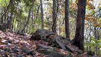
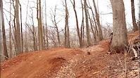
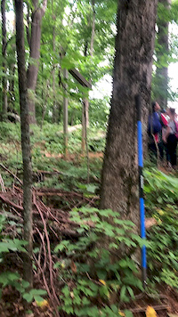
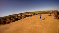
Photos of Boone Mountain Bike
Videos of Boone Mountain Bike
0:05 |
218 |
Oct 15, 2020
trail: PBJ
0:49 |
347 |
Mar 20, 2020

trail: PBJ
2:26 |
237 |
Mar 6, 2020

trail: PBJ
3:15 |
364 |
Jan 2, 2020

trail: Jumbo Shrimp
2:38 |
4193 |
Nov 27, 2019
trail: PBJ
0:07 |
36 |
Aug 17, 2019

trail: Jumbo Shrimp
0:34 |
2464 |
May 13, 2019
trail: Middle Earth Trail
0:58 |
40 |
May 2, 2019
Recent Trail Reports
| status | trail | date | condition | info | user |
|---|---|---|---|---|---|
| Transfer Station--Army Truck Connector | Jun 6, 2026 @ 2:39pm (America/New_York) Jun 6, 2026 | Ideal | KristianJackson BAC | ||
| Transfer Station | Jun 6, 2026 @ 2:39pm (America/New_York) Jun 6, 2026 | Ideal | KristianJackson BAC | ||
| The Roman Road | Jun 6, 2026 @ 2:39pm (America/New_York) Jun 6, 2026 | Ideal | KristianJackson BAC | ||
| The Jam | Jun 6, 2026 @ 2:39pm (America/New_York) Jun 6, 2026 | Ideal | KristianJackson BAC | ||
| The Blue Ridge | Jun 6, 2026 @ 2:39pm (America/New_York) Jun 6, 2026 | Ideal | KristianJackson BAC | ||
| Stone Soup (Lower Black Forest) | Jun 6, 2026 @ 2:39pm (America/New_York) Jun 6, 2026 | Ideal | KristianJackson BAC | ||
| Rocky Branch Trail | Jun 6, 2026 @ 2:39pm (America/New_York) Jun 6, 2026 | Ideal | KristianJackson BAC | ||
| PBJ Session Connection | Jun 6, 2026 @ 2:39pm (America/New_York) Jun 6, 2026 | Ideal | KristianJackson BAC | ||
| PBJ | Jun 6, 2026 @ 2:39pm (America/New_York) Jun 6, 2026 | Ideal | KristianJackson BAC | ||
| Ol' Hoss | Jun 6, 2026 @ 2:39pm (America/New_York) Jun 6, 2026 | Ideal | KristianJackson BAC |
Activity Feed
| username | action | type | title | date |
|---|---|---|---|---|
| Nathan9540 | add | photo | activity #96695569 | Jun 10, 2026 @ 2:13pm Jun 10, 2026 |
| robertscottpierce | wishlist | region | activity #96691330 | Jun 10, 2026 @ 12:59pm Jun 10, 2026 |
| Nathan9540 | add | photo | activity #96594886 and 6 more | Jun 9, 2026 @ 3:57am Jun 9, 2026 |
| NimblePossum | wishlist | trail | activity #96540826 and 1 more | Jun 8, 2026 @ 8:17am Jun 8, 2026 |
| KristianJackson | add | report | activity #96392422 and 29 more | Jun 6, 2026 @ 11:39am Jun 6, 2026 |
Recent Comments
| username | type | title | comment | date |
|---|---|---|---|---|
| trail | Inefficient, meandering, boring flat trail... | May 9, 2026 @ 1:10pm May 9, 2026 | ||
| trail | Stupid trail and not a black diamond. The... | May 9, 2026 @ 1:09pm May 9, 2026 | ||
| trail | Good spot to session for an intermediate rider... | Sep 1, 2025 @ 11:26am Sep 1, 2025 | ||
| report | Corrected! | Jun 23, 2025 @ 11:03am Jun 23, 2025 | ||
| report | All clear | Sep 17, 2024 @ 3:51am Sep 17, 2024 |
Local Badges
-

Epic Ride Climb 2k34 awarded -

Climbing 10k Badge36 awarded -

Climbing 100k Badge0 awarded -

Epic Ride Descent 2k37 awarded -

Descent 10k Badge38 awarded -

Descent 100k Badge2 awarded
Bike & Skill Parks
| name | type | city | rating |
|---|---|---|---|
| Pump Track | skill park | Boone | |
| Jump Start Skills Park | skill park | Boone | |
| Stone Binge Skill Park | skill park | Boone | |
| Skinny Skill Park | skill park | Boone |
Activity Type Stats
| activitytype | trails | distance | descent | descent distance | total vertical | rating | global rank | state rank | photos | reports | routes | ridelogs |
|---|---|---|---|---|---|---|---|---|---|---|---|---|
| Mountain Bike | 37 | 21 miles | 1,467 ft | 6 miles | 938 ft | #1,163 | #447 | 132 | 1,043 | 3 | 9,313 | |
| E-Bike | 4 | 3 miles | 52 ft | 4,377 ft | 213 ft | #5,103 | #1,592 | 364 | 175 | |||
| Gravel Bike | 10 | 8 miles | 217 ft | 3 miles | 272 ft | #597 | #335 | 2 | 13 | |||
| Adaptive Bike | 6 | 5 miles | 164 ft | 2 miles | 259 ft | #598 | #832 | 64 | ||||
| Hike | 42 | 26 miles | 2,510 ft | 8 miles | 2,474 ft | #5,111 | #1,799 | 969 | 401 | |||
| Trail Running | 42 | 26 miles | 2,510 ft | 8 miles | 2,474 ft | #4,704 | #1,453 | 969 | 448 |
Frequently Asked Questions About Boone
▼
What are the best places to ride in Boone?
Boone has 2 areas to explore for mountain biking. The top rated areas are:
▼
What are the highest rated mountain biking trails in Boone?
The highest rated mountain biking trails in Boone are:
- PBJ (4.6/5)
- Stone Soup (Lower Black Forest) (4.5/5)
- Ol' Hoss (4.4/5)
- Basic Shrimp Roll (4.3/5)
- Black Forest (4.3/5)
▼
What is the best time of the year to ride in Boone?
Based on ride log data, the most popular months to ride in Boone are:
- July (153 activities)
- May (84 activities)
- June (84 activities)
▼
Where can I park to ride in Boone?
There are 15 parking locations listed in Boone. The most popular parking spots are: View all parking and trailhead locations on the map to plan your visit.
Activities
Trails
- By brenthillier
 NSMBA TRAILFORKS & contributors
 - Admins: BAC
- #3384 - 14,071 views
- boone activity log | embed map of Boone mountain bike trails | boone mountain biking points of interest
Downloading of trail gps tracks in kml & gpx formats is enabled for Boone.
You must login to download files.