close
-
Layers w
- Weather Layers
- Pro
- Pro
- Pro
- Pro
- Pro
- Pro
- More Layers
- Pro
- Pro
- Pro
- Pro
-
Upgrade to

3D
Trail Conditions
- Unknown
- Snow Groomed
- Snow Packed
- Snow Covered
- Snow Cover Partial
- Freeze/thaw Cycle
- Icy
- Prevalent Mud
- Wet
- Variable
- Ideal
- Dry
- Very Dry
Trail Flow (Ridden Direction)
Trailforks scans users ridelogs to determine the most popular direction each trail is ridden. A good flowing trail network will have most trails flowing in a single direction according to their intension.
The colour categories are based on what percentage of riders are riding a trail in its intended direction.
The colour categories are based on what percentage of riders are riding a trail in its intended direction.
- > 96%
- > 90%
- > 80%
- > 70%
- > 50%
- < 50%
- bi-directional trail
- no data
Trail Last Ridden
Trailforks scans ridelogs to determine the last time a trail was ridden.
- < 2 days
- < 1 week
- < 2 weeks
- < 1 month
- < 6 months
- > 6 months
Trail Ridden Direction
The intended direction a trail should be ridden.
- Downhill Only
- Downhill Primary
- Both Directions
- Uphill Primary
- Uphill Only
- One Direction
Contribute Details
Colors indicate trail is missing specified detail.
- Description
- Photos
- Description & Photos
- Videos
Trail Popularity ?
Trailforks scans ridelogs to determine which trails are ridden the most in the last 9 months.
Trails are compared with nearby trails in the same city region with a possible 25 colour shades.
Think of this as a heatmap, more rides = more kinetic energy = warmer colors.
- most popular
- popular
- less popular
- not popular
ATV/ORV/OHV Filter
Max Vehicle Width
inches
US Cell Coverage
Legend

Radar Time
Activity Recordings
Trailforks uses anonymized public activity data.
?
Activity Recordings
Trailforks uses anonymized public activity data.
?
Personal Heatmap
▶
Activity Types
all
/
none
▶
Options
2
Date range
month
–
Winter Trails
Warning
A routing network for winter maps does not exist. Selecting trails using the winter trails layer has been disabled.
Missing Trails
Most Popular
Least Popular
Trails are colored based on popularity. The more popular a trail is, the more red. Less popular trails trend towards green.
Jump Magnitude Heatmap
Heatmap of where riders jump on trails. Zoom in to see individual jumps, click circles to view jump details.
BC Backroad Status
![map legend]()
Service Road Atlas is a free to use, community-driven service for viewing and creating reports on the numerous back-country service roads around B.C. and Alberta.

Slope Aspect
Direction the slope faces
Trails Deemphasized
Trails are shown in grey.
Only show trails with no bike usage.
Suggested Layers
Based on selected activity type
Save the current map location and zoom level as your default home location whenever this page is loaded.
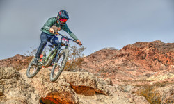
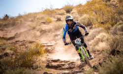
SaveBootleg Canyon is known for its outstanding hiking trails, beautiful lake views, and some of the best mountain biking in the country. With over 36 miles of trails, the lower trails are for beginners while upper trails will have you challenging your biking skills. For those of you who dare, hike or grab a shuttle to the top of the mountain and enjoy the views of both the Las Vegas Valley and Lake Mead as you navigate the steep maze of technical downhill trails.
source: Bootleg Canyon website
 google parking directions
 Activities Click to view
- Mountain Bike
43 trails
- E-Bike
7 trails
- Hike
42 trails
- Trail Running
42 trails
Region Details
- 2
- 3
- 3
- 16
- 8
- 8
- 1
Region Status
Open as of May 30, 2026Stats
- Avg Trail Rating
- Trails (view details)
- 42
- Trails Mountain Bike
- 43
- Trails E-Bike
- 7
- Trails Hike
- 42
- Trails Trail Running
- 42
- Total Distance
- 50 miles
- Total Descent
- 12,704 ft
- Total Vertical
- 2,217 ft
- Highest Trailhead
- 3,606 ft
- Reports
- 600
- Photos
- 514
- Ridden Counter
- 18,973
Articles

Details Announced for the Ole Burro Enduro Series at Bootleg Canyon
Aug 1, 2025 from pinkbike.com
2025 Ole Burro Enduro at Bootleg Canyon Joins the Ole Burro Enduro at Blue Diamond.
Race Report: 2025 Southwest Regional Gravity Champs Round #2 at Bootleg Canyon
Feb 19, 2025 from pinkbike.com
The racecourse got watered with 1/2 an inch of rain on Thursday, providing perfect tacky conditions for racing.
Details Announced for 2020 Reaper Madness - Bootleg Canyon
Mar 4, 2020 from pinkbike.com
The event will take place on Friday, March 13, 2020.
Popular Bootleg Canyon Mountain Biking Trails
• 100 ★ 4.1 • 1 mile • 78 ft • 1,681 •
Highly rated popular blue difficulty singletrack. This mountain bike primary trail can be used both directions and has a moderate overall physical rating with a 78 ft black diamond climb. On average it takes 10 minutes to complete this trail.
• 90 ★ 4.2 • 4,077 ft • 52 ft • 1,097 •
Super tech first section with big drops (4 to 6 inches)
• 95 ★ 4.4 • 1 mile • 2 ft • 1,092 •
Really fun and flowy downhill trail. The start of this trail is at the top,you will want to ride DOWN the hill on . You can ride this down to the veterans building and shuttle back up, or take the Par None back up.
• 95 ★ 4.5 • 4,163 ft • 60 ft • 779 •
Ride both ways for a fun trail. There are multiple g-outs on this trail, If you keep your speed up you can make it up the short steep climbs after the g-outs.
• 65 ★ 3.7 • 1 mile • 101 ft • 737 •
Moderately popular blue difficulty singletrack. This mountain bike primary trail. On average it takes 12 minutes to complete this trail.
• 100 ★ 2.7 • 4,293 ft • 103 ft • 726 •
Alternate\easier way back to main parking lot after descending .
• 75 ★ 3.8 • 2 miles • 374 ft • 686 •
First section is a little tricky, but fun. Close to a Black diamond. Once you reach the bottom, you have a slow gradual climb back up to the middle parking lot. Trail is both directions but you will want to ride this clockwise.
• 95 ★ 4.0 • 484 ft • 35 ft • 670 •
Popular blue difficulty singletrack. This mountain bike primary trail can be used both directions. On average it takes minutes to complete this trail.
Bootleg Canyon Mountain Bike Routes
11 miles • 1,531 ft • 6 •
A great route that incorporates two of Bootleg Canyon's best trails: and !
14 miles • 1,548 ft • 7 •
A little longer route in Bootleg Canyon for intermediate riders.
6 miles • 811 ft • 8 •
Awesome night ride, I Love Bootleg Canyon, if ever in the area head to All Mountain and check out Bootleg...
9 miles • 911 ft • 14 •
Route in Bootleg Canyon for intermediate riders.
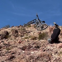
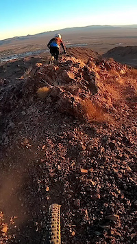
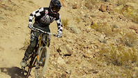
Photos of Bootleg Canyon Mountain Bike
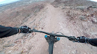
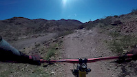
Videos of Bootleg Canyon Mountain Bike
trail: Snake Back
0:22 |
52 |
Feb 28, 2025
trail: Boy Scout
0:27 |
|
Apr 13, 2023
trail: Snake Back
0:10 |
328 |
Dec 12, 2022
trail: Elevator Shaft
0:15 |
346 |
Jan 7, 2022
trail: Poop Chute
0:35 |
506 |
Dec 24, 2018
trail: Caldera
0:30 |
422 |
Apr 30, 2018
trail: Snake Back
3:35 |
814 |
Nov 29, 2017
trail: Reaper
6:46 |
511 |
Jun 3, 2017
Recent Trail Reports
Activity Feed
| username | action | type | title | date |
|---|---|---|---|---|
| caiello | ridden | trail | activity #97321675 | Jun 19, 2026 @ 8:56am 1 day |
| caiello | wishlist | route | activity #97295875 | Jun 18, 2026 @ 9:19pm 2 days |
| BrianntaYtB | vote | trail | activity #97153664 | Jun 16, 2026 @ 6:25pm Jun 16, 2026 |
| BrianntaYtB | ridden | trail | activity #97153659 | Jun 16, 2026 @ 6:25pm Jun 16, 2026 |
| CoreyWV3s2M | difficultyvote | trail | activity #96919502 | Jun 13, 2026 @ 3:05pm Jun 13, 2026 |
Recent Comments
| username | type | title | comment | date |
|---|---|---|---|---|
| trail | Fun roller coaster ride in the style of 18... | Feb 19, 2026 @ 8:39am Feb 19, 2026 | ||
| trail | Fun trail. Reminds me of 18 Road area in... | Feb 19, 2026 @ 8:38am Feb 19, 2026 | ||
| trail | Rode down the east side of the inner loop and... | Feb 19, 2026 @ 8:26am Feb 19, 2026 | ||
| trail | Rode down the east side of the inner loop and... | Feb 19, 2026 @ 8:26am Feb 19, 2026 | ||
| trail | Just recently groomed, no loose rock. Feels... | Dec 22, 2025 @ 1:45pm Dec 22, 2025 |
Nearby Areas
| name | distance | ||||
|---|---|---|---|---|---|
| Sloan Canyon Trails | 15 | 70 | 9 | 1 | 8.9 km |
| Clark County Wetlands Park | 4 | 10.2 km | |||
| Sunset Park | 14 km | ||||
| Rainbow Gardens | 14.4 km | ||||
| Eastside | 1 | 6 | 5 | 15.4 km |
Local Badges
-

Completionist1 awarded
Activity Type Stats
| activitytype | trails | distance | descent | descent distance | total vertical | rating | global rank | state rank | photos | reports | routes | ridelogs |
|---|---|---|---|---|---|---|---|---|---|---|---|---|
| Mountain Bike | 43 | 50 miles | 12,661 ft | 28 miles | 2,182 ft | #921 | #339 | 533 | 600 | 10 | 16,496 | |
| E-Bike | 7 | 13 miles | 735 ft | 4 miles | 1,601 ft | #4,842 | #1,330 | 537 | 3 | 1,666 | ||
| Hike | 42 | 48 miles | 11,096 ft | 26 miles | 2,218 ft | #339 | #191 | 14 | 600 | 384 | ||
| Trail Running | 42 | 48 miles | 11,096 ft | 26 miles | 2,218 ft | #3,390 | #909 | 600 | 404 |
Frequently Asked Questions About Bootleg Canyon
▼
What are the highest rated mountain biking trails in Bootleg Canyon?
The highest rated mountain biking trails in Bootleg Canyon are:
- Reaper (4.4/5)
- Coyote Canyon (4.4/5)
- Diva (4.3/5)
- Armageddon (4.3/5)
- Ginger (4.3/5)
▼
What is the best time of the year to ride in Bootleg Canyon?
Based on ride log data, the most popular months to ride in Bootleg Canyon are:
- November (202 activities)
- December (202 activities)
- February (175 activities)
▼
Where can I park to ride in Bootleg Canyon?
There are 5 parking locations listed in Bootleg Canyon. The most popular parking spots are: View all parking and trailhead locations on the map to plan your visit.
▼
What is the longest trail in Bootleg Canyon?
The longest trail in Bootleg Canyon is Caldera at 3.9 miles. View all trails sorted by distance.
Activities
- By brenthillier
 NSMBA TRAILFORKS & contributors
 - Admins: BLM NV GBNM
- #3949 - 55,564 views
- bootleg canyon activity log | embed map of Bootleg Canyon mountain bike trails | bootleg canyon mountain biking points of interest
Downloading of trail gps tracks in kml & gpx formats is enabled for Bootleg Canyon.
You must login to download files.