close
-
Layers w
- Weather Layers
- Pro
- Pro
- Pro
- Pro
- Pro
- Pro
- More Layers
- Pro
- Pro
- Pro
- Pro
-
Upgrade to

3D
Trail Conditions
- Unknown
- Snow Groomed
- Snow Packed
- Snow Covered
- Snow Cover Partial
- Freeze/thaw Cycle
- Icy
- Prevalent Mud
- Wet
- Variable
- Ideal
- Dry
- Very Dry
Trail Flow (Ridden Direction)
Trailforks scans users ridelogs to determine the most popular direction each trail is ridden. A good flowing trail network will have most trails flowing in a single direction according to their intension.
The colour categories are based on what percentage of riders are riding a trail in its intended direction.
The colour categories are based on what percentage of riders are riding a trail in its intended direction.
- > 96%
- > 90%
- > 80%
- > 70%
- > 50%
- < 50%
- bi-directional trail
- no data
Trail Last Ridden
Trailforks scans ridelogs to determine the last time a trail was ridden.
- < 2 days
- < 1 week
- < 2 weeks
- < 1 month
- < 6 months
- > 6 months
Trail Ridden Direction
The intended direction a trail should be ridden.
- Downhill Only
- Downhill Primary
- Both Directions
- Uphill Primary
- Uphill Only
- One Direction
Contribute Details
Colors indicate trail is missing specified detail.
- Description
- Photos
- Description & Photos
- Videos
Trail Popularity ?
Trailforks scans ridelogs to determine which trails are ridden the most in the last 9 months.
Trails are compared with nearby trails in the same city region with a possible 25 colour shades.
Think of this as a heatmap, more rides = more kinetic energy = warmer colors.
- most popular
- popular
- less popular
- not popular
ATV/ORV/OHV Filter
Max Vehicle Width
inches
US Cell Coverage
Legend

Radar Time
Activity Recordings
Trailforks uses anonymized public activity data.
?
Activity Recordings
Trailforks uses anonymized public activity data.
?
Personal Heatmap
▶
Activity Types
all
/
none
▶
Options
2
Date range
month
–
Winter Trails
Warning
A routing network for winter maps does not exist. Selecting trails using the winter trails layer has been disabled.
Missing Trails
Most Popular
Least Popular
Trails are colored based on popularity. The more popular a trail is, the more red. Less popular trails trend towards green.
Jump Magnitude Heatmap
Heatmap of where riders jump on trails. Zoom in to see individual jumps, click circles to view jump details.
BC Backroad Status
![map legend]()
Service Road Atlas is a free to use, community-driven service for viewing and creating reports on the numerous back-country service roads around B.C. and Alberta.

Slope Aspect
Direction the slope faces
Trails Deemphasized
Trails are shown in grey.
Only show trails with no bike usage.
Suggested Layers
Based on selected activity type
Save the current map location and zoom level as your default home location whenever this page is loaded.
Save
No description for Bootleg Mountain has been added yet!
Login or register to submit one.
 google parking directions
Primary Trail Type: All-Mountain & Downhill
Shuttleable: YES
Land Status: Crown Land
google parking directions Activities Click to view
- Mountain Bike
25 trails
- E-Bike
22 trails
- Hike
20 trails
- Trail Running
20 trails
Region Details
- 6
- 3
- 7
- 9
Region Status
Open as of 2 daysStats
- Avg Trail Rating
- Trails (view details)
- 26
- Trails Mountain Bike
- 25
- Trails E-Bike
- 22
- Trails Hike
- 20
- Trails Trail Running
- 20
- Trails Snowshoe
- 1
- Trails Nordic Ski
- 1
- Total Distance
- 43 miles
- Total Descent
- 11,988 ft
- Total Vertical
- 4,653 ft
- Highest Trailhead
- 7,822 ft
- Reports
- 877
- Photos
- 302
- Ridden Counter
- 9,160
Articles
Exploring BC's Lesser Known Riding Destinations on the Bikes & Beers Tour
Sep 14, 2019 from pinkbike.com
Seven days of full-on riding on some of British Columbia's best trail networks.
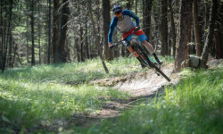
Popular Bootleg Mountain Mountain Biking Trails
• 95 ★ 4.5 • 5,052 ft • 0 ft • 1,502 •
This machine built trail is a 1.5km downhill/ flow/ jump trail. It can be ridden by all riders and has nice smooth dirt with very few rocks. The 44 features include tons of table tops and a gap jump over a big fallen tree, as well as...
• 80 ★ 4.7 • 4,688 ft • 10 ft • 1,036 •
This trail is fast and fluid with giant berms and terrific tabletops for intermediate riders with some bonus optional steep roll lines. A great stepping stone for riders experienced on who are looking to improve their jumping skills and...
• 90 ★ 4.9 • 5 miles • 1,928 ft • 872 •
If you want to see some unicorns you are going to have to get up high. This is the primary climb trail that will bring up to the top of as well as entry points to , , , . It provides a quieter, less dusty and more unicorn infused...
• 90 ★ 3.8 • 407 ft • 0 ft • 837 •
Single track from Atlas to the and road access. PPP starts immediately on your right at the exit of this connector.
• 70 ★ 4.3 • 5,046 ft • 0 ft • 646 •
Getting bored of ? This is a lower mountain black flow trail with gap jumps, berms, and drops. The shaped drop in ramp and first jumps are indicative of what's to come on this high speed trail that takes you down to the main parking lot...
• 65 ★ 4.6 • 2 miles • 0 ft • 639 •
This trail is a downhill racer's dream. The upper sections of this trail compromise of more loomy natural features with roots and rocks a plenty. There are a couple boardwalked log rides with small drops from 1ft -3ft on the upper...
• 55 ★ 4.6 • 3,524 ft • 0 ft • 531 •
This machine built trail is a 1.2km downhill/ flow/ jump trail that has non stop action from top to bottom with 34 features. There are tons of table tops, gap jumps, berms and drops. It received a complete refresh in the summer of 2023...
• 45 ★ 4.7 • 2 miles • 0 ft • 454 •
Did you earn your descent by pedalling to the top of Bootleg FSR? will not disappoint and gives you the most bang for your buck. Going down for over 6km and 850m of elevation drop if you connect trails to the base area, be prepared to...
Bootleg Mountain Mountain Bike Routes
15 miles • 1,335 ft • 5 • Point to Point •
This is the current route of the Trans Canada Trail through the Kimberley BC Region. The western portion...
★ 3.0 • 49 miles • 8,954 ft • 22 •
2022 Kimberley Unofficial Triple Crown
10 miles • 895 ft • 0 • Point to Point •
The Trans Canada Route through Kimberley
• 17 miles • 3,763 ft • 11 •
• 14 miles • 2,764 ft • 9 •
• 5 miles • 16 ft • 3 •
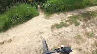
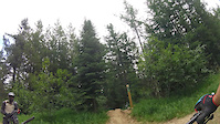
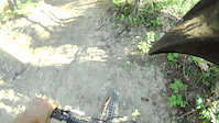
Photos of Bootleg Mountain Mountain Bike
Videos of Bootleg Mountain Mountain Bike
trail: NIMBY
4:02 |
74 |
Oct 8, 2022
7:03 |
527 |
Aug 10, 2017
0:29 |
171 |
Aug 6, 2017
trail: Pinch and Roll
0:12 |
702 |
Aug 8, 2016
youtuber
![I COULD BARELY KEEP UP WITH HER!!]()
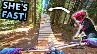
trail: Snow Mexican
18:34 |
111 |
Nov 13, 2025 , Kimberley
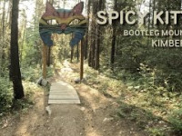
trail: Spicy Kitty
179 |
Jun 17, 2025 , Kimberley
8:42 |
97 |
Sep 30, 2024 , Kimberley
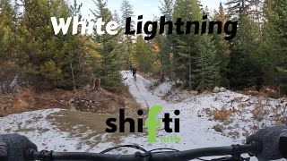
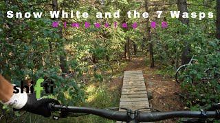
trail: White Lightning
3:07 |
81 |
Sep 30, 2024 , Kimberley
Current Trail Warnings
| status | trail | date | condition | user | info |
|---|---|---|---|---|---|
| White Lightning | Jun 16, 2026 @ 5:34pm (America/Edmonton) 2 days | Unknown | singdinger | Large tree down in blind after large hip... |
Recent Trail Reports
| status | trail | date | condition | info | user |
|---|---|---|---|---|---|
| haǂaʔ¢u swaʔ (Sneaking Cougar -Trans Canada Trail) | Jun 13, 2026 @ 4:23pm (America/Edmonton) Jun 13, 2026 | Ideal | Mckenzieinc KTRG | ||
| E61 (Cross Country) | Jun 13, 2026 @ 4:23pm (America/Edmonton) Jun 13, 2026 | Ideal | Mckenzieinc KTRG | ||
| Atlas Shrugged | Jun 11, 2026 @ 10:05pm (America/Edmonton) Jun 11, 2026 | Wet | Mckenzieinc KTRG | ||
| Snow Mexican | Jun 11, 2026 @ 10:05pm (America/Edmonton) Jun 11, 2026 | Wet | Mckenzieinc KTRG | ||
| Bootridge Access Road | Jun 11, 2026 @ 10:04pm (America/Edmonton) Jun 11, 2026 | Unknown | Mckenzieinc KTRG | ||
| Unicorn Hunting (Bootleg Climb Trail) | Jun 11, 2026 @ 10:03pm (America/Edmonton) Jun 11, 2026 | Ideal | Mckenzieinc KTRG | ||
| Pinch and Roll | Jun 11, 2026 @ 4:12pm (America/Edmonton) Jun 11, 2026 | Variable | TomintheNorth KTRG | ||
| Spicy Kitty | Jun 10, 2026 @ 7:17am (America/Edmonton) Jun 10, 2026 | Unknown | yukonman | ||
| White Lightning Climb | May 29, 2026 @ 8:10pm (America/Edmonton) May 29, 2026 | Unknown | yukonman | ||
| Atlas to Pinch Connector | May 24, 2026 @ 5:24pm (America/Edmonton) May 24, 2026 | Ideal | engjay |
Activity Feed
| username | action | type | title | date |
|---|---|---|---|---|
| theduckrides | wishlist | trail | activity #97230342 | Jun 17, 2026 @ 8:51pm 15 hours |
| singdinger | add | report | activity #97145781 | Jun 16, 2026 @ 4:34pm 2 days |
| Mckenzieinc | add | report | activity #96920737 and 1 more | Jun 13, 2026 @ 3:23pm Jun 13, 2026 |
| Finnegan4 | wishlist | region | activity #96902097 | Jun 13, 2026 @ 11:50am Jun 13, 2026 |
| lplug | vote | trail | activity #96888318 | Jun 13, 2026 @ 9:37am Jun 13, 2026 |
Recent Comments
| username | type | title | comment | date |
|---|---|---|---|---|
| report | Dylan's the man! | Jun 12, 2026 @ 11:53am Jun 12, 2026 | ||
| report | Tree cleared/trail clear. | Jun 11, 2026 @ 3:06pm Jun 11, 2026 | ||
| report | Tree down about 200 m from end of trail near... | May 27, 2026 @ 12:08pm May 27, 2026 | ||
| report | Tree down | May 27, 2026 @ 11:57am May 27, 2026 | ||
| report | Those look like the trees I cleared yesterday... | May 15, 2026 @ 9:13pm May 15, 2026 |
Nearby Areas
| name | distance | ||||
|---|---|---|---|---|---|
| Kimberley Area Trails | 2 | 16 | 1 | 2.3 km | |
| Kimberley Nature Park | 11 | 34 | 7 | 2.7 km | |
| Kimberley Nordic Center and Ski Hill | 11 | 22 | 5 | 3.3 km | |
| Lois Creek | 16 | 12 | 6.3 km | ||
| Wycliffe Regional Park | 5 | 22 | 5 | 2 | 9.2 km |
Local Badges
-

Completionist0 awarded
Activity Type Stats
| activitytype | trails | distance | descent | descent distance | total vertical | rating | global rank | state rank | photos | reports | routes | ridelogs |
|---|---|---|---|---|---|---|---|---|---|---|---|---|
| Mountain Bike | 25 | 36 miles | 9,196 ft | 14 miles | 3,100 ft | #2,113 | #128 | 301 | 877 | 3 | 5,499 | |
| E-Bike | 22 | 35 miles | 9,157 ft | 14 miles | 3,100 ft | #2,941 | #99 | 675 | 3 | 210 | ||
| Hike | 20 | 36 miles | 8,428 ft | 12 miles | 4,652 ft | #4,977 | #208 | 1 | 741 | 2 | 74 | |
| Trail Running | 20 | 36 miles | 8,428 ft | 12 miles | 4,652 ft | 741 | 2 | 11 | ||||
| Snowshoe | 1 | 3 miles | 256 ft | 1 mile | 358 ft | 73 | 1 | |||||
| Nordic Ski | 1 | 3 miles | 256 ft | 1 mile | 358 ft | 73 | 1 |
Frequently Asked Questions About Bootleg Mountain
▼
What are the highest rated mountain biking trails in Bootleg Mountain?
The highest rated mountain biking trails in Bootleg Mountain are:
- Snow Mexican (4.6/5)
- Unicorn Hunting (Bootleg Climb Trail) (4.5/5)
- Purple People Pleaser (4.5/5)
- White Lightning (4.5/5)
- Atlas Shrugged (4.5/5)
▼
What is the best time of the year to ride in Bootleg Mountain?
Based on ride log data, the most popular months to ride in Bootleg Mountain are:
- July (169 activities)
- August (125 activities)
- June (101 activities)
▼
Where can I park to ride in Bootleg Mountain?
There are 3 parking locations listed in Bootleg Mountain. The most popular parking spots are: View all parking and trailhead locations on the map to plan your visit.
▼
What is the longest trail in Bootleg Mountain?
The longest trail in Bootleg Mountain is Unicorn Hunting (Bootleg Climb Trail) at 8.1 km. View all trails sorted by distance.
Activities
- By canadaka
 Trailforks & contributors
 - Admins: Mckenzieinc, KTS, duck, Mckenzieinc, PColtrane, pascalgrayphoto, Thisguyinkimberley, kimberley-trails-society, STMS, RDEK
- #2342 - 33,293 views
- bootleg mountain activity log | embed map of Bootleg Mountain mountain bike trails | bootleg mountain mountain biking points of interest
Downloading of trail gps tracks in kml & gpx formats is enabled for Bootleg Mountain.
You must login to download files.