close
-
Layers w
- Weather Layers
- Pro
- Pro
- Pro
- Pro
- Pro
- Pro
- More Layers
- Pro
- Pro
- Pro
- Pro
-
Upgrade to

3D
Trail Conditions
- Unknown
- Snow Groomed
- Snow Packed
- Snow Covered
- Snow Cover Partial
- Freeze/thaw Cycle
- Icy
- Prevalent Mud
- Wet
- Variable
- Ideal
- Dry
- Very Dry
Trail Flow (Ridden Direction)
Trailforks scans users ridelogs to determine the most popular direction each trail is ridden. A good flowing trail network will have most trails flowing in a single direction according to their intension.
The colour categories are based on what percentage of riders are riding a trail in its intended direction.
The colour categories are based on what percentage of riders are riding a trail in its intended direction.
- > 96%
- > 90%
- > 80%
- > 70%
- > 50%
- < 50%
- bi-directional trail
- no data
Trail Last Ridden
Trailforks scans ridelogs to determine the last time a trail was ridden.
- < 2 days
- < 1 week
- < 2 weeks
- < 1 month
- < 6 months
- > 6 months
Trail Ridden Direction
The intended direction a trail should be ridden.
- Downhill Only
- Downhill Primary
- Both Directions
- Uphill Primary
- Uphill Only
- One Direction
Contribute Details
Colors indicate trail is missing specified detail.
- Description
- Photos
- Description & Photos
- Videos
Trail Popularity ?
Trailforks scans ridelogs to determine which trails are ridden the most in the last 9 months.
Trails are compared with nearby trails in the same city region with a possible 25 colour shades.
Think of this as a heatmap, more rides = more kinetic energy = warmer colors.
- most popular
- popular
- less popular
- not popular
ATV/ORV/OHV Filter
Max Vehicle Width
inches
US Cell Coverage
Legend

Radar Time
Activity Recordings
Trailforks uses anonymized public activity data.
?
Activity Recordings
Trailforks uses anonymized public activity data.
?
Personal Heatmap
▶
Activity Types
all
/
none
▶
Options
2
Date range
month
–
Winter Trails
Warning
A routing network for winter maps does not exist. Selecting trails using the winter trails layer has been disabled.
Missing Trails
Most Popular
Least Popular
Trails are colored based on popularity. The more popular a trail is, the more red. Less popular trails trend towards green.
Jump Magnitude Heatmap
Heatmap of where riders jump on trails. Zoom in to see individual jumps, click circles to view jump details.
BC Backroad Status
![map legend]()
Service Road Atlas is a free to use, community-driven service for viewing and creating reports on the numerous back-country service roads around B.C. and Alberta.

Slope Aspect
Direction the slope faces
Trails Deemphasized
Trails are shown in grey.
Only show trails with no bike usage.
Suggested Layers
Based on selected activity type
Save the current map location and zoom level as your default home location whenever this page is loaded.
SaveBosnia and Herzegovina (Bosna i Hercegovina / Босна и Херцеговина, pronounced [bôsna i xěrtseɡoʋina]),[a] abbreviated BiH or B&H, sometimes called Bosnia–Herzegovina and often known informally as Bosnia, is a country at the crossroads of south and southeast Europe, located in the Balkans. The capital and largest city is Sarajevo. Bosnia and Herzegovina borders Serbia to the east, Montenegro to the southeast, and Croatia to the north and southwest. It is not entirely landlocked; in the south it has a narrow coast on the Adriatic Sea, which is about 20 kilometres (12 miles) long and surrounds the town of Neum. Bosnia, which is the inland region of the country, has a moderate continental climate with hot summers and cold, snowy winters. In the central and eastern regions of the country, the geography is mountainous, in the northwest it is moderately hilly, and in the northeast it is predominantly flat. Herzegovina, which is the smaller, southern region of the country, has a Mediterranean climate and is mostly mountainous.
The area that is now Bosnia and Herzegovina has been inhabited by human beings since at least the Upper Paleolithic, but evidence suggests that during the Neolithic age, permanent human settlements were established, including those that belonged to the Butmir, Kakanj, and Vučedol cultures. After the arrival of the first Indo-Europeans, the area was populated by several Illyrian and Celtic civilizations. Culturally, politically, and socially, the country has a rich and complex history. The ancestors of the South Slavic peoples that populate the area today arrived during the 6th through the 9th century. In the 12th century, the Banate of Bosnia was established; by the 14th century this had evolved into the Kingdom of Bosnia. In the mid-15th century, it was annexed into the Ottoman Empire, under whose rule it remained until the late 19th century. The Ottomans brought Islam to the region, and altered much of the country’s cultural and social outlook.
From the late 19th century until World War I, the country was annexed into the Austro-Hungarian monarchy. In the interwar period, Bosnia and Herzegovina was part of the kingdom of Yugoslavia. After World War II, it was granted full republic status in the newly formed Socialist Federal Republic of Yugoslavia. In 1992, following the breakup of Yugoslavia, the republic proclaimed independence. This was followed by the Bosnian War, which lasted until late 1995 and was brought to a close with the signing of the Dayton Agreement.
Today, the country is home to three main ethnic groups, designated “constituent peoples” in the country’s constitution. The Bosniaks are the largest group of the three, the Serbs are the second-largest, and the Croats are the third-largest. In English, all natives of Bosnia and Herzegovina, regardless of ethnicity, are called Bosnian. Minorities, who under the constitution are categorized as "others", include Jews, Roma, Albanians, Montenegrins, Ukrainians and Turks.
Bosnia and Herzegovina has a bicameral legislature and a three-member presidency made up of one member from each of the three major ethnic groups. However, the central government's power is highly limited, as the country is largely decentralized. It comprises two autonomous entities—the Federation of Bosnia and Herzegovina and Republika Srpska—and a third unit, the Brčko District, which is governed by its own local government. The Federation of Bosnia and Herzegovina furthermore consists of 10 cantons.
Bosnia and Herzegovina is a developing country and ranks 73rd in human development. Its economy is dominated by industry and agriculture, followed by tourism and the service sector. Tourism has increased significantly in recent years.[12][13] The country has a social-security and universal-healthcare system, and primary- and secondary-level education is tuition-free. It is a member of the UN, the Organization for Security and Co-operation in Europe, the Council of Europe, the Partnership for Peace, and the Central European Free Trade Agreement; it is also a founding member of the Union for the Mediterranean, established in July 2008.[14] The country is an applicant for membership in the European Union and has been a candidate for NATO membership since April 2010, when it received a Membership Action Plan.[15]
Links
Region Details
- 101
- 15
- 99
- 90
- 16
Stats
- Avg Trail Rating
- Trails (view details)
- 334
- Trails Mountain Bike
- 321
- Trails E-Bike
- 268
- Trails Gravel Bike
- 4
- Trails Adaptive Bike
- 26
- Trails Winter Fat Bike
- 49
- Trails Horse
- 81
- Trails Hike
- 284
- Trails Trail Running
- 284
- Trails Dirtbike/Moto
- 110
- Trails Observed Trials
- 26
- Trails ATV/ORV/OHV
- 99
- Trails Snowmobile
- 6
- Trails Snowshoe
- 7
- Trails Downhill Ski
- 7
- Trails Backcountry Ski
- 7
- Trails Nordic Ski
- 8
- Total Distance
- 536 miles
- Total Descent
- 112,566 ft
- Total Vertical
- 6,625 ft
- Highest Trailhead
- 6,813 ft
- Reports
- 473
- Photos
- 513
- Ridden Counter
- 2,194
Popular Trail Networks
view all areas »Sub Regions
- Brčko District (0)
- Federation of Bosnia and Herzegovina (189)
- Canton 10 (11)
- Kupres (11)
- Canton Goražde (1)
- Central Bosnia Canton (1)
- Herzegovina-Neretva Canton (17)
- Sarajevo Canton (92)
- Sarajevo (92)
- Tuzlanski Canton (37)
- Una-Sana Canton (19)
- Bihac (2)
- West Herzegovina Canton (5)
- Siroki Brijeg (5)
- Zenica-Doboj Canton (1)
- Zenica (1)
- Cazin (24)
- Canton 10 (11)
- Republika Srpska (132)
- Banja Luka (14)
- Bileca (5)
- Doboj (1)
- East Sarajevo (102)
- Foca (3)
- Kalnovik (4)
- Modrica (2)
- Trebinje (2)
- Banja Luka (14)
Popular Bosnia and Herzegovina Mountain Biking Trails
• 50 ★ 4.5 • 2,792 ft • 0 ft • 30 •
• 45 ★ 4.5 • 1 mile • 0 ft • 28 •
Stage from Kupres Enduro Race. Build by Miro - the local trail and shuttle guy
• 85 ★ 5.0 • 2,756 ft • 29 ft • 27 •
Popular blue difficulty singletrack. This mountain bike primary trail can be used downhill primary and has a easy overall physical rating with a 29 ft black diamond climb. Trail visibility is always easy to follow. On average it takes 8 minutes to complete this trail.
• 75 ★ 0.0 • 617 ft • 0 ft • 27 •
Popular blue difficulty singletrack. This mountain bike primary trail can be used downhill only. Trail visibility is always easy to follow. On average it takes minutes to complete this trail.
• 100 ★ 5.0 • 433 ft • 0 ft • 24 •
Popular blue difficulty singletrack. This mountain bike primary trail can be used both directions and has a moderate overall physical rating with a 0 ft blue climb. Trail visibility is always easy to follow. On average it takes 1 minutes to complete this trail.
• 70 ★ 5.0 • 4,705 ft • 0 ft • 21 •
Popular black diamond difficulty singletrack. This mountain bike primary trail can be used downhill primary and has a hard overall physical rating with a 0 ft black diamond climb. Trail visibility is always easy to follow. On average it takes 6 minutes to complete this trail.
• 85 ★ 5.0 • 4,613 ft • 0 ft • 21 •
Popular blue difficulty singletrack. This mountain bike primary trail can be used downhill primary and has a moderate overall physical rating with a 0 ft green climb. It features berm, bridge, drop and skinny. Trail visibility is always easy to follow. On average it takes 8 minutes to complete this trail.
Bosnia and Herzegovina Mountain Bike Routes
★ 5.0 • 25 miles • 4,050 ft • 4 • Loop •
MTB Marathon is a route that combines history, physical challenge, and absolute isolation in nature. This...
★ 5.0 • 3 miles • 613 ft • 6 • Loop •
XCO Evolution je kružna XCO Cross Country MTB ruta dužine 4,5 km, smeštena u Bike Park Evolution,...
8 miles • 479 ft • 2 •
Giro Di Ciro Sarajevo: The Newly Opened Cycling Route to Pale Bosnia and Herzegovina has just gained...
★ 5.0 • 30 miles • 4,233 ft • 7 • Loop •
iznzanredna ruta od babinog dola
★ 5.0 • 1 mile • 4 • Point to Point •
Katera DH trail je prva downhiil staza u Istocnom Sarajevu. Duga je nesto vise od 2 km .
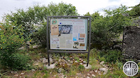
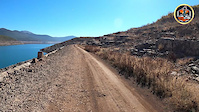
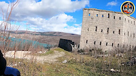
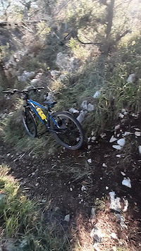
Photos of Bosnia and Herzegovina Mountain Bike
Videos of Bosnia and Herzegovina Mountain Bike
featured
![Bike Park Evolution]()
trail: Roller coaster
0:13 |
15 |
Sep 11, 2025
trail: Borovi Stovrela strmi spust
0:46 |
2 |
May 30, 2026
0:03 |
|
Dec 30, 2023
trail: Katera Trail
3:24 |
17 |
Dec 15, 2023
trail: TVRĐAVA STRAČ
10:09 |
19 |
Jun 18, 2023
trail: Pored jezera 01
4:17 |
3 |
Mar 14, 2023
trail: Dvorac Drakuljica
2:05 |
22 |
Mar 14, 2023
trail: Brko Trail
0:09 |
25 |
Nov 30, 2022
Recent Comments
| username | type | title | comment | date |
|---|---|---|---|---|
| trail | nice, not too narrow but steep beside and... | Jun 7, 2025 @ 1:15pm Jun 7, 2025 | ||
| trail | fast no turns, a lot of roots awesome :) | Jun 7, 2025 @ 1:10pm Jun 7, 2025 | ||
| trail | nice flowy trail but the grass and bushes need... | Jun 7, 2025 @ 1:04pm Jun 7, 2025 | ||
| trail | Steiler Beginn, zwei Steilstufen zum... | Sep 8, 2024 @ 6:50am Sep 8, 2024 | ||
| trail | Trail is ok but it looks like a hiking trail. | Jun 14, 2024 @ 10:04am Jun 14, 2024 |
Bike & Skill Parks
| name | type | city | rating |
|---|---|---|---|
| Bike Park Evolution | bike park | East Sarajevo |
Activity Type Stats
| activitytype | trails | distance | descent | descent distance | total vertical | rating | global rank | state rank | photos | reports | routes | ridelogs |
|---|---|---|---|---|---|---|---|---|---|---|---|---|
| Mountain Bike | 321 | 516 miles | 110,456 ft | 261 miles | 5,951 ft | #51 | 509 | 472 | 49 | 7,683 | ||
| E-Bike | 268 | 427 miles | 82,720 ft | 200 miles | 5,951 ft | #46 | 2 | 412 | 13 | 913 | ||
| Gravel Bike | 4 | 10 miles | 2,530 ft | 7 miles | 4,600 ft | #38 | 28 | 9 | 44 | |||
| Adaptive Bike | 26 | 70 miles | 8,894 ft | 27 miles | 4,944 ft | #32 | 23 | 4 | ||||
| Winter Fat Bike | 49 | 111 miles | 14,669 ft | 52 miles | 5,728 ft | #27 | 16 | |||||
| Horse | 81 | 142 miles | 21,995 ft | 65 miles | 5,725 ft | #36 | 70 | |||||
| Hike | 284 | 469 miles | 94,167 ft | 227 miles | 6,624 ft | #48 | 1 | 453 | 2 | 1,449 | ||
| Trail Running | 284 | 463 miles | 95,180 ft | 226 miles | 6,624 ft | #52 | 442 | 4 | 250 | |||
| Dirtbike/Moto | 110 | 199 miles | 29,199 ft | 91 miles | 5,951 ft | #30 | 80 | 2 | 3 | |||
| Observed Trials | 26 | 41 miles | 5,715 ft | 16 miles | 5,039 ft | #35 | 9 | 1 | ||||
| ATV/ORV/OHV | 99 | 189 miles | 26,791 ft | 85 miles | 5,856 ft | #28 | 72 | 1 | ||||
| Snowmobile | 6 | 3 miles | 1,257 ft | 2 miles | 5,522 ft | #35 | ||||||
| Snowshoe | 7 | 4 miles | 1,385 ft | 2 miles | 5,853 ft | #39 | 1 | |||||
| Downhill Ski | 7 | 4 miles | 1,385 ft | 2 miles | 5,853 ft | #37 | 1 | 368 | ||||
| Backcountry Ski | 7 | 4 miles | 1,385 ft | 2 miles | 5,853 ft | #38 | 1 | 250 | ||||
| Nordic Ski | 8 | 5 miles | 1,722 ft | 3 miles | 5,853 ft | #39 | 1 | 31 |
Activities
- Bosnia and Herzegovina Mountain Biking Trails
- Bosnia and Herzegovina E-Biking Trails
- Bosnia and Herzegovina Adaptive Biking Trails
- Bosnia and Herzegovina Winter Fat Biking Trails
- Bosnia and Herzegovina Horseback Trails
- Bosnia and Herzegovina Hiking Trails
- Bosnia and Herzegovina Trail Running Trails
- Bosnia and Herzegovina Dirtbiking Trails
- Bosnia and Herzegovina Observed Trials Trails
- Bosnia and Herzegovina ATVing/Offroading Trails
- Bosnia and Herzegovina Snowmobiling Trails
- Bosnia and Herzegovina Snowshoeing Trails
- Bosnia and Herzegovina Skiing Trails
- Bosnia and Herzegovina Backcountry Skiing Trails
- Bosnia and Herzegovina Nordic Skiing Trails
Trails
- Hard trails in Bosnia and Herzegovina
- Easy trails in Bosnia and Herzegovina
- Favorite trails in Bosnia and Herzegovina
- Most ridden trails in Bosnia and Herzegovina
- Singletrack in Bosnia and Herzegovina
- Viewpoint trails in Bosnia and Herzegovina
- Trails with technical features in Bosnia and Herzegovina
- Race routes in Bosnia and Herzegovina
- By Sljivex & contributors
- Admins: MTB Evolution, marko-ristivojevic-evolution
- #3270 - 16,091 views
- bosnia and herzegovina activity log | embed map of Bosnia and Herzegovina mountain bike trails | bosnia and herzegovina mountain biking points of interest polygons
Downloading of trail gps tracks in kml & gpx formats is disabled for Bosnia and Herzegovina.