close
-
Layers w
- Weather Layers
- Pro
- Pro
- Pro
- Pro
- Pro
- Pro
- More Layers
- Pro
- Pro
- Pro
- Pro
-
Upgrade to

3D
Trail Conditions
- Unknown
- Snow Groomed
- Snow Packed
- Snow Covered
- Snow Cover Partial
- Freeze/thaw Cycle
- Icy
- Prevalent Mud
- Wet
- Variable
- Ideal
- Dry
- Very Dry
Trail Flow (Ridden Direction)
Trailforks scans users ridelogs to determine the most popular direction each trail is ridden. A good flowing trail network will have most trails flowing in a single direction according to their intension.
The colour categories are based on what percentage of riders are riding a trail in its intended direction.
The colour categories are based on what percentage of riders are riding a trail in its intended direction.
- > 96%
- > 90%
- > 80%
- > 70%
- > 50%
- < 50%
- bi-directional trail
- no data
Trail Last Ridden
Trailforks scans ridelogs to determine the last time a trail was ridden.
- < 2 days
- < 1 week
- < 2 weeks
- < 1 month
- < 6 months
- > 6 months
Trail Ridden Direction
The intended direction a trail should be ridden.
- Downhill Only
- Downhill Primary
- Both Directions
- Uphill Primary
- Uphill Only
- One Direction
Contribute Details
Colors indicate trail is missing specified detail.
- Description
- Photos
- Description & Photos
- Videos
Trail Popularity ?
Trailforks scans ridelogs to determine which trails are ridden the most in the last 9 months.
Trails are compared with nearby trails in the same city region with a possible 25 colour shades.
Think of this as a heatmap, more rides = more kinetic energy = warmer colors.
- most popular
- popular
- less popular
- not popular
ATV/ORV/OHV Filter
Max Vehicle Width
inches
US Cell Coverage
Legend

Radar Time
Activity Recordings
Trailforks uses anonymized public activity data.
?
Activity Recordings
Trailforks uses anonymized public activity data.
?
Personal Heatmap
▶
Activity Types
all
/
none
▶
Options
2
Date range
month
–
Winter Trails
Warning
A routing network for winter maps does not exist. Selecting trails using the winter trails layer has been disabled.
Missing Trails
Most Popular
Least Popular
Trails are colored based on popularity. The more popular a trail is, the more red. Less popular trails trend towards green.
Jump Magnitude Heatmap
Heatmap of where riders jump on trails. Zoom in to see individual jumps, click circles to view jump details.
BC Backroad Status
![map legend]()
Service Road Atlas is a free to use, community-driven service for viewing and creating reports on the numerous back-country service roads around B.C. and Alberta.

Slope Aspect
Direction the slope faces
Trails Deemphasized
Trails are shown in grey.
Only show trails with no bike usage.
Suggested Layers
Based on selected activity type
Save the current map location and zoom level as your default home location whenever this page is loaded.
Save
No description for Boulder has been added yet!
Login or register to submit one.
Activities Click to view
- Mountain Bike
240 trails
- E-Bike
106 trails
- Gravel Bike
1 trails
- Adaptive Bike
0 trails
- Horse
123 trails
- Hike
371 trails
- Trail Running
380 trails
Region Details
- 51
- 26
- 49
- 40
- 41
- 19
- 3
Region Status
Open as of 12 hoursStats
- Avg Trail Rating
- Trails (view details)
- 374
- Trails Mountain Bike
- 244
- Trails E-Bike
- 106
- Trails Gravel Bike
- 1
- Trails Horse
- 123
- Trails Hike
- 380
- Trails Trail Running
- 380
- Trails Dirtbike/Moto
- 2
- Trails Observed Trials
- 2
- Trails ATV/ORV/OHV
- 2
- Trails Snowshoe
- 1
- Total Distance
- 272 miles
- Total Descent
- 48,428 ft
- Total Vertical
- 3,408 ft
- Highest Trailhead
- 8,476 ft
- Reports
- 11,356
- Photos
- 548
- Ridden Counter
- 145,989
Articles
More Than Miles: Here’s How to Plan the Perfect Runcation
Aug 1, 2025 from outsideonline.com
Running trips—from Utah's desert to Patagonia's peaks—offer the most thrilling (and humbling) adventures this writer's ever experienced.
An Insider’s Guide to the Best Hikes in Boulder, Colorado
Feb 26, 2024 from outsideonline.com
After 25 years of hiking in his hometown of Boulder, guidebook author James Dziezynski reveals his all-time favorite treks in the area. Plus,...
Sub Regions
-
Betasso Preserve
- 4
- 1
-
Boulder Open Space
- 1
-
Boulder Valley Ranch / Boulder Reservoir
- 4
- 7
- 1
-
CU South Campus
- 5
- 5
- 1
-
Eldorado Canyon State Park
- 2
-
Lefthand OHV
- 8
- 35
- 14
- 3
-
Marshall Mesa/Doudy Draw/Flatirons Vista
- 17
- 4
-
Teller Farm Open Space
- 3
-
The People's Crossing Park
-
Valmont Bike Park
- 12
- 20
- 5
-
Walker Mountain
- 1
- 6
- 7
-
Walker Ranch
- 1
- 1
- 2
Popular Boulder Mountain Biking Trails
• 100 ★ 3.2 • 2 miles • 90 ft • 2,621 •
Mayhoffer Singltree is another connector piece of the Dirty Bismark loop. It was one of the final sections opened. The trail has a very nice easy grade and no rocks at all! It's fantastic for beginners and young 'uns.
• 100 ★ 3.9 • 3,675 ft • 165 ft • 1,923 •
The connects the popular and trails. While the loops are direction for bikes, the is bidirectional with some exposure and blind corners so caution is recommended. Going from Canyon to Benji, the trail descends to a drainage and then...
• 90 ★ 4.0 • 2 miles • 497 ft • 1,763 •
is directional for bikers, and the direction changes approximately every four weeks. Please follow posted signs. The preferred direction from the Link Loop is clockwise (not that you have a choice, just be excited if that's the...
• 95 ★ 3.0 • 1,420 ft • 12 ft • 1,648 •
Singletrack connector from to Springbook Loop.
• 95 ★ 4.0 • 1 mile • 240 ft • 1,647 •
This trail is the easier direction to climb the Springbrook Loop. The trail hugs the hillside and is also a flowy descent. Half way through it flattens out on the top of the mesa and has great views of the Flatirons. Then it climbs...
• 95 ★ 3.4 • 1 mile • 268 ft • 1,630 •
trail is a short trail that is relatively fast and technical. It is not a steep trail, but lots of small, loose rocks and turns exist. It is an uphill and downhill trail, but it is primarily for downhill. Hiking is also allowed so be...
• 100 ★ 3.0 • 3,990 ft • 12 ft • 1,622 •
A short section of mostly smooth singletrack connecting Community Ditch and .
• 100 ★ 3.0 • 2 miles • 335 ft • 1,569 •
The begins at the mouth of and is a 6' wide paved path for the first 1/2 mile. The trail then goes through an underpass under Drive and switched to crushed gravel. Running along , this is a very scenic and accessible trail just outside...
Boulder Mountain Bike Routes
Marshall Mesa Doudy Draw Loop Featured
★ 4.0 • 12 miles • 988 ft • 14 • Loop •
This route gives a great tour of the best trails Marshall Mesa has to offer. The ride starts at the main...
Marshall Mesa Beginner Ride Featured
★ 4.0 • 5 miles • 272 ft • 1 • Out & Back •
The Boulder Mountainbike Alliance's Recommendation for Easiest Ride at Marshall Mesa. People in Boulder...
North Boulder MTB Featured
★ 5.0 • 12 miles • 854 ft • 5 • Loop •
Starting in 2024, singletrack options north of Boulder just got a whole lot better! The opened in July and...
Super Betasso via Four Mile Featured
★ 5.0 • 15 miles • 1,506 ft • 7 • Loop •
This is the easiest way to ride Betasso from town. This route starts on the west side of the paved Boulder...
Betasso Loops Featured
★ 3.4 • 7 miles • 950 ft • 9 • Loop •
Betasso Preserve is a great intermediate area close to downtown Boulder. Because of its popularity, bikes...
Walker Out-and-Back to Stairs Featured
★ 3.5 • 11 miles • 2,465 ft • 3 • Out & Back •
This is an advanced ride, due to steep climbs and lots (and lots and lots) of rocks. Walker Ranch can be...
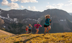
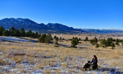
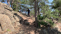
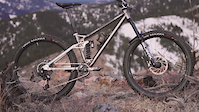
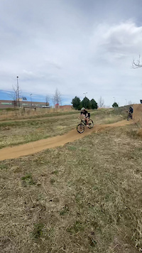
Photos of Boulder Mountain Bike
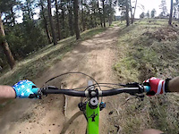
Videos of Boulder Mountain Bike

trail: Valmont Paved Pumptrack
0:09 |
22 |
Jan 10, 2026

trail: Deadass
0:24 |
85 |
Jan 12, 2024
trail: David Lee Roth
0:08 |
328 |
Nov 8, 2023

trail: Slopestyle L
0:23 |
57 |
Nov 8, 2023
trail: Lefthand Access 2
0:29 |
|
Mar 4, 2023

trail: Lefthand Access 1
0:29 |
|
Mar 3, 2023
trail: Valmont Paved Pumptrack
0:05 |
|
Mar 28, 2022
trail: Hot Lap
4:02 |
314 |
Jun 3, 2020
Recent Trail Reports
| status | trail | date | condition | info | user |
|---|---|---|---|---|---|
| Mayhoffer-Singletree | Jun 28, 2026 @ 8:46am (America/Denver) 12 hours | Ideal | CraigiBWrwZ | ||
| Benjamin Loop | Jun 28, 2026 @ 8:58am (America/Denver) 12 hours | Ideal | TimIl23DW | ||
| Loop Link | Jun 28, 2026 @ 8:58am (America/Denver) 12 hours | Ideal | TimIl23DW | ||
| Fourmile Link | Jun 27, 2026 @ 9:22am (America/Denver) 1 day | Ideal | CullenaYpnze | ||
| Betasso Link | Jun 26, 2026 @ 5:20pm (America/Denver) 2 days | Ideal | tshralper | ||
| Multi-Use Trail | Jun 23, 2026 @ 9:21am (America/Denver) Jun 23, 2026 | Variable | CraigiBWrwZ | ||
| Cowdrey Draw | Jun 21, 2026 @ 7:25am (America/Denver) Jun 21, 2026 | Ideal | TimIl23DW | ||
| Greenbelt Plateau | Jun 21, 2026 @ 7:25am (America/Denver) Jun 21, 2026 | Ideal | TimIl23DW | ||
| High Plains | Jun 21, 2026 @ 7:25am (America/Denver) Jun 21, 2026 | Ideal | TimIl23DW | ||
| Meadowlark Trail | Jun 21, 2026 @ 7:25am (America/Denver) Jun 21, 2026 | Ideal | TimIl23DW |
Activity Feed
| username | action | type | title | date |
|---|---|---|---|---|
| deaconb | add | photo | activity #98038564 and 3 more | Jun 28, 2026 @ 6:20pm 1 hours |
| CraigiBWrwZ | add | report | activity #98036078 | Jun 28, 2026 @ 5:27pm 2 hours |
| TimIl23DW | add | report | activity #98022114 and 1 more | Jun 28, 2026 @ 1:51pm 6 hours |
| CullenaYpnze | add | report | activity #97933030 | Jun 27, 2026 @ 1:28pm 1 day |
| tkoester | ridden | trail | activity #97874970 | Jun 26, 2026 @ 8:54pm 2 days |
Recent Comments
| username | type | title | comment | date |
|---|---|---|---|---|
| trail | Not sure what this used to be like, but now... | Jun 13, 2026 @ 3:08pm Jun 13, 2026 | ||
| trail | “What trails do you want to do... | Jun 2, 2026 @ 11:51am Jun 2, 2026 | ||
| report | Marshall mesa and Dowdy all dry and running great | Apr 19, 2026 @ 10:05am Apr 19, 2026 | ||
| trail | Shit rips | Apr 14, 2026 @ 9:37am Apr 14, 2026 | ||
| trail | Rode it today! Boring af maybe a black | Apr 12, 2026 @ 2:54pm Apr 12, 2026 |
Local Badges
-

Completionist0 awarded -

Epic Ride 50k10,413 awarded -

Top 10 Trails53 awarded -

10 Black Trails635 awarded -

10 Expert Trails103 awarded -
Completionist0 awarded
Bike & Skill Parks
| name | type | city | rating |
|---|---|---|---|
| Valmont Bike Park | skill park | Boulder |
Activity Type Stats
| activitytype | trails | distance | descent | descent distance | total vertical | rating | global rank | state rank | photos | reports | routes | ridelogs |
|---|---|---|---|---|---|---|---|---|---|---|---|---|
| Mountain Bike | 240 | 171 miles | 23,806 ft | 75 miles | 3,123 ft | #87 | #32 | 464 | 11,187 | 34 | 142,694 | |
| E-Bike | 106 | 97 miles | 4,941 ft | 41 miles | 3,123 ft | #1,042 | #805 | 7,173 | 2 | 4,616 | ||
| Gravel Bike | 1 | #106 | #381 | 60 | 6 | 1,909 | ||||||
| Horse | 123 | 96 miles | 13,688 ft | 44 miles | 2,979 ft | #259 | #442 | 1,638 | 17 | 7 | ||
| Hike | 371 | 270 miles | 47,106 ft | 118 miles | 3,409 ft | #107 | #62 | 114 | 9,794 | 36 | 21,389 | |
| Trail Running | 380 | 270 miles | 47,106 ft | 118 miles | 3,409 ft | #163 | #70 | 2 | 9,794 | 32 | 24,409 | |
| Dirtbike/Moto | 2 | 7 miles | 1,260 ft | 5 miles | 791 ft | 1,257 | 1 | 23 | ||||
| Observed Trials | 2 | 7 miles | 1,260 ft | 5 miles | 791 ft | 33 | 4 | |||||
| ATV/ORV/OHV | 2 | 7 miles | 1,260 ft | 5 miles | 791 ft | 1,257 | 1 | |||||
| Snowshoe | 1 | 899 ft | 43 ft | 3 | 17 | 25 |
Frequently Asked Questions About Boulder
▼
What are the best places to ride in Boulder?
Boulder has 15 areas to explore for mountain biking. The top rated areas are:
▼
What are the highest rated mountain biking trails in Boulder?
The highest rated mountain biking trails in Boulder are:
- Slopestyle L (4.6/5)
- Corkscrew (4.5/5)
- GZA (4.5/5)
- Brown Town (4.4/5)
- Fourmile Link (4.3/5)
▼
What is the best time of the year to ride in Boulder?
Based on ride log data, the most popular months to ride in Boulder are:
- July (531 activities)
- June (336 activities)
- August (328 activities)
▼
Where can I park to ride in Boulder?
Activities
Trails
Points of Interest
- Eldorado Canyon Visitor Center Information
- Reflection Point Viewpoint
- Anemone Point Viewpoint
- Mallory Cave Sight
- Royal Arch Viewpoint
- Shelter Cabin
- Crags Hotel Ruins Sight
- Continental Divide Overlook Viewpoint
- Shirttall Peak Summit
- South Boulder Peak Summit
- Scar Top Mountain (8,776 ft)
- Twin Sisters Peak (8,694 ft)
- South Boulder Peak (8,543 ft)
- By canadaka
 Trailforks & contributors
 - Admins: BMA, IMBA, WendyBMA, BMA, mattoid, amrosen, getvert, mpopetz, Pumpntrail, andrewbikeboulder
- #4922 - 40,873 views
- boulder activity log | embed map of Boulder mountain bike trails | boulder mountain biking points of interest
Downloading of trail gps tracks in kml & gpx formats is enabled for Boulder.
You must login to download files.