close
-
Layers w
- Weather Layers
- Pro
- Pro
- Pro
- Pro
- Pro
- Pro
- More Layers
- Pro
- Pro
- Pro
- Pro
-
Upgrade to

3D
Trail Conditions
- Unknown
- Snow Groomed
- Snow Packed
- Snow Covered
- Snow Cover Partial
- Freeze/thaw Cycle
- Icy
- Prevalent Mud
- Wet
- Variable
- Ideal
- Dry
- Very Dry
Trail Flow (Ridden Direction)
Trailforks scans users ridelogs to determine the most popular direction each trail is ridden. A good flowing trail network will have most trails flowing in a single direction according to their intension.
The colour categories are based on what percentage of riders are riding a trail in its intended direction.
The colour categories are based on what percentage of riders are riding a trail in its intended direction.
- > 96%
- > 90%
- > 80%
- > 70%
- > 50%
- < 50%
- bi-directional trail
- no data
Trail Last Ridden
Trailforks scans ridelogs to determine the last time a trail was ridden.
- < 2 days
- < 1 week
- < 2 weeks
- < 1 month
- < 6 months
- > 6 months
Trail Ridden Direction
The intended direction a trail should be ridden.
- Downhill Only
- Downhill Primary
- Both Directions
- Uphill Primary
- Uphill Only
- One Direction
Contribute Details
Colors indicate trail is missing specified detail.
- Description
- Photos
- Description & Photos
- Videos
Trail Popularity ?
Trailforks scans ridelogs to determine which trails are ridden the most in the last 9 months.
Trails are compared with nearby trails in the same city region with a possible 25 colour shades.
Think of this as a heatmap, more rides = more kinetic energy = warmer colors.
- most popular
- popular
- less popular
- not popular
ATV/ORV/OHV Filter
Max Vehicle Width
inches
US Cell Coverage
Legend

Radar Time
Activity Recordings
Trailforks uses anonymized public activity data.
?
Activity Recordings
Trailforks uses anonymized public activity data.
?
Personal Heatmap
▶
Activity Types
all
/
none
▶
Options
2
Date range
month
–
Winter Trails
Warning
A routing network for winter maps does not exist. Selecting trails using the winter trails layer has been disabled.
Missing Trails
Most Popular
Least Popular
Trails are colored based on popularity. The more popular a trail is, the more red. Less popular trails trend towards green.
Jump Magnitude Heatmap
Heatmap of where riders jump on trails. Zoom in to see individual jumps, click circles to view jump details.
BC Backroad Status
![map legend]()
Service Road Atlas is a free to use, community-driven service for viewing and creating reports on the numerous back-country service roads around B.C. and Alberta.

Slope Aspect
Direction the slope faces
Trails Deemphasized
Trails are shown in grey.
Only show trails with no bike usage.
Suggested Layers
Based on selected activity type
Save the current map location and zoom level as your default home location whenever this page is loaded.
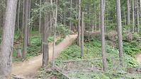
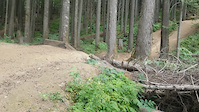
SaveThe Boulder Mountain trails are mainly downhill oriented. Fast and furious. Most people use the logging roads to shuttle to the tops of the trails then enjoy the downhill riding.
Primary Trail Type: All-Mountain & Downhill
eBikes Allowed:
Yes
Shuttleable: YES
 google parking directions
 Access Info:
From Revelstoke go west on the TCH, turn north on on Westside Road where Hwy 23 goes south (first lights) and drive for 5.5 km to Boulder Mountain FSR ( where the Snowmobile Club Welcome Center is). Turn left on Boulder Mountain FSR and drive 1 km to the parking area on the left just over the bridge. Park here and ride up or leave a vehicle here and shuttle. Home Run trail will get you back to this parking lot.
Activities Click to view
- Mountain Bike
29 trails
- E-Bike
28 trails
- Horse
1 trails
- Hike
18 trails
- Trail Running
18 trails
Region Details
- 7
- 5
- 11
- 5
Region Status
Caution as of Jun 12, 2026Stats
- Avg Trail Rating
- Trails (view details)
- 28
- Trails Mountain Bike
- 30
- Trails E-Bike
- 28
- Trails Horse
- 1
- Trails Hike
- 18
- Trails Trail Running
- 18
- Trails Dirtbike/Moto
- 1
- Trails ATV/ORV/OHV
- 2
- Trails Snowmobile
- 1
- Total Distance
- 24 miles
- Total Descent
- 9,729 ft
- Total Vertical
- 3,947 ft
- Highest Trailhead
- 5,451 ft
- Reports
- 759
- Photos
- 306
- Ridden Counter
- 23,362
Popular Boulder Mountain Mountain Biking Trails
• 100 ★ 3.5 • 1,493 ft • 14 ft • 2,862 •
This trail connects you to the Boulder parking lot. Steep and rooty in a couple sections, and largely flat and pedally in the middle. There are 2 optional small gap jumps.
• 100 ★ 3.6 • 876 ft • 9 ft • 2,176 •
Take a right off along a ridge with some techy roots. Then drops down into flowy berms and small table jumps.
• 100 ★ 4.2 • 4,534 ft • 43 ft • 2,119 •
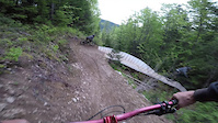
Flowy machine built trail that starts in a cut block with great views of Revy. Berms, rollers and a few tables the whole way down make it a fast, smooth trail that's great for a warm up lap. Loose dirt in the cut block gives way to hero...
• 95 ★ 4.4 • 4,610 ft • 24 ft • 1,560 •
A fast, brakes off trail through old growth with plenty of fun little jumps and a couple bigger optional ones. Ride arounds on everything. It has some crazy, old secret stunts for viewing pleasure along the way.
• 95 ★ 4.9 • 4,186 ft • 6 ft • 1,472 •
is moderately technical with lots of roots, and loamy dirt that might get stuck on your goggles. Watch out for the Hot Dog Hallway jumps which get progressively larger as you descend. Make some noise when you drop-in and DO NOT PUSH...
• 100 ★ 4.3 • 915 ft • 0 ft • 1,436 •
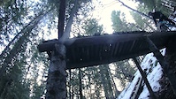
is a freeride zone with jumps and drops of various sizes. Remember to scout all features before you drop in.
• 90 ★ 4.8 • 2,051 ft • 0 ft • 1,401 •
Fast, steep, rooty, & loose! Steeper than the lower part of . Note: Hot Dog Hallway was rebuilt in October 2024. Please ride slowly your first time down until you're comfortable with the new line.
• 100 ★ 4.9 • 2,196 ft • 29 ft • 1,371 •
The main trail is only single black, but some of the optional stunts are double black. Mix of flow, rooty steep sections, and jumps. Optional TTFs include: a large drop, wall ride jump, and gap jump.
Boulder Mountain Mountain Bike Routes
★ 5.0 • 7 miles • 1,474 ft • 2 •
The first 2 trails you should probably ride on Boulder. Most shuttle but the climb is mellow to ride these...
7 miles • 1,498 ft • 5 •
18 miles • 4,949 ft • 9 •
No Shuttling on Boulder!!!!! Short Course Day 2 - stages 4,6,7
39 miles • 11,611 ft • 22 • Loop •
Route aimed at riding all trails on trail forks. I started from the Big Eddy Side, into logging left...
19 miles • 4,044 ft • 9 •
No Shuttling on Boulder!!!!! Short Course - Stage 1 only
★ 4.0 • 25 miles • 6,255 ft • 47 • Loop • Race •
STAGE ORDER (This is the Sequence Which You Will Ride The Stages In) U21 and U15 = 1,2,3,4 21-29 Men =...
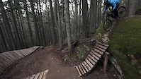
Photos of Boulder Mountain Mountain Bike
Videos of Boulder Mountain Mountain Bike
trail: Snakes & Ladders
0:15 |
10 |
Jun 4, 2026
trail: Cash Advance
0:17 |
13 |
Oct 20, 2025
trail: Gravy Bacon
0:27 |
42 |
Nov 11, 2024
trail: Gravy Bacon
0:32 |
8 |
Nov 11, 2024
trail: Boondocker
0:10 |
80 |
Mar 10, 2022
trail: Boondocker
0:07 |
58 |
Mar 10, 2022
trail: Loggin' Leftovers
0:01 |
1881 |
Dec 5, 2021
trail: Man Quads
0:05 |
283 |
Nov 28, 2021
Recent Trail Reports
| status | trail | date | condition | info | user |
|---|---|---|---|---|---|
| Loggin' Leftovers | Jun 12, 2026 @ 5:23pm (America/Vancouver) Jun 12, 2026 | Ideal | bigmanbaz | ||
| Iron Lotus | Jun 11, 2026 @ 6:30pm (America/Vancouver) Jun 11, 2026 | Ideal | efx888 | ||
| Man Quads | Jun 11, 2026 @ 6:28pm (America/Vancouver) Jun 11, 2026 | Ideal | efx888 | ||
| Rednecks Revenge | Jun 10, 2026 @ 9:55pm (America/Vancouver) Jun 10, 2026 | Unknown | SkarpLord | ||
| School's Out! | Jun 6, 2026 @ 4:34pm (America/Vancouver) Jun 6, 2026 | Ideal | benkwia | ||
| Access Road | Jun 6, 2026 @ 4:29pm (America/Vancouver) Jun 6, 2026 | Ideal | benkwia | ||
| Tall Timber | Jun 4, 2026 @ 7:29pm (America/Vancouver) Jun 4, 2026 | Unknown | axcooper RCA | ||
| The Detention Centre | Jun 4, 2026 @ 8:57am (America/Vancouver) Jun 4, 2026 | Ideal | bigmanbaz | ||
| Sisyphus | Jun 2, 2026 @ 6:07pm (America/Vancouver) Jun 2, 2026 | Ideal | axcooper RCA | ||
| Gravy Bacon | May 29, 2026 @ 12:25pm (America/Vancouver) May 29, 2026 | Ideal | bigmanbaz |
Activity Feed
| username | action | type | title | date |
|---|---|---|---|---|
| andi1983 | ridden | trail | activity #97558873 | Jun 22, 2026 @ 6:59am 17 hours |
| enjoiashely | wishlist | trail | activity #97522534 | Jun 21, 2026 @ 2:48pm 1 day |
| riderenew72 | add | karma | activity #97402890 | Jun 20, 2026 @ 9:11am 3 days |
| JSnFdzlP | wishlist | trail | activity #97269618 | Jun 18, 2026 @ 12:26pm Jun 18, 2026 |
| ChristopherZITjx | ridden | trail | activity #97231434 | Jun 17, 2026 @ 9:28pm Jun 17, 2026 |
Recent Comments
| username | type | title | comment | date |
|---|---|---|---|---|
| trail | Still under snow | Apr 5, 2026 @ 5:52pm Apr 5, 2026 | ||
| report | C C R. Could ppo O lpp playing every w | Oct 2, 2025 @ 11:34am Oct 2, 2025 | ||
| report | Z | Sep 26, 2025 @ 12:46pm Sep 26, 2025 | ||
| trail | I | Aug 24, 2025 @ 5:39am Aug 24, 2025 | ||
| trail | Legitimately the best and most beautiful... | Aug 21, 2025 @ 11:34pm Aug 21, 2025 |
Nearby Areas
| name | distance | ||||
|---|---|---|---|---|---|
| Mount Revelstoke National Park | 1 | 4 | 2.3 km | ||
| Greenbelt/Flats | 13 | 3 km | |||
| City/Greenbelt Trails | 3.2 km | ||||
| Frisby | 3 | 1 | 1 | 3.6 km | |
| Mount Macpherson | 23 | 44 | 21 | 4 km |
Local Badges
-

Completionist6 awarded
Bike & Skill Parks
| name | type | city | rating |
|---|---|---|---|
| Detention Center | skill park | Revelstoke |
Upcoming Local Events
Local Trail Supporters
- Miranda Murphy Inc., CPA
- Cronometer
![]()
- Revelstoke Suspension Services
- Jake & Jay Construction
- Nakimu Ventures
- Jake-Jay Construction
![Rocky Mountain Bicycles]()
Local Trail Supporters
- Miranda Murphy Inc., CPA
- Cronometer
![]()
- Revelstoke Suspension Services
- Jake & Jay Construction
- Nakimu Ventures
- Jake-Jay Construction
![Rocky Mountain Bicycles]()
Activity Type Stats
| activitytype | trails | distance | descent | descent distance | total vertical | rating | global rank | state rank | photos | reports | routes | ridelogs |
|---|---|---|---|---|---|---|---|---|---|---|---|---|
| Mountain Bike | 29 | 24 miles | 9,728 ft | 11 miles | 3,947 ft | #890 | #75 | 306 | 762 | 12 | 11,164 | |
| E-Bike | 28 | 19 miles | 9,629 ft | 11 miles | 1,998 ft | #2,912 | #97 | 729 | 2 | 412 | ||
| Horse | 1 | 6 miles | 272 ft | 1 mile | 1,998 ft | #634 | #17 | 279 | 2 | |||
| Hike | 18 | 20 miles | 7,021 ft | 8 miles | 3,947 ft | #5,542 | #233 | 659 | 178 | |||
| Trail Running | 18 | 20 miles | 7,021 ft | 8 miles | 3,947 ft | #4,683 | #161 | 657 | 32 | |||
| Dirtbike/Moto | 1 | 6 miles | 272 ft | 1 mile | 1,998 ft | #73 | 253 | 34 | ||||
| ATV/ORV/OHV | 2 | 11 miles | 371 ft | 2 miles | 3,947 ft | #42 | 254 | 8 | ||||
| Snowmobile | 1 | 5 miles | 98 ft | 3,123 ft | 1,952 ft | 5 |
Frequently Asked Questions About Boulder Mountain
▼
What are the highest rated mountain biking trails in Boulder Mountain?
The highest rated mountain biking trails in Boulder Mountain are:
- Boondocker (4.7/5)
- Upper Boondocker (4.7/5)
- Gravy Bacon (4.7/5)
- Rednecks Revenge (4.6/5)
- Cash Advance (4.5/5)
▼
What is the best time of the year to ride in Boulder Mountain?
Based on ride log data, the most popular months to ride in Boulder Mountain are:
- June (155 activities)
- July (134 activities)
- August (89 activities)
▼
Where can I park to ride in Boulder Mountain?
There are 2 parking locations listed in Boulder Mountain. The most popular parking spots are:
▼
What is the longest trail in Boulder Mountain?
The longest trail in Boulder Mountain is Sisyphus at 3.2 km. View all trails sorted by distance.
Activities
Trails
Points of Interest
- By ankhou
 & contributors
 - Admins: RCA, RNSC, RCA
- #4144 - 45,825 views
- boulder mountain activity log | embed map of Boulder Mountain mountain bike trails | boulder mountain mountain biking points of interest
Downloading of trail gps tracks in kml & gpx formats is enabled for Boulder Mountain.
You must login to download files.