close
-
Layers w
- Weather Layers
- Pro
- Pro
- Pro
- Pro
- Pro
- Pro
- More Layers
- Pro
- Pro
- Pro
- Pro
-
Upgrade to

3D
Trail Conditions
- Unknown
- Snow Groomed
- Snow Packed
- Snow Covered
- Snow Cover Partial
- Freeze/thaw Cycle
- Icy
- Prevalent Mud
- Wet
- Variable
- Ideal
- Dry
- Very Dry
Trail Flow (Ridden Direction)
Trailforks scans users ridelogs to determine the most popular direction each trail is ridden. A good flowing trail network will have most trails flowing in a single direction according to their intension.
The colour categories are based on what percentage of riders are riding a trail in its intended direction.
The colour categories are based on what percentage of riders are riding a trail in its intended direction.
- > 96%
- > 90%
- > 80%
- > 70%
- > 50%
- < 50%
- bi-directional trail
- no data
Trail Last Ridden
Trailforks scans ridelogs to determine the last time a trail was ridden.
- < 2 days
- < 1 week
- < 2 weeks
- < 1 month
- < 6 months
- > 6 months
Trail Ridden Direction
The intended direction a trail should be ridden.
- Downhill Only
- Downhill Primary
- Both Directions
- Uphill Primary
- Uphill Only
- One Direction
Contribute Details
Colors indicate trail is missing specified detail.
- Description
- Photos
- Description & Photos
- Videos
Trail Popularity ?
Trailforks scans ridelogs to determine which trails are ridden the most in the last 9 months.
Trails are compared with nearby trails in the same city region with a possible 25 colour shades.
Think of this as a heatmap, more rides = more kinetic energy = warmer colors.
- most popular
- popular
- less popular
- not popular
ATV/ORV/OHV Filter
Max Vehicle Width
inches
US Cell Coverage
Legend

Radar Time
Activity Recordings
Trailforks uses anonymized public activity data.
?
Activity Recordings
Trailforks uses anonymized public activity data.
?
Personal Heatmap
▶
Activity Types
all
/
none
▶
Options
2
Date range
month
–
Winter Trails
Warning
A routing network for winter maps does not exist. Selecting trails using the winter trails layer has been disabled.
Missing Trails
Most Popular
Least Popular
Trails are colored based on popularity. The more popular a trail is, the more red. Less popular trails trend towards green.
Jump Magnitude Heatmap
Heatmap of where riders jump on trails. Zoom in to see individual jumps, click circles to view jump details.
BC Backroad Status
![map legend]()
Service Road Atlas is a free to use, community-driven service for viewing and creating reports on the numerous back-country service roads around B.C. and Alberta.

Slope Aspect
Direction the slope faces
Trails Deemphasized
Trails are shown in grey.
Only show trails with no bike usage.
Suggested Layers
Based on selected activity type
Save the current map location and zoom level as your default home location whenever this page is loaded.
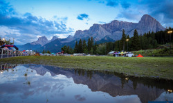
SaveBow Valley is a valley located along the upper Bow River. Lake Louise and Banff.
Activities Click to view
- Mountain Bike
324 trails
- E-Bike
136 trails
- Horse
47 trails
- Hike
598 trails
- Trail Running
600 trails
- Snowmobile
5 trails
- Snowshoe
112 trails
- Backcountry Ski
15 trails
- Nordic Ski
76 trails
Stats
- Avg Trail Rating
- Trails (view details)
- 626
- Trails Mountain Bike
- 324
- Trails E-Bike
- 136
- Trails Winter Fat Bike
- 2
- Trails Horse
- 47
- Trails Hike
- 598
- Trails Trail Running
- 600
- Trails Snowmobile
- 5
- Trails Snowshoe
- 112
- Trails Backcountry Ski
- 15
- Trails Nordic Ski
- 76
- Total Distance
- 790 miles
- Total Descent
- 125,278 ft
- Total Vertical
- 6,156 ft
- Highest Trailhead
- 10,306 ft
- Reports
- 6,352
- Photos
- 2,231
- Ridden Counter
- 196,964
Articles
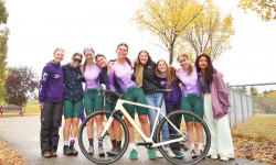
How the Canmore Women’s Enduro Turned a Local Race Into a Community Movement
Dec 2, 2025 from pinkbike.com
What began as an inclusive local enduro has grown into Peak Pursuits, one of Canada’s fastest-growing all-female cycling teams.
Race Report: Rockies 24 in Canmore Alberta
Aug 7, 2025 from pinkbike.com
Riders from across the globe ventured to Canada's Rocky Mountains in search of some prime XC racing.
Highlight Video: A Very Wet 2025 Canmore Enduro
Jul 25, 2025 from pinkbike.com
An unusually rainy summer for Alberta made for a wet and wild race.
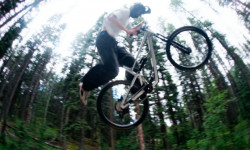
Video: Josh Holte Pushes the New Ripmo AF To The Limit On Canmore's Finest Trails
Jul 22, 2025 from pinkbike.com
It seems that the bigger the pants, the more steeze you have these days.
Popular Trail Networks
view all areas »Sub Regions
- Canmore (293)
- Exshaw (47)
- Barrier Lake (16)
- Exshaw Mountain (25)
- Sibbald Lake (7)
Popular Bow Valley Mountain Biking Trails
• 100 ★ 4.5 • 2 miles • 249 ft • 3,461 •
A great new trail that climbs up from the meadow to the top of T2 (providing an additional access to that area). The downtrack is buff and well bermed. Good in winter as well
• 100 ★ 4.1 • 2,225 ft • 38 ft • 3,357 •
A short, fun connector trail from and George Town Interpretive to the Canmore Trail. It flows well in both directions and features a couple of wide, low bridges and a short section of baby head rocks.
• 100 ★ 4.6 • 1,391 ft • 0 ft • 2,759 •
Berms, jumps, rollers and doubles. Try it, you'll like it!
• 100 ★ 4.0 • 643 ft • 0 ft • 2,718 •
Built for a race, this short, bermy downhill is a fun ride. by the road beside it, down from or up from Lower Mad Haandler.
• 100 ★ 4.5 • 5,118 ft • 11 ft • 2,652 •
A long flowy rollercoaster down from towards the trail. Recently (2018 ) extended to parallel the paved trail to the entrance to the Biathalon stadium.
Bow Valley Mountain Bike Routes
★ 3.0 • 4 miles • 810 ft • 4 • Loop •
Loop is a regional favorite. Well built with more drops, tech, and slab than is common for this area. The...
★ 4.0 • 5 miles • 650 ft • 3 • Loop •
ORANGE LOOP: 7.5 km (mainly single track) • The CNC’s most popular trail. • Best ridden clockwise...
★ 5.0 • 14 miles • 2,864 ft • 8 •
The newest Pedal for Pints loop, starting at Quarry Lake parking lot, going up Highline for a full west to...
★ 5.0 • 8 miles • 1,030 ft • 9 •
Have fun exploring the awesome single track up at the Nordic Center! Mostly climbing to start, with some...
★ 5.0 • 36 miles • 870 ft • 7 • Loop •
This is a great option for a one-way loop from Canmore to Banff and back to Canmore. Mostly downhill...
★ 5.0 • 11 miles • 1,472 ft • 9 • Loop •
To distinguish from the already-existing ‘ where this route uses additional trail segments than the...
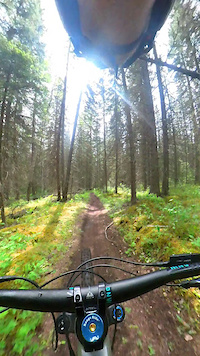
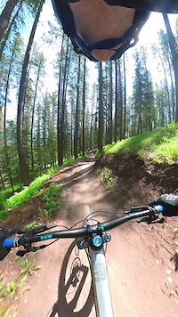
Photos of Bow Valley Mountain Bike
Videos of Bow Valley Mountain Bike
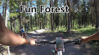
trail: Fun Forest
0:06 |
93 |
Aug 2, 2024
trail: No Homers Connector
0:09 |
36 |
Jun 30, 2024
trail: Soft Yoghurt
0:13 |
55 |
Jun 30, 2024
0:11 |
316 |
Apr 4, 2024
trail: Dropasauras Rex
0:12 |
238 |
Sep 15, 2021
0:13 |
118 |
Jul 19, 2021
trail: Canmore Trail
0:07 |
162 |
Mar 21, 2021

trail: Lower Prospector Climb
0:31 |
112 |
Dec 10, 2020
Current Trail Warnings
| status | trail | date | condition | user | info |
|---|---|---|---|---|---|
| Long Road to Ruin Canmore Nordic Centre | Jun 16, 2026 @ 12:58pm (America/Edmonton) Jun 16, 2026 | Ideal | gmkayaker | tree down | |
| Guy Lafleur Three Sisters Mountain Village | Jun 15, 2026 @ 5:05pm (America/Edmonton) Jun 15, 2026 | Unknown | HungleP | East access bridge from Deadman’s is... | |
| Loki's Three Sisters Mountain Village | Jun 15, 2026 @ 5:01pm (America/Edmonton) Jun 15, 2026 | Unknown | HungleP | Wildlife fence cuts through the middle of... |
Recent Trail Reports
Activity Feed
| username | action | type | title | date |
|---|---|---|---|---|
| Zemu | comment | trail | activity #97400613 | Jun 20, 2026 @ 8:51am 2 hours |
| Zemu | comment | trail | activity #97399578 | Jun 20, 2026 @ 8:39am 2 hours |
| Zemu | comment | trail | activity #97398007 | Jun 20, 2026 @ 8:23am 3 hours |
| Zemu | add | report | activity #97394068 and 4 more | Jun 20, 2026 @ 7:41am 3 hours |
| Nataliap25 | add | report | activity #97358540 and 3 more | Jun 19, 2026 @ 6:17pm 17 hours |
Recent Comments
| username | type | title | comment | date |
|---|---|---|---|---|
| trail | Although legal for bike traffic, the very last... | Jun 20, 2026 @ 8:51am 2 hours | ||
| trail | Not a technical trail but a wonderful romp... | Jun 20, 2026 @ 8:39am 2 hours | ||
| trail | Although not a technical trail, this is a... | Jun 20, 2026 @ 8:23am 3 hours | ||
| trail | it's just one rock roll/drop but it's fun for... | Jun 17, 2026 @ 8:28pm 3 days | ||
| trail | Just a damn great trail. | Jun 16, 2026 @ 5:56am Jun 16, 2026 |
Local Badges
-

Epic Ride 50k1,592 awarded -

Completionist8 awarded -

Top 10 Trails62 awarded -
Epic Ride 50k114 awarded -
Completionist0 awarded -

Big Ride 30k226 awarded
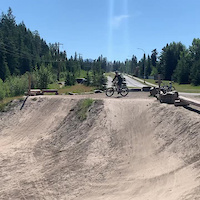
Bike & Skill Parks
| name | type | city | rating |
|---|---|---|---|
| Canmore Nordic Center Bike Skills Park | skill park | Canmore | |
| Millennium Mountain Bike Skills Park | skill park | Canmore | |
| Benchlands Skills Park | skill park | Canmore | |
| Quarry Lake Drop Zone | skill park | Canmore | |
| Benchlands Drop Zone | skill park | Canmore |
Local Products
Local Trail Supporters
![Smith Optics]()
- Friends of Kananaskis Country
Activity Type Stats
| activitytype | trails | distance | descent | descent distance | total vertical | rating | global rank | state rank | photos | reports | routes | ridelogs |
|---|---|---|---|---|---|---|---|---|---|---|---|---|
| Mountain Bike | 324 | 374 miles | 55,440 ft | 164 miles | 5,791 ft | 2,060 | 6,180 | 152 | 121,362 | |||
| E-Bike | 136 | 98 miles | 14,006 ft | 45 miles | 2,730 ft | 3 | 4,771 | 11 | 5,032 | |||
| Winter Fat Bike | 2 | 32 | 15 | 147 | ||||||||
| Horse | 47 | 58 miles | 6,713 ft | 24 miles | 1,827 ft | 1,632 | 29 | |||||
| Hike | 598 | 761 miles | 122,503 ft | 257 miles | 6,158 ft | 113 | 6,149 | 14 | 19,239 | |||
| Trail Running | 600 | 761 miles | 122,769 ft | 258 miles | 6,158 ft | 3 | 6,149 | 22 | 19,467 | |||
| Snowmobile | 5 | 5 miles | 666 ft | 2 miles | 696 ft | 155 | 2 | |||||
| Snowshoe | 112 | 157 miles | 28,022 ft | 48 miles | 6,010 ft | 184 | 4 | 183 | ||||
| Backcountry Ski | 15 | 23 miles | 2,615 ft | 7 miles | 5,285 ft | 162 | 3 | 2,317 | ||||
| Nordic Ski | 76 | 94 miles | 10,033 ft | 38 miles | 2,428 ft | 18 | 169 | 3 | 17,443 |
Frequently Asked Questions About Bow Valley
▼
What are the best places to ride in Bow Valley?
Bow Valley has 14 areas to explore for mountain biking. The top rated areas are:
▼
What are the highest rated mountain biking trails in Bow Valley?
The highest rated mountain biking trails in Bow Valley are:
- Cloudline (4.6/5)
- Lower Prospector Descent (4.5/5)
- EKG (4.5/5)
- Razors Edge (4.5/5)
- Soft Yoghurt (4.5/5)
▼
What is the best time of the year to ride in Bow Valley?
Based on ride log data, the most popular months to ride in Bow Valley are:
- July (2,306 activities)
- June (1,568 activities)
- August (1,536 activities)
▼
What is the longest trail in Bow Valley?
The longest trail in Bow Valley is Stoney Trail at 19.3 km. View all trails sorted by distance.
Activities
Trails
Points of Interest
- By canadaka
 Trailforks & contributors
 - Admins: AEF, Canadmos, warrenmacdonald, BVMBA, AlbertaParks
- #4697 - 18,236 views
- bow valley activity log | embed map of Bow Valley mountain bike trails | bow valley mountain biking points of interest polygons
Downloading of trail gps tracks in kml & gpx formats is enabled for Bow Valley.
You must login to download files.