close
-
Layers w
- Weather Layers
- Pro
- Pro
- Pro
- Pro
- Pro
- Pro
- More Layers
- Pro
- Pro
- Pro
- Pro
-
Upgrade to

3D
Trail Conditions
- Unknown
- Snow Groomed
- Snow Packed
- Snow Covered
- Snow Cover Partial
- Freeze/thaw Cycle
- Icy
- Prevalent Mud
- Wet
- Variable
- Ideal
- Dry
- Very Dry
Trail Flow (Ridden Direction)
Trailforks scans users ridelogs to determine the most popular direction each trail is ridden. A good flowing trail network will have most trails flowing in a single direction according to their intension.
The colour categories are based on what percentage of riders are riding a trail in its intended direction.
The colour categories are based on what percentage of riders are riding a trail in its intended direction.
- > 96%
- > 90%
- > 80%
- > 70%
- > 50%
- < 50%
- bi-directional trail
- no data
Trail Last Ridden
Trailforks scans ridelogs to determine the last time a trail was ridden.
- < 2 days
- < 1 week
- < 2 weeks
- < 1 month
- < 6 months
- > 6 months
Trail Ridden Direction
The intended direction a trail should be ridden.
- Downhill Only
- Downhill Primary
- Both Directions
- Uphill Primary
- Uphill Only
- One Direction
Contribute Details
Colors indicate trail is missing specified detail.
- Description
- Photos
- Description & Photos
- Videos
Trail Popularity ?
Trailforks scans ridelogs to determine which trails are ridden the most in the last 9 months.
Trails are compared with nearby trails in the same city region with a possible 25 colour shades.
Think of this as a heatmap, more rides = more kinetic energy = warmer colors.
- most popular
- popular
- less popular
- not popular
ATV/ORV/OHV Filter
Max Vehicle Width
inches
US Cell Coverage
Legend

Radar Time
Activity Recordings
Trailforks uses anonymized public activity data.
?
Activity Recordings
Trailforks uses anonymized public activity data.
?
Personal Heatmap
▶
Activity Types
all
/
none
▶
Options
2
Date range
month
–
Winter Trails
Warning
A routing network for winter maps does not exist. Selecting trails using the winter trails layer has been disabled.
Missing Trails
Most Popular
Least Popular
Trails are colored based on popularity. The more popular a trail is, the more red. Less popular trails trend towards green.
Jump Magnitude Heatmap
Heatmap of where riders jump on trails. Zoom in to see individual jumps, click circles to view jump details.
BC Backroad Status
![map legend]()
Service Road Atlas is a free to use, community-driven service for viewing and creating reports on the numerous back-country service roads around B.C. and Alberta.

Slope Aspect
Direction the slope faces
Trails Deemphasized
Trails are shown in grey.
Only show trails with no bike usage.
Suggested Layers
Based on selected activity type
Save the current map location and zoom level as your default home location whenever this page is loaded.
Save
No description for Boxford has been added yet!
Login or register to submit one.
Activities Click to view
- Mountain Bike
287 trails
- E-Bike
9 trails
- Gravel Bike
0 trails
- Adaptive Bike
0 trails
- Winter Fat Bike
0 trails
- Horse
86 trails
- Hike
309 trails
- Trail Running
306 trails
- Snowshoe
127 trails
- Nordic Ski
109 trails
Region Details
- 43
- 2
- 193
- 41
- 6
Region Status
Caution as of 9 hoursStats
- Avg Trail Rating
- Trails (view details)
- 295
- Trails Mountain Bike
- 298
- Trails E-Bike
- 9
- Trails Horse
- 86
- Trails Hike
- 309
- Trails Trail Running
- 306
- Trails Snowshoe
- 127
- Trails Nordic Ski
- 109
- Total Distance
- 136 miles
- Total Descent
- 5,767 ft
- Total Vertical
- 252 ft
- Highest Trailhead
- 296 ft
- Reports
- 166
- Photos
- 63
- Ridden Counter
- 17,443
Sub Regions
-
100 Acre Woods
- 16
- 4
-
Baldpate Pond
- 13
- 4
-
Boxford Common
- 1
- 8
- 2
-
Boxford State Forest
- 69
- 8
- 3
-
Cleaveland Farm State Forest
- 13
- 2
- 2
-
Leonard Farm
- 2
-
Lockwood Forest
- 9
- 6
-
Lord Forest
- 10
-
Lord-Ericson Woods
- 5
-
Nason Conservation Land
- 6
-
Perkins Woods
- 6
- 5
-
Shaven Crown Hill
-
Wildcat Conservation Area
- 14
- 6
- 1
-
Windrush Farm
- 6
- 2
-
Witch Hollow
- 4
- 3
Popular Boxford Mountain Biking Trails
• 100 ★ 0.0 • 2,112 ft • 53 ft • 313 •
Popular green difficulty singletrack. This mountain bike primary trail can be used both directions. On average it takes 3 minutes to complete this trail.
• 90 ★ 0.0 • 1,916 ft • 34 ft • 290 •
Popular blue difficulty singletrack. This mountain bike primary trail can be used both directions. On average it takes 3 minutes to complete this trail.
• 90 ★ 0.0 • 1 mile • 63 ft • 287 •
Popular green difficulty doubletrack. This multi-use trail can be used both directions and has a easy overall physical rating with a 63 ft green climb. On average it takes 10 minutes to complete this trail.
• 100 ★ 0.0 • 584 ft • 21 ft • 251 •
Popular green difficulty singletrack. This mountain bike primary trail can be used both directions. On average it takes minutes to complete this trail.
• 100 ★ 0.0 • 840 ft • 14 ft • 231 •
Popular green difficulty singletrack. This mountain bike primary trail can be used both directions. On average it takes 1 minutes to complete this trail.
• 90 ★ 0.0 • 512 ft • 0 ft • 219 •
Popular green difficulty singletrack. This mountain bike primary trail can be used both directions. On average it takes minutes to complete this trail.
• 100 ★ 0.0 • 981 ft • 28 ft • 215 •
Popular green difficulty singletrack. This multi-use trail can be used both directions. On average it takes 1 minutes to complete this trail.
• 100 ★ 0.0 • 1,716 ft • 17 ft • 210 •
Easy trail leading from Route 97 to the back of Perkins Woods
Boxford Mountain Bike Routes
5 miles • 436 ft • 3 • Loop •
Starting at Lockwood parking area and riding a short section of road to Boxford State Forest. Route runs...
8 miles • 489 ft • 7 • Loop •
TTTTTTTTTTTTTTTTTTTTTTTTTTTTTTTTTTTTTTTTTTTTTTTTTTTTTTTTTTTTTT
9 miles • 428 ft • 9 • Loop •
Fun loop starting & ending at Park in Topsfield, MA
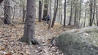
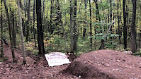
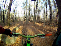
Photos of Boxford Mountain Bike
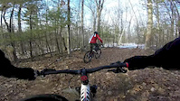
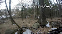
Videos of Boxford Mountain Bike
trail: Bald Hill
0:05 |
9 |
Apr 23, 2026
trail: 100 (BCT)
0:05 |
170 |
Dec 6, 2019

trail: 111
0:20 |
58 |
Jan 31, 2016
trail: 111
2:57 |
62 |
Jan 30, 2016
trail: 111
0:59 |
20 |
Jan 30, 2016

trail: 45
0:39 |
374 |
Nov 27, 2015
trail: 95
2:25 |
84 |
Nov 15, 2015

trail: Burning Bush Road Junction
0:46 |
64 |
Jul 6, 2015
Recent Trail Reports
| status | trail | date | condition | info | user |
|---|---|---|---|---|---|
| Old Forest St | Jun 21, 2026 @ 9:37am (America/New_York) 9 hours | Unknown | seddiejay | ||
| Fuller Trail | Jun 21, 2026 @ 9:37am (America/New_York) 9 hours | Dry | seddiejay | ||
| Track 023 | Dec 13, 2025 @ 1:06pm (America/New_York) Dec 13, 2025 | Ideal | glenzx | ||
| Sharpners Pond Road | Oct 18, 2025 @ 9:59am (America/New_York) Oct 18, 2025 | Ideal | jpm621 | ||
| Lynx Trail | Aug 2, 2025 @ 7:39pm Aug 2, 2025 | Ideal | Tommyrides74 | ||
| Middleton Road | Jul 21, 2025 @ 5:59pm Jul 21, 2025 | Ideal | jpm621 | ||
| ECG - Great Pond Drive | Jul 21, 2025 @ 5:59pm Jul 21, 2025 | Ideal | jpm621 | ||
| ECG - Georgetown Road | Jul 21, 2025 @ 5:59pm Jul 21, 2025 | Ideal | jpm621 | ||
| ECG - Pond Road | Jul 21, 2025 @ 5:59pm Jul 21, 2025 | Ideal | jpm621 | ||
| Salem Street (BCT-Bike Route) | Jul 2, 2025 @ 9:03am Jul 2, 2025 | Ideal | jpm621 |
Activity Feed
| username | action | type | title | date |
|---|---|---|---|---|
| seddiejay | add | report | activity #97485369 and 1 more | Jun 21, 2026 @ 8:03am 8 hours |
| OIFVeteran | wishlist | trail | activity #96920759 and 3 more | Jun 13, 2026 @ 3:23pm Jun 13, 2026 |
| OIFVeteran | wishlist | trail | activity #96920698 and 1 more | Jun 13, 2026 @ 3:22pm Jun 13, 2026 |
| OIFVeteran | wishlist | trail | activity #96920662 | Jun 13, 2026 @ 3:22pm Jun 13, 2026 |
| Tuck649 | wishlist | trail | activity #96192465 | Jun 3, 2026 @ 5:18pm Jun 3, 2026 |
Recent Comments
| username | type | title | comment | date |
|---|---|---|---|---|
| trail | Just rode this trail and circuit for the first... | Jun 21, 2025 @ 4:04pm Jun 21, 2025 | ||
| trail | This is marked the Overlook | Oct 6, 2024 @ 10:20am Oct 6, 2024 | ||
| trail | As of May 2024, this seems to be the worse of... | Jun 2, 2024 @ 10:10am Jun 2, 2024 | ||
| trail | Bees warning 9/1/23 | Sep 1, 2023 @ 9:00pm Sep 1, 2023 | ||
| trail | BEES WARNING | Sep 1, 2023 @ 8:56pm Sep 1, 2023 |
Local Badges
-

Completionist0 awarded -

Epic Ride 50k659 awarded -

10 Green Trails200 awarded -

Top 10 Trails0 awarded -

Big Ride 30k1,647 awarded -
Completionist0 awarded
Activity Type Stats
| activitytype | trails | distance | descent | descent distance | total vertical | rating | global rank | state rank | photos | reports | routes | ridelogs |
|---|---|---|---|---|---|---|---|---|---|---|---|---|
| Mountain Bike | 287 | 133 miles | 5,469 ft | 31 miles | 253 ft | #926 | #362 | 54 | 170 | 7 | 8,224 | |
| E-Bike | 9 | 3 miles | 135 ft | 1 mile | 75 ft | #9,028 | #2,764 | 134 | 143 | |||
| Horse | 86 | 24 miles | 955 ft | 7 miles | 154 ft | #1,297 | #793 | 11 | 11 | |||
| Hike | 309 | 136 miles | 5,768 ft | 33 miles | 253 ft | #1,174 | #542 | 2 | 173 | 1 | 522 | |
| Trail Running | 306 | 135 miles | 5,725 ft | 32 miles | 253 ft | #927 | #350 | 173 | 310 | |||
| Snowshoe | 127 | 37 miles | 1,749 ft | 11 miles | 249 ft | #452 | #146 | 7 | 6 | 46 | ||
| Nordic Ski | 109 | 32 miles | 1,526 ft | 10 miles | 249 ft | #582 | #191 | 5 | 83 |
Frequently Asked Questions About Boxford
▼
What are the best places to ride in Boxford?
Boxford has 15 areas to explore for mountain biking. The top rated areas are:
▼
What are the highest rated mountain biking trails in Boxford?
The highest rated mountain biking trails in Boxford are:
- Price Trail 2 (4.1/5)
- Say S (4.1/5)
- Twisted Lamb Trail (4/5)
- Beaver Dam (4/5)
- Track 018 (4/5)
▼
What is the best time of the year to ride in Boxford?
Based on ride log data, the most popular months to ride in Boxford are:
- May (162 activities)
- June (127 activities)
- April (122 activities)
▼
Where can I park to ride in Boxford?
There are 27 parking locations listed in Boxford. The most popular parking spots are: View all parking and trailhead locations on the map to plan your visit.
Activities
Trails
- By NewEnglandSkier13
 MV NEMBA MH&T & contributors
 - Admins: NS NEMBA, SiamDelightRules
- #29132 - 5,175 views
- boxford activity log | embed map of Boxford mountain bike trails | boxford mountain biking points of interest
Downloading of trail gps tracks in kml & gpx formats is enabled for Boxford.
You must login to download files.