close
-
Layers w
- Weather Layers
- Pro
- Pro
- Pro
- Pro
- Pro
- Pro
- More Layers
- Pro
- Pro
- Pro
- Pro
-
Upgrade to

3D
Trail Conditions
- Unknown
- Snow Groomed
- Snow Packed
- Snow Covered
- Snow Cover Partial
- Freeze/thaw Cycle
- Icy
- Prevalent Mud
- Wet
- Variable
- Ideal
- Dry
- Very Dry
Trail Flow (Ridden Direction)
Trailforks scans users ridelogs to determine the most popular direction each trail is ridden. A good flowing trail network will have most trails flowing in a single direction according to their intension.
The colour categories are based on what percentage of riders are riding a trail in its intended direction.
The colour categories are based on what percentage of riders are riding a trail in its intended direction.
- > 96%
- > 90%
- > 80%
- > 70%
- > 50%
- < 50%
- bi-directional trail
- no data
Trail Last Ridden
Trailforks scans ridelogs to determine the last time a trail was ridden.
- < 2 days
- < 1 week
- < 2 weeks
- < 1 month
- < 6 months
- > 6 months
Trail Ridden Direction
The intended direction a trail should be ridden.
- Downhill Only
- Downhill Primary
- Both Directions
- Uphill Primary
- Uphill Only
- One Direction
Contribute Details
Colors indicate trail is missing specified detail.
- Description
- Photos
- Description & Photos
- Videos
Trail Popularity ?
Trailforks scans ridelogs to determine which trails are ridden the most in the last 9 months.
Trails are compared with nearby trails in the same city region with a possible 25 colour shades.
Think of this as a heatmap, more rides = more kinetic energy = warmer colors.
- most popular
- popular
- less popular
- not popular
ATV/ORV/OHV Filter
Max Vehicle Width
inches
US Cell Coverage
Legend

Radar Time
Activity Recordings
Trailforks uses anonymized public activity data.
?
Activity Recordings
Trailforks uses anonymized public activity data.
?
Personal Heatmap
▶
Activity Types
all
/
none
▶
Options
2
Date range
month
–
Winter Trails
Warning
A routing network for winter maps does not exist. Selecting trails using the winter trails layer has been disabled.
Missing Trails
Most Popular
Least Popular
Trails are colored based on popularity. The more popular a trail is, the more red. Less popular trails trend towards green.
Jump Magnitude Heatmap
Heatmap of where riders jump on trails. Zoom in to see individual jumps, click circles to view jump details.
BC Backroad Status
![map legend]()
Service Road Atlas is a free to use, community-driven service for viewing and creating reports on the numerous back-country service roads around B.C. and Alberta.

Slope Aspect
Direction the slope faces
Trails Deemphasized
Trails are shown in grey.
Only show trails with no bike usage.
Suggested Layers
Based on selected activity type
Save the current map location and zoom level as your default home location whenever this page is loaded.
SaveBoyce Park was dedicated as an Allegheny County park in 1963. It is named after the locally-born William D. Boyce, founder of the Boy Scouts. As a result, all of the picnic groves and shelters have names with Boy Scout associations: Tenderfoot, Eagle, Den, etc. Excavations on the site in 1976 by anthropologists led the discovery of artifacts and 26 burial sites, suggesting that the Monongahela people occupied the site in the 14th century. At over 1,000 acres, Boyce Park features a wide variety of recreational infrastructure, including a wave pool and the only downhill skiing facility in the County.
Boyce's trail system includes 28 miles of single-track and 1.4 miles of gravel roads. Boyce's trails are enjoyed by riders of all skill level.
Boyce's trail system includes 28 miles of single-track and 1.4 miles of gravel roads. Boyce's trails are enjoyed by riders of all skill level.
Primary Trail Type: Cross-Country
Land Status: County Park
Land Manager: Allegheny County Parks
 google parking directions
Links
Activities Click to view
- Mountain Bike
72 trails
- Horse
4 trails
- Hike
72 trails
- Trail Running
72 trails
- Nordic Ski
15 trails
Region Details
- 3
- 30
- 28
- 4
Region Status
Open as of Jun 13, 2026Stats
- Avg Trail Rating
- Trails (view details)
- 65
- Trails Mountain Bike
- 73
- Trails Horse
- 4
- Trails Hike
- 72
- Trails Trail Running
- 72
- Trails Nordic Ski
- 15
- Total Distance
- 25 miles
- Total Descent
- 2,809 ft
- Total Vertical
- 299 ft
- Highest Trailhead
- 1,343 ft
- Reports
- 345
- Photos
- 13
- Ridden Counter
- 5,488
Popular Boyce Park Mountain Biking Trails
• 95 ★ 3.9 • 1 mile • 138 ft • 219 •
This trail is successively blazed: Green with a white circle, Green with a Black circle, and Green. If you have followed the loop after crossing the "road," the trailhead starts on the other side. My preference when the trails split is...
• 95 ★ 5.0 • 988 ft • 0 ft • 212 •
Trail is marked with a blaze and a white triangle. There is some decent flow to be had in the upper parts of the trail, but the lower section as you approach the parking lot is a steep rock and root garden. It can be climbed, but most...
• 100 ★ 5.0 • 784 ft • 8 ft • 207 •
A short connector that avoids having to take the gravel road to connect between the White Blue Dot and Blue trails.
• 100 ★ 4.5 • 2,480 ft • 34 ft • 196 •
This trail is extremely popular with mountain bikers, and is a must-visit on the east side of Boyce Park. The entire trail is covered in roots, and features a moderately large drop when ridden counter-clockwise. Expect a bumpy ride with...
• 80 ★ 3.7 • 3,186 ft • 52 ft • 192 •
This trail follows the Yellow Blaze markings. You can access it via a small unblazed access trail at the top of the loop or by simply using the Yellow Blaze Blue Dot from the Model Airplane Field. You'll probably want to skip the climb...
• 95 ★ 5.0 • 558 ft • 0 ft • 183 •
Trail used for the XC race. You can ride from the lodge loop to the fire road, but there's an extension that can allow you to reach .
• 95 ★ 0.0 • 1,073 ft • 3 ft • 175 •
A short connector to the trail that rides alongnside the Archery range and connects to the range parking lot, as well as the lot on Centerview Dr
• 100 ★ 0.0 • 499 ft • 9 ft • 175 •
Popular green difficulty singletrack. This multi-use trail can be used both directions. On average it takes minutes to complete this trail.
Boyce Park Mountain Bike Routes
★ 5.0 • 3 miles • 231 ft • 0 •
An easy flowing trail designed for NICA racing. Consists of a variety of double track and single track...
• 5 miles • 684 ft • 10 •
• 14 miles • 1,603 ft • 25 •
• 5 miles • 465 ft • 8 •
• 4 miles • 476 ft • 7 •
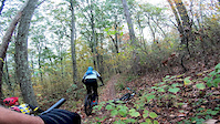
Photos of Boyce Park Mountain Bike
Videos of Boyce Park Mountain Bike
trail: Roller Coaster
0:43 |
275 |
Apr 4, 2020
Current Trail Warnings
| status | trail | date | condition | user | info |
|---|---|---|---|---|---|
| Wave Pool Trail - Orange Blaze | Jun 13, 2026 @ 12:42pm (America/New_York) Jun 13, 2026 | Dry | matosta13 | Large tree down across trail, blocking trail |
Recent Trail Reports
| status | trail | date | condition | info | user |
|---|---|---|---|---|---|
| White Red Dot to White Blue Dot Connector | Jun 7, 2026 @ 5:40pm (America/Detroit) Jun 7, 2026 | Ideal | JasonQuKqQN | ||
| Upper Sinkholes | Jun 7, 2026 @ 5:40pm (America/Detroit) Jun 7, 2026 | Ideal | JasonQuKqQN | ||
| Blue Blaze Yellow Dot to White Blaze Connector A | Jun 7, 2026 @ 5:40pm (America/Detroit) Jun 7, 2026 | Ideal | JasonQuKqQN | ||
| Boyce Loop | Jun 7, 2026 @ 5:40pm (America/Detroit) Jun 7, 2026 | Ideal | JasonQuKqQN | ||
| Tunnel Trail | Jun 4, 2026 @ 5:56pm (America/Detroit) Jun 4, 2026 | Ideal | JasonQuKqQN | ||
| NICA Switchbacks | Jun 4, 2026 @ 5:56pm (America/Detroit) Jun 4, 2026 | Ideal | JasonQuKqQN | ||
| Blue Blaze Yellow Dot to White Blaze Connector B | Jun 4, 2026 @ 5:56pm (America/Detroit) Jun 4, 2026 | Ideal | JasonQuKqQN | ||
| Blue Blaze Black Dot | Jun 4, 2026 @ 5:56pm (America/Detroit) Jun 4, 2026 | Ideal | JasonQuKqQN | ||
| Blue Blaze to Blue Blaze Red Dot Connector | Jun 4, 2026 @ 5:56pm (America/Detroit) Jun 4, 2026 | Ideal | JasonQuKqQN | ||
| Blue Blaze Blue Triangle | Jun 4, 2026 @ 5:56pm (America/Detroit) Jun 4, 2026 | Ideal | JasonQuKqQN |
Activity Feed
| username | action | type | title | date |
|---|---|---|---|---|
| matosta13 | add | report | activity #96888853 | Jun 13, 2026 @ 9:42am Jun 13, 2026 |
| JasonQuKqQN | add | report | activity #96529234 and 3 more | Jun 8, 2026 @ 3:49am Jun 8, 2026 |
| JasonQuKqQN | add | report | activity #96294241 and 6 more | Jun 5, 2026 @ 7:28am Jun 5, 2026 |
| JasonQuKqQN | add | report | activity #95672490 and 4 more | May 27, 2026 @ 5:16pm May 27, 2026 |
| marquisdaveyg | add | report | activity #94977812 | May 18, 2026 @ 8:31am May 18, 2026 |
Recent Comments
| username | type | title | comment | date |
|---|---|---|---|---|
| trail | Trail is nonexistent. Should be considered closed. | Oct 5, 2025 @ 10:19am Oct 5, 2025 | ||
| trail | This is a good trail, rode in the clockwise... | Apr 13, 2024 @ 6:40pm Apr 13, 2024 | ||
| trail | This trail is good but EXTREMELY MUDDY and... | Apr 13, 2024 @ 6:38pm Apr 13, 2024 | ||
| trail | This trail is fun for Boyce park, but the... | Apr 13, 2024 @ 6:37pm Apr 13, 2024 | ||
| trail | I rode this like 5 times in a row!. It's tons... | Apr 13, 2024 @ 6:36pm Apr 13, 2024 |
Nearby Areas
| name | distance | ||||
|---|---|---|---|---|---|
| Pleasant Valley Park | 4 | 5 | 5.1 km | ||
| Dark Hollow Woods | 1 | 8 | 4 | 5.5 km | |
| Falling Springs | 3 | 6.6 km | |||
| Frick Park | 8 | 26 | 8 | 2 | 8.6 km |
| White Oak Park | 7 | 8 | 8.9 km |
Local Badges
-

Completionist0 awarded
Activity Type Stats
| activitytype | trails | distance | descent | descent distance | total vertical | rating | global rank | state rank | photos | reports | routes | ridelogs |
|---|---|---|---|---|---|---|---|---|---|---|---|---|
| Mountain Bike | 72 | 25 miles | 2,808 ft | 12 miles | 299 ft | #3,181 | #1,116 | 43 | 348 | 2 | 3,483 | |
| Horse | 4 | 3,232 ft | 39 ft | 1,184 ft | 177 ft | 15 | ||||||
| Hike | 72 | 25 miles | 2,795 ft | 12 miles | 299 ft | #6,043 | #2,185 | 341 | 152 | |||
| Trail Running | 72 | 25 miles | 2,795 ft | 12 miles | 299 ft | #5,249 | #1,593 | 341 | 32 | |||
| Nordic Ski | 15 | 2 miles | 46 ft | 3,369 ft | 75 ft | #1,451 | #692 | 2 |
Frequently Asked Questions About Boyce Park
▼
What are the highest rated mountain biking trails in Boyce Park?
The highest rated mountain biking trails in Boyce Park are:
- Roller Coaster (4.3/5)
- Blue Blaze Red Dot (4.2/5)
- Yellow Blaze Brown Dot (4.1/5)
- White Blaze Blue dot to Blue Blaze Connector (4.1/5)
- NICA Switchbacks (4.1/5)
▼
What is the best time of the year to ride in Boyce Park?
Based on ride log data, the most popular months to ride in Boyce Park are:
- May (67 activities)
- July (63 activities)
- August (56 activities)
▼
Where can I park to ride in Boyce Park?
There are 5 parking locations listed in Boyce Park. The most popular parking spots are: View all parking and trailhead locations on the map to plan your visit.
▼
What is the longest trail in Boyce Park?
The longest trail in Boyce Park is White Blaze at 1.6 miles. View all trails sorted by distance.
Activities
Trails
- By eastsideride & contributors
- Admins: Trail PGH
- #4792 - 14,342 views
- boyce park activity log | embed map of Boyce Park mountain bike trails | boyce park mountain biking points of interest
Downloading of trail gps tracks in kml & gpx formats is enabled for Boyce Park.
You must login to download files.