close
-
Layers w
- Weather Layers
- Pro
- Pro
- Pro
- Pro
- Pro
- Pro
- More Layers
- Pro
- Pro
- Pro
- Pro
-
Upgrade to

3D
Trail Conditions
- Unknown
- Snow Groomed
- Snow Packed
- Snow Covered
- Snow Cover Partial
- Freeze/thaw Cycle
- Icy
- Prevalent Mud
- Wet
- Variable
- Ideal
- Dry
- Very Dry
Trail Flow (Ridden Direction)
Trailforks scans users ridelogs to determine the most popular direction each trail is ridden. A good flowing trail network will have most trails flowing in a single direction according to their intension.
The colour categories are based on what percentage of riders are riding a trail in its intended direction.
The colour categories are based on what percentage of riders are riding a trail in its intended direction.
- > 96%
- > 90%
- > 80%
- > 70%
- > 50%
- < 50%
- bi-directional trail
- no data
Trail Last Ridden
Trailforks scans ridelogs to determine the last time a trail was ridden.
- < 2 days
- < 1 week
- < 2 weeks
- < 1 month
- < 6 months
- > 6 months
Trail Ridden Direction
The intended direction a trail should be ridden.
- Downhill Only
- Downhill Primary
- Both Directions
- Uphill Primary
- Uphill Only
- One Direction
Contribute Details
Colors indicate trail is missing specified detail.
- Description
- Photos
- Description & Photos
- Videos
Trail Popularity ?
Trailforks scans ridelogs to determine which trails are ridden the most in the last 9 months.
Trails are compared with nearby trails in the same city region with a possible 25 colour shades.
Think of this as a heatmap, more rides = more kinetic energy = warmer colors.
- most popular
- popular
- less popular
- not popular
ATV/ORV/OHV Filter
Max Vehicle Width
inches
US Cell Coverage
Legend

Radar Time
Activity Recordings
Trailforks uses anonymized public activity data.
?
Activity Recordings
Trailforks uses anonymized public activity data.
?
Personal Heatmap
▶
Activity Types
all
/
none
▶
Options
2
Date range
month
–
Winter Trails
Warning
A routing network for winter maps does not exist. Selecting trails using the winter trails layer has been disabled.
Missing Trails
Most Popular
Least Popular
Trails are colored based on popularity. The more popular a trail is, the more red. Less popular trails trend towards green.
Jump Magnitude Heatmap
Heatmap of where riders jump on trails. Zoom in to see individual jumps, click circles to view jump details.
BC Backroad Status
![map legend]()
Service Road Atlas is a free to use, community-driven service for viewing and creating reports on the numerous back-country service roads around B.C. and Alberta.

Slope Aspect
Direction the slope faces
Trails Deemphasized
Trails are shown in grey.
Only show trails with no bike usage.
Suggested Layers
Based on selected activity type
Save the current map location and zoom level as your default home location whenever this page is loaded.
SaveBozeman is a city in and the seat of Gallatin County, Montana. Located in southwest Montana, the 2010 census put Bozeman's population at 37,280 and by 2019 the population had risen to 49,831, making it the fourth largest city in Montana. It is the principal city of the Bozeman, MT Micropolitan Statistical Area, consisting of all of Gallatin County with a population of 97,304. It is the largest Micropolitan Statistical Area in Montana, the fastest growing Micropolitan Statistical Area in the United States in both 2018 and 2019 and is the third largest of all Montana's statistical areas.
The city is named after John M. Bozeman who established the Bozeman Trail and was a founder of the town in August 1864. The town became incorporated in April 1883 with a city council form of government and in January 1922 transitioned to its current city manager/city commission form of government. Bozeman was elected an All-America City in 2001 by the National Civic League.
Bozeman is home to Montana State University. The local newspaper is the Bozeman Daily Chronicle, and the city is served by Bozeman Yellowstone International Airport.
source: City of Bozeman Government
Links
Region Supporters & Maintainers
![]()
Gallatin Valley Land Trust
since 1990Maintainer
Activities Click to view
- Mountain Bike
371 trails
- E-Bike
124 trails
- Gravel Bike
2 trails
- Adaptive Bike
1 trails
- Winter Fat Bike
5 trails
- Horse
138 trails
- Hike
425 trails
- Trail Running
423 trails
- Dirtbike/Moto
96 trails
- Observed Trials
9 trails
- ATV/ORV/OHV
69 trails
- Snowmobile
14 trails
- Snowshoe
51 trails
- Downhill Ski
86 trails
- Backcountry Ski
44 trails
- Nordic Ski
105 trails
Region Details
- 64
- 79
- 65
- 92
- 44
- 7
Region Status
Caution as of 1 dayStats
- Avg Trail Rating
- Trails (view details)
- 565
- Trails Mountain Bike
- 372
- Trails E-Bike
- 124
- Trails Gravel Bike
- 2
- Trails Adaptive Bike
- 1
- Trails Winter Fat Bike
- 5
- Trails Horse
- 138
- Trails Hike
- 425
- Trails Trail Running
- 423
- Trails Dirtbike/Moto
- 96
- Trails Observed Trials
- 9
- Trails ATV/ORV/OHV
- 69
- Trails Snowmobile
- 14
- Trails Snowshoe
- 51
- Trails Downhill Ski
- 86
- Trails Backcountry Ski
- 44
- Trails Nordic Ski
- 106
- Total Distance
- 834 miles
- Total Descent
- 124,977 ft
- Total Vertical
- 5,759 ft
- Highest Trailhead
- 10,207 ft
- Reports
- 4,625
- Photos
- 1,071
- Ridden Counter
- 85,579
Sub Regions
-
Bangtail Mountains
- 6
-
Bridger Range
- 14
- 12
- 4
-
Crosscut Trail System
- 11
- 6
- 2
-
Gallatin County Regional Park
- 1
-
Glen Lake Rotary Park
-
Highland Glen
- 9
-
Kirk Hill
-
Moser
- 4
- 17
- 3
-
Northern Gallatin Range
- 20
- 34
- 26
- 3
-
Triangle Trail System
- 61
- 17
- 5
Popular Bozeman Mountain Biking Trails
• 100 ★ 4.4 • 5 miles • 1,265 ft • 1,378 •
Great ride down, but watch out for the two creek crossings and root systems from trailside trees. Head up the trail. At the fork, head left as the sign suggests. This is very much a one way loop. Climb for a while. Check out the old...
• 100 ★ 4.9 • 4 miles • 635 ft • 1,256 •
This trail is covers rolling terrain and connects to the Triple Tree trails, providing a connection from Main Street of Bozeman to the foothills of the Gallatin Mountains. Dogs need to be on leash for this trail, the locals get cranky.
• 90 ★ 4.5 • 9 miles • 2,352 ft • 801 •
This IMBA Epic is one of the most famous rides around Bozeman for a reason, stunning views of the Bridger and Crazy Mountains and mile after mile of glorious singletrack. Trail can be ridden in either direction although most people ride...
• 90 ★ 4.0 • 2 miles • 169 ft • 776 •
Park at either the trailhead, or somewhere around the hospital/Lindley Park. This trail is pretty easy, with a few very short mellow climbs. Most of the trail is flat or slightly rolling single track. Great views of the Bridgers and...
• 80 ★ 0.0 • 1 mile • 111 ft • 766 •
Popular green difficulty singletrack. This multi-use trail can be used both directions and has a easy overall physical rating with a 111 ft green climb. On average it takes 6 minutes to complete this trail.
• 100 ★ 4.3 • 5 miles • 637 ft • 739 •
Old logging road access turned into nice wide gravel trail. Some climbs are slightly rocky. Ski trail, no bikes Dec 1st to April 16th.
• 85 ★ 4.3 • 7 miles • 547 ft • 704 •
Opens to dirt bikes 6/16
• 100 ★ 5.0 • 3,619 ft • 29 ft • 665 •
is a bike only downhill flow trail. Lots of berms and jump for all abilities. Hikers, please leave this one for the bikers. Bikers, please obey all posted signs and don't ride up this trail. It is meant to be a fun fast downhill and we...
Bozeman Mountain Bike Routes
★ 4.3 • 22 miles • 3,493 ft • 6 •
★ 4.0 • 112 miles • 17,580 ft • 17 • Loop •
Taken from Ryan Krueger over at bikepacking.com. BIG thanks to him and David Tucker for putting this out...
3 miles • 410 ft • 2 • Loop •
Quick loop for some technical singletrack and ending with flow
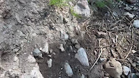
Photos of Bozeman Mountain Bike
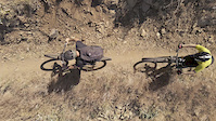
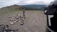
Videos of Bozeman Mountain Bike
trail: Wall of Death
0:21 |
94 |
Sep 6, 2022

trail: Sacajawea Summit Trail
0:59 |
1548 |
Jan 3, 2022

trail: Wheeler Gulch Trail
0:59 |
269 |
Aug 26, 2021

trail: Corbly Gulch
0:23 |
198 |
Jul 6, 2021
trail: Johnson Canyon
0:56 |
148 |
Aug 11, 2020

trail: Leverich Canyon
0:00 |
8545 |
Jul 8, 2020
trail: Emerald Lake
0:00 |
334 |
Jul 7, 2020
trail: Sypes Canyon
50:51 |
220 |
Jun 29, 2020
Current Trail Warnings
| status | trail | date | condition | user | info |
|---|---|---|---|---|---|
| Mt. Blackmore | Jun 18, 2026 @ 1:44pm (America/Denver) 2 days | Snow Covered | Readytj | no downed trees. dry for 3.5 miles, and... | |
| Bangtail Guard Station - Bangtail Divide Central (IMBA Epic) | Jun 15, 2026 @ 3:06pm (America/Denver) Jun 15, 2026 | Ideal | Bwyoung Trailblazers | Large tree fall still present. 30-60 mins... | |
| Golden Rule | Jun 2, 2026 @ 7:09pm (America/Denver) Jun 2, 2026 | Wet | crosscut CMSC | Golden Rule trail has not yet opened for... |
Recent Trail Reports
Activity Feed
| username | action | type | title | date |
|---|---|---|---|---|
| sdcnaples | wishlist | trail | activity #97339207 | Jun 19, 2026 @ 12:54pm 15 hours |
| nickpdx | vote | trail | activity #97301352 | Jun 19, 2026 @ 12:41am 1 day |
| nickpdx | add | report | activity #97290283 | Jun 18, 2026 @ 7:01pm 1 day |
| Talonb700 | wishlist | route | activity #97271246 | Jun 18, 2026 @ 12:53pm 2 days |
| Readytj | add | report | activity #97270728 | Jun 18, 2026 @ 12:44pm 2 days |
Recent Comments
| username | type | title | comment | date |
|---|---|---|---|---|
| report | Entire trail is “unsanctioned” the lowest... | Jun 17, 2026 @ 8:59pm 2 days | ||
| trail | Way too many jumps for my taste. I don’t... | Jun 13, 2026 @ 9:44am Jun 13, 2026 | ||
| trail | Up to the ross pass was fairly clear only one... | Jun 3, 2026 @ 1:02pm Jun 3, 2026 | ||
| report | Hailstorm yesterday afternoon | Jun 2, 2026 @ 7:28pm Jun 2, 2026 | ||
| trail | Seems like every bit of moisture has... | May 31, 2026 @ 8:43am May 31, 2026 |
Local Badges
-

Completionist0 awarded -

Big Ride 30k9,834 awarded -

Epic Ride 50k3,566 awarded -

Top 10 Trails0 awarded -
Completionist0 awarded -
Completionist0 awarded
Bike & Skill Parks
| name | type | city | rating |
|---|---|---|---|
| Pump Track | skill park | Bozeman | |
| Westlake Park | skill park | Bozeman | |
| Gran Cielo Paved Pumptrack | skill park | Bozeman | |
| Crosscut Skills Park | skill park | Bozeman |
Upcoming Local Events
Local Products
Local Products
Activity Type Stats
| activitytype | trails | distance | descent | descent distance | total vertical | rating | global rank | state rank | photos | reports | routes | ridelogs |
|---|---|---|---|---|---|---|---|---|---|---|---|---|
| Mountain Bike | 371 | 678 miles | 86,814 ft | 256 miles | 5,686 ft | #119 | #45 | 1,013 | 4,611 | 66 | 84,103 | |
| E-Bike | 124 | 366 miles | 40,469 ft | 130 miles | 5,016 ft | #211 | #669 | 3,523 | 7 | 1,541 | ||
| Gravel Bike | 2 | #241 | #870 | 46 | 3 | 630 | ||||||
| Adaptive Bike | 1 | #214 | #1,503 | 9 | 2 | |||||||
| Winter Fat Bike | 5 | #60 | #874 | 1 | 16 | 2 | 22 | |||||
| Horse | 138 | 437 miles | 55,928 ft | 159 miles | 4,954 ft | #12 | #308 | 12 | 2,062 | 5 | 19 | |
| Hike | 425 | 725 miles | 93,281 ft | 272 miles | 5,758 ft | #43 | #36 | 18 | 4,615 | 13 | 13,749 | |
| Trail Running | 423 | 723 miles | 93,274 ft | 272 miles | 5,758 ft | #26 | #22 | 28 | 4,614 | 13 | 22,253 | |
| Dirtbike/Moto | 96 | 334 miles | 39,475 ft | 123 miles | 4,633 ft | #40 | #22 | 6 | 1,715 | 101 | ||
| Observed Trials | 9 | 35 miles | 3,802 ft | 13 miles | 2,605 ft | #28 | #10 | 27 | 13 | |||
| ATV/ORV/OHV | 69 | 256 miles | 25,456 ft | 90 miles | 3,953 ft | #23 | #15 | 4 | 1,555 | 10 | ||
| Snowmobile | 14 | 68 miles | 3,694 ft | 21 miles | 2,677 ft | #21 | #16 | 978 | 27 | |||
| Snowshoe | 51 | 123 miles | 10,446 ft | 52 miles | 3,894 ft | #67 | #19 | 1 | 1,689 | 1 | 120 | |
| Downhill Ski | 86 | 26 miles | 20,988 ft | 23 miles | 2,910 ft | #127 | #54 | 1,443 | 5,160 | |||
| Backcountry Ski | 44 | 92 miles | 6,362 ft | 30 miles | 5,207 ft | #48 | #11 | 1,522 | 5,183 | |||
| Nordic Ski | 105 | 95 miles | 9,524 ft | 47 miles | 3,114 ft | #26 | #9 | 1,630 | 1 | 9,206 |
Frequently Asked Questions About Bozeman
▼
What are the best places to ride in Bozeman?
Bozeman has 19 areas to explore for mountain biking. The top rated areas are:
▼
What are the highest rated mountain biking trails in Bozeman?
The highest rated mountain biking trails in Bozeman are:
- Painted Hills (4.4/5)
- Gnomadic (4.4/5)
- Big Thigh Country (4.4/5)
- Wheeler Gulch Trail (4.4/5)
- Leverich Canyon (4.4/5)
▼
What is the best time of the year to ride in Bozeman?
Based on ride log data, the most popular months to ride in Bozeman are:
- July (1,779 activities)
- August (945 activities)
- June (771 activities)
▼
Where can I park to ride in Bozeman?
There are 72 parking locations listed in Bozeman. The most popular parking spots are: View all parking and trailhead locations on the map to plan your visit.
Activities
- Bozeman Mountain Biking Trails
- Bozeman E-Biking Trails
- Bozeman Winter Fat Biking Trails
- Bozeman Horseback Trails
- Bozeman Hiking Trails
- Bozeman Trail Running Trails
- Bozeman Dirtbiking Trails
- Bozeman Observed Trials Trails
- Bozeman ATVing/Offroading Trails
- Bozeman Snowmobiling Trails
- Bozeman Snowshoeing Trails
- Bozeman Skiing Trails
- Bozeman Backcountry Skiing Trails
- Bozeman Nordic Skiing Trails
Trails
Points of Interest
- By chuktA
 TRAILFORKS NFTA & contributors
 - Admins: SWMMBA, HCC
- #7068 - 83,600 views
- bozeman activity log | embed map of Bozeman mountain bike trails | bozeman mountain biking points of interest polygons
Downloading of trail gps tracks in kml & gpx formats is enabled for Bozeman.
You must login to download files.