close
-
Layers w
- Weather Layers
- Pro
- Pro
- Pro
- Pro
- Pro
- Pro
- More Layers
- Pro
- Pro
- Pro
- Pro
-
Upgrade to

3D
Trail Conditions
- Unknown
- Snow Groomed
- Snow Packed
- Snow Covered
- Snow Cover Partial
- Freeze/thaw Cycle
- Icy
- Prevalent Mud
- Wet
- Variable
- Ideal
- Dry
- Very Dry
Trail Flow (Ridden Direction)
Trailforks scans users ridelogs to determine the most popular direction each trail is ridden. A good flowing trail network will have most trails flowing in a single direction according to their intension.
The colour categories are based on what percentage of riders are riding a trail in its intended direction.
The colour categories are based on what percentage of riders are riding a trail in its intended direction.
- > 96%
- > 90%
- > 80%
- > 70%
- > 50%
- < 50%
- bi-directional trail
- no data
Trail Last Ridden
Trailforks scans ridelogs to determine the last time a trail was ridden.
- < 2 days
- < 1 week
- < 2 weeks
- < 1 month
- < 6 months
- > 6 months
Trail Ridden Direction
The intended direction a trail should be ridden.
- Downhill Only
- Downhill Primary
- Both Directions
- Uphill Primary
- Uphill Only
- One Direction
Contribute Details
Colors indicate trail is missing specified detail.
- Description
- Photos
- Description & Photos
- Videos
Trail Popularity ?
Trailforks scans ridelogs to determine which trails are ridden the most in the last 9 months.
Trails are compared with nearby trails in the same city region with a possible 25 colour shades.
Think of this as a heatmap, more rides = more kinetic energy = warmer colors.
- most popular
- popular
- less popular
- not popular
ATV/ORV/OHV Filter
Max Vehicle Width
inches
US Cell Coverage
Legend

Radar Time
Activity Recordings
Trailforks uses anonymized public activity data.
?
Activity Recordings
Trailforks uses anonymized public activity data.
?
Personal Heatmap
▶
Activity Types
all
/
none
▶
Options
2
Date range
month
–
Winter Trails
Warning
A routing network for winter maps does not exist. Selecting trails using the winter trails layer has been disabled.
Missing Trails
Most Popular
Least Popular
Trails are colored based on popularity. The more popular a trail is, the more red. Less popular trails trend towards green.
Jump Magnitude Heatmap
Heatmap of where riders jump on trails. Zoom in to see individual jumps, click circles to view jump details.
BC Backroad Status
![map legend]()
Service Road Atlas is a free to use, community-driven service for viewing and creating reports on the numerous back-country service roads around B.C. and Alberta.

Slope Aspect
Direction the slope faces
Trails Deemphasized
Trails are shown in grey.
Only show trails with no bike usage.
Suggested Layers
Based on selected activity type
Save the current map location and zoom level as your default home location whenever this page is loaded.
Save
No description for Braga has been added yet!
Login or register to submit one.
This region uses the Uk/Euro style trail grading system.
Region Details
- 35
- 2
- 58
- 16
- 7
Stats
- Avg Trail Rating
- Trails (view details)
- 118
- Trails Mountain Bike
- 121
- Trails E-Bike
- 108
- Trails Horse
- 4
- Trails Hike
- 75
- Trails Trail Running
- 75
- Total Distance
- 44 miles
- Total Descent
- 22,408 ft
- Total Vertical
- 2,582 ft
- Highest Trailhead
- 2,950 ft
- Reports
- 703
- Photos
- 1,397
- Ridden Counter
- 3,760
Sub Regions
- Barcelos (5)
- Monte do Facho (0)
- Braga (28)
- Santa Marta (27)
- Guimarães (29)
- Montanha da Penha (27)
- Terras De Bouro (65)
Popular Braga Mountain Biking Trails
• 85 ★ 5.0 • 1,184 ft • 0 ft • 105 •
Este trilho podemos divido-lo em 3 secções: A primeira inicia-se num set up de madeira e pedra e termina exactamente assim, com a diferença que o último é muito maior, pelo meio fica uma sequência de curvas brutais.
• 60 ★ 4.8 • 771 ft • 0 ft • 92 •
Um trilho com alguma dificuldade técnica e muita rocha durante 3km!
• 95 ★ 4.8 • 1 mile • 0 ft • 91 •
Podemos divido-lo em 3 secções: A terceira secção é a linha verdadeiramente de downhill, super rápida com trialeiras desafiantes mas muito divertidas.
• 85 ★ 4.6 • 2,188 ft • 0 ft • 91 •
Popular blue difficulty singletrack. This mountain bike primary trail can be used downhill primary. Trail visibility is always easy to follow. On average it takes 2 minutes to complete this trail.
• 90 ★ 5.0 • 3,383 ft • 3 ft • 80 •
Apesar de não ser nenhuma pista preta, aconselhamos uma primeira passagem de reconhecimento para os estreantes. É um trilho técnico, vários saltos, releves e pontes, sempre com possibilidade de passar ao lado, aliás como todos os...
• 95 ★ 5.0 • 4,560 ft • 3 ft • 78 •
is a natural trail with some berms, jumps and rocks. Take care of your rear derailleur.
• 100 ★ 4.8 • 1,991 ft • 0 ft • 71 •
Popular blue difficulty singletrack. This mountain bike primary trail. Trail visibility is always easy to follow. On average it takes 6 minutes to complete this trail.
• 85 ★ 5.0 • 1,631 ft • 0 ft • 69 •
Apesar de não ser nenhuma pista preta, aconselhamos uma primeira passagem de reconhecimento para os estreantes. É um trilho técnico, vários saltos, releves e pontes, sempre com possibilidade de passar ao lado, aliás como todos os...
Braga Mountain Bike Routes
★ 5.0 • 13 miles • 2,596 ft • 0 •
32 miles • 7,687 ft • 26 • Shuttled •
Route around terras de bouro. ideal for endro
★ 5.0 • 13 miles • 2,596 ft • 0 •
★ 4.0 • 33 miles • 4,806 ft • 0 •
Saída de Felgueiras, St. Antonino St. Marinha, Barragem da Quimadela, Fafe, Felgueiras.
42 miles • 6,722 ft • 0 •
In summer (July/August) there are places that aren't clean, with lot of vegetation can't pass with the...
Photos of Braga Mountain Bike
Videos of Braga Mountain Bike
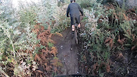
trail: Baloiço 1
0:20 |
8 |
Jan 12, 2026
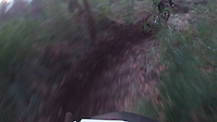
trail: Regional
0:06 |
239 |
Jan 16, 2022
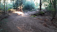
trail: Regional
0:08 |
141 |
Dec 8, 2021
trail: Malhadeira
2:31 |
73 |
Apr 29, 2021
trail: Regional
0:15 |
80 |
Feb 19, 2021
trail: Regional
0:16 |
69 |
Nov 19, 2020
trail: Regional
0:09 |
115 |
Sep 10, 2020
trail: Regional
8:10 |
25 |
Jun 23, 2020
Recent Trail Reports
Activity Feed
| username | action | type | title | date |
|---|---|---|---|---|
| pdrmartins | add | report | activity #97548519 | Jun 22, 2026 @ 1:25am 1 day |
| pdrmartins | add | report | activity #97548517 and 21 more | Jun 22, 2026 @ 1:25am 1 day |
| PNQJX2Ee | wishlist | trail | activity #97213433 | Jun 17, 2026 @ 3:40pm Jun 17, 2026 |
| N2Dtgs | ridden | route | activity #97129677 | Jun 16, 2026 @ 12:08pm Jun 16, 2026 |
| remymetailler | add | video | activity #97087580 | Jun 15, 2026 @ 10:00pm Jun 15, 2026 |
Recent Comments
| username | type | title | comment | date |
|---|---|---|---|---|
| trail | A finais de Agosto de 2025 o quintal do Gomes... | Aug 21, 2025 @ 2:03am Aug 21, 2025 | ||
| trail | A massive grid with locks blocks the entrance... | Aug 15, 2024 @ 3:54am Aug 15, 2024 | ||
| trail | This Trail is very nice if you like jumps and... | Aug 14, 2024 @ 10:58am Aug 14, 2024 | ||
| report | GPS Track is not accurate in the beginning. | Aug 14, 2024 @ 10:55am Aug 14, 2024 | ||
| report | added pictures | Oct 1, 2023 @ 2:53pm Oct 1, 2023 |
Local Badges
-

Epic Ride Descent 2k0 awarded -

Descent 10k Badge0 awarded -
Descent 10k Badge1 awarded -
Epic Ride Descent 2k2 awarded -

Descent 100k Badge0 awarded -

Mountain Biking 100k Badge0 awarded
Local Mountain Biking Directory
-
Braga Enduro Trails
![Braga Enduro Trails]()
-
In Nature
![In Nature]()
-
BikezoneBike Shop
-
CitybikeBike Shop
-
Doctor BikeBike Shop
-
FamabikeBike Shop
Activity Type Stats
| activitytype | trails | distance | descent | descent distance | total vertical | rating | global rank | state rank | photos | reports | routes | ridelogs |
|---|---|---|---|---|---|---|---|---|---|---|---|---|
| Mountain Bike | 120 | 44 miles | 22,408 ft | 32 miles | 2,582 ft | 1,396 | 713 | 14 | 13,423 | |||
| E-Bike | 108 | 38 miles | 18,793 ft | 28 miles | 2,582 ft | 3 | 706 | 6 | 2,316 | |||
| Horse | 4 | 42 | ||||||||||
| Hike | 75 | 23 miles | 6,473 ft | 12 miles | 2,238 ft | 674 | 1,095 | |||||
| Trail Running | 75 | 23 miles | 6,473 ft | 12 miles | 2,238 ft | 674 | 1 | 94 |
Activities
Trails
- By brenthillier
 NSMBA TRAILFORKS & contributors
 - Admins: elyari, AMG, marcossantamaria
- #9891 - 7,132 views
- braga activity log | embed map of Braga mountain bike trails | braga mountain biking points of interest
Downloading of trail gps tracks in kml & gpx formats is enabled for Braga.
You must login to download files.