close
-
Layers w
- Weather Layers
- Pro
- Pro
- Pro
- Pro
- Pro
- Pro
- More Layers
- Pro
- Pro
- Pro
- Pro
-
Upgrade to

3D
Trail Conditions
- Unknown
- Snow Groomed
- Snow Packed
- Snow Covered
- Snow Cover Partial
- Freeze/thaw Cycle
- Icy
- Prevalent Mud
- Wet
- Variable
- Ideal
- Dry
- Very Dry
Trail Flow (Ridden Direction)
Trailforks scans users ridelogs to determine the most popular direction each trail is ridden. A good flowing trail network will have most trails flowing in a single direction according to their intension.
The colour categories are based on what percentage of riders are riding a trail in its intended direction.
The colour categories are based on what percentage of riders are riding a trail in its intended direction.
- > 96%
- > 90%
- > 80%
- > 70%
- > 50%
- < 50%
- bi-directional trail
- no data
Trail Last Ridden
Trailforks scans ridelogs to determine the last time a trail was ridden.
- < 2 days
- < 1 week
- < 2 weeks
- < 1 month
- < 6 months
- > 6 months
Trail Ridden Direction
The intended direction a trail should be ridden.
- Downhill Only
- Downhill Primary
- Both Directions
- Uphill Primary
- Uphill Only
- One Direction
Contribute Details
Colors indicate trail is missing specified detail.
- Description
- Photos
- Description & Photos
- Videos
Trail Popularity ?
Trailforks scans ridelogs to determine which trails are ridden the most in the last 9 months.
Trails are compared with nearby trails in the same city region with a possible 25 colour shades.
Think of this as a heatmap, more rides = more kinetic energy = warmer colors.
- most popular
- popular
- less popular
- not popular
ATV/ORV/OHV Filter
Max Vehicle Width
inches
US Cell Coverage
Legend

Radar Time
Activity Recordings
Trailforks uses anonymized public activity data.
?
Activity Recordings
Trailforks uses anonymized public activity data.
?
Personal Heatmap
▶
Activity Types
all
/
none
▶
Options
2
Date range
month
–
Winter Trails
Warning
A routing network for winter maps does not exist. Selecting trails using the winter trails layer has been disabled.
Missing Trails
Most Popular
Least Popular
Trails are colored based on popularity. The more popular a trail is, the more red. Less popular trails trend towards green.
Jump Magnitude Heatmap
Heatmap of where riders jump on trails. Zoom in to see individual jumps, click circles to view jump details.
BC Backroad Status
![map legend]()
Service Road Atlas is a free to use, community-driven service for viewing and creating reports on the numerous back-country service roads around B.C. and Alberta.

Slope Aspect
Direction the slope faces
Trails Deemphasized
Trails are shown in grey.
Only show trails with no bike usage.
Suggested Layers
Based on selected activity type
Save the current map location and zoom level as your default home location whenever this page is loaded.
Save
No description for Brandenburg has been added yet!
Login or register to submit one.
This region uses the Uk/Euro style trail grading system.
Region Details
- 4
- 31
- 14
- 8
- 1
Stats
- Avg Trail Rating
- Trails (view details)
- 58
- Trails Mountain Bike
- 58
- Trails E-Bike
- 31
- Trails Horse
- 5
- Trails Hike
- 46
- Trails Trail Running
- 44
- Total Distance
- 30 miles
- Total Descent
- 3,188 ft
- Total Vertical
- 404 ft
- Highest Trailhead
- 515 ft
- Reports
- 138
- Photos
- 34
- Ridden Counter
- 1,463
Sub Regions
- Cottbus (Stadtkreis) (1)
- Frankfurt (Oder) (Stadtkreis) (2)
- Landkreis Dahme-Spreewald (21)
- Königs Wusterhausen (12)
- Wüstemarker Forst (10)
- Wildau (6)
- Zeuthen (3)
- Königs Wusterhausen (12)
- Landkreis Märkisch-Oderland (7)
- Bad Freienwalde (1)
- Rüdersdorf bei Berlin (4)
- Bad Freienwalde (1)
- Landkreis Oder-Spree (18)
- Bad Saarow (2)
- Spreenhagen (4)
- Rauener Berge (12)
- Bad Saarow (2)
- Landkreis Ostprignitz-Ruppin (6)
- Landkreis Potsdam-Mittelmark (1)
- Schwielowsee (1)
- Schwielowsee (1)
- Landkreis Teltow-Fläming (1)
- Potsdam (Stadtkreis) (1)
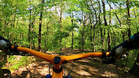
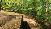
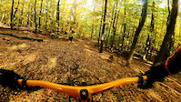
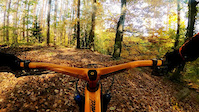
Popular Brandenburg Mountain Biking Trails
• 100 ★ 3.0 • 1,650 ft • 3 ft • 15 •
Galgenberg or Pulverberg... Gallows Mountain or Gunpowder Hill. There aren't many steep hills in Brandenberg, but this is a fun one. Various lines. The steepest line is way over to the left, off the edge of the old munitions factory...
• ★ 3.0 • 1 mile • 134 ft • 13 •
Easy peasy trail along banks of Lake Flaksee, from Woltersdorf to Erkner, or vice versa.
• ★ 5.0 • 2 miles • 113 ft • 11 •
Rooty single trail along Lake Kalksee. There are many hikers around due to 2 hospitals being nearby.
• 60 ★ 2.0 • 2 miles • 31 ft • 10 •
The best trail both up and down the Rauener Berge to or from Bad Saarow. It's a straight route, but don't let that fool you into thinking it's boring. It's got some great rolling hills and fun diversions.
• 20 ★ 5.0 • 3 miles • 51 ft • 10 •
Trail leading from Tasdorf to Hennickendorf all along western banks of Lake Stienitzsee. Northern part of the trail leads on jetties through Gummiwiesen, a swamp.
• ★ 4.0 • 2,979 ft • 9 ft • 9 •
Rooty trail around Lake Wupatzsee. Watch out for hikers.
• 70 ★ 4.0 • 4,633 ft • 22 ft • 9 •
Open at both ends with tight rolling singletrack in the middle. Some natural features to get some air if you want to.
• 100 ★ 4.0 • 1,348 ft • 6 ft • 9 •
kurze blaue Line mit einigen Geländestufen und einem Wurzelfeld
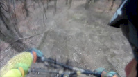
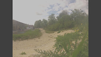
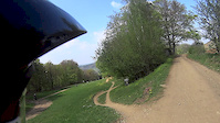
Photos of Brandenburg Mountain Bike
Videos of Brandenburg Mountain Bike
trail: Rauener Berge Ski Jump
0:11 |
273 |
Oct 26, 2021
trail: Rauener Berge Ski Jump
0:06 |
162 |
Oct 26, 2021
trail: Cannonball
0:47 |
130 |
Oct 26, 2021
trail: 7 hills
0:16 |
80 |
Oct 26, 2021
trail: Transition
0:55 |
310 |
Feb 15, 2018
trail: Transition
3:31 |
211 |
Oct 12, 2014
trail: Transition
3:11 |
230 |
Apr 14, 2014
trail: Transition
3:41 |
565 |
Oct 21, 2013
Recent Trail Reports
Activity Feed
| username | action | type | title | date |
|---|---|---|---|---|
| pauwa1 | ridden | trail | activity #95560876 | May 26, 2026 @ 6:40am May 26, 2026 |
| xflowBLN | add | report | activity #95255062 | May 22, 2026 @ 10:58am May 22, 2026 |
| xflowBLN | add | report | activity #95255061 | May 22, 2026 @ 10:58am May 22, 2026 |
| TomKuaJ0F | ridden | trail | activity #94167714 | May 6, 2026 @ 11:17am May 6, 2026 |
| StarG3CBIb | wishlist | trail | activity #92375663 | Apr 11, 2026 @ 3:50am Apr 11, 2026 |
Recent Comments
| username | type | title | comment | date |
|---|---|---|---|---|
| trail | Good conditions. | Jun 18, 2023 @ 1:21am Jun 18, 2023 | ||
| trail | Left line very sandy. Right line actually... | Nov 14, 2020 @ 12:29pm Nov 14, 2020 |
Local Badges
-

Epic Mountain Bike Climb 2k0 awarded -

Climbing 10k Badge2 awarded -

Mountain Biking 100k Badge0 awarded -

Epic Ride Descent 2k0 awarded -

Descent 10k Badge2 awarded -

Descent 100k Badge0 awarded
Bike & Skill Parks
| name | type | city | rating |
|---|---|---|---|
| Frankfurt Oder Indoor motocross | skill park | ||
| Kröbeln motocross | skill park | ||
| Joachimsthal motocross | skill park | ||
| Seelübbe motocross | skill park | ||
| Wriezen | skill park | Bad Freienwalde |
Activity Type Stats
| activitytype | trails | distance | descent | descent distance | total vertical | rating | global rank | state rank | photos | reports | routes | ridelogs |
|---|---|---|---|---|---|---|---|---|---|---|---|---|
| Mountain Bike | 58 | 30 miles | 3,189 ft | 14 miles | 404 ft | 29 | 138 | 10,630 | ||||
| E-Bike | 31 | 21 miles | 2,070 ft | 10 miles | 404 ft | 5 | 124 | 436 | ||||
| Horse | 5 | 6 miles | 407 ft | 3 miles | 390 ft | 5 | ||||||
| Hike | 46 | 28 miles | 2,785 ft | 13 miles | 404 ft | 132 | 2,283 | |||||
| Trail Running | 44 | 28 miles | 2,641 ft | 13 miles | 404 ft | 131 | 213 |
Activities
Trails
- By brenthillier
 NSMBA TRAILFORKS & contributors
 - Admins: Sasse82, elreyrules, cemoorelife
- #8116 - 13,504 views
- brandenburg activity log | embed map of Brandenburg mountain bike trails | brandenburg mountain biking points of interest
Downloading of trail gps tracks in kml & gpx formats is enabled for Brandenburg.
You must login to download files.