close
-
Layers w
- Weather Layers
- Pro
- Pro
- Pro
- Pro
- Pro
- Pro
- More Layers
- Pro
- Pro
- Pro
- Pro
-
Upgrade to

3D
Trail Conditions
- Unknown
- Snow Groomed
- Snow Packed
- Snow Covered
- Snow Cover Partial
- Freeze/thaw Cycle
- Icy
- Prevalent Mud
- Wet
- Variable
- Ideal
- Dry
- Very Dry
Trail Flow (Ridden Direction)
Trailforks scans users ridelogs to determine the most popular direction each trail is ridden. A good flowing trail network will have most trails flowing in a single direction according to their intension.
The colour categories are based on what percentage of riders are riding a trail in its intended direction.
The colour categories are based on what percentage of riders are riding a trail in its intended direction.
- > 96%
- > 90%
- > 80%
- > 70%
- > 50%
- < 50%
- bi-directional trail
- no data
Trail Last Ridden
Trailforks scans ridelogs to determine the last time a trail was ridden.
- < 2 days
- < 1 week
- < 2 weeks
- < 1 month
- < 6 months
- > 6 months
Trail Ridden Direction
The intended direction a trail should be ridden.
- Downhill Only
- Downhill Primary
- Both Directions
- Uphill Primary
- Uphill Only
- One Direction
Contribute Details
Colors indicate trail is missing specified detail.
- Description
- Photos
- Description & Photos
- Videos
Trail Popularity ?
Trailforks scans ridelogs to determine which trails are ridden the most in the last 9 months.
Trails are compared with nearby trails in the same city region with a possible 25 colour shades.
Think of this as a heatmap, more rides = more kinetic energy = warmer colors.
- most popular
- popular
- less popular
- not popular
ATV/ORV/OHV Filter
Max Vehicle Width
inches
US Cell Coverage
Legend

Radar Time
Activity Recordings
Trailforks uses anonymized public activity data.
?
Activity Recordings
Trailforks uses anonymized public activity data.
?
Personal Heatmap
▶
Activity Types
all
/
none
▶
Options
2
Date range
month
–
Winter Trails
Warning
A routing network for winter maps does not exist. Selecting trails using the winter trails layer has been disabled.
Missing Trails
Most Popular
Least Popular
Trails are colored based on popularity. The more popular a trail is, the more red. Less popular trails trend towards green.
Jump Magnitude Heatmap
Heatmap of where riders jump on trails. Zoom in to see individual jumps, click circles to view jump details.
BC Backroad Status
![map legend]()
Service Road Atlas is a free to use, community-driven service for viewing and creating reports on the numerous back-country service roads around B.C. and Alberta.

Slope Aspect
Direction the slope faces
Trails Deemphasized
Trails are shown in grey.
Only show trails with no bike usage.
Suggested Layers
Based on selected activity type
Save the current map location and zoom level as your default home location whenever this page is loaded.
Save
No description for Brandon has been added yet!
Login or register to submit one.
Links
Activities Click to view
- Mountain Bike
110 trails
- E-Bike
72 trails
- Gravel Bike
1 trails
- Adaptive Bike
0 trails
- Winter Fat Bike
0 trails
- Hike
110 trails
- Trail Running
109 trails
- ATV/ORV/OHV
17 trails
- Snowmobile
17 trails
- Snowshoe
37 trails
- Nordic Ski
27 trails
Region Details
- 2
- 2
- 48
- 44
- 5
Region Status
Open as of Apr 30, 2026Stats
- Avg Trail Rating
- Trails (view details)
- 103
- Trails Mountain Bike
- 110
- Trails E-Bike
- 72
- Trails Gravel Bike
- 1
- Trails Horse
- 1
- Trails Hike
- 110
- Trails Trail Running
- 109
- Trails ATV/ORV/OHV
- 17
- Trails Snowmobile
- 17
- Trails Snowshoe
- 37
- Trails Nordic Ski
- 27
- Total Distance
- 84 miles
- Total Descent
- 4,786 ft
- Total Vertical
- 446 ft
- Highest Trailhead
- 1,608 ft
- Reports
- 625
- Photos
- 216
- Ridden Counter
- 7,905
Sub Regions
-
Brandon Hills
- 17
- 36
- 5
-
Brandon Riverbank
- 3
- 1
-
Criddle/Vane Homestead Provincial Park
- 1
-
Hanbury Hill Park
- 2
- 5
-
Kenton
- 1
-
Rivers Provincial Park
- 2
Popular Brandon Mountain Biking Trails
• 100 ★ 5.0 • 2,139 ft • 0 ft • 232 •
Highly rated popular blue difficulty singletrack. This mountain bike primary trail can be used both directions and has a moderate overall physical rating with a 0 ft blue climb. Winter use: Groomed Smooth snow grooming. On average it takes 3 minutes to complete this trail.
• 100 ★ 5.0 • 2 miles • 83 ft • 224 •
Highly rated popular blue difficulty singletrack. This mountain bike primary trail can be used both directions. Winter use: Groomed Smooth snow grooming. On average it takes 13 minutes to complete this trail.
• 95 ★ 4.7 • 3,615 ft • 35 ft • 223 •
Highly rated popular blue difficulty singletrack. This mountain bike primary trail can be used both directions and has a moderate overall physical rating with a 35 ft blue climb. Winter use: Groomed Smooth snow grooming. On average it takes 5 minutes to complete this trail.
• 100 ★ 0.0 • 617 ft • 6 ft • 197 •
Popular blue difficulty singletrack. This mountain bike primary trail can be used downhill primary. On average it takes minutes to complete this trail.
• 95 ★ 4.4 • 1,050 ft • 52 ft • 195 •
Popular blue difficulty singletrack. This mountain bike primary trail can be used both directions. On average it takes 1 minutes to complete this trail.
• 90 ★ 5.0 • 3,133 ft • 29 ft • 185 •
Highly rated popular blue difficulty singletrack. This mountain bike primary trail can be used both directions. Winter use: Groomed Smooth snow grooming. On average it takes 4 minutes to complete this trail.
• 85 ★ 5.0 • 2,490 ft • 6 ft • 184 •
Highly rated popular blue difficulty singletrack. This mountain bike primary trail can be used both directions and has a moderate overall physical rating with a 6 ft blue climb. On average it takes 3 minutes to complete this trail.
Brandon Mountain Bike Routes
★ 4.4 • 9 miles • 634 ft • 25 •
A great taste of the great sections of the brandon hills
5 miles • 274 ft • 36 • Out & Back •
Wasn't too muddy except for a few spots on fire trail. Looked like a bobcat or something had been through,...
3 miles • 50 ft • 0 • Loop •
Kenworth Nature Trail - Kenton MB. Located at Lonesome Oak Campground, Kenworth Dam, and the town of...
Photos of Brandon Mountain Bike
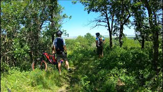
Videos of Brandon Mountain Bike
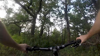
trail: Twist It Up
0:49 |
780 |
Aug 31, 2017
19:08 |
136 |
Sep 10, 2024
Recent Trail Reports
| status | trail | date | condition | info | user |
|---|---|---|---|---|---|
| Woodtick | Apr 30, 2026 @ 7:56pm (America/Mexico_City) Apr 30, 2026 | Ideal | ericfrazer TOHadm | ||
| Winter Ant | Apr 30, 2026 @ 7:56pm (America/Mexico_City) Apr 30, 2026 | Ideal | ericfrazer TOHadm | ||
| Two Way | Apr 30, 2026 @ 7:56pm (America/Mexico_City) Apr 30, 2026 | Ideal | ericfrazer TOHadm | ||
| Twisted it Up - Extended | Apr 30, 2026 @ 7:56pm (America/Mexico_City) Apr 30, 2026 | Ideal | ericfrazer TOHadm | ||
| Twist It Up | Apr 30, 2026 @ 7:56pm (America/Mexico_City) Apr 30, 2026 | Ideal | ericfrazer TOHadm | ||
| Twig N' Berries | Apr 30, 2026 @ 7:56pm (America/Mexico_City) Apr 30, 2026 | Ideal | ericfrazer TOHadm | ||
| TP Two | Apr 30, 2026 @ 7:56pm (America/Mexico_City) Apr 30, 2026 | Ideal | ericfrazer TOHadm | ||
| TP One | Apr 30, 2026 @ 7:56pm (America/Mexico_City) Apr 30, 2026 | Ideal | ericfrazer TOHadm | ||
| Tower Connector | Apr 30, 2026 @ 7:56pm (America/Mexico_City) Apr 30, 2026 | Ideal | ericfrazer TOHadm | ||
| Straight out | Apr 30, 2026 @ 7:56pm (America/Mexico_City) Apr 30, 2026 | Ideal | ericfrazer TOHadm |
Activity Feed
| username | action | type | title | date |
|---|---|---|---|---|
| Cottomb | wishlist | trail | activity #96893340 | Jun 13, 2026 @ 10:26am Jun 13, 2026 |
| claytonheppner | add | route | activity #96252537 | Jun 4, 2026 @ 2:34pm Jun 4, 2026 |
| jgwcav | ridden | trail | activity #95663815 | May 27, 2026 @ 3:10pm May 27, 2026 |
| ericfrazer | add | report | activity #93750446 and 62 more | Apr 30, 2026 @ 6:55pm Apr 30, 2026 |
| Je85my8 | ridden | trail | activity #93451665 | Apr 26, 2026 @ 9:30am Apr 26, 2026 |
Recent Comments
| username | type | title | comment | date |
|---|---|---|---|---|
| report | ** Northeast | Aug 22, 2025 @ 10:21am Aug 22, 2025 | ||
| trail | Massive blind washed out area in a low lying... | Aug 22, 2025 @ 10:16am Aug 22, 2025 | ||
| trail | Fun little technical downhill. Good to hit... | Aug 16, 2024 @ 8:19am Aug 16, 2024 | ||
| trail | The trails were very good condition. Could use... | Aug 14, 2024 @ 6:38am Aug 14, 2024 | ||
| trail | Finn down hills mixed with some short uphills. | Aug 1, 2021 @ 6:51pm Aug 1, 2021 |
Local Badges
-

10 Green Trails48 awarded -

10 Blue Trails127 awarded -

Epic Ride Climb 2k1 awarded -

Climbing 10k Badge37 awarded -

Climbing 100k Badge6 awarded -

Epic Ride Descent 2k1 awarded
Local Mountain Biking Directory
-
Westman Trail Association
-
Brandon Riverbank Inc.
-
Stream 'n' WoodBike Shop
![Stream 'n' Wood]()
-
A&lBike Shop
Activity Type Stats
| activitytype | trails | distance | descent | descent distance | total vertical | rating | global rank | state rank | photos | reports | routes | ridelogs |
|---|---|---|---|---|---|---|---|---|---|---|---|---|
| Mountain Bike | 110 | 83 miles | 4,777 ft | 24 miles | 446 ft | #746 | #2 | 154 | 623 | 7 | 22,060 | |
| E-Bike | 72 | 55 miles | 2,037 ft | 14 miles | 443 ft | #2,523 | #6 | 8 | 515 | 678 | ||
| Gravel Bike | 1 | #420 | #9 | 1 | 642 | |||||||
| Horse | 1 | 3 miles | 56 ft | 4,695 ft | 39 ft | 162 | 1 | 2 | ||||
| Hike | 110 | 83 miles | 4,787 ft | 24 miles | 446 ft | #1,609 | 44 | 626 | 1 | 1,315 | ||
| Trail Running | 109 | 82 miles | 4,777 ft | 24 miles | 446 ft | #2,390 | #3 | 624 | 2 | 714 | ||
| ATV/ORV/OHV | 17 | 12 miles | 236 ft | 4 miles | 151 ft | #725 | #1 | 162 | 21 | |||
| Snowmobile | 17 | 12 miles | 236 ft | 4 miles | 151 ft | #271 | #5 | 1 | ||||
| Snowshoe | 37 | 26 miles | 463 ft | 7 miles | 367 ft | #565 | #4 | 6 | 69 | 1 | 115 | |
| Nordic Ski | 27 | 25 miles | 554 ft | 7 miles | 436 ft | #794 | #9 | 8 | 93 |
Frequently Asked Questions About Brandon
▼
What are the best places to ride in Brandon?
Brandon has 7 areas to explore for mountain biking. The top rated areas are:
▼
What are the highest rated mountain biking trails in Brandon?
The highest rated mountain biking trails in Brandon are:
- Burning Bush (4.6/5)
- North Face (4.6/5)
- Merglan (4.5/5)
- Twist It Up (4.5/5)
- TP Two (4.5/5)
▼
What is the best time of the year to ride in Brandon?
Based on ride log data, the most popular months to ride in Brandon are:
- July (724 activities)
- May (655 activities)
- June (584 activities)
▼
Where can I park to ride in Brandon?
There are 6 parking locations listed in Brandon. The most popular parking spots are: View all parking and trailhead locations on the map to plan your visit.
Activities
Trails
- By ericfrazer
 TOHadm & contributors
 - Admins: MPP, MB, crislabossiere, WTA
- #6138 - 12,967 views
- brandon activity log | embed map of Brandon mountain bike trails | brandon mountain biking points of interest polygons
Downloading of trail gps tracks in kml & gpx formats is enabled for Brandon.
You must login to download files.