close
-
Layers w
- Weather Layers
- Pro
- Pro
- Pro
- Pro
- Pro
- Pro
- More Layers
- Pro
- Pro
- Pro
- Pro
-
Upgrade to

3D
Trail Conditions
- Unknown
- Snow Groomed
- Snow Packed
- Snow Covered
- Snow Cover Partial
- Freeze/thaw Cycle
- Icy
- Prevalent Mud
- Wet
- Variable
- Ideal
- Dry
- Very Dry
Trail Flow (Ridden Direction)
Trailforks scans users ridelogs to determine the most popular direction each trail is ridden. A good flowing trail network will have most trails flowing in a single direction according to their intension.
The colour categories are based on what percentage of riders are riding a trail in its intended direction.
The colour categories are based on what percentage of riders are riding a trail in its intended direction.
- > 96%
- > 90%
- > 80%
- > 70%
- > 50%
- < 50%
- bi-directional trail
- no data
Trail Last Ridden
Trailforks scans ridelogs to determine the last time a trail was ridden.
- < 2 days
- < 1 week
- < 2 weeks
- < 1 month
- < 6 months
- > 6 months
Trail Ridden Direction
The intended direction a trail should be ridden.
- Downhill Only
- Downhill Primary
- Both Directions
- Uphill Primary
- Uphill Only
- One Direction
Contribute Details
Colors indicate trail is missing specified detail.
- Description
- Photos
- Description & Photos
- Videos
Trail Popularity ?
Trailforks scans ridelogs to determine which trails are ridden the most in the last 9 months.
Trails are compared with nearby trails in the same city region with a possible 25 colour shades.
Think of this as a heatmap, more rides = more kinetic energy = warmer colors.
- most popular
- popular
- less popular
- not popular
ATV/ORV/OHV Filter
Max Vehicle Width
inches
US Cell Coverage
Legend

Radar Time
Activity Recordings
Trailforks uses anonymized public activity data.
?
Activity Recordings
Trailforks uses anonymized public activity data.
?
Personal Heatmap
▶
Activity Types
all
/
none
▶
Options
2
Date range
month
–
Winter Trails
Warning
A routing network for winter maps does not exist. Selecting trails using the winter trails layer has been disabled.
Missing Trails
Most Popular
Least Popular
Trails are colored based on popularity. The more popular a trail is, the more red. Less popular trails trend towards green.
Jump Magnitude Heatmap
Heatmap of where riders jump on trails. Zoom in to see individual jumps, click circles to view jump details.
BC Backroad Status
![map legend]()
Service Road Atlas is a free to use, community-driven service for viewing and creating reports on the numerous back-country service roads around B.C. and Alberta.

Slope Aspect
Direction the slope faces
Trails Deemphasized
Trails are shown in grey.
Only show trails with no bike usage.
Suggested Layers
Based on selected activity type
Save the current map location and zoom level as your default home location whenever this page is loaded.
Save
No description for Brandywine has been added yet!
Login or register to submit one.
 google parking directions
Primary Trail Type: Cross-Country
Land Status: Crown Land
google parking directions Activities Click to view
- Mountain Bike
9 trails
- E-Bike
4 trails
- Hike
14 trails
- Trail Running
14 trails
- Snowmobile
0 trails
- Snowshoe
2 trails
- Backcountry Ski
2 trails
Region Details
- 1
- 3
- 2
- 2
Region Status
Caution as of Apr 23, 2026Stats
- Avg Trail Rating
- Trails (view details)
- 11
- Trails Mountain Bike
- 9
- Trails E-Bike
- 4
- Trails Hike
- 14
- Trails Trail Running
- 14
- Trails Snowshoe
- 2
- Trails Backcountry Ski
- 2
- Total Distance
- 14 miles
- Total Descent
- 863 ft
- Total Vertical
- 5,793 ft
- Highest Trailhead
- 7,224 ft
- Reports
- 111
- Photos
- 108
- Ridden Counter
- 3,721
Popular Brandywine Mountain Biking Trails
• 70 ★ 4.8 • 5 miles • 653 ft • 778 •
Popular green difficulty family friendly gravel path. This multi-use trail can be used both directions and has a moderate overall physical rating with a 653 ft blue climb. Trail visibility is always easy to follow. On average it takes 55 minutes to complete this trail.
• 50 ★ 3.0 • 2,362 ft • 44 ft • 383 •
This is a better option to riding the sea to sky along the road. Access via the southernmost campsite. Cross the railway track at the end instead of connecting of the very rough and slippery continuation and then connect with the trail...
• 55 ★ 0.0 • 2 miles • 60 ft • 359 •
Nice fast double track. Wanders on gentle ground thru pine forest (rare for the coastal environment) and small lake areas to the north end of the park.
• 20 ★ 5.0 • 2,106 ft • 62 ft • 110 •
Less popular green difficulty family friendly machine groomed. This mountain bike primary trail can be used both directions and has a moderate overall physical rating with a 62 ft green climb. Trail visibility is always easy to follow. On average it takes 5 minutes to complete this trail.
• 5 ★ 2.0 • 2,142 ft • 6 ft • 78 •
Portion of Cal-Cheak trail in Brandywine Falls Prov Park.
• 5 ★ 1.0 • 3,658 ft • 100 ft • 67 • • hike
Portion of Cal-Cheak trail in Brandywine Falls Prov Park. Technical trail, rideable for the most part with a couple HAB sections, watch for slick rocks in the wet
Videos of Brandywine Mountain Bike
15:04 |
171 |
Jun 5, 2023 , Whistler
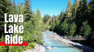
trail: Lava Lake
8:12 |
208 |
Jun 5, 2023 , Whistler
4:30 |
659 |
May 16, 2022 , Whistler
16:24 |
316 |
Apr 5, 2022 , Whistler
youtuber
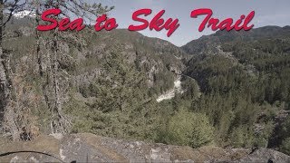
![Mountain Biking Whistler, BC - Sea to Sky Trail]()
11:52 |
1238 |
May 17, 2018 , Whistler

trail: Brandywine Meadows
7:58 |
549 |
Sep 9, 2022 , Whistler
Recent Trail Reports
| status | trail | date | condition | info | user |
|---|---|---|---|---|---|
| Cal-Cheak North | Apr 23, 2026 @ 9:56am (America/Vancouver) Apr 23, 2026 | Ideal | Jxroussel | ||
| Sea to Sky Cal-Cheak Alt | Jun 15, 2025 @ 10:06pm Jun 15, 2025 | Variable | mmaxk | ||
| Lava Lake | Jun 3, 2025 @ 1:36pm Jun 3, 2025 | Ideal | Bobbo8 | ||
| Cal-Cheak South | Apr 13, 2024 @ 1:40pm Apr 13, 2024 | Variable | ben-hryciw WORCA | ||
| Cal-Cheak MID-BFPP | Apr 13, 2024 @ 1:39pm Apr 13, 2024 | Ideal | ben-hryciw WORCA |
Activity Feed
| username | action | type | title | date |
|---|---|---|---|---|
| KristinaWngYNn | wishlist | trail | activity #97602260 | Jun 22, 2026 @ 8:27pm Jun 22, 2026 |
| s6fYUP | add | photo | activity #96506303 and 2 more | Jun 7, 2026 @ 4:24pm Jun 7, 2026 |
| radhoffman | ridden | trail | activity #96403076 | Jun 6, 2026 @ 1:41pm Jun 6, 2026 |
| s6fYUP | add | photo | activity #96317802 | Jun 5, 2026 @ 1:24pm Jun 5, 2026 |
| bgs2012 | wishlist | trail | activity #95998689 | May 31, 2026 @ 9:44pm May 31, 2026 |
Recent Comments
| username | type | title | comment | date |
|---|---|---|---|---|
| trail | This trail is overgrown and I don't recommend... | Sep 30, 2025 @ 7:08am Sep 30, 2025 | ||
| trail | Ideal but two trees down (one is big) just... | Apr 28, 2025 @ 5:23am Apr 28, 2025 | ||
| trail | With the downed trees cleared, this is now a... | Jun 23, 2024 @ 10:18am Jun 23, 2024 | ||
| trail | for those of us from Southern Ontario who cut... | Apr 14, 2024 @ 7:53am Apr 14, 2024 | ||
| trail | It's more hike than bike due to the basalt... | Apr 13, 2024 @ 1:44pm Apr 13, 2024 |
Nearby Areas
| name | distance | ||||
|---|---|---|---|---|---|
| Jane Lakes | 5 | 6.7 km | |||
| Cheakamus | 17 | 16 | 20 | 7 | 6.8 km |
| Whistler South CRA | 4 | 18 | 10 | 8.2 km | |
| Westside - Sproatt | 52 | 29 | 21 | 8.5 km | |
| Whistler Village | 1 | 13 | 8 | 3 | 10.5 km |
Local Products
Activity Type Stats
| activitytype | trails | distance | descent | descent distance | total vertical | rating | global rank | state rank | photos | reports | routes | ridelogs |
|---|---|---|---|---|---|---|---|---|---|---|---|---|
| Mountain Bike | 9 | 9 miles | 735 ft | 3 miles | 312 ft | #9,511 | #368 | 66 | 107 | 331 | ||
| E-Bike | 4 | 7 miles | 577 ft | 3 miles | 312 ft | #8,040 | #296 | 70 | 34 | |||
| Hike | 14 | 14 miles | 863 ft | 4 miles | 5,794 ft | #3,276 | #151 | 41 | 109 | 1,024 | ||
| Trail Running | 14 | 14 miles | 863 ft | 4 miles | 5,794 ft | #7,539 | #283 | 109 | 127 | |||
| Snowshoe | 2 | 8 miles | 413 ft | 2 miles | 5,794 ft | #1,013 | #88 | 6 | 5 | |||
| Backcountry Ski | 2 | 4 miles | 125 ft | 2,766 ft | 2,785 ft | #444 | #44 | 3 | 188 |
Frequently Asked Questions About Brandywine
▼
What are the highest rated mountain biking trails in Brandywine?
The highest rated mountain biking trails in Brandywine are:
- Sea To Sky (Brandywine/Cal-Cheak) (4.3/5)
- Sea to Sky Cal-Cheak Alt (4.1/5)
- Cal-Cheak North (3.8/5)
- Cal-Cheak South (3.5/5)
- Cal-Cheak MID-BFPP (2.6/5)
▼
What is the best time of the year to ride in Brandywine?
Based on ride log data, the most popular months to ride in Brandywine are:
- July (17 activities)
- August (10 activities)
- May (7 activities)
▼
Where can I park to ride in Brandywine?
There are 3 parking locations listed in Brandywine. The most popular parking spots are: View all parking and trailhead locations on the map to plan your visit.
▼
What is the longest trail in Brandywine?
The longest trail in Brandywine is Sea To Sky (Brandywine/Cal-Cheak) at 4.9 miles. View all trails sorted by distance.
Activities
Trails
Points of Interest
- By flipfantasia
 WORCA & contributors
 - Admins: WORCA, RMOW, WNSC, ridingloam, snowdan, nkoshure, WORCA, TFerrao, dirtshifter, seb-kemp
- #27876 - 4,563 views
- brandywine activity log | embed map of Brandywine mountain bike trails | brandywine mountain biking points of interest polygons
Downloading of trail gps tracks in kml & gpx formats is enabled for Brandywine.
You must login to download files.