close
-
Layers w
- Weather Layers
- Pro
- Pro
- Pro
- Pro
- Pro
- Pro
- More Layers
- Pro
- Pro
- Pro
- Pro
-
Upgrade to

3D
Trail Conditions
- Unknown
- Snow Groomed
- Snow Packed
- Snow Covered
- Snow Cover Partial
- Freeze/thaw Cycle
- Icy
- Prevalent Mud
- Wet
- Variable
- Ideal
- Dry
- Very Dry
Trail Flow (Ridden Direction)
Trailforks scans users ridelogs to determine the most popular direction each trail is ridden. A good flowing trail network will have most trails flowing in a single direction according to their intension.
The colour categories are based on what percentage of riders are riding a trail in its intended direction.
The colour categories are based on what percentage of riders are riding a trail in its intended direction.
- > 96%
- > 90%
- > 80%
- > 70%
- > 50%
- < 50%
- bi-directional trail
- no data
Trail Last Ridden
Trailforks scans ridelogs to determine the last time a trail was ridden.
- < 2 days
- < 1 week
- < 2 weeks
- < 1 month
- < 6 months
- > 6 months
Trail Ridden Direction
The intended direction a trail should be ridden.
- Downhill Only
- Downhill Primary
- Both Directions
- Uphill Primary
- Uphill Only
- One Direction
Contribute Details
Colors indicate trail is missing specified detail.
- Description
- Photos
- Description & Photos
- Videos
Trail Popularity ?
Trailforks scans ridelogs to determine which trails are ridden the most in the last 9 months.
Trails are compared with nearby trails in the same city region with a possible 25 colour shades.
Think of this as a heatmap, more rides = more kinetic energy = warmer colors.
- most popular
- popular
- less popular
- not popular
ATV/ORV/OHV Filter
Max Vehicle Width
inches
US Cell Coverage
Legend

Radar Time
Activity Recordings
Trailforks uses anonymized public activity data.
?
Activity Recordings
Trailforks uses anonymized public activity data.
?
Personal Heatmap
▶
Activity Types
all
/
none
▶
Options
2
Date range
month
–
Winter Trails
Warning
A routing network for winter maps does not exist. Selecting trails using the winter trails layer has been disabled.
Missing Trails
Most Popular
Least Popular
Trails are colored based on popularity. The more popular a trail is, the more red. Less popular trails trend towards green.
Jump Magnitude Heatmap
Heatmap of where riders jump on trails. Zoom in to see individual jumps, click circles to view jump details.
BC Backroad Status
![map legend]()
Service Road Atlas is a free to use, community-driven service for viewing and creating reports on the numerous back-country service roads around B.C. and Alberta.

Slope Aspect
Direction the slope faces
Trails Deemphasized
Trails are shown in grey.
Only show trails with no bike usage.
Suggested Layers
Based on selected activity type
Save the current map location and zoom level as your default home location whenever this page is loaded.
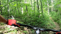
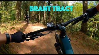
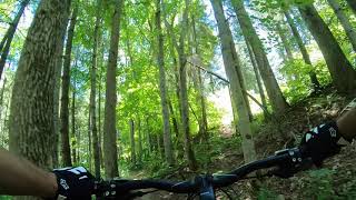
SaveThe Brant Tract has approximately 20km of trail and is located just south of Paisley on Concession 12. Trails range from tight and technical, to open and flowing concepts, and are able to satisfy beginning riders to the more advanced cross-country rider. While riding the property you will view spectacular vistas of valleys, wetlands and towering pines. Don’t forget to pack bug repellent
source: Brant Tract
Primary Trail Type: Cross-Country
 google parking directions
Links
Activities Click to view
- Mountain Bike
16 trails
- Hike
16 trails
- Trail Running
16 trails
- Snowshoe
0 trails
- Nordic Ski
0 trails
Region Details
- 2
- 6
- 5
- 3
Region Status
Caution as of Jun 3, 2026Local Trail Association
Stats
- Avg Trail Rating
- Trails (view details)
- 16
- Trails Mountain Bike
- 16
- Trails E-Bike
- 1
- Trails Hike
- 16
- Trails Trail Running
- 16
- Total Distance
- 11 miles
- Total Descent
- 493 ft
- Total Vertical
- 82 ft
- Highest Trailhead
- 823 ft
- Reports
- 236
- Photos
- 19
- Ridden Counter
- 2,187
Popular Brant Tract Mountain Biking Trails
• 90 ★ 5.0 • 2,694 ft • 3 ft • 228 •
Popular green difficulty singletrack. This mountain bike primary trail can be used both directions. On average it takes 3 minutes to complete this trail.
• 95 ★ 4.5 • 2,047 ft • 17 ft • 206 •
Popular blue difficulty singletrack. This mountain bike primary trail can be used both directions and has a easy overall physical rating with a 17 ft green climb. On average it takes 3 minutes to complete this trail.
• 85 ★ 4.4 • 2,238 ft • 28 ft • 188 •
Popular blue difficulty singletrack. This mountain bike primary trail can be used both directions. On average it takes 2 minutes to complete this trail.
• 65 ★ 4.0 • 2,743 ft • 37 ft • 182 •
Moderately popular blue difficulty singletrack. This mountain bike primary trail can be used both directions and has a easy overall physical rating with a 37 ft green climb. On average it takes 4 minutes to complete this trail.
• 100 ★ 4.5 • 4,787 ft • 39 ft • 180 •
Popular green difficulty singletrack. This mountain bike primary trail can be used both directions and has a easy overall physical rating with a 39 ft green climb. On average it takes 7 minutes to complete this trail.
• 60 ★ 5.0 • 3,855 ft • 15 ft • 168 •
Moderately popular green difficulty singletrack. This mountain bike primary trail can be used both directions. On average it takes 5 minutes to complete this trail.
• 65 ★ 5.0 • 2,890 ft • 68 ft • 166 •
Moderately popular blue difficulty singletrack. This mountain bike primary trail can be used both directions and has a easy overall physical rating with a 68 ft green climb. On average it takes 5 minutes to complete this trail.
• 75 ★ 5.0 • 1 mile • 99 ft • 153 •
It's black diamond because it's slightly harder than an intermediate trail but not by much. Some fun switchbacks and fairly skinny trail on side of hill but nothing too technical.
Videos of Brant Tract Mountain Bike
trail: Devil's Elbow
4:25 |
210 |
Jun 10, 2018
14:04 |
425 |
Sep 25, 2021

14:22 |
380 |
Aug 31, 2018

trail: Red Pine Loop
0:13 |
501 |
Jul 6, 2018 , Brockton Municipality

trail: Rabbit Run
9:08 |
434 |
Jul 6, 2018 , Brockton Municipality

trail: Rabbit Run
9:08 |
378 |
Jul 6, 2018 , Brockton Municipality

trail: The Express
9:16 |
461 |
Jul 6, 2018 , Brockton Municipality
trail: The Shocker
4:22 |
441 |
Jul 6, 2018 , Brockton Municipality
Recent Trail Reports
| status | trail | date | condition | info | user |
|---|---|---|---|---|---|
| The Brainbuster | Jun 3, 2026 @ 11:52am (America/Toronto) Jun 3, 2026 | Ideal | MichealYu9vCs | ||
| Devil's Elbow | May 15, 2026 @ 2:11pm (America/Toronto) May 15, 2026 | Ideal | trail-knob | ||
| The Shocker | May 15, 2026 @ 2:10pm (America/Toronto) May 15, 2026 | Ideal | trail-knob | ||
| Buck Run | May 15, 2026 @ 2:10pm (America/Toronto) May 15, 2026 | Ideal | trail-knob | ||
| Razor's Edge | May 15, 2026 @ 2:10pm (America/Toronto) May 15, 2026 | Ideal | trail-knob | ||
| The Widow Maker | May 15, 2026 @ 2:10pm (America/Toronto) May 15, 2026 | Variable | trail-knob | ||
| Rabbit Run | May 15, 2026 @ 2:09pm (America/Toronto) May 15, 2026 | Ideal | trail-knob | ||
| Rick's Retreat | May 15, 2026 @ 2:08pm (America/Toronto) May 15, 2026 | Variable | trail-knob | ||
| The Maples | May 15, 2026 @ 2:07pm (America/Toronto) May 15, 2026 | Ideal | trail-knob | ||
| Red Pine Loop | May 15, 2026 @ 2:07pm (America/Toronto) May 15, 2026 | Ideal | trail-knob |
Activity Feed
| username | action | type | title | date |
|---|---|---|---|---|
| MichealYu9vCs | comment | report | activity #96585470 | Jun 8, 2026 @ 10:15pm Jun 8, 2026 |
| PE02Bk | wishlist | region | activity #96412161 | Jun 6, 2026 @ 3:50pm Jun 6, 2026 |
| MichealYu9vCs | add | report | activity #96159078 | Jun 3, 2026 @ 8:53am Jun 3, 2026 |
| trail-knob | add | report | activity #94757913 and 9 more | May 15, 2026 @ 11:07am May 15, 2026 |
| Lifebynels | wishlist | region | activity #93854147 | May 2, 2026 @ 6:40am May 2, 2026 |
Recent Comments
| username | type | title | comment | date |
|---|---|---|---|---|
| report | Tree cleared | Jun 8, 2026 @ 10:15pm Jun 8, 2026 | ||
| report | Closure ended | Sep 3, 2025 @ 3:28pm Sep 3, 2025 | ||
| trail | Some deep ruts where puddles have been... | Aug 20, 2024 @ 5:35pm Aug 20, 2024 | ||
| trail | Found all trail littered in roots and a total... | Aug 6, 2019 @ 5:54pm Aug 6, 2019 | ||
| trail | Tried this trail after a rain fall and it was... | Aug 6, 2019 @ 5:46pm Aug 6, 2019 |
Nearby Areas
| name | distance | ||||
|---|---|---|---|---|---|
| Hanover Community Trails | 11.6 km | ||||
| SVCA - Allan Park Conservation Area | 11 | 8 | 16.3 km | ||
| Biener's Bush | 7 | 1 | 16.8 km | ||
| MacGregor Point Provinical Park | 5 | 1 | 16.9 km | ||
| Inverhuron Bike Park | 2 | 17.8 km |
Activity Type Stats
| activitytype | trails | distance | descent | descent distance | total vertical | rating | global rank | state rank | photos | reports | routes | ridelogs |
|---|---|---|---|---|---|---|---|---|---|---|---|---|
| Mountain Bike | 16 | 11 miles | 492 ft | 3 miles | 82 ft | #4,453 | #86 | 16 | 236 | 1,117 | ||
| E-Bike | 1 | 1 mile | 115 ft | 2,270 ft | 56 ft | 138 | 10 | |||||
| Hike | 16 | 11 miles | 492 ft | 3 miles | 82 ft | #11,835 | #268 | 3 | 236 | 23 | ||
| Trail Running | 16 | 11 miles | 492 ft | 3 miles | 82 ft | #10,787 | #198 | 236 | 25 |
Frequently Asked Questions About Brant Tract
▼
What are the highest rated mountain biking trails in Brant Tract?
The highest rated mountain biking trails in Brant Tract are:
- Buck Run (4.2/5)
- Razor's Edge (4.2/5)
- Devil's Elbow (4.2/5)
- Rabbit Run (4.1/5)
- Rolling Ferns (4.1/5)
▼
What is the best time of the year to ride in Brant Tract?
Based on ride log data, the most popular months to ride in Brant Tract are:
- July (47 activities)
- August (37 activities)
- September (31 activities)
▼
Where can I park to ride in Brant Tract?
There are 1 parking locations listed in Brant Tract. The most popular parking spots are:
▼
What is the longest trail in Brant Tract?
The longest trail in Brant Tract is The Widow Maker at 1.1 miles. View all trails sorted by distance.
Activities
Trails
Points of Interest
- By markholloway
 Trailforks Map Team & contributors
 - Admins: apply
- #9697 - 8,369 views
- brant tract activity log | embed map of Brant Tract mountain bike trails | brant tract mountain biking points of interest
Downloading of trail gps tracks in kml & gpx formats is enabled for Brant Tract.
You must login to download files.