close
-
Layers w
- Weather Layers
- Pro
- Pro
- Pro
- Pro
- Pro
- Pro
- More Layers
- Pro
- Pro
- Pro
- Pro
-
Upgrade to

3D
Trail Conditions
- Unknown
- Snow Groomed
- Snow Packed
- Snow Covered
- Snow Cover Partial
- Freeze/thaw Cycle
- Icy
- Prevalent Mud
- Wet
- Variable
- Ideal
- Dry
- Very Dry
Trail Flow (Ridden Direction)
Trailforks scans users ridelogs to determine the most popular direction each trail is ridden. A good flowing trail network will have most trails flowing in a single direction according to their intension.
The colour categories are based on what percentage of riders are riding a trail in its intended direction.
The colour categories are based on what percentage of riders are riding a trail in its intended direction.
- > 96%
- > 90%
- > 80%
- > 70%
- > 50%
- < 50%
- bi-directional trail
- no data
Trail Last Ridden
Trailforks scans ridelogs to determine the last time a trail was ridden.
- < 2 days
- < 1 week
- < 2 weeks
- < 1 month
- < 6 months
- > 6 months
Trail Ridden Direction
The intended direction a trail should be ridden.
- Downhill Only
- Downhill Primary
- Both Directions
- Uphill Primary
- Uphill Only
- One Direction
Contribute Details
Colors indicate trail is missing specified detail.
- Description
- Photos
- Description & Photos
- Videos
Trail Popularity ?
Trailforks scans ridelogs to determine which trails are ridden the most in the last 9 months.
Trails are compared with nearby trails in the same city region with a possible 25 colour shades.
Think of this as a heatmap, more rides = more kinetic energy = warmer colors.
- most popular
- popular
- less popular
- not popular
ATV/ORV/OHV Filter
Max Vehicle Width
inches
US Cell Coverage
Legend

Radar Time
Activity Recordings
Trailforks uses anonymized public activity data.
?
Activity Recordings
Trailforks uses anonymized public activity data.
?
Personal Heatmap
▶
Activity Types
all
/
none
▶
Options
2
Date range
month
–
Winter Trails
Warning
A routing network for winter maps does not exist. Selecting trails using the winter trails layer has been disabled.
Missing Trails
Most Popular
Least Popular
Trails are colored based on popularity. The more popular a trail is, the more red. Less popular trails trend towards green.
Jump Magnitude Heatmap
Heatmap of where riders jump on trails. Zoom in to see individual jumps, click circles to view jump details.
BC Backroad Status
![map legend]()
Service Road Atlas is a free to use, community-driven service for viewing and creating reports on the numerous back-country service roads around B.C. and Alberta.

Slope Aspect
Direction the slope faces
Trails Deemphasized
Trails are shown in grey.
Only show trails with no bike usage.
Suggested Layers
Based on selected activity type
Save the current map location and zoom level as your default home location whenever this page is loaded.
Save
No description for Bratislava has been added yet!
Login or register to submit one.
Activities Click to view
- Mountain Bike
77 trails
- E-Bike
47 trails
- Gravel Bike
0 trails
- Adaptive Bike
0 trails
- Winter Fat Bike
0 trails
- Horse
6 trails
- Hike
47 trails
- Trail Running
43 trails
- Snowshoe
14 trails
- Downhill Ski
0 trails
- Nordic Ski
6 trails
Region Details
- 22
- 7
- 27
- 9
- 8
- 1
Region Status
Open as of Jun 18, 2026Stats
- Avg Trail Rating
- Trails (view details)
- 77
- Trails Mountain Bike
- 77
- Trails E-Bike
- 47
- Trails Horse
- 6
- Trails Hike
- 47
- Trails Trail Running
- 43
- Trails Snowmobile
- 1
- Trails Snowshoe
- 14
- Trails Backcountry Ski
- 2
- Trails Nordic Ski
- 6
- Total Distance
- 69 miles
- Total Descent
- 15,035 ft
- Total Vertical
- 1,235 ft
- Highest Trailhead
- 1,662 ft
- Reports
- 4,418
- Photos
- 489
- Ridden Counter
- 17,424
Sub Regions
-
Bikepark Koliba
- 1
- 2
- 1
-
Bratislavský lesopark
- 4
- 22
- 2
- 3
-
Devínska Kobyla
- 1
-
Trail Biely Kríž
- 2
- 2
- 2
-
Záhorská Bystrica
- 2
- 2
- 3
- 1
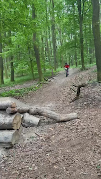
Popular Bratislava Mountain Biking Trails
• 100 ★ 4.6 • 2,720 ft • 0 ft • 528 •
Trail is initial, and the highest elevated part of the TrailBK. It starts under Biely Kríž. This part leads throught undemanding terrain with one light climb and is therefore also suitable for beginners and as a warm-up trail. It has...
• 90 ★ 4.7 • 4,226 ft • 4 ft • 493 •
TBK 2 starts at the top of Piesky (447m). It is a fast, medium-difficulty trail that is almost exclusively downhill. Trail consist of smaller and bigger jumps and gap-jumps, which can be bypassed if needed, and a lot of berms. This part...
• 100 ★ 4.4 • 2 miles • 77 ft • 483 •
Simple trail even for beginners. But nice alternative to parallel tarmac road. Perfectly ride-able in both directions. Just two wooden bridges and few built steps.One or two curves little bit narrow in the steeper hillside, just be...
• 100 ★ 4.3 • 4,659 ft • 25 ft • 463 •
Highly rated popular blue difficulty machine groomed. This mountain bike primary trail can be used downhill only and has a moderate overall physical rating. It features a-frame and berm. Trail visibility is always easy to follow. On average it takes 12 minutes to complete this trail.
• 80 ★ 4.8 • 7 miles • 759 ft • 454 •
Simple but beautiful and longest singletrail in Karpaty.
• 85 ★ 4.8 • 5,144 ft • 0 ft • 379 •
Access to trail is located after the uphill section coming off the Červený kríž location. The character of this trail is mainly downhill with few short uphill sections. Slope of the trail is moderate with medium difficulty. The more...
• 80 ★ 4.5 • 3,547 ft • 40 ft • 373 •
Highly rated popular green difficulty singletrack. This mountain bike primary trail can be used both directions and has a easy overall physical rating with a 40 ft green climb. It features bridge. On average it takes 6 minutes to complete this trail.
Bratislava Mountain Bike Routes
16 miles • 2,311 ft • 5 •
Račianska nádhera: Sv.vrch, 3 jamy,Krasňanský a Pekná cesta
★ 4.0 • 4 miles • 714 ft • 0 • Point to Point •
Lesná cesta zacinajuca pri zahradach nad Technickym Sklom idúca popod Devínsku Kobylu postupným...
61 miles • 8,142 ft • 0 • Point to Point •
Beautiful trail with some great views. A lot of wildlife can be seen. 100% rideable.
14 miles • 3,158 ft • 9 • Loop • Race •
We invite you to the / informal / continuation of TBK Enduro race 2019. This time in the form of the final...
• 3 miles • 566 ft • 1 •
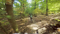
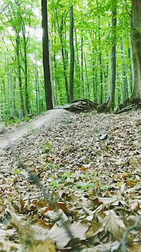
Photos of Bratislava Mountain Bike
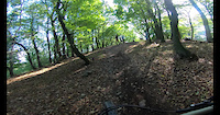
Videos of Bratislava Mountain Bike
trail: Krivé Jarky
0:06 |
396 |
May 17, 2024
trail: TBK Tri
6:10 |
109 |
Mar 2, 2022
trail: Baník
3:16 |
73 |
Jan 25, 2022
trail: Krivé Jarky
4:42 |
362 |
Jan 24, 2022
trail: Baník
0:05 |
301 |
Apr 18, 2021

trail: Kameňák
8:41 |
307 |
Dec 3, 2020
trail: Krasnansky trail
0:54 |
88 |
Oct 10, 2020
trail: TBK Tri
0:06 |
161 |
May 1, 2020
Recent Trail Reports
| status | trail | date | condition | info | user |
|---|---|---|---|---|---|
| TBK Dva | Jun 18, 2026 @ 5:45pm (Europe/Bratislava) Jun 18, 2026 | Ideal | miskolci | ||
| TBK 2 & 3 access road | Jun 18, 2026 @ 5:45pm (Europe/Bratislava) Jun 18, 2026 | Ideal | miskolci | ||
| TBK Jedna | Jun 18, 2026 @ 5:45pm (Europe/Bratislava) Jun 18, 2026 | Ideal | miskolci | ||
| Podokraj | Jun 18, 2026 @ 5:45pm (Europe/Bratislava) Jun 18, 2026 | Ideal | miskolci | ||
| TBK Tri | Jun 14, 2026 @ 8:44pm (Europe/Bratislava) Jun 14, 2026 | Dry | miskolci | ||
| Svätý Vrch 4 | Jun 14, 2026 @ 8:44pm (Europe/Bratislava) Jun 14, 2026 | Ideal | miskolci | ||
| Blue Trail | Jun 10, 2026 @ 4:30pm (Europe/Bratislava) Jun 10, 2026 | Dry | skorpionx7 | ||
| Pekná cesta 1 | Jun 10, 2026 @ 4:30pm (Europe/Bratislava) Jun 10, 2026 | Dry | skorpionx7 | ||
| Obchadzka cervenej TZ | Jun 10, 2026 @ 4:30pm (Europe/Bratislava) Jun 10, 2026 | Ideal | skorpionx7 | ||
| Patbojarsky trail Access Road | Jun 10, 2026 @ 4:30pm (Europe/Bratislava) Jun 10, 2026 | Ideal | skorpionx7 |
Activity Feed
| username | action | type | title | date |
|---|---|---|---|---|
| Martinyle8IS | wishlist | trail | activity #97651823 | Jun 23, 2026 @ 2:15pm Jun 23, 2026 |
| xboyHero06 | ridden | trail | activity #97501917 and 1 more | Jun 21, 2026 @ 10:57am Jun 21, 2026 |
| miskolci | add | report | activity #97272907 and 2 more | Jun 18, 2026 @ 1:22pm Jun 18, 2026 |
| miskolci | add | report | activity #97272906 | Jun 18, 2026 @ 1:22pm Jun 18, 2026 |
| cervom | comment | trail | activity #97028852 | Jun 15, 2026 @ 2:13am Jun 15, 2026 |
Recent Comments
| username | type | title | comment | date |
|---|---|---|---|---|
| trail | Dopad na dropoch na konci by si zasluzil... | Jun 15, 2026 @ 2:13am Jun 15, 2026 | ||
| trail | Definitely a difficult black trail with lots... | Sep 13, 2025 @ 10:21pm Sep 13, 2025 | ||
| trail | Fun, flowy red trail! | Sep 13, 2025 @ 10:17pm Sep 13, 2025 | ||
| trail | Enjoyable red trail! | Sep 13, 2025 @ 10:16pm Sep 13, 2025 | ||
| trail | Nice, flowy red trail! | Sep 13, 2025 @ 10:15pm Sep 13, 2025 |
Local Badges
-
Long and steady0 awarded -

All Black Trails in Bratislava region2 awarded -

Epic Ride 50k8,143 awarded -

Big Ride 30k21,700 awarded -

Top 10 Trails17 awarded -

Completionist2 awarded
Bike & Skill Parks
| name | type | city | rating |
|---|---|---|---|
| Bikepark Koliba | bike park | Bratislava | |
| BMX Rača | skill park | Bratislava | |
| PumpPark Petržalka | skill park | Bratislava | |
| Pedal pumptrack Vrakuňa | skill park | Bratislava | |
| Bmx Dráha Dunajská Lužná | skill park | Bratislava |
Activity Type Stats
| activitytype | trails | distance | descent | descent distance | total vertical | rating | global rank | state rank | photos | reports | routes | ridelogs |
|---|---|---|---|---|---|---|---|---|---|---|---|---|
| Mountain Bike | 77 | 67 miles | 14,081 ft | 32 miles | 1,234 ft | #407 | #3 | 488 | 4,417 | 5 | 92,525 | |
| E-Bike | 47 | 45 miles | 7,362 ft | 20 miles | 1,234 ft | #202 | #2 | 4,135 | 3 | 5,687 | ||
| Horse | 6 | 5 miles | 410 ft | 2 miles | 791 ft | #162 | #1 | 339 | ||||
| Hike | 47 | 46 miles | 6,588 ft | 19 miles | 1,217 ft | #420 | #4 | 4,135 | 2,635 | |||
| Trail Running | 43 | 42 miles | 5,650 ft | 17 miles | 1,217 ft | #620 | #8 | 4,134 | 2,539 | |||
| Snowmobile | 1 | 2 miles | 607 ft | |||||||||
| Snowshoe | 14 | 14 miles | 2,172 ft | 7 miles | 883 ft | #61 | #5 | 78 | ||||
| Backcountry Ski | 2 | 1 mile | 144 ft | 3,579 ft | 138 ft | 1 | ||||||
| Nordic Ski | 6 | 9 miles | 1,414 ft | 5 miles | 538 ft | #112 | #6 | 59 | 63 |
Frequently Asked Questions About Bratislava
▼
What are the best places to ride in Bratislava?
Bratislava has 5 areas to explore for mountain biking. The top rated areas are:
▼
What are the highest rated mountain biking trails in Bratislava?
The highest rated mountain biking trails in Bratislava are:
- TBK Tri (4.7/5)
- Singletrack Cerova Draha (4.6/5)
- Slalomka (4.6/5)
- TBK Dva (4.5/5)
- Krivé Jarky (4.5/5)
▼
What is the best time of the year to ride in Bratislava?
Based on ride log data, the most popular months to ride in Bratislava are:
- July (481 activities)
- May (457 activities)
- August (446 activities)
▼
Where can I park to ride in Bratislava?
There are 10 parking locations listed in Bratislava. The most popular parking spots are: View all parking and trailhead locations on the map to plan your visit.
Activities
Trails
Points of Interest
- By brenthillier
 NSMBA TRAILFORKS & contributors
 - Admins: jxxw, SBOZ, Kenaiwolf
- #7685 - 46,173 views
- bratislava activity log | embed map of Bratislava mountain bike trails | bratislava mountain biking points of interest
Downloading of trail gps tracks in kml & gpx formats is enabled for Bratislava.
You must login to download files.