close
-
Layers w
- Weather Layers
- Pro
- Pro
- Pro
- Pro
- Pro
- Pro
- More Layers
- Pro
- Pro
- Pro
- Pro
-
Upgrade to

3D
Trail Conditions
- Unknown
- Snow Groomed
- Snow Packed
- Snow Covered
- Snow Cover Partial
- Freeze/thaw Cycle
- Icy
- Prevalent Mud
- Wet
- Variable
- Ideal
- Dry
- Very Dry
Trail Flow (Ridden Direction)
Trailforks scans users ridelogs to determine the most popular direction each trail is ridden. A good flowing trail network will have most trails flowing in a single direction according to their intension.
The colour categories are based on what percentage of riders are riding a trail in its intended direction.
The colour categories are based on what percentage of riders are riding a trail in its intended direction.
- > 96%
- > 90%
- > 80%
- > 70%
- > 50%
- < 50%
- bi-directional trail
- no data
Trail Last Ridden
Trailforks scans ridelogs to determine the last time a trail was ridden.
- < 2 days
- < 1 week
- < 2 weeks
- < 1 month
- < 6 months
- > 6 months
Trail Ridden Direction
The intended direction a trail should be ridden.
- Downhill Only
- Downhill Primary
- Both Directions
- Uphill Primary
- Uphill Only
- One Direction
Contribute Details
Colors indicate trail is missing specified detail.
- Description
- Photos
- Description & Photos
- Videos
Trail Popularity ?
Trailforks scans ridelogs to determine which trails are ridden the most in the last 9 months.
Trails are compared with nearby trails in the same city region with a possible 25 colour shades.
Think of this as a heatmap, more rides = more kinetic energy = warmer colors.
- most popular
- popular
- less popular
- not popular
ATV/ORV/OHV Filter
Max Vehicle Width
inches
US Cell Coverage
Legend

Radar Time
Activity Recordings
Trailforks uses anonymized public activity data.
?
Activity Recordings
Trailforks uses anonymized public activity data.
?
Personal Heatmap
▶
Activity Types
all
/
none
▶
Options
2
Date range
month
–
Winter Trails
Warning
A routing network for winter maps does not exist. Selecting trails using the winter trails layer has been disabled.
Missing Trails
Most Popular
Least Popular
Trails are colored based on popularity. The more popular a trail is, the more red. Less popular trails trend towards green.
Jump Magnitude Heatmap
Heatmap of where riders jump on trails. Zoom in to see individual jumps, click circles to view jump details.
BC Backroad Status
![map legend]()
Service Road Atlas is a free to use, community-driven service for viewing and creating reports on the numerous back-country service roads around B.C. and Alberta.

Slope Aspect
Direction the slope faces
Trails Deemphasized
Trails are shown in grey.
Only show trails with no bike usage.
Suggested Layers
Based on selected activity type
Save the current map location and zoom level as your default home location whenever this page is loaded.
Save
No description for Brattleboro has been added yet!
Login or register to submit one.
Activities Click to view
- Mountain Bike
32 trails
- Hike
32 trails
- Trail Running
32 trails
- Nordic Ski
13 trails
Region Details
- 1
- 25
- 5
Region Status
Open as of Nov 16, 2025Stats
- Avg Trail Rating
- Trails (view details)
- 42
- Trails Mountain Bike
- 32
- Trails Hike
- 32
- Trails Trail Running
- 32
- Trails Snowshoe
- 2
- Trails Nordic Ski
- 13
- Total Distance
- 20 miles
- Total Descent
- 2,327 ft
- Total Vertical
- 468 ft
- Highest Trailhead
- 692 ft
- Reports
- 12
- Photos
- 1
- Ridden Counter
- 1,029
Sub Regions
-
Retreat Farm
- 25
- 3
Popular Brattleboro Mountain Biking Trails
• 90 ★ 0.0 • 1,618 ft • 118 ft • 54 •
Popular green difficulty singletrack. This mountain bike primary trail. On average it takes 4 minutes to complete this trail.
• 100 ★ 4.0 • 3,225 ft • 173 ft • 53 •
Popular green difficulty singletrack. This mountain bike primary trail. On average it takes 8 minutes to complete this trail.
• 65 ★ 0.0 • 2,343 ft • 61 ft • 46 •
Moderately popular green difficulty singletrack. This mountain bike primary trail can be used both directions. On average it takes 6 minutes to complete this trail.
• 100 ★ 0.0 • 2,635 ft • 163 ft • 45 •
Popular green difficulty singletrack. This mountain bike primary trail. On average it takes 6 minutes to complete this trail.
• 70 ★ 0.0 • 604 ft • 24 ft • 41 •
Popular green difficulty singletrack. This mountain bike primary trail. On average it takes minutes to complete this trail.
• 75 ★ 0.0 • 1,434 ft • 5 ft • 39 •
Popular blue difficulty singletrack. This multi-use trail can be used both directions and has a moderate overall physical rating with a 5 ft blue climb. On average it takes 4 minutes to complete this trail.
• 85 ★ 0.0 • 690 ft • 53 ft • 37 •
Popular green difficulty singletrack. This mountain bike primary trail. On average it takes 1 minutes to complete this trail.
• 60 ★ 0.0 • 1,480 ft • 177 ft • 32 •
Moderately popular green difficulty mixed. This mountain bike primary trail. On average it takes 4 minutes to complete this trail.
Videos of Brattleboro Mountain Bike
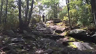
trail: Arcadia
0:28 |
208 |
Oct 2, 2015
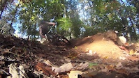
trail: Just For Fun
0:28 |
546 |
Oct 5, 2014
trail: Side Trail
36:10 |
243 |
May 27, 2013

trail: Just For Fun
0:01 |
282 |
Jan 11, 2010
Recent Trail Reports
| status | trail | date | condition | info | user |
|---|---|---|---|---|---|
| Ledge Trail | Nov 16, 2025 @ 9:53am (America/New_York) Nov 16, 2025 | Variable | BrokenHandlebar PHP | ||
| Tower Road | Nov 16, 2025 @ 9:53am (America/New_York) Nov 16, 2025 | Variable | BrokenHandlebar PHP | ||
| Upper Woodlands Trail | Jun 28, 2024 @ 6:52am Jun 28, 2024 | Ideal | Markl6iNd | ||
| Lower Woodlands Trail | Sep 1, 2023 @ 6:44am Sep 1, 2023 | Ideal | Markl6iNd | ||
| Riverstone Preserve | Oct 24, 2022 @ 8:32am Oct 24, 2022 | Wet | Geohoundw | ||
| Arcadia | May 12, 2022 @ 6:15pm May 12, 2022 | Dry | mtenzin | ||
| Side Trail | Oct 15, 2019 @ 11:42am Oct 15, 2019 | Dry | afsdedanaan | ||
| Cemetery Trail | Oct 15, 2019 @ 11:42am Oct 15, 2019 | Dry | afsdedanaan | ||
| Main Trail | Jul 29, 2017 @ 10:10am Jul 29, 2017 | Dry | ErikMM PMTB Sterling |
Activity Feed
| username | action | type | title | date |
|---|---|---|---|---|
| BikeRegCom | add | event | activity #91146142 | Mar 23, 2026 @ 8:36am Mar 23, 2026 |
| BrokenHandlebar | add | report | activity #84270614 and 1 more | Nov 16, 2025 @ 1:41pm Nov 16, 2025 |
| gterwilliger | wishlist | region | activity #78999256 | Aug 26, 2025 @ 12:22pm Aug 26, 2025 |
| eidhaw | wishlist | region | activity #78335279 | Aug 17, 2025 @ 7:59am Aug 17, 2025 |
| fakejerreira | wishlist | region | activity #72549126 | May 27, 2025 @ 6:18pm May 27, 2025 |
Recent Comments
| username | type | title | comment | date |
|---|---|---|---|---|
| trail | There are actually quite a few unmarked single... | Aug 3, 2024 @ 2:37pm Aug 3, 2024 |
Local Badges
-

10 Green Trails12 awarded -

Epic Ride Climb 2k20 awarded -

Climbing 10k Badge7 awarded -

Climbing 100k Badge0 awarded -

Epic Ride Descent 2k18 awarded -

Descent 10k Badge7 awarded
Activity Type Stats
| activitytype | trails | distance | descent | descent distance | total vertical | rating | global rank | state rank | photos | reports | routes | ridelogs |
|---|---|---|---|---|---|---|---|---|---|---|---|---|
| Mountain Bike | 32 | 13 miles | 1,772 ft | 5 miles | 423 ft | #8,456 | #2,715 | 1 | 12 | 1,906 | ||
| Hike | 32 | 13 miles | 1,772 ft | 5 miles | 423 ft | #8,996 | #3,166 | 12 | 162 | |||
| Trail Running | 32 | 13 miles | 1,772 ft | 5 miles | 423 ft | #8,498 | #2,828 | 12 | 70 | |||
| Snowshoe | 2 | 4 miles | 128 ft | 1 mile | 108 ft | 4 | ||||||
| Nordic Ski | 13 | 11 miles | 682 ft | 4 miles | 469 ft | #1,064 | #459 | 64 |
Frequently Asked Questions About Brattleboro
▼
What are the best places to ride in Brattleboro?
Brattleboro has 2 areas to explore for mountain biking. The top rated areas are:
▼
What are the highest rated mountain biking trails in Brattleboro?
The highest rated mountain biking trails in Brattleboro are:
- Lower Woodlands Trail (4/5)
- Ice Pond Trail (4/5)
- Treehouse Trail (4/5)
- Arcadia (4/5)
- Tower Road (4/5)
▼
What is the best time of the year to ride in Brattleboro?
Based on ride log data, the most popular months to ride in Brattleboro are:
- June (27 activities)
- August (26 activities)
- May (26 activities)
▼
Where can I park to ride in Brattleboro?
There are 5 parking locations listed in Brattleboro. The most popular parking spots are: View all parking and trailhead locations on the map to plan your visit.
Activities
Trails
Points of Interest
- By StephaneMarceau
 TRAILFORKS & contributors
 - Admins: VMBA, Velomont, Jwduston, B-K NEMBA, WCoTA, NATSVMBA
- #12262 - 7,394 views
- brattleboro activity log | embed map of Brattleboro mountain bike trails | brattleboro mountain biking points of interest
Downloading of trail gps tracks in kml & gpx formats is enabled for Brattleboro.
You must login to download files.