close
-
Layers w
- Weather Layers
- Pro
- Pro
- Pro
- Pro
- Pro
- Pro
- More Layers
- Pro
- Pro
- Pro
- Pro
-
Upgrade to

3D
Trail Conditions
- Unknown
- Snow Groomed
- Snow Packed
- Snow Covered
- Snow Cover Partial
- Freeze/thaw Cycle
- Icy
- Prevalent Mud
- Wet
- Variable
- Ideal
- Dry
- Very Dry
Trail Flow (Ridden Direction)
Trailforks scans users ridelogs to determine the most popular direction each trail is ridden. A good flowing trail network will have most trails flowing in a single direction according to their intension.
The colour categories are based on what percentage of riders are riding a trail in its intended direction.
The colour categories are based on what percentage of riders are riding a trail in its intended direction.
- > 96%
- > 90%
- > 80%
- > 70%
- > 50%
- < 50%
- bi-directional trail
- no data
Trail Last Ridden
Trailforks scans ridelogs to determine the last time a trail was ridden.
- < 2 days
- < 1 week
- < 2 weeks
- < 1 month
- < 6 months
- > 6 months
Trail Ridden Direction
The intended direction a trail should be ridden.
- Downhill Only
- Downhill Primary
- Both Directions
- Uphill Primary
- Uphill Only
- One Direction
Contribute Details
Colors indicate trail is missing specified detail.
- Description
- Photos
- Description & Photos
- Videos
Trail Popularity ?
Trailforks scans ridelogs to determine which trails are ridden the most in the last 9 months.
Trails are compared with nearby trails in the same city region with a possible 25 colour shades.
Think of this as a heatmap, more rides = more kinetic energy = warmer colors.
- most popular
- popular
- less popular
- not popular
ATV/ORV/OHV Filter
Max Vehicle Width
inches
US Cell Coverage
Legend

Radar Time
Activity Recordings
Trailforks uses anonymized public activity data.
?
Activity Recordings
Trailforks uses anonymized public activity data.
?
Personal Heatmap
▶
Activity Types
all
/
none
▶
Options
2
Date range
month
–
Winter Trails
Warning
A routing network for winter maps does not exist. Selecting trails using the winter trails layer has been disabled.
Missing Trails
Most Popular
Least Popular
Trails are colored based on popularity. The more popular a trail is, the more red. Less popular trails trend towards green.
Jump Magnitude Heatmap
Heatmap of where riders jump on trails. Zoom in to see individual jumps, click circles to view jump details.
BC Backroad Status
![map legend]()
Service Road Atlas is a free to use, community-driven service for viewing and creating reports on the numerous back-country service roads around B.C. and Alberta.

Slope Aspect
Direction the slope faces
Trails Deemphasized
Trails are shown in grey.
Only show trails with no bike usage.
Suggested Layers
Based on selected activity type
Save the current map location and zoom level as your default home location whenever this page is loaded.
SaveActivities Click to view
- Mountain Bike
204 trails
- E-Bike
51 trails
- Gravel Bike
0 trails
- Adaptive Bike
0 trails
- Winter Fat Bike
0 trails
- Horse
34 trails
- Hike
212 trails
- Trail Running
210 trails
- Dirtbike/Moto
40 trails
- ATV/ORV/OHV
28 trails
- Snowmobile
0 trails
- Snowshoe
8 trails
- Downhill Ski
199 trails
- Backcountry Ski
0 trails
- Nordic Ski
33 trails
Region Details
- 58
- 44
- 75
- 26
Region Status
Caution as of 2 daysLocal Trail Association
Stats
- Avg Trail Rating
- Trails (view details)
- 403
- Trails Mountain Bike
- 204
- Trails E-Bike
- 51
- Trails Horse
- 34
- Trails Hike
- 212
- Trails Trail Running
- 210
- Trails Dirtbike/Moto
- 40
- Trails Observed Trials
- 1
- Trails ATV/ORV/OHV
- 28
- Trails Snowshoe
- 8
- Trails Downhill Ski
- 201
- Trails Nordic Ski
- 34
- Total Distance
- 408 miles
- Total Descent
- 131,085 ft
- Total Vertical
- 5,196 ft
- Highest Trailhead
- 14,257 ft
- Reports
- 5,627
- Photos
- 705
- Ridden Counter
- 118,097
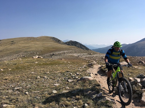
Popular Breckenridge Mountain Biking Trails
• 100 ★ 3.9 • 1,669 ft • 225 ft • 2,230 •
Switchbacks galore. Can be done as an arduous climb or a fast descent. Either way, be wary of riders travelling in the opposite direction. Blind and loose switchbacks make this a popular trail.
• 100 ★ 4.4 • 1 mile • 47 ft • 1,883 •
Fast and mostly smooth berms that throw you through the aspen trees.
• 100 ★ 4.5 • 1,684 ft • 17 ft • 1,779 •
Fun downhill trail with nice berms and little table tops to air out on. Mostly packed dirt, may have some brake bumps here and there, but not rocky or loose. You can roll everything and take it slow and easy.
• 100 ★ 4.5 • 2 miles • 25 ft • 1,638 •
One of the best downhill flow trails in Breckenridge. Features berms, jumps, and small drops. Trail features were recently added which make this trail more difficult than before, though some alternate easier lines exist.
• 100 ★ 3.5 • 2,300 ft • 175 ft • 1,595 •
Primarily used as a climbing trail to access the neighboring and . Fairly leisurely climb. Can also be used as an easier alternate for descending.
• 95 ★ 4.1 • 1 mile • 45 ft • 1,535 •
A great winding mountain trail through the forest - downhill primary. Occasional roots and rock gardens help to keep it interesting. Acceptable downhill for kids age 10+.
• 95 ★ 4.4 • 3 miles • 183 ft • 1,463 •
Highly rated popular blue difficulty singletrack. This mountain bike primary trail can be used both directions. On average it takes 19 minutes to complete this trail.
• 100 ★ 4.0 • 3,573 ft • 17 ft • 1,460 •
Highly rated popular black diamond difficulty singletrack. This mountain bike primary trail and has a hard overall physical rating with a 17 ft black diamond climb. On average it takes 5 minutes to complete this trail.
Breckenridge Mountain Bike Routes
★ 5.0 • 16 miles • 2,158 ft • 10 • Loop •
Fun 15.5 mile intermediate loop that travels some of the CO Trail in the Breckenridge area. Park at the...
★ 4.5 • 18 miles • 2,656 ft • 6 • Shuttled •
This is a car shuttle option for riding the Colorado Trail from Tiger Road / Muggins Gulch near...
★ 4.0 • 18 miles • 2,852 ft • 9 •
Starting in the Highlands, you climb a bit and head over to Side door, which is always a blast. Bombing...
★ 4.0 • 11 miles • 1,383 ft • 21 • Loop •
This loop stitches together several fun sections of trail to include some fun descents in the area...
★ 3.5 • 10 miles • 1,539 ft • 8 • Loop •
Loop wrapping together 2 nice jump trails, & B-line
★ 4.0 • 10 miles • 1,672 ft • 23 • Loop •
Great Loop. Steep climbing out of and approaching Sally Ford Mine. Descent on rocky in parts and tricky....
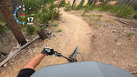
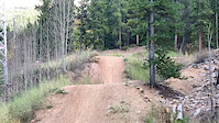
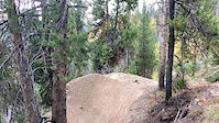
Photos of Breckenridge Mountain Bike
Videos of Breckenridge Mountain Bike
trail: Sidedoor
0:53 |
198 |
Jul 25, 2023
trail: Swinger
3:42 |
171 |
Jul 9, 2023

trail: Swinger
8:16 |
76 |
Nov 19, 2022

trail: Boreas Pass
8:04 |
41 |
Oct 12, 2022
trail: Wellington
0:11 |
120 |
Oct 8, 2022
trail: Sidedoor
0:10 |
198 |
Oct 8, 2022

trail: Boreas Pass
12:27 |
59 |
Oct 2, 2022

trail: Swinger
24:43 |
103 |
Apr 11, 2022
Current Trail Warnings
| status | trail | date | condition | user | info |
|---|---|---|---|---|---|
| Valdero | Jun 17, 2026 @ 1:51pm (America/Denver) Jun 17, 2026 | Ideal | Jockette21 | Huge trees down at top | |
| Great Flume | Jun 16, 2026 @ 2:16pm (America/Los_Angeles) Jun 16, 2026 | Dry | Madhavok | 50+ downed trees. Trail is unrideable. | |
| West Jefferson | Jun 12, 2026 @ 7:33am (America/Denver) Jun 12, 2026 | Variable | nolanvanharte Reporter | I heard reports of many trees down |
Recent Trail Reports
| status | trail | date | condition | info | user |
|---|---|---|---|---|---|
| X10U8 | Jun 18, 2026 @ 10:25am (America/Denver) 2 days | Dry | jcbreck | ||
| Reiling Dredge | Jun 18, 2026 @ 10:25am (America/Denver) 2 days | Dry | jcbreck | ||
| B&B | Jun 18, 2026 @ 10:25am (America/Denver) 2 days | Dry | jcbreck | ||
| CDT CT - Muggins Gulch | Jun 14, 2026 @ 2:50pm (America/Denver) Jun 14, 2026 | Dry | xition | ||
| CDT CT - Georgia Pass to North Fork | Jun 13, 2026 @ 9:29am (America/Denver) Jun 13, 2026 | Unknown | Babritton13 | ||
| Bakers Tank | Jun 9, 2026 @ 4:26pm (America/Denver) Jun 9, 2026 | Dry | breckbike | ||
| Boreas Pass | Jun 9, 2026 @ 4:26pm (America/Denver) Jun 9, 2026 | Dry | breckbike | ||
| True Romance | Jun 8, 2026 @ 6:11pm (America/Denver) Jun 8, 2026 | Ideal | Jockette21 | ||
| River (East Side) | Jun 8, 2026 @ 10:15am (America/Denver) Jun 8, 2026 | Ideal | gymclasshero | ||
| Peaks | Jun 7, 2026 @ 1:53pm (America/Denver) Jun 7, 2026 | Dry | halite |
National Scenic Trails & Official Routes
-
Colorado Trail (Bike)
- Mountain Bike
-
Continental Divide Trail
- Mountain Bike
- Hike
- Trail Running

Activity Feed
| username | action | type | title | date |
|---|---|---|---|---|
| lHoEh9U6 | vote | trail | activity #97416646 | Jun 20, 2026 @ 11:26am 7 hours |
| Cashin85 | ridden | trail | activity #97361125 | Jun 19, 2026 @ 7:13pm 23 hours |
| esahlin | wishlist | route | activity #97353819 | Jun 19, 2026 @ 4:51pm 1 day |
| Jreng87 | wishlist | trail | activity #97335701 | Jun 19, 2026 @ 12:06pm 1 day |
| bortiz | wishlist | route | activity #97334303 | Jun 19, 2026 @ 11:48am 1 day |
Recent Comments
| username | type | title | comment | date |
|---|---|---|---|---|
| trail | June 6th. Huge blow down on the flat section.... | Jun 7, 2026 @ 10:05am Jun 7, 2026 | ||
| trail | Best little dh in the gulches? I'd say so. | Jun 4, 2026 @ 3:14pm Jun 4, 2026 | ||
| trail | Breckenridge Open Space trails map shows it as... | May 24, 2026 @ 4:26pm May 24, 2026 | ||
| report | Downed trees have been cleared. Two snow... | Apr 24, 2026 @ 2:17pm Apr 24, 2026 | ||
| trail | Great trail! Should be directional dh only and... | Apr 12, 2026 @ 7:43pm Apr 12, 2026 |
Local Badges
-

10 Green Trails608 awarded -

10 Blue Trails1,056 awarded -

10 Black Trails322 awarded -

Epic Ride Climb 2k850 awarded -

Climbing 10k Badge362 awarded -

Climbing 100k Badge16 awarded
Bike & Skill Parks
| name | type | city | rating |
|---|---|---|---|
| Breckenridge Resort | bike park | Breckenridge | |
| The Wellington Bike Park and Pump Track | skill park | Breckenridge | |
| Four-O'-Clock Freeride Park | skill park | Breckenridge |
Upcoming Local Events
Local Products
Local Products
Activity Type Stats
| activitytype | trails | distance | descent | descent distance | total vertical | rating | global rank | state rank | photos | reports | routes | ridelogs |
|---|---|---|---|---|---|---|---|---|---|---|---|---|
| Mountain Bike | 204 | 309 miles | 60,715 ft | 150 miles | 4,308 ft | #208 | #78 | 664 | 5,601 | 75 | 46,914 | |
| E-Bike | 51 | 98 miles | 18,921 ft | 45 miles | 3,491 ft | #1,285 | #845 | 1 | 4,716 | 782 | ||
| Horse | 34 | 68 miles | 15,289 ft | 28 miles | 4,760 ft | #572 | #521 | 2,953 | 2 | |||
| Hike | 212 | 330 miles | 65,899 ft | 156 miles | 5,197 ft | #263 | #131 | 30 | 5,556 | 10 | 6,027 | |
| Trail Running | 210 | 329 miles | 65,653 ft | 156 miles | 5,197 ft | #239 | #100 | 16 | 5,556 | 11 | 1,839 | |
| Dirtbike/Moto | 40 | 62 miles | 12,936 ft | 27 miles | 3,173 ft | #95 | #59 | 3 | 3,008 | 60 | ||
| Observed Trials | 1 | 988 ft | 46 ft | 988 ft | 46 ft | 11 | 1 | |||||
| ATV/ORV/OHV | 28 | 46 miles | 11,033 ft | 22 miles | 3,173 ft | #204 | #80 | 1 | 2,947 | 12 | ||
| Snowshoe | 8 | 11 miles | 1,680 ft | 4 miles | 1,785 ft | #70 | #20 | 2,708 | 4 | 190 | ||
| Downhill Ski | 199 | 80 miles | 65,217 ft | 71 miles | 3,054 ft | #51 | #22 | 2,646 | 11,933 | |||
| Nordic Ski | 33 | 6 miles | 607 ft | 2 miles | 1,562 ft | #100 | #24 | 2,704 | 1 | 2,478 |
Frequently Asked Questions About Breckenridge
▼
What are the best places to ride in Breckenridge?
Breckenridge has 4 areas to explore for mountain biking. The top rated areas are:
▼
What are the highest rated mountain biking trails in Breckenridge?
The highest rated mountain biking trails in Breckenridge are:
- B-line (4.5/5)
- Sidedoor (4.5/5)
- Slalom (4.4/5)
- CDT CT - Muggins Gulch (4.4/5)
- Peaks (4.3/5)
▼
What is the best time of the year to ride in Breckenridge?
Based on ride log data, the most popular months to ride in Breckenridge are:
- July (1,211 activities)
- August (711 activities)
- June (508 activities)
▼
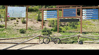
Where can I park to ride in Breckenridge?
There are 35 parking locations listed in Breckenridge. The most popular parking spots are: View all parking and trailhead locations on the map to plan your visit.
Activities
- Breckenridge Mountain Biking Trails
- Breckenridge E-Biking Trails
- Breckenridge Horseback Trails
- Breckenridge Hiking Trails
- Breckenridge Trail Running Trails
- Breckenridge Dirtbiking Trails
- Breckenridge ATVing/Offroading Trails
- Breckenridge Snowshoeing Trails
- Breckenridge Skiing Trails
- Breckenridge Nordic Skiing Trails
Trails
- By J4m3z420
 SCoMBA & contributors
 - Admins: VAIL, SCoMBA
- #4910 - 65,380 views
- breckenridge activity log | embed map of Breckenridge mountain bike trails | breckenridge mountain biking points of interest polygons
Downloading of trail gps tracks in kml & gpx formats is enabled for Breckenridge.
You must login to download files.