close
-
Layers w
- Weather Layers
- Pro
- Pro
- Pro
- Pro
- Pro
- Pro
- More Layers
- Pro
- Pro
- Pro
- Pro
-
Upgrade to

3D
Trail Conditions
- Unknown
- Snow Groomed
- Snow Packed
- Snow Covered
- Snow Cover Partial
- Freeze/thaw Cycle
- Icy
- Prevalent Mud
- Wet
- Variable
- Ideal
- Dry
- Very Dry
Trail Flow (Ridden Direction)
Trailforks scans users ridelogs to determine the most popular direction each trail is ridden. A good flowing trail network will have most trails flowing in a single direction according to their intension.
The colour categories are based on what percentage of riders are riding a trail in its intended direction.
The colour categories are based on what percentage of riders are riding a trail in its intended direction.
- > 96%
- > 90%
- > 80%
- > 70%
- > 50%
- < 50%
- bi-directional trail
- no data
Trail Last Ridden
Trailforks scans ridelogs to determine the last time a trail was ridden.
- < 2 days
- < 1 week
- < 2 weeks
- < 1 month
- < 6 months
- > 6 months
Trail Ridden Direction
The intended direction a trail should be ridden.
- Downhill Only
- Downhill Primary
- Both Directions
- Uphill Primary
- Uphill Only
- One Direction
Contribute Details
Colors indicate trail is missing specified detail.
- Description
- Photos
- Description & Photos
- Videos
Trail Popularity ?
Trailforks scans ridelogs to determine which trails are ridden the most in the last 9 months.
Trails are compared with nearby trails in the same city region with a possible 25 colour shades.
Think of this as a heatmap, more rides = more kinetic energy = warmer colors.
- most popular
- popular
- less popular
- not popular
ATV/ORV/OHV Filter
Max Vehicle Width
inches
US Cell Coverage
Legend

Radar Time
Activity Recordings
Trailforks uses anonymized public activity data.
?
Activity Recordings
Trailforks uses anonymized public activity data.
?
Personal Heatmap
▶
Activity Types
all
/
none
▶
Options
2
Date range
month
–
Winter Trails
Warning
A routing network for winter maps does not exist. Selecting trails using the winter trails layer has been disabled.
Missing Trails
Most Popular
Least Popular
Trails are colored based on popularity. The more popular a trail is, the more red. Less popular trails trend towards green.
Jump Magnitude Heatmap
Heatmap of where riders jump on trails. Zoom in to see individual jumps, click circles to view jump details.
BC Backroad Status
![map legend]()
Service Road Atlas is a free to use, community-driven service for viewing and creating reports on the numerous back-country service roads around B.C. and Alberta.

Slope Aspect
Direction the slope faces
Trails Deemphasized
Trails are shown in grey.
Only show trails with no bike usage.
Suggested Layers
Based on selected activity type
Save the current map location and zoom level as your default home location whenever this page is loaded.
Save
No description for Brecon has been added yet!
Login or register to submit one.
This region uses the Uk/Euro style trail grading system.
Activities Click to view
- Hike
4 trails
- Mountain Bike
3 trails
- Horse
0 trails
- Trail Running
4 trails
Region Details
- 1
- 1
Region Status
Caution as of Jun 12, 2026Stats
- Avg Trail Rating
- Trails (view details)
- 3
- Trails Mountain Bike
- 3
- Trails E-Bike
- 2
- Trails Hike
- 4
- Trails Trail Running
- 4
- Total Distance
- 4 miles
- Total Descent
- 1,932 ft
- Total Vertical
- 1,164 ft
- Highest Trailhead
- 1,972 ft
- Reports
- 47
- Photos
- 86
- Ridden Counter
- 884
Sub Regions
-
Black Mountains
Popular Brecon Mountain Biking Trails
• 70 ★ 4.0 • 2 miles • 3 ft • 97 • • hike
Popular green difficulty singletrack. This hike primary trail can be used both directions. Trail visibility is always easy to follow. On average it takes 14 minutes to complete this trail.
• 5 ★ 5.0 • 1,217 ft • 0 ft • 1 •
A steep and rooty trail, the trail starts by traversing some roots and double drops, before banking right and heading down a steep chute. After this, loamy berms, gaps and drops take you down to the fireroad, with an off camber section...
Brecon Mountain Bike Routes
22 miles • 2,389 ft • 1 • Loop •
This is a classic ride that is a must do if in the area riding. Lots of open space, steep climbs and a...
18 miles • 1,638 ft • 0 • Loop •
Little known area sitting between The Black Mountains and rides. Some steep climbs and fun loose twisting...
Photos of Brecon Mountain Bike
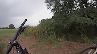
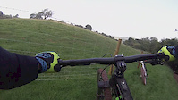
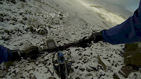
Videos of Brecon Mountain Bike
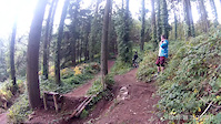
trail: The Gap
6:18 |
28867 |
Feb 23, 2017
trail: The Gap
0:01 |
67 |
Nov 5, 2016
trail: The Gap
4:52 |
69 |
May 29, 2016
trail: The Gap
0:14 |
36 |
Aug 14, 2015
trail: The Gap
0:08 |
235 |
Oct 25, 2014
trail: The Gap
0:00 |
147 |
Oct 15, 2014
trail: The Gap
0:22 |
368 |
Oct 13, 2014
trail: The Gap
5:57 |
154 |
Nov 27, 2013
Recent Trail Reports
| status | trail | date | condition | info | user |
|---|---|---|---|---|---|
| The Gap | Aug 31, 2024 @ 10:35am Aug 31, 2024 | Variable | RadBikeBro NCTC | ||
| Crug Mawr | Aug 20, 2023 @ 6:55am Aug 20, 2023 | Variable | FingleDog | ||
| Steepy McSteepface | Feb 13, 2020 @ 10:44am Feb 13, 2020 | Wet | lewpric3 |
Activity Feed
| username | action | type | title | date |
|---|---|---|---|---|
| Glynwak | wishlist | route | activity #96736603 | Jun 11, 2026 @ 7:37am Jun 11, 2026 |
| DennyuVYUvV | wishlist | route | activity #96531243 and 1 more | Jun 8, 2026 @ 4:49am Jun 8, 2026 |
| Skoott | vote | route | activity #96081727 | Jun 2, 2026 @ 7:11am Jun 2, 2026 |
| Fridolinccqrx0 | wishlist | route | activity #95510877 | May 25, 2026 @ 12:00pm May 25, 2026 |
| Mskinnerclyne | wishlist | route | activity #94635536 | May 13, 2026 @ 10:15am May 13, 2026 |
Recent Comments
| username | type | title | comment | date |
|---|---|---|---|---|
| report | Any more detailed info on getting to the... | Oct 19, 2020 @ 3:48pm Oct 19, 2020 |
Local Mountain Biking Directory
-
Bi-ped-cyclesBike Shop
-
Clive Powell Mountain BikesBike Shop
Activity Type Stats
| activitytype | trails | distance | descent | descent distance | total vertical | rating | global rank | state rank | photos | reports | routes | ridelogs |
|---|---|---|---|---|---|---|---|---|---|---|---|---|
| Mountain Bike | 3 | 4 miles | 1,932 ft | 4 miles | 1,165 ft | #5,115 | #178 | 86 | 47 | 3 | 2,664 | |
| E-Bike | 2 | 2 miles | 1,119 ft | 2 miles | 906 ft | 45 | 2 | 467 | ||||
| Hike | 4 | 4 miles | 1,722 ft | 4 miles | 1,165 ft | #9,510 | #299 | 46 | 1 | 1,415 | ||
| Trail Running | 4 | 4 miles | 1,722 ft | 4 miles | 1,165 ft | #9,891 | #328 | 46 | 1 | 64 |
- By andygaget & contributors
- Admins: apply
- #26543 - 4,362 views
- brecon activity log | embed map of Brecon mountain bike trails | brecon mountain biking points of interest
Downloading of trail gps tracks in kml & gpx formats is enabled for Brecon.
You must login to download files.