close
-
Layers w
- Weather Layers
- Pro
- Pro
- Pro
- Pro
- Pro
- Pro
- More Layers
- Pro
- Pro
- Pro
- Pro
-
Upgrade to

3D
Trail Conditions
- Unknown
- Snow Groomed
- Snow Packed
- Snow Covered
- Snow Cover Partial
- Freeze/thaw Cycle
- Icy
- Prevalent Mud
- Wet
- Variable
- Ideal
- Dry
- Very Dry
Trail Flow (Ridden Direction)
Trailforks scans users ridelogs to determine the most popular direction each trail is ridden. A good flowing trail network will have most trails flowing in a single direction according to their intension.
The colour categories are based on what percentage of riders are riding a trail in its intended direction.
The colour categories are based on what percentage of riders are riding a trail in its intended direction.
- > 96%
- > 90%
- > 80%
- > 70%
- > 50%
- < 50%
- bi-directional trail
- no data
Trail Last Ridden
Trailforks scans ridelogs to determine the last time a trail was ridden.
- < 2 days
- < 1 week
- < 2 weeks
- < 1 month
- < 6 months
- > 6 months
Trail Ridden Direction
The intended direction a trail should be ridden.
- Downhill Only
- Downhill Primary
- Both Directions
- Uphill Primary
- Uphill Only
- One Direction
Contribute Details
Colors indicate trail is missing specified detail.
- Description
- Photos
- Description & Photos
- Videos
Trail Popularity ?
Trailforks scans ridelogs to determine which trails are ridden the most in the last 9 months.
Trails are compared with nearby trails in the same city region with a possible 25 colour shades.
Think of this as a heatmap, more rides = more kinetic energy = warmer colors.
- most popular
- popular
- less popular
- not popular
ATV/ORV/OHV Filter
Max Vehicle Width
inches
US Cell Coverage
Legend

Radar Time
Activity Recordings
Trailforks uses anonymized public activity data.
?
Activity Recordings
Trailforks uses anonymized public activity data.
?
Personal Heatmap
▶
Activity Types
all
/
none
▶
Options
2
Date range
month
–
Winter Trails
Warning
A routing network for winter maps does not exist. Selecting trails using the winter trails layer has been disabled.
Missing Trails
Most Popular
Least Popular
Trails are colored based on popularity. The more popular a trail is, the more red. Less popular trails trend towards green.
Jump Magnitude Heatmap
Heatmap of where riders jump on trails. Zoom in to see individual jumps, click circles to view jump details.
BC Backroad Status
![map legend]()
Service Road Atlas is a free to use, community-driven service for viewing and creating reports on the numerous back-country service roads around B.C. and Alberta.

Slope Aspect
Direction the slope faces
Trails Deemphasized
Trails are shown in grey.
Only show trails with no bike usage.
Suggested Layers
Based on selected activity type
Save the current map location and zoom level as your default home location whenever this page is loaded.
SavePopular Trail Networks
view all areas »
No description for Brescia has been added yet!
Login or register to submit one.
This region uses the Uk/Euro style trail grading system.
Activities Click to view
- Mountain Bike
642 trails
- E-Bike
431 trails
- Horse
13 trails
- Hike
481 trails
- Trail Running
490 trails
- Downhill Ski
51 trails
- Backcountry Ski
9 trails
Region Details
- 87
- 18
- 111
- 226
- 4
- 2
- 9
Stats
- Avg Trail Rating
- Trails (view details)
- 618
- Trails Mountain Bike
- 644
- Trails E-Bike
- 431
- Trails Gravel Bike
- 2
- Trails Winter Fat Bike
- 1
- Trails Horse
- 13
- Trails Hike
- 481
- Trails Trail Running
- 490
- Trails Dirtbike/Moto
- 2
- Trails Snowshoe
- 3
- Trails Downhill Ski
- 51
- Trails Backcountry Ski
- 9
- Trails Nordic Ski
- 1
- Total Distance
- 772 miles
- Total Descent
- 377,884 ft
- Total Vertical
- 8,947 ft
- Highest Trailhead
- 9,165 ft
- Reports
- 1,421
- Photos
- 804
- Ridden Counter
- 18,499
Sub Regions
- Adro (7)
- Bagolino (12)
- Bedizzole (1)
- Berzo Demo (23)
- Bienno (7)
- Brescia (83)
- Campiani (20)
- Gussago (0)
- Monte Maddalena (43)
- Val Trompia (13)
- Darfo Boario (110)
- Argai (3)
- Borno (16)
- Cerreto Bienno (10)
- Lago Moro (20)
- Edolo (33)
- Eno (2)
- Erbusco (4)
- Gardone Riviera (9)
- Gargnano (14)
- Gavardo (7)
- Idro (16)
- Lago d'Idro (16)
- Lonato (1)
- Lozio (3)
- Lumezzane (10)
- Montecampione (6)
- Nuvolento (4)
- Paitone (8)
- Pisogne (5)
- Ponte di Legno (14)
- Rezzato (7)
- Sale Marasino (22)
- Salò (13)
- Corna di Salò (11)
- Sarezzo (2)
- Serle (8)
- Sulzano (15)
- Tignale (8)
- Toscolano (21)
- Tremosine (84)
- Vestone (5)
- Villa Carcina (10)
- Villanuova Sul Clisi (18)
- Zone (29)
- Monte Guglielmo (9)
- Franciacorta (15)
- Valtenesi (0)
Popular Brescia Mountain Biking Trails
• 100 ★ 5.0 • 5 miles • 784 ft • 381 •
Il tratto forse più affascinante a livello paesaggistico della Ciclovia dell'Oglio lungo la vecchia Strada litoranea tra Vello e Toline ora adibita a ciclopedonale.
• 75 ★ 0.0 • 14 miles • 277 ft • 296 •
Costeggiando la sponda Bresciana del Lago d'Iseo da Vello a Paratico
• 100 ★ 4.4 • 1 mile • 65 ft • 175 •
Popular blue difficulty singletrack. This mountain bike primary trail can be used downhill only. On average it takes 4 minutes to complete this trail.
• 100 ★ 4.0 • 3 miles • 1,330 ft • 142 •
Popular green difficulty mixed. This mountain bike primary trail can be used uphill primary and has a moderate overall physical rating with a 1,330 ft green climb. On average it takes 38 minutes to complete this trail.
• 95 ★ 4.7 • 2 miles • 137 ft • 135 •
Fast, flow turns up top, becomes more technical at the bottom. A few technical sections.
• 85 ★ 4.3 • 1 mile • 56 ft • 126 •
Fast, technical singletrail. Loose, rocky terrain. Rock faces. Some highly technical sections in between, where hike-a-bike might be necessary. High exposure in places; don't fall!
• 95 ★ 4.5 • 4 miles • 1,495 ft • 109 •
High alpine, very exposed trail. Amazing views all the way. Many other trails, on both sides of the mountain, are only reachable by this trail.
• 100 ★ 1.0 • 4,350 ft • 0 ft • 106 •
Discesa dalla Madonna del Corno fino ad Iseo. Bel percorso, veloce ma ampio dato che è una strada sterrata seppure poco utilizzata. Ad alta velocità diventa impegnativo perchè ripido e con fondo spesso ricoperto di foglie e ricci di...
Brescia Mountain Bike Routes
★ 4.7 • 13 miles • 3,947 ft • 6 • Loop •
Long route that connects some of the most technical trails in the area ( , Passo Nota - Piazzale Angelini,...
★ 5.0 • 19 miles • 4,878 ft • 6 • Point to Point •
Very long route to Passo Nota, then back towards Piazzale Angelini on the "Pertica" trail. From the...
★ 3.0 • 24 miles • 6,598 ft • 3 • Point to Point •
Probably the most descent you can get in this area, but with lots of climbing involved! Extremely long...
40 miles • 8,267 ft • 1 •
Itinerario di grande soddisfazione, impegnativo e tecnicamente completo, consigliato a bikers allenati ed...
11 miles • 3,603 ft • 1 •
Il sentiero dei 100 tornanti è il sentiero più conosciuto del Lago d’Idro ed attira molti appassionati...
★ 2.0 • 17 miles • 4,670 ft • 2 •
Uno dei pochi itinerari in grado di attirare l’attenzione di bikers da tutta Europa, grazie al suo...
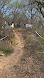
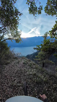
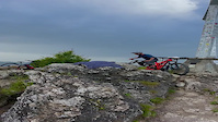
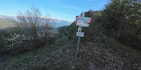
Photos of Brescia Mountain Bike
Videos of Brescia Mountain Bike
trail: Bestone Nord
2:17 |
42 |
Mar 29, 2025
trail: Via Del Maroc
0:32 |
37 |
Mar 29, 2025
trail: Valle Di Pura
8:04 |
78 |
Mar 29, 2025
0:09 |
18 |
Jan 15, 2025
0:11 |
76 |
Nov 30, 2024
trail: DALCO
15:30 |
88 |
Nov 6, 2024
trail: Corna 30 Passi Vetta
0:21 |
|
Sep 16, 2024
6:16 |
66 |
May 1, 2024
Current Trail Warnings
| status | trail | date | condition | user | info |
|---|---|---|---|---|---|
| 136 Tornanti Lago d'Idro | Jun 19, 2026 @ 2:10pm (Europe/Rome) 2 hours | Unknown | Manniger | lowest part that goes north above the... | |
| Nalbò Tremosine | Jun 8, 2026 @ 4:55pm (Europe/Rome) Jun 8, 2026 | Variable | Alexxx1 | abandoned trail. overgrown trees. no fun | |
| Valle delle Pile Tremosine | Jun 8, 2026 @ 1:07pm (Europe/Rome) Jun 8, 2026 | Variable | Alexxx1 | lots of vegetation. no one uses it. 8... |
Recent Trail Reports
Activity Feed
| username | action | type | title | date |
|---|---|---|---|---|
| Manniger | vote | trail | activity #97309052 | Jun 19, 2026 @ 5:10am 2 hours |
| Manniger | add | report | activity #97309023 | Jun 19, 2026 @ 5:10am 2 hours |
| Citto | ridden | trail | activity #97306906 | Jun 19, 2026 @ 4:11am 3 hours |
| Williamavelo | wishlist | trail | activity #97170988 | Jun 17, 2026 @ 3:11am 2 days |
| Alexpanzer | vote | trail | activity #97100170 | Jun 16, 2026 @ 4:46am Jun 16, 2026 |
Recent Comments
| username | type | title | comment | date |
|---|---|---|---|---|
| trail | Perfect trail with really nice Switchbacks. It... | Jun 14, 2026 @ 3:50am Jun 14, 2026 | ||
| trail | Trail begins with a Narrow forest singletrail.... | Jun 7, 2026 @ 12:08pm Jun 7, 2026 | ||
| trail | Bella salita dal Medelet verso i stalletti,... | Jun 3, 2026 @ 4:37am Jun 3, 2026 | ||
| trail | I think this trail is a lot of fun for... | May 24, 2026 @ 7:55am May 24, 2026 | ||
| trail | Mi permetto di correggerti, ma flow indica sì... | Apr 26, 2026 @ 12:47am Apr 26, 2026 |
Local Badges
-

Epic Mountain Bike Climb 2k5 awarded -
Epic Mountain Bike Climb 2k0 awarded -
Epic Mountain Bike Climb 2k1 awarded -
Epic Mountain Bike Climb 2k1 awarded -

10 Blue Trails0 awarded -
10 Blue Trails0 awarded
Bike & Skill Parks
| name | type | city | rating |
|---|---|---|---|
| MX Serle | skill park | Nuvolento | |
| Franciacorta MX | skill park | Erbusco | |
| Odolo motocross | skill park | Villanuova sul Clisi | |
| Rezzato motocross | skill park | Bedizzole | |
| bagnolo mella | skill park | Brescia |
Activity Type Stats
| activitytype | trails | distance | descent | descent distance | total vertical | rating | global rank | state rank | photos | reports | routes | ridelogs |
|---|---|---|---|---|---|---|---|---|---|---|---|---|
| Mountain Bike | 642 | 766 miles | 375,591 ft | 423 miles | 8,947 ft | 801 | 1,411 | 93 | 53,193 | |||
| E-Bike | 431 | 529 miles | 263,606 ft | 294 miles | 8,921 ft | 6 | 1,250 | 50 | 7,866 | |||
| Gravel Bike | 2 | 6 | 1 | 786 | ||||||||
| Winter Fat Bike | 1 | 6 | ||||||||||
| Horse | 13 | 26 miles | 5,823 ft | 11 miles | 6,273 ft | 64 | ||||||
| Hike | 481 | 604 miles | 288,192 ft | 324 miles | 8,947 ft | 1,348 | 2 | 3,126 | ||||
| Trail Running | 490 | 618 miles | 293,983 ft | 331 miles | 8,947 ft | 1,353 | 1 | 777 | ||||
| Dirtbike/Moto | 2 | 9 miles | 1,657 ft | 3 miles | 3,068 ft | 64 | 1 | |||||
| Snowshoe | 3 | 8 miles | 3,435 ft | 3 miles | 3,724 ft | 2 | 12 | |||||
| Downhill Ski | 51 | 15 | 573 | |||||||||
| Backcountry Ski | 9 | 14 miles | 4,967 ft | 5 miles | 3,724 ft | 2 | 351 | |||||
| Nordic Ski | 1 | 1 mile | 1,191 ft | 1 mile | 1,158 ft | 2 | 78 |
Frequently Asked Questions About Brescia
▼
What are the best places to ride in Brescia?
Brescia has 22 areas to explore for mountain biking. The top rated areas are:
▼
What are the highest rated mountain biking trails in Brescia?
The highest rated mountain biking trails in Brescia are:
- Corna Flow (4.7/5)
- Le Acque (4.4/5)
- Pistino di Adro (4.4/5)
- Vesta DH (4.4/5)
- Corna Vecchia - Valle Di Pura (4.4/5)
▼
What is the best time of the year to ride in Brescia?
Based on ride log data, the most popular months to ride in Brescia are:
- August (233 activities)
- July (217 activities)
- June (198 activities)
▼
What is the longest trail in Brescia?
The longest trail in Brescia is Ciclovia dell'Oglio - Da Vello a Paratico at 13.9 miles. View all trails sorted by distance.
Activities
Trails
Points of Interest
- Campeggio Val Tress Camping
- Adventure Land Other
- Area Camper Adventure Land Camping
- Camping Village Boscoblù
- Hotel Valle d' Oro Lodge
- Passerella Bridge
- Panchina gigante Viewpoint
- Panchina Gigante Viewpoint
- Cristo Re Viewpoint
- Ponte di Montecchio Bridge
- Cima Presanella (11,558 ft)
- Monte Gabbiolo (11,230 ft)
- Cima Meridionale del Dosson (11,171 ft)
- By brenthillier
 NSMBA TRAILFORKS & contributors
 - Admins: denitopia, marcoangeletti, cemoorelife, marcoangeletti, adessoomaipiu, micheletraversi
- #9503 - 13,114 views
- brescia activity log | embed map of Brescia mountain bike trails | brescia mountain biking points of interest
Downloading of trail gps tracks in kml & gpx formats is enabled for Brescia.
You must login to download files.