close
-
Layers w
- Weather Layers
- Pro
- Pro
- Pro
- Pro
- Pro
- Pro
- More Layers
- Pro
- Pro
- Pro
- Pro
-
Upgrade to

3D
Trail Conditions
- Unknown
- Snow Groomed
- Snow Packed
- Snow Covered
- Snow Cover Partial
- Freeze/thaw Cycle
- Icy
- Prevalent Mud
- Wet
- Variable
- Ideal
- Dry
- Very Dry
Trail Flow (Ridden Direction)
Trailforks scans users ridelogs to determine the most popular direction each trail is ridden. A good flowing trail network will have most trails flowing in a single direction according to their intension.
The colour categories are based on what percentage of riders are riding a trail in its intended direction.
The colour categories are based on what percentage of riders are riding a trail in its intended direction.
- > 96%
- > 90%
- > 80%
- > 70%
- > 50%
- < 50%
- bi-directional trail
- no data
Trail Last Ridden
Trailforks scans ridelogs to determine the last time a trail was ridden.
- < 2 days
- < 1 week
- < 2 weeks
- < 1 month
- < 6 months
- > 6 months
Trail Ridden Direction
The intended direction a trail should be ridden.
- Downhill Only
- Downhill Primary
- Both Directions
- Uphill Primary
- Uphill Only
- One Direction
Contribute Details
Colors indicate trail is missing specified detail.
- Description
- Photos
- Description & Photos
- Videos
Trail Popularity ?
Trailforks scans ridelogs to determine which trails are ridden the most in the last 9 months.
Trails are compared with nearby trails in the same city region with a possible 25 colour shades.
Think of this as a heatmap, more rides = more kinetic energy = warmer colors.
- most popular
- popular
- less popular
- not popular
ATV/ORV/OHV Filter
Max Vehicle Width
inches
US Cell Coverage
Legend

Radar Time
Activity Recordings
Trailforks uses anonymized public activity data.
?
Activity Recordings
Trailforks uses anonymized public activity data.
?
Personal Heatmap
▶
Activity Types
all
/
none
▶
Options
2
Date range
month
–
Winter Trails
Warning
A routing network for winter maps does not exist. Selecting trails using the winter trails layer has been disabled.
Missing Trails
Most Popular
Least Popular
Trails are colored based on popularity. The more popular a trail is, the more red. Less popular trails trend towards green.
Jump Magnitude Heatmap
Heatmap of where riders jump on trails. Zoom in to see individual jumps, click circles to view jump details.
BC Backroad Status
![map legend]()
Service Road Atlas is a free to use, community-driven service for viewing and creating reports on the numerous back-country service roads around B.C. and Alberta.

Slope Aspect
Direction the slope faces
Trails Deemphasized
Trails are shown in grey.
Only show trails with no bike usage.
Suggested Layers
Based on selected activity type
Save the current map location and zoom level as your default home location whenever this page is loaded.
Save
No description for Brian Head has been added yet!
Login or register to submit one.
Activities Click to view
- Mountain Bike
86 trails
- E-Bike
5 trails
- Gravel Bike
12 trails
- Adaptive Bike
0 trails
- Winter Fat Bike
0 trails
- Horse
20 trails
- Hike
71 trails
- Trail Running
59 trails
- Dirtbike/Moto
5 trails
- ATV/ORV/OHV
5 trails
- Snowshoe
14 trails
- Downhill Ski
59 trails
- Nordic Ski
22 trails
Region Details
- 16
- 1
- 10
- 36
- 19
- 2
Region Status
Open as of 2 daysStats
- Avg Trail Rating
- Trails (view details)
- 185
- Trails Mountain Bike
- 86
- Trails E-Bike
- 5
- Trails Gravel Bike
- 12
- Trails Horse
- 20
- Trails Hike
- 71
- Trails Trail Running
- 59
- Trails Dirtbike/Moto
- 5
- Trails ATV/ORV/OHV
- 5
- Trails Snowshoe
- 14
- Trails Downhill Ski
- 59
- Trails Nordic Ski
- 22
- Total Distance
- 195 miles
- Total Descent
- 49,759 ft
- Total Vertical
- 5,071 ft
- Highest Trailhead
- 11,311 ft
- Reports
- 1,004
- Photos
- 682
- Ridden Counter
- 31,049
Articles
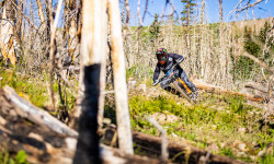
Video: The KHS Pro MTB Team Takes on the Big Mountain Enduro in Brain Head, Utah
Aug 30, 2022 from pinkbike.com
Round three of the Big Mountain Enduro series fired off at Brian Head, Utah with over seven grueling stages at the high altitudes of 10,000 feet...
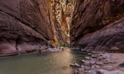
The Narrows: How to Hike Zion's Ultimate Adventure
Jan 24, 2022 from backpacker.com
The Narrows at Zion National Park offers an incredible adventure in America's most amazing slot canyons. Here's how to safely explore them.
Sub Regions
-
Brian Head Forestry Trails
- 5
- 15
- 4
-
Brian Head Resort
- 1
- 2
- 11
- 9
- 2
-
Navajo Lake - River Rim
- 3
- 9
- 6
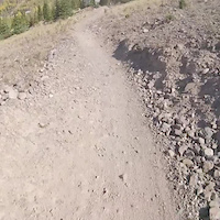
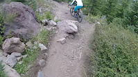
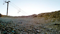
Popular Brian Head Mountain Biking Trails
• 100 ★ 4.4 • 4 miles • 126 ft • 1,318 •
is a rolling intermediate trail that starts really steep just for a little bit then levels off. You traverse along the edge of Sidney Peaks Ridge heading towards the Sidney Peaks Overlook. Sometimes there are a bit of loose rocks, but...
• 100 ★ 4.7 • 3 miles • 27 ft • 1,317 •
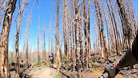
This is a beautiful downhill, mostly loose dirt and rocks on single track. Unfortunately the Brian Head Fire in 2017 burned this area, but has recently been rebuilt and rerouted by the USFS in 2018, then further reroutes at the top to...
• 100 ★ 4.7 • 2 miles • 129 ft • 1,133 •
New extension to cut out a large section of the gravel road, and that climb at the fork. Now instead of turning left going uphill at the fork, you can continue down the ATV road to the right and hook up with this new extension trail
• 95 ★ 4.7 • 2 miles • 156 ft • 1,033 •
Highly rated popular blue difficulty singletrack. This mountain bike primary trail with a 156 ft blue climb. Trail visibility is always easy to follow. On average it takes 16 minutes to complete this trail.
• 100 ★ 4.4 • 955 ft • 0 ft • 916 •
This is probably the most fun to finish your expert run down . Just continue all the way to the last trail and you will drop down through 2 plywood berm style walls, a little rock drop, then you have 2 jump options. You can continue...
• 95 ★ 3.8 • 3,068 ft • 0 ft • 871 •
The is the final installment to the Glitter Flow and Jump line. This trail fast and fun, with table tops great flow.
• 90 ★ 4.9 • 2,297 ft • 3 ft • 863 •
This trail starts off with some flat rock sections that are kind a fun, where the rocks are all laid out like a brick road. A couple little spots to jump between the rocks before you head to the jumps. The jumps are mostly table tops...
• 85 ★ 3.7 • 4 miles • 111 ft • 742 •
Good trail that is somewhere between cross country and "trail". Flowy lines and mostly easy pedaling with a decent small hill or two. The top part is open range so watch out for sheep. Good for a warm up lap before hitting the techier...
Brian Head Mountain Bike Routes
Aquarius Route Featured
★ 3.7 • 196 miles • 17,172 ft • 10 • Point to Point •
The Greatest Bicycle Adventure in the American West. Welcome to Utah’s Color Country, one of the...
Aquarius Trail - Day #1 Featured
38 miles • 2,504 ft • 4 • Point to Point •
13 miles • 354 ft • 4 •
Shuttle Trail from Brian Head Peak to Burger Barn.
13 miles • 351 ft • 4 • Point to Point •
Nice mostly downhill ride from Brian Head to Panguitch Lake
Photos of Brian Head Mountain Bike
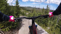
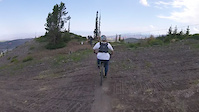
Videos of Brian Head Mountain Bike

trail: Timberglitter
0:09 |
102 |
Aug 20, 2021
trail: Timberline
0:09 |
145 |
Aug 20, 2021

trail: Lil' Gritty, Lower
0:13 |
160 |
Aug 6, 2021
trail: Little Glitter, Upper
0:09 |
|
Jul 23, 2021
trail: Lower Glitter
0:06 |
50 |
Oct 2, 2020
trail: Timberline
0:15 |
285 |
Sep 9, 2019
trail: Lower Glitter
0:23 |
250 |
Aug 23, 2019
trail: Bunker Creek, North
4:05 |
140 |
Jul 22, 2019
Current Trail Warnings
| status | trail | date | condition | user | info |
|---|---|---|---|---|---|
| Bunker Creek Middle | May 27, 2026 @ 4:52pm (America/Denver) May 27, 2026 | Dry | Wildeman21 | Trail dry but tons of trees down. Cut 20+... |
Recent Trail Reports
| status | trail | date | condition | info | user |
|---|---|---|---|---|---|
| Virgin River Rim | Jun 21, 2026 @ 9:56pm (America/Vancouver) 2 days | Ideal | ColinScg9my | ||
| Bunker Creek Ext | Jun 16, 2026 @ 10:07pm (America/Denver) Jun 16, 2026 | Dry | DirtTherapy435 | ||
| East Trailhead Connector | Jun 5, 2026 @ 11:11am (America/Denver) Jun 5, 2026 | Dry | codivist | ||
| Navajo Lake Loop, North | Jun 5, 2026 @ 11:11am (America/Denver) Jun 5, 2026 | Very Dry | codivist | ||
| Te-ah Campground | Jun 5, 2026 @ 11:11am (America/Denver) Jun 5, 2026 | Dry | codivist | ||
| Virgin River Rim | Jun 5, 2026 @ 11:11am (America/Denver) Jun 5, 2026 | Dry | codivist | ||
| Navajo Lake Loop, South | Jun 5, 2026 @ 11:11am (America/Denver) Jun 5, 2026 | Ideal | codivist | ||
| Sidney Peaks | May 12, 2026 @ 1:13pm (America/Denver) May 12, 2026 | Snow Covered | Neariah | ||
| Woods Ranch | Feb 4, 2026 @ 10:00am (America/Denver) Feb 4, 2026 | Snow Cover Partial | WillieJacobsz Trailforks | ||
| Virgin River Rim (Road) | Feb 4, 2026 @ 10:00am (America/Denver) Feb 4, 2026 | Snow Cover Partial | WillieJacobsz Trailforks |
Activity Feed
| username | action | type | title | date |
|---|---|---|---|---|
| Booyato | wishlist | route | activity #97624004 | Jun 23, 2026 @ 7:01am 4 hours |
| ColinScg9my | add | report | activity #97542768 | Jun 21, 2026 @ 9:56pm 2 days |
| ColinScg9my | ridden | trail | activity #97542474 and 3 more | Jun 21, 2026 @ 9:46pm 2 days |
| McqeW | wishlist | trail | activity #97540107 | Jun 21, 2026 @ 8:14pm 2 days |
| codekitchen | wishlist | route | activity #97515182 | Jun 21, 2026 @ 1:18pm 2 days |
Recent Comments
| username | type | title | comment | date |
|---|---|---|---|---|
| trail | Great trail but we had to hike a bike over 15+... | Jun 1, 2026 @ 4:28pm Jun 1, 2026 | ||
| trail | I love this trail. One of my favorites.... | May 31, 2026 @ 1:51pm May 31, 2026 | ||
| trail | Still completely unrideable to many down trees... | May 24, 2026 @ 12:59pm May 24, 2026 | ||
| trail | Completely unrideable to much deadfall 5/24/26 | May 24, 2026 @ 12:58pm May 24, 2026 | ||
| report | Try tr. (. Trtttt t ((. ( t. T ( 5 | Apr 14, 2026 @ 3:57pm Apr 14, 2026 |
Local Badges
-

Completionist0 awarded -

Big Ride 30k1,293 awarded -

Epic Ride 50k506 awarded -

Top 10 Trails0 awarded -
Completionist0 awarded -

10 Green Trails12 awarded
Bike & Skill Parks
| name | type | city | rating |
|---|---|---|---|
| Brian Head Resort | bike park | Brian Head |
Upcoming Local Events
Activity Type Stats
| activitytype | trails | distance | descent | descent distance | total vertical | rating | global rank | state rank | photos | reports | routes | ridelogs |
|---|---|---|---|---|---|---|---|---|---|---|---|---|
| Mountain Bike | 86 | 129 miles | 25,341 ft | 66 miles | 4,816 ft | #871 | #342 | 607 | 997 | 15 | 12,483 | |
| E-Bike | 5 | 22 miles | 1,604 ft | 6 miles | 3,802 ft | #4,170 | #1,372 | 743 | 590 | |||
| Gravel Bike | 12 | 13 miles | 1,949 ft | 6 miles | 2,710 ft | #395 | #980 | 28 | 12 | |||
| Horse | 20 | 58 miles | 11,004 ft | 28 miles | 4,816 ft | #897 | #618 | 281 | ||||
| Hike | 71 | 125 miles | 24,124 ft | 61 miles | 5,072 ft | #493 | #227 | 60 | 911 | 3 | 1,355 | |
| Trail Running | 59 | 101 miles | 19,012 ft | 51 miles | 5,072 ft | #1,913 | #625 | 908 | 3 | 251 | ||
| Dirtbike/Moto | 5 | 22 miles | 1,604 ft | 6 miles | 3,802 ft | #762 | #271 | 224 | 10 | |||
| ATV/ORV/OHV | 5 | 22 miles | 1,604 ft | 6 miles | 3,802 ft | #531 | #190 | 10 | 224 | 33 | ||
| Snowshoe | 14 | 15 miles | 1,053 ft | 6 miles | 1,004 ft | #644 | #262 | 5 | 8 | 1 | 87 | |
| Downhill Ski | 59 | 22 miles | 14,826 ft | 21 miles | 1,296 ft | #214 | #85 | 4 | 2,017 | |||
| Nordic Ski | 22 | 22 miles | 1,388 ft | 8 miles | 1,004 ft | #665 | #232 | 6 | 145 |
Frequently Asked Questions About Brian Head
▼
What are the best places to ride in Brian Head?
Brian Head has 6 areas to explore for mountain biking. The top rated areas are:
▼
What are the highest rated mountain biking trails in Brian Head?
The highest rated mountain biking trails in Brian Head are:
- Dark Hollow (4.5/5)
- Bunker Creek, North (4.4/5)
- Bunker Creek Middle (4.4/5)
- Bunker Creek Ext (4.4/5)
- Navajo Lake Loop, North (4.4/5)
▼
What is the best time of the year to ride in Brian Head?
Based on ride log data, the most popular months to ride in Brian Head are:
- July (315 activities)
- August (289 activities)
- September (198 activities)
▼
Where can I park to ride in Brian Head?
There are 21 parking locations listed in Brian Head. The most popular parking spots are: View all parking and trailhead locations on the map to plan your visit.
Activities
- Brian Head Mountain Biking Trails
- Brian Head E-Biking Trails
- Brian Head Gravel Biking Trails
- Brian Head Horseback Trails
- Brian Head Hiking Trails
- Brian Head Trail Running Trails
- Brian Head Dirtbiking Trails
- Brian Head ATVing/Offroading Trails
- Brian Head Snowshoeing Trails
- Brian Head Skiing Trails
- Brian Head Nordic Skiing Trails
Trails
Points of Interest
- Sawmill Bunkhouse Sight
- Overlook Viewpoint
- The Bartizan Summit
- Panguitch Lake North Campground Camping
- Navajo Peak Summit
- Navajo Lake Overlook Viewpoint
- Sydney Peaks Overlook Viewpoint
- Deer Haven Campground Camping
- Cedar Breaks North Rim Viewpoint
- Cabin ruins Sight
- Brian Head (11,299 ft)
- Sidney Peaks (10,853 ft)
- Horse Valley Peak (10,574 ft)
- By canadaka
 Trailforks & contributors
 - Admins: jkwilliamz, UtahJohn, jpmcghee, jasonmalczyk, IronTC
- #4855 - 24,649 views
- brian head activity log | embed map of Brian Head mountain bike trails | brian head mountain biking points of interest
Downloading of trail gps tracks in kml & gpx formats is enabled for Brian Head.
You must login to download files.