close
-
Layers w
- Weather Layers
- Pro
- Pro
- Pro
- Pro
- Pro
- Pro
- More Layers
- Pro
- Pro
- Pro
- Pro
-
Upgrade to

3D
Trail Conditions
- Unknown
- Snow Groomed
- Snow Packed
- Snow Covered
- Snow Cover Partial
- Freeze/thaw Cycle
- Icy
- Prevalent Mud
- Wet
- Variable
- Ideal
- Dry
- Very Dry
Trail Flow (Ridden Direction)
Trailforks scans users ridelogs to determine the most popular direction each trail is ridden. A good flowing trail network will have most trails flowing in a single direction according to their intension.
The colour categories are based on what percentage of riders are riding a trail in its intended direction.
The colour categories are based on what percentage of riders are riding a trail in its intended direction.
- > 96%
- > 90%
- > 80%
- > 70%
- > 50%
- < 50%
- bi-directional trail
- no data
Trail Last Ridden
Trailforks scans ridelogs to determine the last time a trail was ridden.
- < 2 days
- < 1 week
- < 2 weeks
- < 1 month
- < 6 months
- > 6 months
Trail Ridden Direction
The intended direction a trail should be ridden.
- Downhill Only
- Downhill Primary
- Both Directions
- Uphill Primary
- Uphill Only
- One Direction
Contribute Details
Colors indicate trail is missing specified detail.
- Description
- Photos
- Description & Photos
- Videos
Trail Popularity ?
Trailforks scans ridelogs to determine which trails are ridden the most in the last 9 months.
Trails are compared with nearby trails in the same city region with a possible 25 colour shades.
Think of this as a heatmap, more rides = more kinetic energy = warmer colors.
- most popular
- popular
- less popular
- not popular
ATV/ORV/OHV Filter
Max Vehicle Width
inches
US Cell Coverage
Legend

Radar Time
Activity Recordings
Trailforks uses anonymized public activity data.
?
Activity Recordings
Trailforks uses anonymized public activity data.
?
Personal Heatmap
▶
Activity Types
all
/
none
▶
Options
2
Date range
month
–
Winter Trails
Warning
A routing network for winter maps does not exist. Selecting trails using the winter trails layer has been disabled.
Missing Trails
Most Popular
Least Popular
Trails are colored based on popularity. The more popular a trail is, the more red. Less popular trails trend towards green.
Jump Magnitude Heatmap
Heatmap of where riders jump on trails. Zoom in to see individual jumps, click circles to view jump details.
BC Backroad Status
![map legend]()
Service Road Atlas is a free to use, community-driven service for viewing and creating reports on the numerous back-country service roads around B.C. and Alberta.

Slope Aspect
Direction the slope faces
Trails Deemphasized
Trails are shown in grey.
Only show trails with no bike usage.
Suggested Layers
Based on selected activity type
Save the current map location and zoom level as your default home location whenever this page is loaded.
Save
No description for Brno has been added yet!
Login or register to submit one.
This region uses the Uk/Euro style trail grading system.
Activities Click to view
- Mountain Bike
164 trails
- E-Bike
39 trails
- Gravel Bike
0 trails
- Adaptive Bike
0 trails
- Winter Fat Bike
0 trails
- Hike
141 trails
- Trail Running
141 trails
Region Details
- 6
- 17
- 53
- 60
- 4
Region Status
Caution as of 19 hoursStats
- Avg Trail Rating
- Trails (view details)
- 157
- Trails Mountain Bike
- 166
- Trails E-Bike
- 39
- Trails Horse
- 1
- Trails Hike
- 141
- Trails Trail Running
- 141
- Total Distance
- 113 miles
- Total Descent
- 44,253 ft
- Total Vertical
- 1,201 ft
- Highest Trailhead
- 1,898 ft
- Reports
- 2,220
- Photos
- 496
- Ridden Counter
- 6,360
Articles
Final Results: European XC Championships 2019
Jul 29, 2019 from pinkbike.com
Brno in the Czech Republic played host to a field of top riders all battling for the Euro jersey.
Sub Regions
-
Adamov
- 1
- 8
- 4
-
Bike Arena Netro
- 2
- 4
- 1
-
Brno sever
- 5
- 8
- 9
- 2
-
Hády
- 5
- 3
- 2
-
Holedná
- 1
- 7
- 6
-
Kanice
- 6
- 4
-
Medlánky
- 2
- 2
- 2
-
Okolo Prýglu
- 1
- 8
- 13
-
Rosice
- 1
- 3
-
Singletrail Moravský kras | Mariánské údolí
- 7
- 6
-
Wilsonův les
- 1
- 2
-
Zamilec Trails
- 1
Popular Brno Mountain Biking Trails
• 100 ★ 4.4 • 2 miles • 174 ft • 317 •
First artificially built single-trail from cemetery in 'Líšeň' to 'Mariánské údolí'. The difficulty is given by speed of each biker! Higher speed means higher difficulty!
• 55 ★ 3.2 • 7 miles • 450 ft • 244 •
Second artificially built single-trail in 'Mariánské údolí'. A little bit easier then ' 1' trail.
• 95 ★ 3.8 • 2 miles • 169 ft • 241 •
Popular blue difficulty singletrack. This mountain bike primary trail can be used downhill only and has a moderate overall physical rating with a 169 ft green climb. It features bridge, gap jump and pump track. Trail visibility is always easy to follow. On average it takes 17 minutes to complete this trail.
Naučná Permanently Closed
• 75 ★ 4.5 • 4 miles • 595 ft • 127 •
You can ride this trail in both directions. But usually and most commonly the trail is ridden from the south to the north in last years. It is typical to finish the trail when red sign cross the blue sign.
• 95 ★ 4.2 • 1 mile • 321 ft • 113 •
Singletrail with a lot of curves and deep ravine on left side. Relatively safe but give you an adrenaline.
Brno Mountain Bike Routes
★ 5.0 • 3,068 ft • 0 • Point to Point •
Start objeveného trailu je ihned za krmelcem zvěře na lesní cestě. Prvních zhruba 200m se jede po...
17 miles • 1,713 ft • 0 •
Introduction to 'Chochola' trail. EDIT: transfer along main road to Ochoz with further extension from...
15 miles • 1,935 ft • 0 •
V zimě náročná jízda místy sníh, bahno.... Ale za tu srandu to stojí za to. Opatrně na jednom...
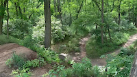
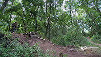
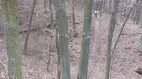
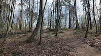
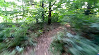
Videos of Brno Mountain Bike
0:12 |
7 |
Dec 25, 2025
0:03 |
3 |
Dec 25, 2025
trail: Nad starým lomem
0:20 |
39 |
Apr 8, 2025
trail: Palačák
0:15 |
65 |
Apr 8, 2025
trail: Loučka enduro
2:27 |
70 |
Sep 24, 2020

trail: Jelen
2:00 |
5233 |
Sep 10, 2018
trail: After work
0:18 |
78 |
Nov 8, 2017
trail: After work
5:57 |
77 |
May 24, 2017
Current Trail Warnings
| status | trail | date | condition | user | info |
|---|---|---|---|---|---|
| Komatrail 2 | May 23, 2026 @ 6:16am (Europe/Prague) May 22, 2026 | Unknown | Jensen1234 | Trail už nejspíš neexistuje, při... |
Recent Trail Reports
| status | trail | date | condition | info | user |
|---|---|---|---|---|---|
| Sedmiradostný Tobogán | Jun 14, 2026 @ 1:24pm (Europe/Vienna) Jun 14, 2026 | Ideal | k2ski | ||
| Hemzal vrch | Jun 14, 2026 @ 1:24pm (Europe/Vienna) Jun 14, 2026 | Ideal | k2ski | ||
| Hemzal | Jun 14, 2026 @ 1:24pm (Europe/Vienna) Jun 14, 2026 | Ideal | k2ski | ||
| Ronovský | May 10, 2026 @ 2:45pm (Europe/Vienna) May 10, 2026 | Dry | k2ski | ||
| Karásek | May 5, 2026 @ 4:46pm (Europe/Vienna) May 5, 2026 | Dry | k2ski | ||
| Kuřimský | Apr 22, 2026 @ 5:34pm (Europe/Vienna) Apr 22, 2026 | Wet | k2ski | ||
| Korytem potoka | Apr 6, 2026 @ 9:56pm (Europe/Prague) Apr 6, 2026 | Unknown | Denny21 | ||
| Dilina | Apr 6, 2026 @ 12:42pm (Europe/Vienna) Apr 6, 2026 | Ideal | Denny21 | ||
| K Rybníčku | Apr 6, 2026 @ 12:42pm (Europe/Vienna) Apr 6, 2026 | Unknown | Denny21 | ||
| Veveřice | Feb 26, 2026 @ 6:58pm (Europe/Prague) Feb 26, 2026 | Wet | Hemalisko |
Activity Feed
| username | action | type | title | date |
|---|---|---|---|---|
| k2ski | add | report | activity #97024634 and 2 more | Jun 14, 2026 @ 11:11pm Jun 14, 2026 |
| Jensen1234 | comment | trail | activity #95288976 and 1 more | May 22, 2026 @ 9:22pm May 22, 2026 |
| Jensen1234 | add | report | activity #95288880 | May 22, 2026 @ 9:19pm May 22, 2026 |
| ViktorHiZylo | ridden | trail | activity #95121826 | May 20, 2026 @ 11:17am May 20, 2026 |
| ToMMyK98 | ridden | trail | activity #94622758 | May 13, 2026 @ 6:24am May 13, 2026 |
Recent Comments
| username | type | title | comment | date |
|---|---|---|---|---|
| trail | Trail začíná u rozhledny Holedná, pak... | May 22, 2026 @ 9:30pm May 22, 2026 | ||
| trail | Trail ve špatném stavu, zarostlý, ... | May 22, 2026 @ 9:22pm May 22, 2026 | ||
| report | The second half is difficult to pass, or even... | Apr 12, 2026 @ 4:34am Apr 12, 2026 | ||
| trail | Toto by snad nemělo být označeno a uvedeno... | Apr 6, 2026 @ 11:22pm Apr 6, 2026 | ||
| trail | Not existing trail anymore. It should be... | Apr 6, 2026 @ 12:55pm Apr 6, 2026 |
Local Badges
-

Top 10 Trails0 awarded -

Descent 100k Badge33 awarded -

Big Ride 30k8,106 awarded -

Epic Ride 50k3,267 awarded -

Descent 10k Badge133 awarded -

Completionist0 awarded
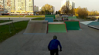
Bike & Skill Parks
| name | type | city | rating |
|---|---|---|---|
| Pařezy | skill park | Brno | |
| Pumptrack pod Pekárnou | skill park | Brno | |
| Koválov Trails | skill park | Brno |
Activity Type Stats
| activitytype | trails | distance | descent | descent distance | total vertical | rating | global rank | state rank | photos | reports | routes | ridelogs |
|---|---|---|---|---|---|---|---|---|---|---|---|---|
| Mountain Bike | 164 | 113 miles | 44,252 ft | 76 miles | 1,201 ft | #553 | #3 | 493 | 2,226 | 3 | 46,664 | |
| E-Bike | 39 | 19 miles | 7,844 ft | 12 miles | 1,115 ft | #1,154 | #4 | 1,940 | 1 | 2,482 | ||
| Horse | 1 | 3,271 ft | 154 ft | 2,726 ft | 154 ft | 401 | ||||||
| Hike | 141 | 107 miles | 40,984 ft | 71 miles | 1,201 ft | #850 | #5 | 1,680 | 2,172 | |||
| Trail Running | 141 | 107 miles | 40,984 ft | 71 miles | 1,201 ft | #592 | #5 | 1,683 | 1,807 |
Frequently Asked Questions About Brno
▼
What are the best places to ride in Brno?
Brno has 13 areas to explore for mountain biking. The top rated areas are:
▼
What are the highest rated mountain biking trails in Brno?
The highest rated mountain biking trails in Brno are:
- Chochola (4.5/5)
- Pod Mniší horou (4.4/5)
- Pigsty (4.4/5)
- Mechový (4.4/5)
- Obřanský hrad (4.3/5)
▼
What is the best time of the year to ride in Brno?
Based on ride log data, the most popular months to ride in Brno are:
- May (160 activities)
- July (155 activities)
- April (149 activities)
▼
Where can I park to ride in Brno?
There are 4 parking locations listed in Brno. The most popular parking spots are: View all parking and trailhead locations on the map to plan your visit.
Activities
Trails
Points of Interest
- By radari & contributors
- Admins: ČeMBA, ČeMBA, ČeMBA, ČeMBA, ČeMBA, ČeMBA, ČeMBA, ČeMBA, ČeMBA, ČeMBA
- #6230 - 59,637 views
- brno activity log | embed map of Brno mountain bike trails | brno mountain biking points of interest
Downloading of trail gps tracks in kml & gpx formats is enabled for Brno.
You must login to download files.