close
-
Layers w
- Weather Layers
- Pro
- Pro
- Pro
- Pro
- Pro
- Pro
- More Layers
- Pro
- Pro
- Pro
- Pro
-
Upgrade to

3D
Trail Conditions
- Unknown
- Snow Groomed
- Snow Packed
- Snow Covered
- Snow Cover Partial
- Freeze/thaw Cycle
- Icy
- Prevalent Mud
- Wet
- Variable
- Ideal
- Dry
- Very Dry
Trail Flow (Ridden Direction)
Trailforks scans users ridelogs to determine the most popular direction each trail is ridden. A good flowing trail network will have most trails flowing in a single direction according to their intension.
The colour categories are based on what percentage of riders are riding a trail in its intended direction.
The colour categories are based on what percentage of riders are riding a trail in its intended direction.
- > 96%
- > 90%
- > 80%
- > 70%
- > 50%
- < 50%
- bi-directional trail
- no data
Trail Last Ridden
Trailforks scans ridelogs to determine the last time a trail was ridden.
- < 2 days
- < 1 week
- < 2 weeks
- < 1 month
- < 6 months
- > 6 months
Trail Ridden Direction
The intended direction a trail should be ridden.
- Downhill Only
- Downhill Primary
- Both Directions
- Uphill Primary
- Uphill Only
- One Direction
Contribute Details
Colors indicate trail is missing specified detail.
- Description
- Photos
- Description & Photos
- Videos
Trail Popularity ?
Trailforks scans ridelogs to determine which trails are ridden the most in the last 9 months.
Trails are compared with nearby trails in the same city region with a possible 25 colour shades.
Think of this as a heatmap, more rides = more kinetic energy = warmer colors.
- most popular
- popular
- less popular
- not popular
ATV/ORV/OHV Filter
Max Vehicle Width
inches
US Cell Coverage
Legend

Radar Time
Activity Recordings
Trailforks uses anonymized public activity data.
?
Activity Recordings
Trailforks uses anonymized public activity data.
?
Personal Heatmap
▶
Activity Types
all
/
none
▶
Options
2
Date range
month
–
Winter Trails
Warning
A routing network for winter maps does not exist. Selecting trails using the winter trails layer has been disabled.
Missing Trails
Most Popular
Least Popular
Trails are colored based on popularity. The more popular a trail is, the more red. Less popular trails trend towards green.
Jump Magnitude Heatmap
Heatmap of where riders jump on trails. Zoom in to see individual jumps, click circles to view jump details.
BC Backroad Status
![map legend]()
Service Road Atlas is a free to use, community-driven service for viewing and creating reports on the numerous back-country service roads around B.C. and Alberta.

Slope Aspect
Direction the slope faces
Trails Deemphasized
Trails are shown in grey.
Only show trails with no bike usage.
Suggested Layers
Based on selected activity type
Save the current map location and zoom level as your default home location whenever this page is loaded.
Save
No description for Brockville has been added yet!
Login or register to submit one.
Activities Click to view
- Mountain Bike
101 trails
- E-Bike
53 trails
- Adaptive Bike
0 trails
- Hike
102 trails
- Trail Running
100 trails
- Snowshoe
7 trails
- Backcountry Ski
6 trails
- Nordic Ski
28 trails
Region Details
- 10
- 28
- 39
- 22
- 2
Region Status
Open as of May 2, 2026Stats
- Avg Trail Rating
- Trails (view details)
- 109
- Trails Mountain Bike
- 101
- Trails E-Bike
- 53
- Trails Hike
- 102
- Trails Trail Running
- 100
- Trails Snowshoe
- 7
- Trails Backcountry Ski
- 6
- Trails Nordic Ski
- 28
- Total Distance
- 29 miles
- Total Descent
- 2,158 ft
- Total Vertical
- 198 ft
- Highest Trailhead
- 474 ft
- Reports
- 150
- Photos
- 59
- Ridden Counter
- 3,363
Sub Regions
-
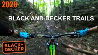
Black and Decker Trails
- 8
- 21
- 18
- 2
Popular Brockville Mountain Biking Trails
• 100 ★ 0.0 • 712 ft • 7 ft • 106 •
Popular blue difficulty singletrack. This mountain bike primary trail can be used both directions. On average it takes 1 minutes to complete this trail.
• 85 ★ 5.0 • 1,486 ft • 0 ft • 100 •
Beginner jump line with several small jumps, drops and a ladder bridge.
• 95 ★ 0.0 • 863 ft • 11 ft • 91 •
Popular black diamond difficulty singletrack. This mountain bike primary trail. On average it takes 4 minutes to complete this trail.
• 85 ★ 0.0 • 535 ft • 7 ft • 87 •
Popular blue difficulty singletrack. This mountain bike primary trail. It features rock garden. On average it takes 2 minutes to complete this trail.
• 100 ★ 0.0 • 545 ft • 0 ft • 82 •
Popular green difficulty singletrack. This mountain bike primary trail. On average it takes 1 minutes to complete this trail.
• 90 ★ 0.0 • 548 ft • 0 ft • 80 •
Popular green difficulty doubletrack. This mountain bike primary trail can be used both directions. On average it takes minutes to complete this trail.
• 85 ★ 0.0 • 2,815 ft • 52 ft • 79 •
Popular blue difficulty singletrack. This mountain bike primary trail. It features ladder bridge. On average it takes 6 minutes to complete this trail.
Brockville Mountain Bike Routes
4 miles • 364 ft • 16 •
This loop shows off most of the singletrack and many of the cooler features.
Photos of Brockville Mountain Bike
Videos of Brockville Mountain Bike

trail: Steep Chute
20:06 |
315 |
Sep 19, 2021 , Brockville

trail: Slab Street
20:06 |
222 |
Sep 19, 2021 , Brockville

trail: West Entrance
20:06 |
235 |
Sep 19, 2021 , Brockville

trail: River Run
20:06 |
242 |
Sep 19, 2021 , Brockville

trail: Lazy Train
20:06 |
365 |
Sep 19, 2021 , Brockville

trail: 401 Ridge Run
20:06 |
181 |
Sep 19, 2021 , Brockville

trail: South Flow
20:06 |
171 |
Sep 19, 2021 , Brockville
trail: The Jump Line
20:06 |
288 |
Sep 19, 2021 , Brockville
Recent Trail Reports
| status | trail | date | condition | info | user |
|---|---|---|---|---|---|
| Brock Trail | Aug 10, 2025 @ 9:52am Aug 10, 2025 | Ideal | paulloeffelholz | ||
| South Flow | Aug 10, 2025 @ 9:52am Aug 10, 2025 | Dry | paulloeffelholz | ||
| BD1 | Aug 10, 2025 @ 9:52am Aug 10, 2025 | Dry | paulloeffelholz | ||
| BD12 | Aug 10, 2025 @ 9:52am Aug 10, 2025 | Dry | paulloeffelholz | ||
| Bedrock Road | Aug 10, 2025 @ 9:52am Aug 10, 2025 | Dry | paulloeffelholz | ||
| BD14 | Aug 10, 2025 @ 9:52am Aug 10, 2025 | Dry | paulloeffelholz | ||
| West Entrance | Aug 10, 2025 @ 9:52am Aug 10, 2025 | Dry | paulloeffelholz | ||
| River Run | Aug 10, 2025 @ 9:52am Aug 10, 2025 | Dry | paulloeffelholz | ||
| Steep Chute | Aug 10, 2025 @ 9:52am Aug 10, 2025 | Dry | paulloeffelholz | ||
| Railroad Trail | Aug 10, 2025 @ 9:52am Aug 10, 2025 | Dry | paulloeffelholz |
Activity Feed
| username | action | type | title | date |
|---|---|---|---|---|
| Br1ngiton | add | trail | activity #92354877 and 3 more | Apr 10, 2026 @ 5:18pm Apr 10, 2026 |
| Br1ngiton | update | trail | activity #92354304 and 15 more | Apr 10, 2026 @ 5:08pm Apr 10, 2026 |
| Codiez1Pk8j | wishlist | route | activity #84998992 | Nov 30, 2025 @ 6:10pm Nov 30, 2025 |
| Duff07 | wishlist | region | activity #79343925 | Aug 31, 2025 @ 9:52am Aug 31, 2025 |
| UncleFlow | ridden | trail | activity #78187650 | Aug 15, 2025 @ 9:44am Aug 15, 2025 |
Recent Comments
| username | type | title | comment | date |
|---|---|---|---|---|
| trail | My favourite trail at Black And Decker. | Jul 24, 2021 @ 9:28am Jul 24, 2021 |
Local Badges
-

Epic Ride Climb 2k0 awarded -

Climbing 10k Badge1 awarded -

Climbing 100k Badge0 awarded -

Epic Ride Descent 2k0 awarded -

Descent 10k Badge1 awarded -

Descent 100k Badge0 awarded
Bike & Skill Parks
| name | type | city | rating |
|---|---|---|---|
| Rotary Park Pump Track. | skill park | Brockville |
Activity Type Stats
| activitytype | trails | distance | descent | descent distance | total vertical | rating | global rank | state rank | photos | reports | routes | ridelogs |
|---|---|---|---|---|---|---|---|---|---|---|---|---|
| Mountain Bike | 101 | 24 miles | 1,686 ft | 9 miles | 197 ft | #4,182 | #72 | 59 | 137 | 3 | 1,610 | |
| E-Bike | 53 | 11 miles | 869 ft | 4 miles | 138 ft | #4,411 | #77 | 133 | 2 | 29 | ||
| Hike | 102 | 25 miles | 1,768 ft | 10 miles | 197 ft | #5,007 | #97 | 137 | 1 | 110 | ||
| Trail Running | 100 | 24 miles | 1,726 ft | 9 miles | 197 ft | #4,513 | #74 | 137 | 1 | 71 | ||
| Snowshoe | 7 | 1 mile | 85 ft | 2,034 ft | 102 ft | #1,287 | #123 | 10 | 42 | |||
| Backcountry Ski | 6 | 1 mile | 118 ft | 2,182 ft | 82 ft | #590 | #15 | 9 | 1 | |||
| Nordic Ski | 28 | 13 miles | 1,093 ft | 5 miles | 135 ft | #906 | #63 | 12 | 4 | 41 |
Frequently Asked Questions About Brockville
▼
What are the best places to ride in Brockville?
Brockville has 2 areas to explore for mountain biking. The top rated areas are:
▼
What are the highest rated mountain biking trails in Brockville?
The highest rated mountain biking trails in Brockville are:
- The Jump Line (4.1/5)
- Central Ave Park (4/5)
- Upper ATV Entrance (4/5)
- Brock Trail (3.8/5)
- Brock Trail (3.8/5)
▼
What is the best time of the year to ride in Brockville?
Based on ride log data, the most popular months to ride in Brockville are:
- July (37 activities)
- June (21 activities)
- January (21 activities)
▼
Where can I park to ride in Brockville?
Activities
- By dberndt & contributors
- Admins: apply
- #7510 - 11,667 views
- brockville activity log | embed map of Brockville mountain bike trails | brockville mountain biking points of interest
Downloading of trail gps tracks in kml & gpx formats is enabled for Brockville.
You must login to download files.