close
-
Layers w
- Weather Layers
- Pro
- Pro
- Pro
- Pro
- Pro
- Pro
- More Layers
- Pro
- Pro
- Pro
- Pro
-
Upgrade to

3D
Trail Conditions
- Unknown
- Snow Groomed
- Snow Packed
- Snow Covered
- Snow Cover Partial
- Freeze/thaw Cycle
- Icy
- Prevalent Mud
- Wet
- Variable
- Ideal
- Dry
- Very Dry
Trail Flow (Ridden Direction)
Trailforks scans users ridelogs to determine the most popular direction each trail is ridden. A good flowing trail network will have most trails flowing in a single direction according to their intension.
The colour categories are based on what percentage of riders are riding a trail in its intended direction.
The colour categories are based on what percentage of riders are riding a trail in its intended direction.
- > 96%
- > 90%
- > 80%
- > 70%
- > 50%
- < 50%
- bi-directional trail
- no data
Trail Last Ridden
Trailforks scans ridelogs to determine the last time a trail was ridden.
- < 2 days
- < 1 week
- < 2 weeks
- < 1 month
- < 6 months
- > 6 months
Trail Ridden Direction
The intended direction a trail should be ridden.
- Downhill Only
- Downhill Primary
- Both Directions
- Uphill Primary
- Uphill Only
- One Direction
Contribute Details
Colors indicate trail is missing specified detail.
- Description
- Photos
- Description & Photos
- Videos
Trail Popularity ?
Trailforks scans ridelogs to determine which trails are ridden the most in the last 9 months.
Trails are compared with nearby trails in the same city region with a possible 25 colour shades.
Think of this as a heatmap, more rides = more kinetic energy = warmer colors.
- most popular
- popular
- less popular
- not popular
ATV/ORV/OHV Filter
Max Vehicle Width
inches
US Cell Coverage
Legend

Radar Time
Activity Recordings
Trailforks uses anonymized public activity data.
?
Activity Recordings
Trailforks uses anonymized public activity data.
?
Personal Heatmap
▶
Activity Types
all
/
none
▶
Options
2
Date range
month
–
Winter Trails
Warning
A routing network for winter maps does not exist. Selecting trails using the winter trails layer has been disabled.
Missing Trails
Most Popular
Least Popular
Trails are colored based on popularity. The more popular a trail is, the more red. Less popular trails trend towards green.
Jump Magnitude Heatmap
Heatmap of where riders jump on trails. Zoom in to see individual jumps, click circles to view jump details.
BC Backroad Status
![map legend]()
Service Road Atlas is a free to use, community-driven service for viewing and creating reports on the numerous back-country service roads around B.C. and Alberta.

Slope Aspect
Direction the slope faces
Trails Deemphasized
Trails are shown in grey.
Only show trails with no bike usage.
Suggested Layers
Based on selected activity type
Save the current map location and zoom level as your default home location whenever this page is loaded.
Save
No description for Brooklyn has been added yet!
Login or register to submit one.
Activities Click to view
- Mountain Bike
65 trails
- E-Bike
35 trails
- Adaptive Bike
0 trails
- Horse
12 trails
- Hike
65 trails
- Trail Running
65 trails
- Snowshoe
23 trails
- Nordic Ski
24 trails
Region Details
- 1
- 35
- 11
- 18
Region Status
Open as of Nov 25, 2025Stats
- Avg Trail Rating
- Trails (view details)
- 65
- Trails Mountain Bike
- 65
- Trails E-Bike
- 35
- Trails Horse
- 12
- Trails Hike
- 65
- Trails Trail Running
- 65
- Trails Snowshoe
- 23
- Trails Nordic Ski
- 24
- Total Distance
- 46 miles
- Total Descent
- 924 ft
- Total Vertical
- 159 ft
- Highest Trailhead
- 160 ft
- Reports
- 255
- Photos
- 24
- Ridden Counter
- 59,442
Sub Regions
-
Jamaica Bay Wildlife Refuge Gateway National Recreation Area
- 5
-
Marine Park
- 1
- 13
-
Prospect Park
- 14
-
Shirley Chisholm State Park
- 4
- 5
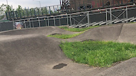
Popular Brooklyn Mountain Biking Trails
• 5 ★ 0.0 • 1 mile • 30 ft • 803 •
Conventional bike lane. As of Feb 2019, there's construction on parts of the path as you approach Berry Park heading west. Mostly a commuter path, but plenty to jib on and pop off of.
• 5 ★ 0.0 • 2 miles • 15 ft • 780 •
Less popular white difficulty paved path. This mountain bike primary trail can be used both directions. On average it takes 41 minutes to complete this trail.
• 5 ★ 4.0 • 1 mile • 66 ft • 660 •
Less popular white difficulty paved path. This mountain bike primary trail can be used both directions. On average it takes 6 minutes to complete this trail.
• 5 ★ 5.0 • 4,134 ft • 77 ft • 598 •
Less popular white difficulty family friendly paved path. This multi-use trail can be used both directions. On average it takes 3 minutes to complete this trail.
• 5 ★ 5.0 • 2,474 ft • 6 ft • 595 •
Less popular white difficulty family friendly paved path. This multi-use trail can be used both directions. On average it takes 1 minutes to complete this trail.
• 5 ★ 5.0 • 3,268 ft • 19 ft • 578 •
Less popular white difficulty family friendly paved path. This multi-use trail can be used both directions. On average it takes 1 minutes to complete this trail.
• 5 ★ 0.0 • 1 mile • 19 ft • 463 •
Less popular white difficulty family friendly paved path. This multi-use trail can be used both directions. On average it takes 4 minutes to complete this trail.
• 5 ★ 5.0 • 2,398 ft • 0 ft • 443 •
Less popular white difficulty family friendly paved path. This mountain bike primary trail can be used both directions. On average it takes 1 minutes to complete this trail.
Brooklyn Mountain Bike Routes
44 miles • 977 ft • 7 •
The Brooklyn-Queens Greenway (BQG) is a 40-mile, continuous pedestrian and cyclist route from Coney Island...
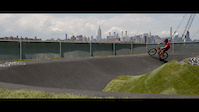
Videos of Brooklyn Mountain Bike
0:06 |
33 |
Aug 13, 2019
4:39 |
745 |
Jul 22, 2015

0:48 |
851 |
Jul 8, 2015
Recent Trail Reports
| status | trail | date | condition | info | user |
|---|---|---|---|---|---|
| Center Drive | Nov 25, 2025 @ 10:21am (Europe/Madrid) Nov 25, 2025 | Ideal | Mincha | ||
| South Lake Drive | Nov 25, 2025 @ 10:21am (Europe/Madrid) Nov 25, 2025 | Ideal | Mincha | ||
| Manhattan Bridge Bike Path | Nov 16, 2025 @ 10:35am (America/Los_Angeles) Nov 16, 2025 | Wet | fstshrk | ||
| Grand Army Plaza Connector | Nov 16, 2025 @ 10:35am (America/Los_Angeles) Nov 16, 2025 | Wet | fstshrk | ||
| Kent Avenue | Jun 11, 2025 @ 9:02am Jun 11, 2025 | Ideal | RobJSinger | ||
| Flushing Avenue | Jun 11, 2025 @ 9:02am Jun 11, 2025 | Ideal | RobJSinger | ||
| Brooklyn Bridge Park Greenway | Jun 11, 2025 @ 9:02am Jun 11, 2025 | Ideal | RobJSinger | ||
| West Drive Connector | Aug 10, 2024 @ 9:14am Aug 10, 2024 | Very Dry | Aholicsound | ||
| West Lake Drive | Oct 13, 2023 @ 1:30pm Oct 13, 2023 | Ideal | gshr | ||
| East Drive | Oct 13, 2023 @ 1:30pm Oct 13, 2023 | Ideal | gshr |
Activity Feed
| username | action | type | title | date |
|---|---|---|---|---|
| perihalajian | wishlist | route | activity #90945181 | Mar 20, 2026 @ 2:52pm Mar 20, 2026 |
| Mincha | add | report | activity #84691910 and 1 more | Nov 25, 2025 @ 2:09am Nov 25, 2025 |
| fstshrk | add | report | activity #84264129 | Nov 16, 2025 @ 12:11pm Nov 16, 2025 |
| fstshrk | add | report | activity #84264128 | Nov 16, 2025 @ 12:11pm Nov 16, 2025 |
| Mincha | add | report | activity #84061895 | Nov 13, 2025 @ 2:50am Nov 13, 2025 |
Recent Comments
| username | type | title | comment | date |
|---|---|---|---|---|
| trail | Crowded but nice views of the Verrazano | Oct 5, 2020 @ 7:18pm Oct 5, 2020 |
Local Badges
-

Epic Ride Climb 2k44 awarded -

Climbing 10k Badge82 awarded -

Climbing 100k Badge7 awarded -

Epic Ride Descent 2k46 awarded -

Descent 10k Badge82 awarded -

Descent 100k Badge7 awarded
Bike & Skill Parks
| name | type | city | rating |
|---|---|---|---|
| Brooklyn Bike Park | skill park | Brooklyn |
Local Mountain Biking Directory
-
Harvest Cyclery
![Harvest Cyclery]()
-
Bike Smith
-
Sheepshead CycleBike Shop
-
718 CycleryBike Shop
![718 Cyclery]()
-
Ride BrooklynBike Shop
-
Larry's Cycle ShopBike Shop
Activity Type Stats
| activitytype | trails | distance | descent | descent distance | total vertical | rating | global rank | state rank | photos | reports | routes | ridelogs |
|---|---|---|---|---|---|---|---|---|---|---|---|---|
| Mountain Bike | 65 | 46 miles | 925 ft | 20 miles | 161 ft | #2,613 | #934 | 24 | 255 | 1 | 40,345 | |
| E-Bike | 35 | 28 miles | 686 ft | 15 miles | 161 ft | #3,932 | #1,313 | 255 | 1 | 1,175 | ||
| Horse | 12 | 5 miles | 23 ft | 4,406 ft | 13 ft | #2,532 | #1,396 | 24 | ||||
| Hike | 65 | 46 miles | 925 ft | 20 miles | 161 ft | #4,589 | #1,621 | 255 | 312 | |||
| Trail Running | 65 | 46 miles | 925 ft | 20 miles | 161 ft | #3,235 | #949 | 255 | 1 | 6,113 | ||
| Snowshoe | 23 | 14 miles | 167 ft | 4 miles | 39 ft | #840 | #390 | |||||
| Nordic Ski | 24 | 15 miles | 203 ft | 4 miles | 39 ft | #883 | #355 | 26 |
Frequently Asked Questions About Brooklyn
▼
What are the best places to ride in Brooklyn?
Brooklyn has 4 areas to explore for mountain biking. The top rated areas are:
▼
What are the highest rated mountain biking trails in Brooklyn?
The highest rated mountain biking trails in Brooklyn are:
- Great Blue Heron Loop (4.1/5)
- East Drive (4.1/5)
- South Lake Drive (4.1/5)
- East Lake Drive (4.1/5)
- West Lake Drive (4.1/5)
▼
What is the best time of the year to ride in Brooklyn?
Based on ride log data, the most popular months to ride in Brooklyn are:
- September (86 activities)
- May (80 activities)
- March (74 activities)
▼
Where can I park to ride in Brooklyn?
There are 4 parking locations listed in Brooklyn. The most popular parking spots are: View all parking and trailhead locations on the map to plan your visit.
Activities
Trails
Points of Interest
- By brenthillier
 NSMBA TRAILFORKS & contributors
 - Admins: NYCMTB
- #9198 - 7,774 views
- brooklyn activity log | embed map of Brooklyn mountain bike trails | brooklyn mountain biking points of interest
Downloading of trail gps tracks in kml & gpx formats is enabled for Brooklyn.
You must login to download files.