close
-
Layers w
- Weather Layers
- Pro
- Pro
- Pro
- Pro
- Pro
- Pro
- More Layers
- Pro
- Pro
- Pro
- Pro
-
Upgrade to

3D
Trail Conditions
- Unknown
- Snow Groomed
- Snow Packed
- Snow Covered
- Snow Cover Partial
- Freeze/thaw Cycle
- Icy
- Prevalent Mud
- Wet
- Variable
- Ideal
- Dry
- Very Dry
Trail Flow (Ridden Direction)
Trailforks scans users ridelogs to determine the most popular direction each trail is ridden. A good flowing trail network will have most trails flowing in a single direction according to their intension.
The colour categories are based on what percentage of riders are riding a trail in its intended direction.
The colour categories are based on what percentage of riders are riding a trail in its intended direction.
- > 96%
- > 90%
- > 80%
- > 70%
- > 50%
- < 50%
- bi-directional trail
- no data
Trail Last Ridden
Trailforks scans ridelogs to determine the last time a trail was ridden.
- < 2 days
- < 1 week
- < 2 weeks
- < 1 month
- < 6 months
- > 6 months
Trail Ridden Direction
The intended direction a trail should be ridden.
- Downhill Only
- Downhill Primary
- Both Directions
- Uphill Primary
- Uphill Only
- One Direction
Contribute Details
Colors indicate trail is missing specified detail.
- Description
- Photos
- Description & Photos
- Videos
Trail Popularity ?
Trailforks scans ridelogs to determine which trails are ridden the most in the last 9 months.
Trails are compared with nearby trails in the same city region with a possible 25 colour shades.
Think of this as a heatmap, more rides = more kinetic energy = warmer colors.
- most popular
- popular
- less popular
- not popular
ATV/ORV/OHV Filter
Max Vehicle Width
inches
US Cell Coverage
Legend

Radar Time
Activity Recordings
Trailforks uses anonymized public activity data.
?
Activity Recordings
Trailforks uses anonymized public activity data.
?
Personal Heatmap
▶
Activity Types
all
/
none
▶
Options
2
Date range
month
–
Winter Trails
Warning
A routing network for winter maps does not exist. Selecting trails using the winter trails layer has been disabled.
Missing Trails
Most Popular
Least Popular
Trails are colored based on popularity. The more popular a trail is, the more red. Less popular trails trend towards green.
Jump Magnitude Heatmap
Heatmap of where riders jump on trails. Zoom in to see individual jumps, click circles to view jump details.
BC Backroad Status
![map legend]()
Service Road Atlas is a free to use, community-driven service for viewing and creating reports on the numerous back-country service roads around B.C. and Alberta.

Slope Aspect
Direction the slope faces
Trails Deemphasized
Trails are shown in grey.
Only show trails with no bike usage.
Suggested Layers
Based on selected activity type
Save the current map location and zoom level as your default home location whenever this page is loaded.
Save
No description for Brooksville has been added yet!
Login or register to submit one.
Activities Click to view
- Mountain Bike
41 trails
- E-Bike
48 trails
- Adaptive Bike
0 trails
- Winter Fat Bike
0 trails
- Horse
4 trails
- Hike
50 trails
- Trail Running
50 trails
- Dirtbike/Moto
10 trails
Region Details
- 4
- 1
- 22
- 11
Region Status
Caution as of Apr 3, 2026Stats
- Avg Trail Rating
- Trails (view details)
- 64
- Trails Mountain Bike
- 41
- Trails E-Bike
- 48
- Trails Gravel Bike
- 2
- Trails Horse
- 4
- Trails Hike
- 50
- Trails Trail Running
- 50
- Trails Dirtbike/Moto
- 10
- Total Distance
- 135 miles
- Total Descent
- 4,515 ft
- Total Vertical
- 185 ft
- Highest Trailhead
- 195 ft
- Reports
- 422
- Photos
- 283
- Ridden Counter
- 20,198
Sub Regions
-
Croom Tucker Hill Day Use Area
- 1
- 22
- 11
Popular Brooksville Mountain Biking Trails
• 95 ★ 2.0 • 1 mile • 149 ft • 791 •
Popular green difficulty singletrack. This multi-use trail can be used downhill primary. On average it takes 9 minutes to complete this trail.
• 80 ★ 1.0 • 1,380 ft • 14 ft • 725 •
Popular green difficulty singletrack. This multi-use trail can be used both directions. On average it takes 3 minutes to complete this trail.
• 75 ★ 3.0 • 2,497 ft • 19 ft • 716 •
Popular blue difficulty singletrack. This mountain bike primary trail can be used both directions. On average it takes 6 minutes to complete this trail.
• 90 ★ 2.5 • 1,478 ft • 12 ft • 714 •
Popular blue difficulty singletrack. This multi-use trail can be used both directions. On average it takes 2 minutes to complete this trail.
• 80 ★ 2.0 • 788 ft • 26 ft • 713 •
Popular green difficulty singletrack. This multi-use trail can be used both directions. On average it takes 1 minutes to complete this trail.
• 60 ★ 4.3 • 1 mile • 143 ft • 707 •
Highly rated moderately popular blue difficulty singletrack. This multi-use trail can be used downhill primary. It features wallride. On average it takes 21 minutes to complete this trail.
• 100 ★ 2.0 • 1,089 ft • 3 ft • 707 •
Popular blue difficulty singletrack. This mountain bike primary trail can be used both directions. On average it takes 1 minutes to complete this trail.
Brooksville Mountain Bike Routes
★ 5.0 • 35 miles • 1,069 ft • 24 • Loop •
This is the 2024 CroomFest 35 mile Race Course
★ 1.0 • 12 miles • 420 ft • 17 • Loop •
Starts and End at the 10 Miles Bail Out parking area
12 miles • 422 ft • 3 • Loop •
XC style route with a mix of sand and medium pack dirt. Route is great for getting in shape because the...
• 16 miles • 677 ft • 4 •
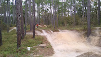
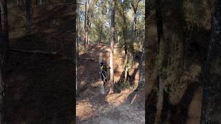
Photos of Brooksville Mountain Bike
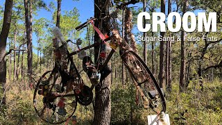
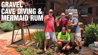
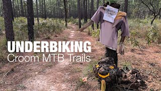
Videos of Brooksville Mountain Bike
trail: Drunken Monkey
0:07 |
416 |
Nov 28, 2021
trail: Drunken Monkey
0:13 |
45 |
Feb 4, 2026 , Brooksville
6:09 |
60 |
May 26, 2025
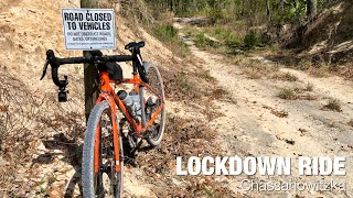
trail: Chassahowitzka Main Road
5:30 |
51 |
May 26, 2025 , Brooksville
trail: Chassahowitzka Main Road
6:45 |
41 |
May 26, 2025 , Brooksville

trail: Chassahowitzka Main Road
11:20 |
34 |
May 26, 2025 , Brooksville

trail: Chassahowitzka Main Road
11:24 |
44 |
May 26, 2025 , Brooksville
4:15 |
41 |
May 4, 2025
Recent Trail Reports
| status | trail | date | condition | info | user |
|---|---|---|---|---|---|
| Southeast Blue | Apr 3, 2026 @ 8:04am (America/Havana) Apr 3, 2026 | Dry | AdrianqKjAOn | ||
| Grey Goose | Nov 30, 2025 @ 10:16am (America/New_York) Nov 30, 2025 | Ideal | Firelightning50qpDcKS | ||
| White Lightning | Nov 30, 2025 @ 10:16am (America/New_York) Nov 30, 2025 | Dry | Firelightning50qpDcKS | ||
| BootLegger Hill | Nov 30, 2025 @ 10:15am (America/New_York) Nov 30, 2025 | Dry | Firelightning50qpDcKS | ||
| Prohibition | Nov 30, 2025 @ 10:13am (America/New_York) Nov 30, 2025 | Dry | Firelightning50qpDcKS | ||
| The Hooch | Nov 30, 2025 @ 10:12am (America/New_York) Nov 30, 2025 | Dry | Firelightning50qpDcKS | ||
| Moonshine | Nov 30, 2025 @ 10:11am (America/New_York) Nov 30, 2025 | Dry | Firelightning50qpDcKS | ||
| Yellow Loop Connector | Sep 7, 2025 @ 7:57am Sep 7, 2025 | Very Dry | q-dawg | ||
| Red Connector - Yellow to Blue | Sep 7, 2025 @ 7:57am Sep 7, 2025 | Ideal | q-dawg | ||
| Connector | Sep 7, 2025 @ 7:57am Sep 7, 2025 | Ideal | q-dawg |
Activity Feed
| username | action | type | title | date |
|---|---|---|---|---|
| 5QauMB | wishlist | trail | activity #96922303 | Jun 13, 2026 @ 3:46pm Jun 13, 2026 |
| JohnBergen | ridden | route | activity #96680047 | Jun 10, 2026 @ 9:55am Jun 10, 2026 |
| JohnBergen | wishlist | trail | activity #96677953 | Jun 10, 2026 @ 9:22am Jun 10, 2026 |
| afoxer | ridden | route | activity #96081690 | Jun 2, 2026 @ 7:10am Jun 2, 2026 |
| eric34 | ridden | trail | activity #92262276 and 1 more | Apr 9, 2026 @ 10:12am Apr 9, 2026 |
Recent Comments
| username | type | title | comment | date |
|---|---|---|---|---|
| report | Very sandy in some spots. 15+ spider webs to... | Jul 26, 2024 @ 8:59pm Jul 26, 2024 | ||
| trail | Just a s small hole with a root filled climb. | Jan 28, 2022 @ 7:54am Jan 28, 2022 | ||
| report | No closed sign, back open | Oct 19, 2021 @ 4:08pm Oct 19, 2021 | ||
| trail | Main area of Drunken Monkey was closed... | Sep 26, 2021 @ 5:26am Sep 26, 2021 | ||
| trail | 5 inches of standing water at the bottom,... | Jul 22, 2020 @ 9:04am Jul 22, 2020 |
Local Badges
-

10 Green Trails479 awarded -

10 Blue Trails307 awarded -

Epic Ride Climb 2k3 awarded -

Climbing 10k Badge34 awarded -

Climbing 100k Badge3 awarded -

Epic Ride Descent 2k3 awarded
Bike & Skill Parks
| name | type | city | rating |
|---|---|---|---|
| Croom Motorcycle Area | skill park | Brooksville |
Local Mountain Biking Directory
-
Brooksville BicyclesBike Shop
-
Crank Works BicyclesBike Shop
Activity Type Stats
| activitytype | trails | distance | descent | descent distance | total vertical | rating | global rank | state rank | photos | reports | routes | ridelogs |
|---|---|---|---|---|---|---|---|---|---|---|---|---|
| Mountain Bike | 41 | 76 miles | 3,081 ft | 28 miles | 187 ft | #1,568 | #589 | 280 | 421 | 6 | 14,725 | |
| E-Bike | 48 | 76 miles | 3,297 ft | 30 miles | 187 ft | #2,195 | #952 | 2 | 389 | 2 | 961 | |
| Gravel Bike | 2 | #514 | #281 | 63 | ||||||||
| Horse | 4 | 10 miles | 348 ft | 6 miles | 141 ft | #2,392 | #1,322 | 51 | 5 | |||
| Hike | 50 | 114 miles | 3,917 ft | 39 miles | 187 ft | #2,324 | #932 | 404 | 3 | 239 | ||
| Trail Running | 50 | 114 miles | 3,917 ft | 39 miles | 187 ft | #2,129 | #675 | 404 | 3 | 78 | ||
| Dirtbike/Moto | 10 | 10 miles | 292 ft | 5 miles | 75 ft | #957 | #356 | 51 | 66 |
Frequently Asked Questions About Brooksville
▼
What are the best places to ride in Brooksville?
Brooksville has 1 areas to explore for mountain biking. The top rated areas are:
▼
What are the highest rated mountain biking trails in Brooksville?
The highest rated mountain biking trails in Brooksville are:
- Drunken Monkey (4.2/5)
- Hangman's Ridge (4.1/5)
- South Yellow (4/5)
- North Yellow (4/5)
- Goose the Monkey (4/5)
▼
What is the best time of the year to ride in Brooksville?
Based on ride log data, the most popular months to ride in Brooksville are:
- April (308 activities)
- February (249 activities)
- May (248 activities)
▼
Where can I park to ride in Brooksville?
There are 10 parking locations listed in Brooksville. The most popular parking spots are: View all parking and trailhead locations on the map to plan your visit.
Activities
Trails
- By brenthillier
 NSMBA TRAILFORKS & contributors
 - Admins: apply
- #5922 - 6,318 views
- brooksville activity log | embed map of Brooksville mountain bike trails | brooksville mountain biking points of interest
Downloading of trail gps tracks in kml & gpx formats is enabled for Brooksville.
You must login to download files.