close
-
Layers w
- Weather Layers
- Pro
- Pro
- Pro
- Pro
- Pro
- Pro
- More Layers
- Pro
- Pro
- Pro
- Pro
-
Upgrade to

3D
Trail Conditions
- Unknown
- Snow Groomed
- Snow Packed
- Snow Covered
- Snow Cover Partial
- Freeze/thaw Cycle
- Icy
- Prevalent Mud
- Wet
- Variable
- Ideal
- Dry
- Very Dry
Trail Flow (Ridden Direction)
Trailforks scans users ridelogs to determine the most popular direction each trail is ridden. A good flowing trail network will have most trails flowing in a single direction according to their intension.
The colour categories are based on what percentage of riders are riding a trail in its intended direction.
The colour categories are based on what percentage of riders are riding a trail in its intended direction.
- > 96%
- > 90%
- > 80%
- > 70%
- > 50%
- < 50%
- bi-directional trail
- no data
Trail Last Ridden
Trailforks scans ridelogs to determine the last time a trail was ridden.
- < 2 days
- < 1 week
- < 2 weeks
- < 1 month
- < 6 months
- > 6 months
Trail Ridden Direction
The intended direction a trail should be ridden.
- Downhill Only
- Downhill Primary
- Both Directions
- Uphill Primary
- Uphill Only
- One Direction
Contribute Details
Colors indicate trail is missing specified detail.
- Description
- Photos
- Description & Photos
- Videos
Trail Popularity ?
Trailforks scans ridelogs to determine which trails are ridden the most in the last 9 months.
Trails are compared with nearby trails in the same city region with a possible 25 colour shades.
Think of this as a heatmap, more rides = more kinetic energy = warmer colors.
- most popular
- popular
- less popular
- not popular
ATV/ORV/OHV Filter
Max Vehicle Width
inches
US Cell Coverage
Legend

Radar Time
Activity Recordings
Trailforks uses anonymized public activity data.
?
Activity Recordings
Trailforks uses anonymized public activity data.
?
Personal Heatmap
▶
Activity Types
all
/
none
▶
Options
2
Date range
month
–
Winter Trails
Warning
A routing network for winter maps does not exist. Selecting trails using the winter trails layer has been disabled.
Missing Trails
Most Popular
Least Popular
Trails are colored based on popularity. The more popular a trail is, the more red. Less popular trails trend towards green.
Jump Magnitude Heatmap
Heatmap of where riders jump on trails. Zoom in to see individual jumps, click circles to view jump details.
BC Backroad Status
![map legend]()
Service Road Atlas is a free to use, community-driven service for viewing and creating reports on the numerous back-country service roads around B.C. and Alberta.

Slope Aspect
Direction the slope faces
Trails Deemphasized
Trails are shown in grey.
Only show trails with no bike usage.
Suggested Layers
Based on selected activity type
Save the current map location and zoom level as your default home location whenever this page is loaded.
Save
No description for Brown Mountain has been added yet!
Login or register to submit one.
 google parking directions
google parking directions Activities Click to view
- Mountain Bike
19 trails
- E-Bike
2 trails
- Horse
7 trails
- Hike
22 trails
- Trail Running
21 trails
Region Details
- 2
- 12
- 5
Region Status
Caution as of May 27, 2026Stats
- Avg Trail Rating
- Trails (view details)
- 21
- Trails Mountain Bike
- 19
- Trails E-Bike
- 2
- Trails Horse
- 7
- Trails Hike
- 22
- Trails Trail Running
- 21
- Total Distance
- 52 miles
- Total Descent
- 4,872 ft
- Total Vertical
- 3,090 ft
- Highest Trailhead
- 7,263 ft
- Reports
- 104
- Photos
- 250
- Ridden Counter
- 932
Popular Brown Mountain Mountain Biking Trails
• 70 ★ 4.3 • 14 miles • 1,242 ft • 193 •
Highly rated popular blue difficulty singletrack. This multi-use trail can be used both directions and has a moderate overall physical rating with a 1,242 ft blue climb. On average it takes 2 hours7 minutes to complete this trail.
• 40 ★ 3.7 • 6 miles • 545 ft • 96 •
Fun trail, if you enjoy deep pine loam, this ride is for you! From 4 Mile Lake it's a gradual 700 vert foot climb, only difficult in places because of the loam, sticks, & pine cones. Then you can enjoy a magnificent view from the...
• 35 ★ 3.8 • 9 miles • 407 ft • 80 •
A beautifully scenic family friendly trail through old growth fir and lava flows.
• 40 ★ 3.0 • 3,730 ft • 201 ft • 74 • • hike
Moderately popular blue difficulty singletrack. This hike primary trail can be used both directions. On average it takes 7 minutes to complete this trail.
• 40 ★ 4.0 • 1,918 ft • 49 ft • 63 •
Moderately popular green difficulty singletrack. This mountain bike primary trail can be used both directions and has a easy overall physical rating with a 49 ft green climb. On average it takes 2 minutes to complete this trail.
• 40 ★ 3.4 • 3 miles • 269 ft • 50 • • horse
Moderately popular green difficulty singletrack. This horse primary trail can be used both directions and has a easy overall physical rating with a 269 ft green climb. On average it takes 39 minutes to complete this trail.
• 30 ★ 0.0 • 7 miles • 194 ft • 42 •
Less popular green difficulty doubletrack. This mountain bike primary trail can be used both directions and has a easy overall physical rating with a 194 ft green climb. On average it takes 40 minutes to complete this trail.
• 40 ★ 0.0 • 443 ft • 15 ft • 34 •
Moderately popular green difficulty singletrack. This mountain bike primary trail can be used both directions. On average it takes 3 minutes to complete this trail.
Brown Mountain Mountain Bike Routes
★ 5.0 • 19 miles • 1,761 ft • 2 • Loop •
Overview Head to Lake of the Woods for endless views, deep forests, and alpine lakes, a scenic one-hour...
• 25 miles • 2,234 ft • 3 •
• 25 miles • 1,930 ft • 1 •
• 17 miles • 1,615 ft • 3 •
• 7 miles • 687 ft • 2 •
• 16 miles • 1,296 ft • 1 •
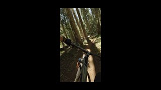
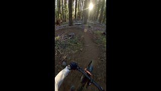
Photos of Brown Mountain Mountain Bike
Videos of Brown Mountain Mountain Bike
trail: Brown Mountain Loop
2:26 |
306 |
Aug 13, 2023 , Klamath Falls
trail: Rye Spur
8:31 |
209 |
Aug 10, 2023 , Klamath Falls

trail: Brown Mountain Loop
1480 |
Jun 20, 2014 , Klamath Falls
trail: Rye Spur
1061 |
Jun 19, 2014 , Klamath Falls
Recent Trail Reports
| status | trail | date | condition | info | user |
|---|---|---|---|---|---|
| Brown Mountain Loop | May 27, 2026 @ 2:46pm (America/Los_Angeles) May 27, 2026 | Ideal | brundlefly | ||
| Rye Spur | May 17, 2026 @ 4:17pm (America/Los_Angeles) May 17, 2026 | Ideal | everettw | ||
| Tomahawk | May 5, 2026 @ 8:23pm (America/Los_Angeles) May 5, 2026 | Dry | mountzlu | ||
| Cascade Canal | Aug 3, 2025 @ 9:58am Aug 3, 2025 | Dry | MFortier61 | ||
| South Ridge | Jun 8, 2025 @ 9:34am Jun 8, 2025 | Dry | quackfu RVMBA | ||
| LOW Trail Aspen to Lodge | May 29, 2025 @ 11:53am May 29, 2025 | Ideal | Jasoncoatney | ||
| Power Line Road | Jul 3, 2024 @ 6:44am Jul 3, 2024 | Dry | loam-ranger308 RVMBA | ||
| High Lakes Trail | May 27, 2024 @ 4:25pm May 27, 2024 | Dry | joemyers COTA | ||
| Fish Lake Trail | Oct 7, 2023 @ 8:03am Oct 7, 2023 | Unknown | trailforks Trailforks | ||
| Brown Mountain | Oct 25, 2022 @ 11:32am Oct 25, 2022 | Variable | TFerrao WORCA |
Activity Feed
| username | action | type | title | date |
|---|---|---|---|---|
| Ccball0525 | wishlist | trail | activity #97023661 | Jun 14, 2026 @ 10:30pm Jun 14, 2026 |
| crockpot2001 | comment | trail | activity #96497762 | Jun 7, 2026 @ 2:27pm Jun 7, 2026 |
| jrolv | add | photo | activity #95863246 | May 30, 2026 @ 9:51am May 30, 2026 |
| brundlefly | add | report | activity #95732084 | May 28, 2026 @ 2:07pm May 28, 2026 |
| everettw | ridden | trail | activity #94956705 | May 17, 2026 @ 7:43pm May 17, 2026 |
Recent Comments
| username | type | title | comment | date |
|---|---|---|---|---|
| trail | It does not appear that there have been many... | Jun 7, 2026 @ 2:27pm Jun 7, 2026 | ||
| trail | Spring 2026 — 0.3mi of new trail now exists... | May 6, 2026 @ 6:30am May 6, 2026 | ||
| trail | Very little treefall. No snow. Mosquitos... | Apr 11, 2026 @ 3:10am Apr 11, 2026 | ||
| trail | Trail clear of major treefall | Apr 11, 2026 @ 3:09am Apr 11, 2026 | ||
| trail | Lots of tree fall. Massive tree about .5 miles... | Nov 9, 2025 @ 1:35pm Nov 9, 2025 |
Nearby Areas
| name | distance | ||||
|---|---|---|---|---|---|
| Spence Mountain | 11 | 19 | 11 | 17 km | |
| Roxy Ann Peak | 6 | 6 | 1 | 25.1 km | |
| Lithia Park | 6 | 26.3 km | |||
| Lost Creek Lake | 6 | 5 | 26.4 km | ||
| Rogue River Basin | 1 | 26.5 km |
Local Badges
-

Completionist0 awarded
Activity Type Stats
| activitytype | trails | distance | descent | descent distance | total vertical | rating | global rank | state rank | photos | reports | routes | ridelogs |
|---|---|---|---|---|---|---|---|---|---|---|---|---|
| Mountain Bike | 19 | 50 miles | 4,846 ft | 21 miles | 2,047 ft | #5,415 | #1,962 | 249 | 104 | 1 | 1,165 | |
| E-Bike | 2 | 7 miles | 1,355 ft | 4 miles | 1,257 ft | #7,681 | #2,294 | 2 | 56 | 97 | ||
| Horse | 7 | 25 miles | 2,940 ft | 12 miles | 1,667 ft | #1,483 | #756 | 45 | 2 | |||
| Hike | 22 | 52 miles | 4,872 ft | 21 miles | 3,091 ft | #4,663 | #1,671 | 104 | 1 | 127 | ||
| Trail Running | 21 | 50 miles | 4,872 ft | 21 miles | 2,060 ft | #4,210 | #1,204 | 104 | 1 | 37 |
Frequently Asked Questions About Brown Mountain
▼
What are the highest rated mountain biking trails in Brown Mountain?
The highest rated mountain biking trails in Brown Mountain are:
- Brown Mountain Loop (4.2/5)
- LOW Trail Aspen to Lodge (4/5)
- LOW South Family Loop (4/5)
- High Lakes Trail (3.8/5)
- Brown Mountain (3.8/5)
▼
What is the best time of the year to ride in Brown Mountain?
Based on ride log data, the most popular months to ride in Brown Mountain are:
- July (36 activities)
- June (19 activities)
- August (17 activities)
▼
Where can I park to ride in Brown Mountain?
There are 7 parking locations listed in Brown Mountain. The most popular parking spots are: View all parking and trailhead locations on the map to plan your visit.
▼
What is the longest trail in Brown Mountain?
The longest trail in Brown Mountain is Brown Mountain Loop at 23.0 km. View all trails sorted by distance.
Activities
Trails
- By brenthillier
 NSMBA TRAILFORKS & contributors
 - Admins: KTA
- #3381 - 10,439 views
- brown mountain activity log | embed map of Brown Mountain mountain bike trails | brown mountain mountain biking points of interest
Downloading of trail gps tracks in kml & gpx formats is enabled for Brown Mountain.
You must login to download files.