close
-
Layers w
- Weather Layers
- Pro
- Pro
- Pro
- Pro
- Pro
- Pro
- More Layers
- Pro
- Pro
- Pro
- Pro
-
Upgrade to

3D
Trail Conditions
- Unknown
- Snow Groomed
- Snow Packed
- Snow Covered
- Snow Cover Partial
- Freeze/thaw Cycle
- Icy
- Prevalent Mud
- Wet
- Variable
- Ideal
- Dry
- Very Dry
Trail Flow (Ridden Direction)
Trailforks scans users ridelogs to determine the most popular direction each trail is ridden. A good flowing trail network will have most trails flowing in a single direction according to their intension.
The colour categories are based on what percentage of riders are riding a trail in its intended direction.
The colour categories are based on what percentage of riders are riding a trail in its intended direction.
- > 96%
- > 90%
- > 80%
- > 70%
- > 50%
- < 50%
- bi-directional trail
- no data
Trail Last Ridden
Trailforks scans ridelogs to determine the last time a trail was ridden.
- < 2 days
- < 1 week
- < 2 weeks
- < 1 month
- < 6 months
- > 6 months
Trail Ridden Direction
The intended direction a trail should be ridden.
- Downhill Only
- Downhill Primary
- Both Directions
- Uphill Primary
- Uphill Only
- One Direction
Contribute Details
Colors indicate trail is missing specified detail.
- Description
- Photos
- Description & Photos
- Videos
Trail Popularity ?
Trailforks scans ridelogs to determine which trails are ridden the most in the last 9 months.
Trails are compared with nearby trails in the same city region with a possible 25 colour shades.
Think of this as a heatmap, more rides = more kinetic energy = warmer colors.
- most popular
- popular
- less popular
- not popular
ATV/ORV/OHV Filter
Max Vehicle Width
inches
US Cell Coverage
Legend

Radar Time
Activity Recordings
Trailforks uses anonymized public activity data.
?
Activity Recordings
Trailforks uses anonymized public activity data.
?
Personal Heatmap
▶
Activity Types
all
/
none
▶
Options
2
Date range
month
–
Winter Trails
Warning
A routing network for winter maps does not exist. Selecting trails using the winter trails layer has been disabled.
Missing Trails
Most Popular
Least Popular
Trails are colored based on popularity. The more popular a trail is, the more red. Less popular trails trend towards green.
Jump Magnitude Heatmap
Heatmap of where riders jump on trails. Zoom in to see individual jumps, click circles to view jump details.
BC Backroad Status
![map legend]()
Service Road Atlas is a free to use, community-driven service for viewing and creating reports on the numerous back-country service roads around B.C. and Alberta.

Slope Aspect
Direction the slope faces
Trails Deemphasized
Trails are shown in grey.
Only show trails with no bike usage.
Suggested Layers
Based on selected activity type
Save the current map location and zoom level as your default home location whenever this page is loaded.
SaveBeginner and intermedia trails across 280 acres feature a variety of terrain, sweeping views, and lots of miles. Nestled in-between the city and county’s central park for outdoor sports, many of the trails recently underwent a massive reworking for improved drainage and bike flow.
Primary Trail Type: Cross-Country
Land Status: City Managed
 google parking directions
 Activities Click to view
- Mountain Bike
38 trails
- E-Bike
24 trails
- Hike
38 trails
- Trail Running
38 trails
Region Details
- 3
- 4
- 15
- 15
Region Status
Open as of May 3, 2026Stats
- Avg Trail Rating
- Trails (view details)
- 37
- Trails Mountain Bike
- 38
- Trails E-Bike
- 24
- Trails Horse
- 2
- Trails Hike
- 38
- Trails Trail Running
- 38
- Total Distance
- 33 miles
- Total Descent
- 2,511 ft
- Total Vertical
- 398 ft
- Highest Trailhead
- 5,541 ft
- Reports
- 1,735
- Photos
- 46
- Ridden Counter
- 21,905
Popular Brownlow / Pioneer Park Mountain Biking Trails
• 100 ★ 3.8 • 4,091 ft • 16 ft • 1,030 •
Popular blue difficulty singletrack. This mountain bike primary trail can be used both directions. On average it takes 4 minutes to complete this trail.
• 95 ★ 4.8 • 3,438 ft • 0 ft • 1,005 •
Popular blue difficulty singletrack. This multi-use trail can be used both directions. On average it takes 3 minutes to complete this trail.
• 100 ★ 3.0 • 814 ft • 31 ft • 947 •
Popular blue difficulty singletrack. This mountain bike primary trail can be used both directions. On average it takes minutes to complete this trail.
• 90 ★ 4.0 • 2 miles • 177 ft • 904 •
Highly rated popular blue difficulty singletrack. This multi-use trail can be used both directions and has a moderate overall physical rating with a 177 ft blue climb. On average it takes 9 minutes to complete this trail.
• 90 ★ 3.0 • 2 miles • 51 ft • 834 •
Popular green difficulty singletrack. This multi-use trail can be used both directions. On average it takes 4 minutes to complete this trail.
• 85 ★ 0.0 • 2,129 ft • 56 ft • 818 •
Popular blue difficulty singletrack. This mountain bike primary trail can be used both directions. On average it takes 2 minutes to complete this trail.
• 85 ★ 3.7 • 1,808 ft • 0 ft • 811 •
Popular blue difficulty singletrack. This mountain bike primary trail can be used uphill primary. On average it takes 1 minutes to complete this trail.
• 85 ★ 2.6 • 3,465 ft • 45 ft • 750 •
Popular green difficulty dirt/gravel road. This mountain bike primary trail can be used both directions. On average it takes 2 minutes to complete this trail.
Brownlow / Pioneer Park Mountain Bike Routes
★ 2.0 • 4,813 ft • 97 ft • 1 •
1 mile short course northwest of ball field
1 mile • 99 ft • 2 •
Park: Service Road Climb and Four Steps Descent Loop
6 miles • 347 ft • 8 • Loop •
This segment consists of two 3.1 mile loops. Ride them clockwise. You can ride the first 3.1 segment twice...
1,696 ft • 42 ft • 1 •
1/3 mile short course NW of ball field in Park
12 miles • 1,487 ft • 3 •
Prescott Circle Trail, broken into 10-12 mile segments (Part 1 of 5)
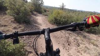
Photos of Brownlow / Pioneer Park Mountain Bike
Videos of Brownlow / Pioneer Park Mountain Bike
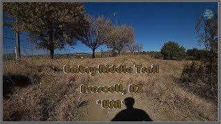
trail: Tunnel to Tunnel
5:29 |
306 |
Nov 2, 2020 , Prescott

trail: Pioneer Trail
257 |
Sep 17, 2020 , Prescott
trail: Pioneer Trail
352 |
Sep 17, 2020 , Prescott

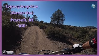
trail: Legacy
9:55 |
698 |
May 29, 2020 , Prescott

trail: Longview
11:09 |
534 |
May 22, 2020 , Prescott
11:43 |
583 |
May 13, 2020 , Prescott
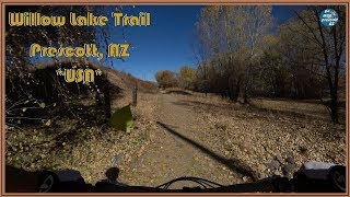
trail: Willow Lake
10:18 |
658 |
Dec 2, 2019 , Prescott
Recent Trail Reports
| status | trail | date | condition | info | user |
|---|---|---|---|---|---|
| Pioneer Trail | May 3, 2026 @ 1:08pm (America/Phoenix) May 3, 2026 | Ideal | Chinny928 | ||
| Pioneer Trail | May 3, 2026 @ 1:08pm (America/Phoenix) May 3, 2026 | Ideal | Chinny928 | ||
| Moving Pictures | May 3, 2026 @ 1:08pm (America/Phoenix) May 3, 2026 | Ideal | Chinny928 | ||
| Jacob's Ladder | May 3, 2026 @ 1:08pm (America/Phoenix) May 3, 2026 | Ideal | Chinny928 | ||
| Ridge | May 3, 2026 @ 1:08pm (America/Phoenix) May 3, 2026 | Ideal | Chinny928 | ||
| Little Four Steps | May 3, 2026 @ 1:08pm (America/Phoenix) May 3, 2026 | Ideal | Chinny928 | ||
| Legacy | May 3, 2026 @ 1:08pm (America/Phoenix) May 3, 2026 | Ideal | Chinny928 | ||
| Longview | May 3, 2026 @ 7:31am (America/Phoenix) May 3, 2026 | Dry | mej16489 | ||
| Green Loop | Apr 5, 2026 @ 5:43pm (America/Phoenix) Apr 5, 2026 | Dry | noahmaz06 | ||
| Tunnel to Tunnel | Jan 18, 2026 @ 1:41pm (America/Phoenix) Jan 18, 2026 | Ideal | Chinny928 |
Activity Feed
| username | action | type | title | date |
|---|---|---|---|---|
| mlbinaz | ridden | trail | activity #95579081 | May 26, 2026 @ 11:32am May 26, 2026 |
| helesh | vote | trail | activity #95570210 | May 26, 2026 @ 9:30am May 26, 2026 |
| GOEhTDLC | wishlist | trail | activity #95539321 | May 25, 2026 @ 7:21pm May 25, 2026 |
| phoebeteskey | wishlist | route | activity #95262784 | May 22, 2026 @ 12:55pm May 22, 2026 |
| Chinny928 | add | report | activity #93989311 and 6 more | May 3, 2026 @ 3:28pm May 3, 2026 |
Recent Comments
| username | type | title | comment | date |
|---|---|---|---|---|
| trail | At the top of this trail there is a "wrong... | Dec 13, 2025 @ 2:27pm Dec 13, 2025 | ||
| trail | Erosion has made this trail probably the most... | Oct 8, 2025 @ 9:00am Oct 8, 2025 | ||
| trail | The eastern portion of this trail is extremely... | Sep 11, 2025 @ 9:05am Sep 11, 2025 | ||
| report | Zz | Jul 17, 2025 @ 6:42pm Jul 17, 2025 | ||
| trail | Longview Trail is closed for about a mile from... | Jan 1, 2025 @ 2:12pm Jan 1, 2025 |
Nearby Areas
| name | distance | ||||
|---|---|---|---|---|---|
| Constellation trails | 3 | 10 | 2.8 km | ||
| Granite Gardens | 1 | 3.3 km | |||
| Granite Dells | 9 | 8 | 30 | 15 | 3.4 km |
| Granite Basin | 8 | 22 | 3 | 3.7 km | |
| Storm Trails | 4 | 3 | 19 | 2 | 4.2 km |
Local Badges
-

Completionist11 awarded
Local Mountain Biking Directory
-
Prescott Mountain Bike Alliance
![Prescott Mountain Bike Alliance]()
-
Soul Ride
![Soul Ride]()
-
Chain Events
![Chain Events]()
-
Bikesmith Cycle & FitnessBike Shop
-
Ironclad BicyclesBike Shop
![Ironclad Bicycles]()
-
High Gear Bike ShopBike Shop
![High Gear Bike Shop]()
Local Products
Activity Type Stats
| activitytype | trails | distance | descent | descent distance | total vertical | rating | global rank | state rank | photos | reports | routes | ridelogs |
|---|---|---|---|---|---|---|---|---|---|---|---|---|
| Mountain Bike | 38 | 33 miles | 2,510 ft | 14 miles | 397 ft | #756 | #290 | 44 | 1,737 | 34 | 11,525 | |
| E-Bike | 24 | 21 miles | 1,358 ft | 8 miles | 397 ft | #4,566 | #1,258 | 2 | 1,718 | 1 | 337 | |
| Horse | 2 | 2 miles | 56 ft | 1,942 ft | 112 ft | 107 | 3 | |||||
| Hike | 38 | 33 miles | 2,510 ft | 14 miles | 397 ft | #5,943 | #2,147 | 1,737 | 480 | |||
| Trail Running | 38 | 33 miles | 2,510 ft | 14 miles | 397 ft | #4,815 | #1,412 | 1,737 | 1 | 735 |
Frequently Asked Questions About Brownlow / Pioneer Park
▼
What are the highest rated mountain biking trails in Brownlow / Pioneer Park?
The highest rated mountain biking trails in Brownlow / Pioneer Park are:
- Four Steps (4.3/5)
- Jacob's Ladder (4.2/5)
- Pioneer Trail (4.1/5)
- Longview (4.1/5)
- Legacy (4/5)
▼
What is the best time of the year to ride in Brownlow / Pioneer Park?
Based on ride log data, the most popular months to ride in Brownlow / Pioneer Park are:
- October (79 activities)
- July (68 activities)
- April (67 activities)
▼
Where can I park to ride in Brownlow / Pioneer Park?
There are 4 parking locations listed in Brownlow / Pioneer Park. The most popular parking spots are: View all parking and trailhead locations on the map to plan your visit.
▼
What is the longest trail in Brownlow / Pioneer Park?
The longest trail in Brownlow / Pioneer Park is Pioneer Park at 3.7 miles. View all trails sorted by distance.
Activities
Trails
- Hard trails in Brownlow / Pioneer Park
- Easy trails in Brownlow / Pioneer Park
- Favorite trails in Brownlow / Pioneer Park
- Most ridden trails in Brownlow / Pioneer Park
- Singletrack in Brownlow / Pioneer Park
- Viewpoint trails in Brownlow / Pioneer Park
- Trails with technical features in Brownlow / Pioneer Park
- Race routes in Brownlow / Pioneer Park
- By rwinkster
 PMBA & contributors
 - Admins: PMBA, UMC-s, rowbearto-Prescott, PMBA
- #10912 - 13,783 views
- brownlow / pioneer park activity log | embed map of Brownlow / Pioneer Park mountain bike trails | brownlow / pioneer park mountain biking points of interest
Downloading of trail gps tracks in kml & gpx formats is enabled for Brownlow / Pioneer Park.
You must login to download files.