close
-
Layers w
- Weather Layers
- Pro
- Pro
- Pro
- Pro
- Pro
- Pro
- More Layers
- Pro
- Pro
- Pro
- Pro
-
Upgrade to

3D
Trail Conditions
- Unknown
- Snow Groomed
- Snow Packed
- Snow Covered
- Snow Cover Partial
- Freeze/thaw Cycle
- Icy
- Prevalent Mud
- Wet
- Variable
- Ideal
- Dry
- Very Dry
Trail Flow (Ridden Direction)
Trailforks scans users ridelogs to determine the most popular direction each trail is ridden. A good flowing trail network will have most trails flowing in a single direction according to their intension.
The colour categories are based on what percentage of riders are riding a trail in its intended direction.
The colour categories are based on what percentage of riders are riding a trail in its intended direction.
- > 96%
- > 90%
- > 80%
- > 70%
- > 50%
- < 50%
- bi-directional trail
- no data
Trail Last Ridden
Trailforks scans ridelogs to determine the last time a trail was ridden.
- < 2 days
- < 1 week
- < 2 weeks
- < 1 month
- < 6 months
- > 6 months
Trail Ridden Direction
The intended direction a trail should be ridden.
- Downhill Only
- Downhill Primary
- Both Directions
- Uphill Primary
- Uphill Only
- One Direction
Contribute Details
Colors indicate trail is missing specified detail.
- Description
- Photos
- Description & Photos
- Videos
Trail Popularity ?
Trailforks scans ridelogs to determine which trails are ridden the most in the last 9 months.
Trails are compared with nearby trails in the same city region with a possible 25 colour shades.
Think of this as a heatmap, more rides = more kinetic energy = warmer colors.
- most popular
- popular
- less popular
- not popular
ATV/ORV/OHV Filter
Max Vehicle Width
inches
US Cell Coverage
Legend

Radar Time
Activity Recordings
Trailforks uses anonymized public activity data.
?
Activity Recordings
Trailforks uses anonymized public activity data.
?
Personal Heatmap
▶
Activity Types
all
/
none
▶
Options
2
Date range
month
–
Winter Trails
Warning
A routing network for winter maps does not exist. Selecting trails using the winter trails layer has been disabled.
Missing Trails
Most Popular
Least Popular
Trails are colored based on popularity. The more popular a trail is, the more red. Less popular trails trend towards green.
Jump Magnitude Heatmap
Heatmap of where riders jump on trails. Zoom in to see individual jumps, click circles to view jump details.
BC Backroad Status
![map legend]()
Service Road Atlas is a free to use, community-driven service for viewing and creating reports on the numerous back-country service roads around B.C. and Alberta.

Slope Aspect
Direction the slope faces
Trails Deemphasized
Trails are shown in grey.
Only show trails with no bike usage.
Suggested Layers
Based on selected activity type
Save the current map location and zoom level as your default home location whenever this page is loaded.
Save
No description for Brownsville has been added yet!
Login or register to submit one.
Activities Click to view
- Mountain Bike
106 trails
- E-Bike
105 trails
- Gravel Bike
4 trails
- Adaptive Bike
0 trails
- Winter Fat Bike
0 trails
- Horse
19 trails
- Hike
144 trails
- Trail Running
145 trails
- Snowmobile
11 trails
- Snowshoe
100 trails
- Downhill Ski
12 trails
- Backcountry Ski
55 trails
- Nordic Ski
26 trails
Region Details
- 5
- 43
- 32
- 24
- 1
- 1
Region Status
Closed as of Jun 11, 2026Stats
- Avg Trail Rating
- Trails (view details)
- 163
- Trails Mountain Bike
- 106
- Trails E-Bike
- 105
- Trails Gravel Bike
- 4
- Trails Horse
- 19
- Trails Hike
- 144
- Trails Trail Running
- 145
- Trails Snowmobile
- 11
- Trails Snowshoe
- 100
- Trails Downhill Ski
- 12
- Trails Backcountry Ski
- 55
- Trails Nordic Ski
- 26
- Total Distance
- 68 miles
- Total Descent Distance
- 24 miles
- Total Descent
- 11,568 ft
- Total Vertical
- 2,668 ft
- Highest Trailhead
- 3,106 ft
- Reports
- 6,488
- Photos
- 257
- Ridden Counter
- 58,118
Articles

Vermont's 5 Most Popular Trail Networks According to Trailforks Data
Oct 19, 2021 from pinkbike.com
What the Green Mountain State lacks in square mileage, it more than makes up for in its sheer volume of mountain bike trails.
Sub Regions
-
Ascutney Trails
- 43
- 31
- 24
- 1
- 1
Popular Brownsville Mountain Biking Trails
• 100 ★ 3.7 • 2,431 ft • 81 ft • 1,762 •
One of two primary connectors between ski area trails and West Town Forest trails. Fun, flowy singletrack in the woods, combined with open-slope rolling terrain above the Center, and a stream crossing in the middle.
• 100 ★ 4.5 • 1,171 ft • 19 ft • 1,530 •
Easy, but very scenic trail below the waterfall. The bridge below the waterfall can be slippery during wet spells.
• 100 ★ 5.0 • 699 ft • 30 ft • 1,489 •
A singletrack up-only section of to avoid a very steep climb.
• 95 ★ 4.4 • 2,894 ft • 135 ft • 1,075 •
A many switch back climb to get you up a ski slope. This trail cris crosses the grassy slope with many of the turns in the woods or at the edges of the grass. This trail has bridges, berms and some rock rollovers to enjoy riding both up...
• 95 ★ 4.0 • 1,798 ft • 3 ft • 1,066 •
A switch back climb to get you up and over to the west side of the trail network or down and over to the east side of the trail network. There is even an uphill option to ease the climb on your right side. Its conveniently marked with a...
• 95 ★ 0.0 • 2,231 ft • 59 ft • 1,023 •
Mix of single and double track, mostly single, with road crossings. Wide boardwalks over marshy/wet areas (low to ground) gentle slope uphills with only a few short steeper ups.
• 80 ★ 4.5 • 1 mile • 432 ft • 1,006 •
Weaves through beautiful open hardwood/sedge forest along ridge. popular connector.
Brownsville Mountain Bike Routes
ATA: Recommended route for Beginners Featured
1 mile • 156 ft • 2 • Loop •
5 miles • 527 ft • 8 •
This route is a combination of Beginner and Emerging GLOW skill levels, as explained below. Beginner GLOW...
13 miles • 1,415 ft • 6 •
Advanced **New for 2023 New to guided rides for Flow State 2023, this route climbs up the ski area and...
5 miles • 838 ft • 9 • Loop •
Basic route up the central Town Forest climbing trail and traversing to Paradise Hill. Ride the Paradise...
★ 5.0 • 5 miles • 706 ft • 47 • Loop •
Climbing Paradise Hill/Nirvana gets you up on the South Ridge where the famous Grassy Knoll awaits. Go...
★ 2.5 • 8 miles • 1,295 ft • 19 •
This is true Ascutney and features our signature singletrack, switchbacks, brook crossings, bridges and...
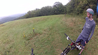
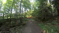
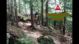
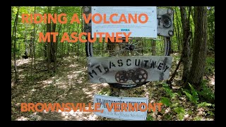
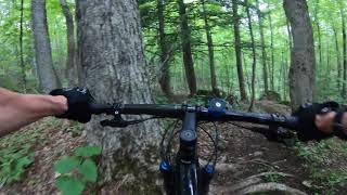
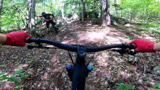
Photos of Brownsville Mountain Bike
Videos of Brownsville Mountain Bike
trail: Hay Ride
10:46 |
473 |
Aug 31, 2013
trail: Mile Long Field
7:06 |
578 |
Jul 30, 2013
trail: Boulder Dash
3:31 |
3 |
Jun 18, 2026 , Brownsville
8:14 |
497 |
Jul 9, 2021
0:47 |
440 |
Jul 1, 2021
trail: Lynx
13:31 |
1392 |
Oct 1, 2020 , Brownsville

trail: Cloud 9.9
0:16 |
595 |
Jun 30, 2020 , Brownsville
trail: Windsor Trail
6:22 |
29 |
Oct 23, 2025 , Brownsville
Recent Trail Reports
| status | trail | date | condition | info | user |
|---|---|---|---|---|---|
| Lynx | Jun 11, 2026 @ 10:51am (America/New_York) Jun 11, 2026 | Unknown | unissamog ATA | ||
| Kickstands Up! | Jun 6, 2026 @ 2:39pm (America/New_York) Jun 6, 2026 | Ideal | OGEswj | ||
| Burger Grinder | Jun 6, 2026 @ 2:38pm (America/New_York) Jun 6, 2026 | Variable | OGEswj | ||
| Powder Keg | Jun 6, 2026 @ 2:38pm (America/New_York) Jun 6, 2026 | Variable | OGEswj | ||
| Norcross - 3 | Jun 4, 2026 @ 1:26pm (America/New_York) Jun 4, 2026 | Dry | unissamog ATA | ||
| Norcross - 2 | May 31, 2026 @ 12:37pm (America/New_York) May 31, 2026 | Variable | unissamog ATA | ||
| Bi-Pass | May 30, 2026 @ 10:21pm (America/New_York) May 30, 2026 | Unknown | unissamog ATA | ||
| Bobolink | May 29, 2026 @ 6:46am (America/New_York) May 29, 2026 | Variable | unissamog ATA | ||
| Cathy's Crossing | May 29, 2026 @ 6:45am (America/New_York) May 29, 2026 | Variable | unissamog ATA | ||
| Home Again | May 29, 2026 @ 6:44am (America/New_York) May 29, 2026 | Variable | unissamog ATA |
Activity Feed
| username | action | type | title | date |
|---|---|---|---|---|
| Graham0Ohbwy | add | photo | activity #97253320 | Jun 18, 2026 @ 8:16am 3 hours |
| Graham0Ohbwy | add | video | activity #97253124 | Jun 18, 2026 @ 8:12am 3 hours |
| colinreuter | add | event | activity #97181843 and 1 more | Jun 17, 2026 @ 7:24am 1 day |
| dkk98tAV | wishlist | trail | activity #97140415 | Jun 16, 2026 @ 3:12pm 2 days |
| JacksonKcXdI4 | add | photo | activity #97130344 | Jun 16, 2026 @ 12:16pm 2 days |
Recent Comments
| username | type | title | comment | date |
|---|---|---|---|---|
| trail | Landing on some sharp rocks, stuff like bike... | Jun 16, 2026 @ 12:11pm 2 days | ||
| trail | how high | Jun 15, 2026 @ 11:29am 3 days | ||
| report | Thank you for the report, we will clear them... | May 17, 2026 @ 6:55am May 17, 2026 | ||
| report | There were a total of 3 trees across the trail... | May 17, 2026 @ 4:59am May 17, 2026 | ||
| report | Thank you for the trail report. I cut the... | May 15, 2026 @ 11:15am May 15, 2026 |
Local Badges
-

10 Black Trails269 awarded -

Epic Ride 50k1,162 awarded -

Top 10 Trails4 awarded -

Completionist0 awarded -

Big Ride 30k1,710 awarded -

10 Expert Trails54 awarded
Bike & Skill Parks
| name | type | city | rating |
|---|---|---|---|
| Andrew Goulet Skills Park | skill park | Brownsville |
Upcoming Local Events
Activity Type Stats
| activitytype | trails | distance | descent | descent distance | total vertical | rating | global rank | state rank | photos | reports | routes | ridelogs |
|---|---|---|---|---|---|---|---|---|---|---|---|---|
| Mountain Bike | 106 | 46 miles | 7,369 ft | 18 miles | 1,125 ft | #717 | #277 | 241 | 6,472 | 37 | 12,667 | |
| E-Bike | 105 | 46 miles | 7,464 ft | 18 miles | 1,125 ft | #2,419 | #988 | 1 | 5,412 | 7 | 445 | |
| Gravel Bike | 4 | 2 miles | 89 ft | 2,372 ft | 423 ft | #525 | #1,082 | 317 | 166 | |||
| Horse | 19 | 7 miles | 732 ft | 3 miles | 410 ft | #880 | #613 | 4,608 | 64 | |||
| Hike | 144 | 64 miles | 8,898 ft | 20 miles | 2,667 ft | #2,096 | 8 | 6,074 | 7 | 926 | ||
| Trail Running | 145 | 64 miles | 9,032 ft | 20 miles | 2,667 ft | #2,394 | #725 | 6,080 | 11 | 389 | ||
| Snowmobile | 11 | 6 miles | 322 ft | 1 mile | 1,148 ft | #313 | #163 | 3,243 | 3 | |||
| Snowshoe | 100 | 42 miles | 4,656 ft | 10 miles | 2,635 ft | #402 | #124 | 1 | 3,571 | 2 | 78 | |
| Downhill Ski | 12 | 3 miles | 1,749 ft | 3 miles | 492 ft | #640 | #296 | 7 | 50 | |||
| Backcountry Ski | 55 | 30 miles | 3,599 ft | 6 miles | 2,635 ft | #388 | #80 | 1 | 3,386 | 463 | ||
| Nordic Ski | 26 | 11 miles | 768 ft | 3 miles | 1,204 ft | #945 | #385 | 3,320 | 1 | 228 |
Frequently Asked Questions About Brownsville
▼
What are the best places to ride in Brownsville?
Brownsville has 2 areas to explore for mountain biking. The top rated areas are:
▼
What are the highest rated mountain biking trails in Brownsville?
The highest rated mountain biking trails in Brownsville are:
- Powder Keg (4.6/5)
- Kickstands Up! (4.3/5)
- Falls Trail (4.3/5)
- Broadway Black Line (4.2/5)
- South Ridge Run (4.2/5)
▼
What is the best time of the year to ride in Brownsville?
Based on ride log data, the most popular months to ride in Brownsville are:
- July (534 activities)
- August (240 activities)
- September (196 activities)
▼
Where can I park to ride in Brownsville?
There are 9 parking locations listed in Brownsville. The most popular parking spots are: View all parking and trailhead locations on the map to plan your visit.
Activities
- Brownsville Mountain Biking Trails
- Brownsville E-Biking Trails
- Brownsville Horseback Trails
- Brownsville Hiking Trails
- Brownsville Trail Running Trails
- Brownsville Snowmobiling Trails
- Brownsville Snowshoeing Trails
- Brownsville Skiing Trails
- Brownsville Backcountry Skiing Trails
- Brownsville Nordic Skiing Trails
Trails
Points of Interest
- Quarry Lookout Viewpoint
- Kiosk Information
- Check-In - Ascutney Outdoor Center Information
- View from quarry waterfall Viewpoint
- Observation Tower Sight
- Log Shelter Cabin
- Communication Tower Sight
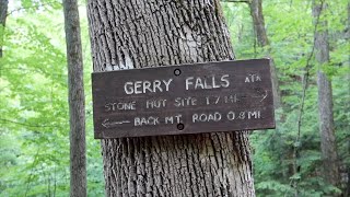
- Gerry's Falls Sight
- Rock Face TTF
- Emergency Point Information
- Mt Ascutney (3,130 ft)
- Ascutney North (3,097 ft)
- Ascutney South (2,881 ft)
- By StephaneMarceau
 TRAILFORKS & contributors
 - Admins: VMBA, Velomont, Jwduston, ATA, Ascutney, UWV
- #12125 - 6,059 views
- brownsville activity log | embed map of Brownsville mountain bike trails | brownsville mountain biking points of interest
Downloading of trail gps tracks in kml & gpx formats is enabled for Brownsville.
You must login to download files.